Showing posts with label Fires. Show all posts

Tuesday, March 25, 2014

NASA MODIS: Agricultural fires across Sierra Leone

Credit: NASA image courtesy Jeff Schmaltz, MODIS Rapid Response Team.

Marked in red, hundreds of land use fires burn in the fields across Sierra Leone.

Most fires in this region are deliberately set for a variety of reasons, including slash and burn agriculture.

When a plot of land becomes exhausted, farmers shift cultivation to another plot where they cut the trees and brush at the beginning of the dry season in January and February.

Once the dead plant material has dried, they set fire to it. Such fires peak in March and April right before farming season begins.

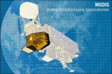
From space, MODIS detects thermal anomalies, including fires, flares, and volcanoes.

Each MODIS "fire pixel" or fire detection covers one square kilometer, which means that one or more fire is burning in the corresponding one-square kilometer area on the ground.

There are hundreds of fire pixels evident in this image, so there are at least that many distinct fires burning in this scene.

MODIS tends to undercount fires because it can't detect fires through smoke or clouds, nor does it see small cool fires, a fire type common to land use fires.

Where there is fire, there is also smoke, affecting air quality. Smoke contains soot and other particulates that pose a threat to human health and affect regional climate. Burning also releases greenhouse gases.

This natural-colour satellite image was collected by the Moderate Resolution Imaging Spectroradiometer (MODIS) aboard the Aqua satellite on March 24, 2014.


Saturday, December 7, 2013

NASA's Curiosity Rover Fires 100,000th ChemCam Laser Shot on Mars

NASA's Mars rover Curiosity fires its mast-mounted ChemCam laser at a rock target in this artist's illustration. 

The laser has fired more than 100,000 shots on Mars.

Credit: NASA/JPL-Caltech

NASA's trigger-happy Curiosity rover has fired its 100,000th laser shot on Mars, a science milestone in its mission to determine what rocks on the Red Planet are made of, NASA announced Thursday (Dec. 5).

Each laser pulse shot by the Curiosity rover packs the power nearly 1 million light bulbs — strong enough to vaporize rock and dust from up to 30 feet (9 meters) away.

"#PewPewPew I've fired my ChemCam laser 100,000+ times on Mars for SCIENCE!" Curiosity's team wrote in the voice of the rover in a Twitter post Thursday.

Originating from the French-made ChemCam instrument on Curiosity's "head," these beams are used to study the chemical composition of Mars.

ChemCam has a spectrometer that analyzes the light emitted by the zapped targets on Mars.

The instrument is sensitive enough to detect light from every element on the periodic table.

NASA's Curiosity Mars rover is equipped with a Chemistry and Camera (ChemCam) instrument to fire lasers at targets. 

In late October 2013, a Martian rock called "Ithaca," that received the rover's 100,000th zapping.

Credit: NASA/JPL-Caltech /LANL /CNES /IRAP


The 100,000th laser firing came as Curiosity was shooting a target called "Ithaca" in late October, according to NASA.

Roger Wiens, a planetary scientist at Los Alamos National Laboratory and principal investigator for ChemCam, said the laser-firing instrument has exceeded expectations.

"The information we've gleaned from the instrument will continue to enhance our understanding of the Red Planet, and will nicely complement information from the other nine instruments aboard Curiosity as we continue our odyssey to Mount Sharp," Wiens said in a statement from Los Alamos.

Rising 3 miles (5 kilometers) from the center of Mars' huge Gale Crater — where Curiosity landed in August 2012 — Mount Sharp is the rover's main destination.

Scientists hope Curiosity, which is about the size of a small SUV, will uncover clues about the ancient environment and habitability of Mars while scouring the foothills of the mountain.

The Curiosity rover has already made some amazing discoveries on Mars using ChemCam and its other instruments.

Besides findings that Mars had a rather wet past, Curiosity recently helped scientists determine that each cubic foot of surface soil on Mars is made up of 2 percent water, which may be enough to quench the thirst of future astronauts.

"ChemCam was designed to fire one million shots, so we’ll have lots of stories to tell later on," Wiens added.

Monday, September 9, 2013

French Father Fires Kids' Toys into Space

A French father allowed his children to send their toys into space...and managed to retrieve them.

Nicholas L. sourced a helium-filled weather balloon from a US army surplus store, and a parachute and GPS tracker system was shipped from Hong Kong.

After fitting two GoPro waterproof cameras onto his makeshift spacecraft, he gathered his family in a French field and let his children launch the balloon.

The astronauts were an Angry Bird piggy character and a Hello Kitty toy.

The balloon ascends to a height of around 20,000 metres above sea level before popping and the parachute let it drift down into a crop field unharmed.


Tuesday, June 18, 2013

NASA Mars Curiosity Fires Laser 100X To Create Soil Indent - Time-Lapse Video


Laser shots that harness a million watts of power for about five one-billionths of a second were fired by MSL's ChemCam instrument into a soil target named 'Sutton Inlier'. 

Sixteen frames from the 20 minutes experiment are time-lapsed/looped.

Credit: NASA / JPL-Caltech

Tuesday, June 4, 2013

NASA MODIS image: Pollution and Fires in Eastern China

Images are generated at NASA's Goddard Space Flight Center in Greenbelt, Md. 

Credit: Image: Jeff Schmaltz, NASA Goddard MODIS Rapid Response Team

NASA's Aqua satellite captured multiple plumes of smoke from agricultural fires and further evidence of growing industrial pollution in China.

China has long since denied it's destructive role in climate change, despite evidence to the contrary.

The smoke and haze stretches from Inner Mongolia, located north of Beijing, south and west including the provinces of Hebei, Shedong, Henan, Shanxi, Hubai, Hunan, and Chongqing.

The Moderate Resolution Imaging Spectroradiometer (MODIS) instrument aboard NASA's Aqua satellite has infrared capabilities that can detect heat from the various wildfires.

In the MODIS images, fires, or hot spots are colour coded as red areas in imagery and smoke appears in light brown. Images are generated at NASA's Goddard Space Flight Center in Greenbelt, Md.


Friday, February 24, 2012

NASA Satellite Image: Pipeline ablaze outside Homs, Syria

This satellite image shows a pipeline fire in Homs, Syria. 

The pipeline, which runs through the rebel-held neighbourhood of Baba Amr, had been shelled by regime troops for the previous 12 days, according to two activist groups, the Local Coordination Committees and the Britain-based Syrian Observatory for Human Rights. 

The state news agency, SANA, blamed "armed terrorists" for the pipeline attack.

Picture: DigitalGlobe/AP

Sunday, October 23, 2011

NASA Animation: Global Fire Observations and MODIS NDVI


This visualization leads viewers on a narrated global tour of fire detections beginning in July 2002 and ending July 2011.

The visualization also includes vegetation and snow cover data to show how fires respond to seasonal changes.

The tour begins in Australia in 2002 by showing a network of massive grassland fires spreading across interior Australia as well as the greener Eucalyptus forests in the northern and eastern part of the continent.

The tour then shifts to Asia where large numbers of agricultural fires are visible first in China in June 2004, then across a huge swath of Europe and western Russia in August, and then across India and Southeast Asia through the early part of 2005.

It moves next to Africa, the continent that has more abundant burning than any other. MODIS observations have shown that some 70 percent of the world's fires occur in Africa alone.

In what's a fairly average burning season, the visualization shows a huge outbreak of savanna fires during the dry season in Central Africa in July, August, and September of 2006, driven mainly by agricultural activities but also by the fact that the region experiences more lightning than anywhere else in the world.

The tour shifts next to South America where a steady flickering of fire is visible across much of the Amazon rainforest with peaks of activity in September and November of 2009.

Almost all of the fires in the Amazon are the direct result of human activity, including slash-and-burn agriculture, because the high moisture levels in the region prevent inhibit natural fires from occurring.

It concludes in North America, a region where fires are comparatively rare. North American fires make up just 2 percent of the world's burned area each year.

The fires that receive the most attention in the United States, the uncontrolled forest fires in the West, are less visible than the wave of agricultural fires prominent in the Southeast and along the Mississippi River Valley, but some of the large wildfires that struck Texas earlier this spring are visible.

More information on the Fire Information for Resource Management (FIRMS) is available at http://maps.geog.umd.edu/firms/

Friday, August 6, 2010

Smoke from Forest Fires close Moscow Airports

A dense smog shrouded Moscow on Friday, grounding flights at the city's international airports, seeping into homes and offices and stinging the eyes of residents as wildfires raged to the east and south.

Dozens of incoming flights were diverted from the capital's Domodedovo and Vnukovo airport hubs, as smog from blazes around the capital brought runway visibility down to 220 yards, airport officials reported.

All incoming flights to Moscow were being offered alternative airports at which to land, but the decision to divert was up to individual flight crews, Domodedovo spokeswoman Yelena Galanova said.

Moscow's other main airport, situated on the opposite side of the city from most of the blazes, freed up tarmac space to receive some planes. Other flights diverted to St. Petersburg and Kazan, a city 500 miles (800 kilometers) east of Moscow, Irina Ivanova, a Vnukovo Airport spokeswoman, said.

Visibility in parts of the capital was down to a few dozen yards due to the smog caused by the fires, which carries a strong burning smell and causes coughing. Airborne pollutants such as carbon monoxide were four times higher than average readings — the worst seen to date in the Russian capital.

Kremlin spires and church domes disappeared into the dirty mist, which is forecast to hang in the air for days due to the lack of wind.

"It hurts my eyes," student Valeriya Kuleva said on a central Moscow street. "I'm wearing a mask, but nothing helps."

"It's just impossible to work," said Moscow resident Mikhail Borodin, in his late 20s, as he removed a mask to puff on a cigarette. "I don't know what the government is doing, they should just cancel office hours."

More than 500 separate blazes were burning nationwide Friday, mainly across western Russia, according to the Emergencies Ministry. Dozens of forest and peat bog fires around Moscow have ignited amid the country's most intense heat wave in 130 years of record-keeping.

"All high-temperature records have been beaten, never has this country seen anything like this, and we simply have no experience of working in such conditions," Moscow emergency official Yuri Besedin said Friday.

He added that 31 forest fires and 15 peat-bog fires were burning in the Moscow region alone.

At least 52 people have died and 2,000 homes have been destroyed in the blazes. Russian officials have admitted that the 10,000 firefighters battling the blazes aren't enough — an assessment echoed by many villagers, who said the fires swept through their hamlets in minutes.

To minimize further damage, Russian workers have evacuated explosives from military facilities and were sending planes, helicopters and even robots to help control blazes around the country's top nuclear research facility in Sarov, 300 miles east of Moscow.

Fires in British Columbia: MODIS Rapid Response System.


Several large forest fires burned in British Columbia, Canada on August 4, 2010. The fires are outlined in red in this true-color image taken by the Moderate Resolution Imaging Spectroradiometer (MODIS) on NASA’s Aqua satellite. The fires shown in this image are in the Cariboo region of the province, where 120 fires were burning on August 3.

Many of the large fires ignited in a lightning storm on July 28, and additional lightning-caused fires started on August 3, said the wildfire management branch of the forest service in British Columbia. More than 400 fires burned throughout British Columbia on August 3, reported the Canadian Broadcasting Corporation.

The large image is the highest resolution (most detailed) version of the image. The image is available in additional resolutions from the MODIS Rapid Response System.

Thursday, July 29, 2010

NASA MODIS Image: Fires in Eastern Siberia


Fires raged in eastern Siberia in late July 2010, sending a plume of thick smoke hundreds of kilometers wide over the Bering Sea. News sources attributed fires in the Russian Federation to drought, heat, and human activity.

The Moderate Resolution Imaging Spectroradiometer (MODIS) on NASA’s Terra satellite captured this natural-color image on July 25, 2010. Red outlines indicate areas with unusually high surface temperatures associated with actively burning fires.

This image shows the region north of the Kamchatka Peninsula. The largest collection of fires is clustered around a river that feeds into the Penzhinskaya Guba, part of the Sea of Okhotsk.

Smaller clusters of fires also burn in the northwest, northeast, and south. Most of the fires send their smoke toward the northeast, but east of the burning fires, winds carry the smoke toward the southeast. Off the coast, the smoke plume is thick enough to completely hide parts of the Bering Sea.
Severe fires also burned over other areas of eastern Siberia throughout July 2010.