Showing posts with label craters. Show all posts

Monday, January 26, 2015

NASA Galileo Image: Jupiter’s cratered moon, Callisto

The speckled object depicted here is Callisto, Jupiter’s second largest moon. 

This image was taken in May 2001 by NASA’s Galileo spacecraft, which studied Jupiter and its moons from 1995 until 2003.

Similar in appearance to a golf ball, Callisto is covered almost uniformly with pockmarks and craters across its surface, evidence of relentless collisions.

In fact, Callisto is the most heavily cratered object in the Solar System.

The moon is made up of equal parts of rock and ice, the brighter parts of Callisto’s surface are thought to be mainly water ice, whereas the darker patches are regions of highly eroded and ice-poor rocky material.

Callisto is roughly the same size as the planet Mercury, but only about a third of the mass. It is the outermost of Jupiter’s four large Galilean satellites, a group consisting of Io, Europa, Ganymede and Callisto.

It orbits relatively far away from Jupiter compared to these other satellites: it lies 1 880 000 km from the planet, roughly 26 times the radius of the planet itself.

While this in itself is not unusual, our Moon orbits at some 60 times Earth’s radius, the important thing is Callisto’s isolation from its neighbouring moons.

Callisto’s closest neighbour is Ganymede, which orbits 800 000 km closer to Jupiter.

This isolation means that Callisto does not experience any significant tidal forces from Jupiter that would tear at its structure.

It also does not show any signs of geological processes such as volcanism or plate tectonics, which we clearly see on moons that are involved in violent cosmic tugs-of-war with Jupiter, such as Io, Europa and Ganymede.

Callisto remains relatively intact and is a witness of the early Solar System: its surface is the oldest terrain, at a truly ancient four billion years.

This image is the only complete full-colour view of Callisto obtained by Galileo.

The spacecraft provided us with a great deal of information about the jovian system: as well as sending the first probe into the atmosphere of Jupiter, and measuring Jupiter’s composition and dynamics, it observed Io’s volcanism, sent back data supporting the idea of a liquid ocean on Europa, and probed the properties of Ganymede and the subject of this image,

Callisto. It also managed to observe the famous Comet Shoemaker–Levy 9 colliding with Jupiter in 1994.

The jovian system will be visited again in the not-too-distant future. In 2016, NASA’s Juno spacecraft will arrive at Jupiter and start to beam back images of the planet’s poles.

Later, ESA’s Juice, short for JUpiter ICy moons Explorer, planned for launch in 2022, will tour the system with the aim of making a breakthrough in our knowledge of the giant gaseous planet and its environs, especially the intriguing moons Ganymede, Europa and Callisto.

Monday, January 19, 2015

NASA Dawn Spacecraft captures new images of CERES craters

The Dawn spacecraft observed Ceres for an hour on Jan. 13, 2015, from a distance of 238,000 miles (383,000 kilometers). 

A little more than half of its surface was observed at a resolution of 27 pixels. 

This animated GIF shows bright and dark features. 

Image Credit: NASA/JPL-Caltech/UCLA/MPS/DLR/IDA/PSI

Latest image from Nasa's Dawn Spacecraft showing the craters on Ceres.

Credit: NASA

NASA's Dawn spacecraft has entered an approach phase in which it will continue to close in on Ceres, a Texas-sized dwarf planet never before visited by a spacecraft.

Dawn launched in 2007 and is scheduled to enter Ceres orbit in March 2015.

Dawn recently emerged from solar conjunction, in which the spacecraft is on the opposite side of the sun, limiting communication with antennas on Earth.

Now that Dawn can reliably communicate with Earth again, mission controllers have programmed the maneuvers necessary for the next stage of the rendezvous, which they label the Ceres approach phase.

Dawn is currently 400,000 miles (640,000 kilometers) from Ceres, approaching it at around 450 miles per hour (725 kilometers per hour).

The spacecraft's arrival at Ceres will mark the first time that a spacecraft has ever orbited two solar system targets.

Monday, September 29, 2014

ESA SMART-1: Revealing unknown regions of the moon

Credit: ESA/SMART-1 /AMIE camera team/Space Exploration Institute

The greyscale pattern of dark and light blotches on the Moon is a familiar sight to stargazers.

However, there are regions that remained relatively mysterious to us until surprisingly recently, most notably the Moon's polar regions, which astronomers have dubbed 'Luna Incognita', or 'the unknown Moon'.

In recent years, missions including ESA SMART-1 have shed light on these regions of the lunar surface, and they are now better known.

This mosaic covers about 700 km by 220 km and was taken by the Advanced Moon Imaging Experiment on SMART-1.

It shows a trio of craters very near to the Moon's north pole, on the edge of the Luna Incognita. From right to left, these craters are named Plaskett, Rozhdestvenskiy and Hermite.

Hermite (104 km diameter) is perched right on the edge of the Moon's northern limb, while Plaskett (109 km diameter) and Rozhdestvenskiy (177 km diameter) overlap the lunar far side.

Lunar South Pole image by ESA SMART-1

Credit: ESA

We only ever see the same hemisphere of the Moon due to 'tidal locking' – this causes the Moon to orbit Earth once in the same time it takes to spin once about its axis.

However, we actually see around 59% of the lunar surface owing to factors such as the eccentricity of the Moon's orbit, its orientation with respect to Earth, and the rotation of Earth.

Over time, these little variations add up and the Moon appears to oscillate slowly, allowing us to peer a bit further around the lunar surface at its edges. This effect is known as libration.

Plaskett's location is within one of the zones that seems to oscillate. For just a few days during a few months each year, Earth can be seen from Plaskett's northern rim, one of the key reasons it may make a suitable lunar outpost for simulating a mission to Mars.

This infrequent contact would be ideal to test how astronauts cope with being isolated from Earth, without requiring the additional separation or risk involved in actually travelling to the Red

Monday, May 26, 2014

ESA SMART-1 Image: A peppering of craters at the Moon's south pole

Credit: ESA /SMART-1 /AMIE camera team; image mosaic: M. Ellouzi/B. Foing

The dark and shadowed regions of the Moon fascinate astronomers and Pink Floyd fans alike.

Our Moon's rotation axis has a tilt of 1.5ยบ, meaning that some parts of its polar regions never see sunlight – the bottoms of certain craters, for example, are always in shadow.

Imaged during summertime in the Moon's southern hemisphere by the Advanced Moon Imaging Experiment (AMIE) on ESA's SMART-1 spacecraft, this mosaic shows a crater-riddled region spanning the lunar south pole.

It is made up of around 40 individual images taken between December 2005 and March 2006, and covers an area of about 500 x 150 km.

The craters visible here include (from right to left, starting with the largest round shape visible in the frame) the Amundsen, Faustini, Shoemaker, Shackleton and de Gerlache craters.

Amundsen is the largest of the bunch at 105 km across, followed by Shoemaker (50 km), Faustini (39 km), de Gerlache (32 km) and Shackleton (19 km).

This group of craters all look different, see varying levels of sunlight and display a range of interesting properties.

Shackleton crater, the small circle visible to the left of centre, contains the south pole within its rim.

By using SMART-1 images to explore the number of small impact craters scattered on the smooth, dark surface surrounding Shackleton, scientists have found this crater to be older than the Apollo 15 landing site (3.3 billion years), but younger than the Apollo 14 site (3.85 billion years).

Shoemaker crater, visible to the upper left of centre, is notable because of the 1999 Lunar Prospector mission, which deliberately crashed into the crater in an attempt to create a detectable plume of water vapour by heating any water ice that may have been present.

No vapour was spotted. However, all is not lost; some permanently shadowed regions have been in the dark for millions of years, and it is still possible that they may contain water ice deposited by comets and water-rich asteroids.

Studying the dark depths of these craters could tell us not just about the history of the Moon, but also about Earth, helping us to understand better how, and how much, water and organic material may have been transferred from the Moon to Earth over its history.

Tuesday, February 11, 2014

ESA Mars Express orbiter reveals overflowing craters

Credit: ESA/DLR/FU Berlin (G. Neukum)

Large and small, hundreds of thousands of craters scar the surface of Mars, hollowed out by a multitude of asteroids and comets that impacted the Red Planet throughout its history.

This image shows a region of the planet's northern hemisphere known as Hephaestus Fossae – after the Greek god of fire – that was imaged by the high-resolution stereo camera on ESA's Mars Express orbiter on 28 December 2007.

The image has been coloured to indicate the elevation of the terrain: green and yellow shades represent shallow ground, while blue and purple stand for deep depressions, down to about 4 km.

Scattered across the scene are a few dozen impact craters that cover a wide range of sizes, with the largest boasting a diameter of around 20 km.

The long and intricate canyon-like features that resemble riverbeds are the phenomenal aftermath of the same fierce impacts that created the largest craters.

When a small body such as a comet or an asteroid crashes at high speed into another object in the Solar System, the collision dramatically heats up the surface at the impact site.

In the case of the large crater seen in this image, the heat produced by such a powerful smash melted the soil – a mixture of rock, dust and also, hidden deep down, water ice – resulting in a massive overflow that flooded the surrounding environment.

Before drying up, this muddy fluid carved a complex pattern of channels while making its way across the planet's surface.

The melted rock–ice mixture also gave rise to the fluidised appearance of the debris blankets surrounding the largest crater.

Based on the lack of similar structures near the small craters in this image, scientists believe that only the most powerful impacts – those responsible for forging the largest craters – were able to dig deep enough to release part of the frozen reservoir of water lying beneath the surface.

Friday, December 20, 2013

NASA Messenger: Mercury’s surface showing a high-reflectance area

MESSENGER spacecraft obtained this image of Mercury’s surface showing a high-reflectance area seemingly confined to a region of lower elevation bounded by linear scarp (cliff) segments. 

Such diffuse bright areas sometimes relate to the deposition of small secondary craters and ray segments by a relatively recent impact crater. 

However, regional images show no rayed craters in the immediate vicinity (except Han Kan).

So a compositional difference might account for the difference in the albedo (brightness) of the material in the low-lying area. 

Are the scarps the result of vertical movement along faults, or were they formed by secondary crater chains? 

Researchers also have yet to explain the hollows on the central peak of the crater at upper left, and the smooth impact melt on the floor of the terrace-walled crater just below center.

Tuesday, June 18, 2013

Dark Side: Australian team maps Moon's hidden craters

Some 66 of the possible 280 additional craters on the Moon, in a photo from Western Australia's Curtin University in Perth released on June 18, 2013. 

Australian scientists Tuesday said they had identified a possible 280 additional craters on the Moon, a finding they said could shed light on the history of the Earth's natural satellite.

Australian scientists Tuesday said they had identified a possible 280 additional craters on the Moon, a finding they said could shed light on the history of the Earth's natural satellite.

By combining gravity and topography data collected by satellites, the scientists from Curtin University in Western Australia were able to use computer modelling to at first identify two basins on the far side of the Moon.

They later developed a high-resolution image to find a total of 280 "candidate basins" which they suspect are craters.

Will Featherstone
"There are many more (craters) that have been mapped from optical observations or from just the shape of the topography," researcher Will Featherstone told reporters.

"So there's many, many craters that were already known, we've just been able to apply this technique to enhance the ones that aren't so easy to see.

"What we have been able to use is the topography and the gravity together to get a stronger indication that there is something there that needs further investigation."

Featherstone said the researchers looked at the lunar surface on both the near and far sides of the Moon, the dark side being more challenging because satellites cannot be tracked from Earth when they are on that side.

To get around this, the researchers used data gathered from a mission which used multiple satellites which were tracking each other as they circled the Moon.

"So when the satellite orbiting the Moon went behind the far side and they couldn't be seen from Earth, they could be seen by other satellites," he said.

Featherstone said of the 280 possible craters, the researchers had classified 66 of them as distinctly visible according to both gravity and topography.

"Scientists can, instead of looking at every square inch of the Moon looking for basins, they can target these areas," he said.

"It just helps investigations of the Moon and the history of the Moon and the solar system," he added.

The team has also done some work on the gravity of Mars and Featherstone said other data sets were also available for Venus and other planets.

He said scientists were optimistic about further discoveries from applying their techniques to new gravity data from NASA's GRAIL mission, which ended in late 2012 when the two satellites - named Ebb and Flow - were deliberately crashed on the Moon.

Saturday, December 8, 2012

ESA Mars Express: HRSC Images - Mountains Look Frosty

This computer-generated perspective view of Charitum Montes was created using data obtained from the High-Resolution Stereo Camera (HRSC) on ESA’s Mars Express.

The image shows the large breach in the northern wall of the crater, located near to the uppermost sand dune.

Centred at around 53°S and 334°E, the image has a ground resolution of about 20 m per pixel. The image shows the large breach in the northern wall of the crater, located near to the uppermost sand dune. 

The dusting of carbon dioxide ice is a seasonal feature in this region, which covers the crater floor and the surrounding plains.

CREDIT: ESA/DLR/FU Berlin (G. Neukum)

ESA's Mars Express spacecraft orbiting Mars has snapped wintry-looking pictures of a mountain range on the Red Planet's southern highlands, where ridges and crater floors are dusted with carbon dioxide frost.

The pictures were captured by the high-resolution stereo camera on the European Space Agency's (ESA) Mars Express.

They show part of Charitum Montes, a large group of rugged mountains stretching over nearly 620 miles (1,000 kilometers) near the southernmost rim of the Argyre impact basin. The brighter features represent a seasonal layer of carbon dioxide frost.

The images, which were obtained on June 18, show that the mountainous region is pockmarked with many large craters, which have been largely filled in with thick sedimentary deposits.

Annotated image of Charitum Montes.

Credits: ESA/DLR/FU Berlin


This colour-coded overhead view is based on an ESA Mars Express HRSC digital terrain model of the region, from which the topography of the landscape can be derived. 

The colour coding shows the very edge of the Charitum Montes mountain region at the top of the image, with the highest elevation, while the subtle pedestal craters that dot the image almost fade away with just a small amount of relief difference between the elevated ejecta and the surrounding area. 

Credits: ESA/DLR/FU Berlin (G. Neukum)

Monday, November 19, 2012

NASA Messenger: Mercury's tectonic plates and pie crust surfaces

NASA MESSENGER has discovered assemblages of tectonic landforms unlike any previously found on Mercury or elsewhere in the Solar System.

The findings are reported in a paper led by Smithsonian scientist Thomas Watters, "Extension and contraction within volcanically buried impact craters and basins on Mercury," published in the December issue of the journal Geology.

The surface of Mercury is covered with deformational landforms that formed by faulting in response to horizontal contraction or shortening as the planet's interior cooled and surface area shrank, causing blocks of crustal material to be pushed together.

Contraction from cooling of Mercury's interior has been so dominant that extensional landforms caused by fault formation in response to horizontal stretching and pulling apart of crustal material had not been previously documented outside of the interiors of a few large impact basins.

Friday, September 7, 2012

ESA Mars Express - Deep faults and disrupted crater at Acheron Fossae

This is an image taken by the High Resolution Stereo Camera (HRSC) on board ESA’s Mars Express of the Acheron Fossae region, an area of intensive tectonic (continental ‘plate’) activity in the past.


Acheron Fossae marks the northern edge of the Tharsis plateau. It is part of a network of extensional fractures that radiates outward from their central focus in the Tharsis ‘bulge’, a huge area of regional uplift where intensive volcanic activity occurred.

Mars Tharsis Plateau
These curved ‘faults’ were caused in the process of this uplift: cracks in the crust formed when the hot material rising from deep in the mantle of Mars pushed the overlying ‘elastic’ lithosphere (surface layers of rock) upward.

When the distorting tensions became too strong, the brittle crust on top of the lithosphere broke along zones of weakness.

The image, from orbit 37, are dominated by these curved features, showing a highly fractured, faulted and deformed area in the central part of the Acheron Fossae.

The feature is situated at approximately 35ยบ-40ยบ North and 220ยบ-230ยบ East, about 1000 kms north of the large Olympus Mons volcano.


Credits: ESA/DLR/FU (G. Neukum)

Wednesday, July 18, 2012

NASA MARS HiRise Image: A Hole In Mars' Surface

What created this unusual hole in Mars?

The hole was discovered by chance on images of the dusty slopes of Mars' Pavonis Mons volcano taken by the HiRISE instrument aboard the robotic Mars Reconnaissance Orbiter currently circling Mars.

 The hole appears to be an opening to an underground cavern, partly illuminated on the image right.

Analysis of this and follow-up images revealed the opening to be about 35 meters across, while the interior shadow angle indicates that the underlying cavern is roughly 20 meters deep.

Why there is a circular crater surrounding this hole remains a topic of speculation, as is the full extent of the underlying cavern.

Holes such as this are of particular interest because their interior caves are relatively protected from the harsh surface of Mars, making them relatively good candidates to contain Martian life.

These pits are therefore prime targets for possible future spacecraft, robots, and even human interplanetary explorers.

Thursday, June 14, 2012

NASA MARS HiRISE: Which Crater Came First?

This image shows two craters, both approximately the same diameter (not quite 3 kilometers, or about 1.8 miles), but quite different in appearance otherwise.

The slightly smaller crater to the south seems to have a sharper rim and steeper sides than its partner to the north, which also appears to contain more small craters inside it and along its rim.

The interior of the northern crater, in particular its south-facing wall, appears to have a similar texture to the ejecta around the southern crater.

This is the second image in a stereo pair (the first is ESP_019346_1690), so we have an anaglyph of these craters.

Although it would require a digital terrain model and more analysis to be certain, in the anaglyph it appears that the southern crater has a higher rim and a deeper center than the northern crater.

All these signs point to the northern crater being quite a bit older than the southern crater, rather than the two craters forming in the same impact event. For an example of two craters that might have formed at the same time (see ESP_020894_1395).

Compare the similarity of those two craters with the disparate appearance of the ones in this image.

This is a stereo pair with ESP_019346_1690.

Thursday, June 7, 2012

ESA Mars Express: Kalocsa Crater shows evidence for climate evolution


ESA’s Mars Express has provided images of a remarkable crater on Mars that may show evidence that the planet underwent significant periodic fluctuations in its climate due to changes in its rotation axis.

On 19 June 2011, Mars Express pointed its high-resolution stereo camera at the Arabia Terra region of Mars, imaging the Danielson and Kalocsa craters.

Danielson crater is named after the late George E Danielson, who was instrumental in the development of many spacecraft cameras flown to Mars. Seen to the right (north) in the image, it is the larger crater, roughly 60 km across.

Kalocsa crater lies in the centre of the image and is smaller, about 33 km in diameter and a kilometre shallower than Danielson. It is named after a town in Hungary famed for its astronomical observatory.

 Danielson crater, like many in the Arabia Terra region, is filled with layered sediments, which in this instance have been heavily eroded over time.

Within the crater are peculiarly layered buttes, known as yardangs.

Yardangs are streamlined hills carved from bedrock or any consolidated or semi-consolidated material by abrasive dust and sand particles carried in the wind.

They are seen on Earth in desert regions, with notable examples in North Africa, Central Asia and Arizona in the United States.

In the case of Danielson crater, it is believed that sediments were cemented by water, possibly from an ancient deep groundwater reservoir, before being eroded by the wind.

The orientation of the yardangs leads scientists to theorise that strong north–northeasterly winds (from the lower right in the image) both deposited the original sediments and then caused their subsequent erosion in a later drier period of martian history.

A 30 km-long field of darker dunes can be seen bisecting the yardangs and is thought to have formed at a later epoch.

The crater floor of Danielson shows evidence for a series of alternating sedimentary layers with roughly uniform thickness and separation.

Some scientists believe that this indicates periodic fluctuations in the climate of Mars, triggered by regular changes in the planet’s axis of rotation. The different layers would have been laid down during different epochs.

By marked contrast, Kalocsa crater shows a completely different topography.

Here, no layered sediments are seen. This is thought to be due to the higher altitude of its floor, with the crater not tapping in to the suspected underlying ancient water reservoir.

Another hypothesis is that this crater is younger than its neighbour, created when water was not present anymore.

Download a 3D Anaglyph Image of  Danielson and Kalocsa here

Monday, April 9, 2012

Second NASA GRAIL MoonKAM Image

Second NASA GRAIL MoonKAM picture is on the ground, it worked perfectly, confirming the trajectory and pointing data!

Friday, April 6, 2012

NASA Mars HiRISE Image: Sunlight Reveals Layers in a Crater Wall

This image is of the rim of a crater. The sun is low in the sky (only 15 degrees above the horizon) and shining full on this crater wall (you can see that the area beyond the rim has got long shadows).

The sun is beautifully illuminating a series of layers exposed in the crater wall which have a variety of different colors.

Note: the subimage is non map-projected, so approximate North is down.

Monday, March 19, 2012

The origin of the Moon's Craters

A Hubble image of the asteroid Vesta. A new paper on the origins of the Moon's craters proposes that asteroids from the neighbourhood of Mars, some as large as Vesta, could have been responsible. Credit: NASA/Hubble

Moon's craters, together with samples of the surface returned during the Apollo program, tell the story of impacts from two different populations of small bodies.

The first rocky collection was gradually depleted over time: About 3.85 billion years ago (the Moon formed about 4.5 billion years ago) there was a cataclysmic heavy bombardment of material onto the surface that lasted only a few hundred million years.

The second collection of bodies appears not to have been depleted, however, and their impacts have continued at a steady pace. We observe this latter group today as Earth-orbit-crossing objects, and their numbers are apparently renewed at about the same rate that they are lost.

All these details are important to our understanding of the Moon, the history of the bombardment of the Earth by the same populations of asteroids, and - not least - to a better understanding of how the solar system evolved and thus how planetary systems around other stars might look during different stages of their evolution.

Provided by Harvard-Smithsonian Center for Astrophysics 

A Tour of the Moon (Narrated) - YouTube


"Tour of the Moon" takes viewers to several interesting locations on the moon. Tour stops included in this breathtaking journey across the moon's surface are: Orientale Basin, Shackleton crater, South Pole-Aitken Basin, Tycho crater, Aristarchus Plateau, Mare Serenitatis, Compton-Belkovich volcano, Jackson crater and Tsiolkovsky crater.

Thursday, February 16, 2012

NASA Cassini: Rhea Before Titan

Craters appear well defined on icy Rhea in front of the hazy orb of the much larger moon Titan in this Cassini spacecraft view of these two Saturn moons.

Lit terrain seen here is on the leading hemispheres of Rhea and Titan. 

North on the moons is up and rotated 13 degrees to the left. 

The limb, or edge of the visible disk, of Rhea is slightly overexposed in this view.

The image was taken in visible green light with the Cassini spacecraft narrow-angle camera on Dec. 10, 2011. 

The view was acquired at a distance of approximately 1.2 million miles (2 million kilometers) from Titan and at a Sun-Titan-spacecraft, or phase, angle of 109 degrees.

The view was acquired at a distance of approximately 810,000 miles (1.3 million kilometers) from Rhea and at a Sun-Rhea-spacecraft, or phase, angle of 109 degrees. Image scale is 8 miles (12 kilometers) per pixel on Titan and 5 miles (8 kilometers) per pixel on Rhea.

Image credit: NASA/JPL-Caltech/Space Science Institute

Wednesday, February 15, 2012

NASA Mars HiRISE: Uplifted Jumble of Ancient Bedrock

Impact craters larger than a certain size have complex forms, including central peaks or other structures that result from structural uplift of the target material.

This provides a mechanism for exposing deep, ancient bedrock.

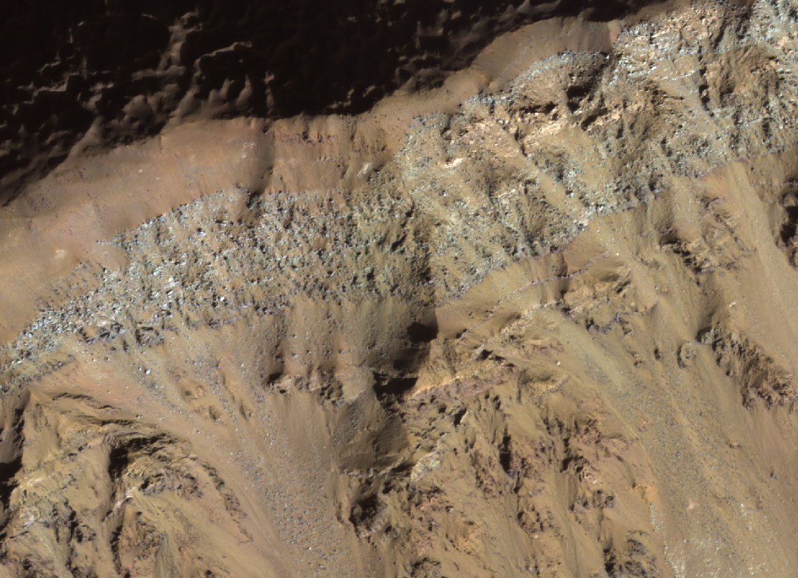
The enhanced-color subimage shows a great variety of colors and textures in the bedrock, where it is exposed from beneath a dark fine-grained mantle. The mantle is sometimes modified by the wind into dunes.

The bedrock here includes massive, layered, and broken-up (brecciated) areas. This crater is located in the volcanic plains between Argyre Planitia and Valles Marineris.

Wednesday, February 1, 2012

MARS HiRISE: Landscape Evolution

A review of existing images of Mars reveals a diverse landscape.

In some instances, such as around volcanoes and in valleys, a casual glance suggests the features are much like those here on Earth.

Closer inspection, however, often confirms differences in scale and or subtle characteristics relative to their more familiar terrestrial counterparts.

These same images also reveal a Mars that is often very different form the Earth. Some locations are marked by huge jumbles of blocks forming chaotic terrain, whereas others are buried beneath blankets of dust. Bizarre “thumbprint,” “Swiss cheese,” and other surface textures also occur.

Current limits on the resolution of Mars images often preclude distinguishing the of processes responsible for shaping a landscape.

The geomorphic thresholds that influence the efficiency and intensity of surface modification by different processes can often be hard to define. Indeed, different processes can sometimes produce very similar appearing landforms.

Detecting the subtle, diagnostic signatures of past water erosion versus wind or other processes often requires the high resolution imagery that will be obtained by HiRISE.

It is the analysis of HiRISE images that may provide some of the clues for a better understanding of the evolving Martian landscape.

See more of the Feb 1st HiRise Images