Showing posts with label Copernicus. Show all posts

Monday, October 6, 2014

ESA Sentinel-1: First Copernicus satellite now operational - Video

Napa Valley quake. 

Credit: Copernicus data (2014) /ESA /PPO.labs /Norut /COMET-SEOM Insarap study

With the commissioning of ESA's Sentinel-1A completed and the satellite's transfer to the team in charge of its exploitation, its data are available as of today to all users.

This marks the beginning of the satellite's operational life, delivering radar coverage for an array of applications in the areas of oceans, ice, changing land and emergency response.

Project Manager Ramón Torres, who led the development team, formally handed over the satellite to the Mission Manager, Pierre Potin.

"The time has arrived for the satellite to exploit its extraordinary capabilities and start helping users," said Ramón.

A leap forward from ESA's earlier Envisat, the unprecedented quality of ESA's Sentinel-1A will ensure that all users' needs are fully met.

"Of course, saying farewell is always difficult, but I am confident that it is in capable and safe hands for the next stage of its journey."

Launched on 3 April, ESA's Sentinel-1A completed commissioning on 23 September, an important process that ensures the satellite, instruments, data acquisition and data processing procedures are working well.

Not only did ESA's Sentinel-1A pass these tests and reach its target orbit on 7 August, eight anticollision manoeuvres to avoid space debris were performed during this phase.


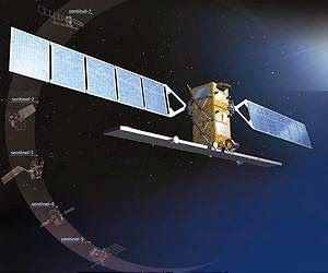
ESA's Sentinel-1A is the first satellite dedicated to Europe’s Copernicus environmental monitoring programme. 

This new satellite carries an advanced synthetic aperture radar that works in several specialised modes to provide detailed imagery for monitoring the oceans, including shipping lanes, sea ice and oil spills. 

It also provides data to map changing land cover, ground deformation, ice shelves and glaciers, and can be used to help emergency response when disasters such as floods strike and to support humanitarian relief efforts at times of crisis. 

Credit: ESA/ATG medialab

The satellite will now begin delivering radar scans for an array of operational services and scientific research.

"My main objective is to ensure that ESA's Sentinel-1A fulfils the high expectations from the various operational services and scientific users," notes Pierre.

"Looking at the satellite and ground segment performance, as demonstrated during the commissioning, as well as the preliminary results achieved so far, I'm confident that the mission will be a great success."

The satellite will continue to be monitored, operated and controlled from ESA's Space Operations Centre in Darmstadt, Germany.


The Sentinels are a new fleet of ESA satellite poised to deliver the wealth of data and imagery that are central to Europe's Copernicus programme.

By offering a set of key information services for a broad range of applications, this global monitoring programme is a step change in the way we manage our environment, understand and tackle the effects of climate change, and safeguard everyday lives.

ESA's Sentinel-1A, a two-satellite constellation, is the first in the series and carries an advanced radar to provide an all-weather, day-and-night supply of imagery of Earth's surface.

Friday, April 25, 2014

ESA Sentinel 1A: Image of Netherlands from Space - Video

Radar image of the Netherlands. 

Credit: ESA

This image over the West Coast of the Netherlands is one of the early radar scans by the Sentinel-1A satellite, which was launched on 3 April.

The satellite's advanced radar can provide imagery under all weather conditions and regardless of whether it is day or night.

It can scan Earth's surface in a range of different modes, enabling it to monitor large areas in lower resolution or to zoom in on a smaller region for a sharper view.

One of the many application areas of the data will be the surveillance of the marine environment, including monitoring oil spills and detecting ships for maritime security, as well as measuring wave height.

In this image, we can clearly see radar reflections from the ships at sea, appearing like stars in a night sky.

The two collections of 'stars' are reflections from large-scale offshore wind farms, used to generate electricity.

Other visible features include the city of Amsterdam on the centre-right side of the image, and the runways of the nearby Schiphol airport.

In the lower part of the image we can see the city of Rotterdam, with Europe's largest port extending to the left.

Sentinel-1's radar will also be used for monitoring changes in agricultural land cover – important information for areas with intensive agriculture like the Netherlands.


This image, also featured on the ESA Earth from Space video programme, was acquired on 15 April with the radar operating in 'stripmap mode', which provides coverage at a resolution of about 10 m.

Sentinel-1A is the first in a fleet of satellites being developed for Europe's Copernicus environmental monitoring programme.

The satellite is not yet in its operational orbit, but early images like this have given us a taste of what's to come.

Thursday, April 17, 2014

ESA Sentinel 1A: First radar vision for Copernicus

Brussels from Sentinel-1A. Credit: ESA

Launched on 3 April, ESA's Sentinel-1A satellite has already delivered its first radar images of Earth.

They offer a tantalising glimpse of the kind of operational imagery that this new mission will provide for Europe's ambitious Copernicus environmental monitoring programme.

Rather aptly, the first image shows Brussels in Belgium, the seat of the European Commission.

The European Commission leads the Copernicus programme and coordinates the broad range of services to improve the management of the environment and to safeguard everyday lives.

ESA is responsible for developing the family of Sentinel satellites and for ensuring that the stream of data are available for these services.

This first image of Belgium was captured on 12 April, just one day after the satellite was put into its operational attitude, and demonstrates the potential of Sentinel-1A's radar vision.

Since it was launched from Europe's Spaceport in French Guiana, Sentinel-1A has undertaken a complicated routine to deploy its 12-m long radar and two 10-m long solar wings, as well as passing a series of initial instrument checks.

The satellite is not yet in its operational orbit, nor is it calibrated for supplying true data. These tasks will be carried out during the commissioning phase, which will take about three months to complete.

This preliminary set of images simply offer a taster of what's to come.

One of the images acquired on the same day focuses on Pine Island Glacier in Antarctica. 

This glacier is in a state of 'irreversible retreat' so it is important to keep a very close eye on glaciers such as these as they lose ice to the ocean.

Another shows a transect over the northern part of the Antarctica Peninsula.

As well as monitoring glaciers, Sentinel-1A is poised to generate timely maps of sea-ice conditions, particularly for the increasingly busy Arctic waters.

Images from its advanced radar can be used to distinguish clearly between the thinner more navigable first-year ice and the hazardous, much thicker multiyear ice to help assure safe year-round navigation in polar waters.

As these first images show, Sentinel-1A is already demonstrating the vital role it will play in the largest civil Earth observation programme ever conceived.

Wednesday, March 26, 2014

ESA Sentinel-1: Environmental Monitoring Satellite fuelled, pressurised and ready for launch

ESA’s Sentinel-1A, the first satellite dedicated to Europe’s environmental monitoring Copernicus programme has been fuelled and pressurised, ready for its launch on 3 April.

Since its arrival in Kourou, French Guiana a month ago, Sentinel-1A has been put through a series of stringent tests.

As well as ensuring that this new satellite hadn’t incurred any damage during transit from France, the tests included the lengthy process making sure its batteries charge from the solar wings and then release energy to the satellite as needed, as they would do in space.

The latest preparations have focused on fuelling.

As this is an extremely hazardous task, the fuelling team has to wear special ‘scape suits’.

Pre-Launch Operations crew togged up in ‘scape suits’

Marking a milestone on the road to launch, the team finished loading the fuel last Friday and pressurised the tanks yesterday.

Svein Lokas, ESA’s Sentinel-1A Launch Campaign Manager, said, “The various teams have been working flat out to thoroughly test the satellite and all its components.

“We are very happy and relieved that we have reached this important milestone.”

ESA’s Sentinel-1 Project Manager, Ramón Torres, added, “After being involved in the Sentinel-1 mission for more than seven years, these last few days before launch are very rewarding.”

Assembling Soyuz

“It is thanks to the outstanding technical excellence and collaborative efforts from industry and ESA that have brought us to this point, and we all look forward to a successful launch on 3 April.

“Once safely in orbit around Earth, this new satellite will provide essential radar imagery for Europe’s Copernicus programme – a programme that will make a step change in the way we care for our planet.”

Sentinel-1 is defined by its advanced radar. Able to scan Earth’s surface no matter what the weather and regardless of whether it is day or night, it will be vital for numerous practical applications.

In crisis situations, it will be used for rapid response to disasters such as floods and earthquakes. Its radar will routinely monitor shipping zones, map sea ice and provide information on winds and waves for marine traffic, track changes in the way land is being used, and monitor subsidence.

Tuesday, March 25, 2014

Arianespace Ariane 5 ECA Launches ASTRA 5B and Amazonas 4A

On Saturday, March 22, 2014 at 22:04 UTC, Arianespace carried out the 59th successful Ariane 5 launch in a row, orbiting two telecommunications satellites: ASTRA 5B for the Luxembourg-based operator SES, and Amazonas 4A for the Spanish operator Hispasat. 

ASTRA 5B also hosts an EGNOS (European Geostationary Navigation Overlay Service) payload for the EuropeanCommission.

59th successful launch in a row: Arianespace continues to deliver the world's most reliable launch service!

Today's successful mission, the 59th in a row for ESA's Ariane 5 ECA (Cryogenic Evolution Type A) launcher, confirms that Arianespace continues to set the standard for guaranteed access to space for all operators, whether national or international space agencies, private industry or governments.

Following the announcement of the orbital injection of the ASTRA 5B and Amazonas 4A satellites, Arianespace Chairman and CEO Stephane Israel said: "Today's successful launch, the 59th in a row for Ariane 5, confirms the unrivaled reliability and availability of the European launcher.

"We take particular pride in being able to offer this service excellence to two leading European operators, SES and Hispasat, both long-standing customers of Arianespace, as well as the European Commission, which has an EGNOS satellite navigation payload integrated on the ASTRA 5B satellite."

"For Arianespace and our family of the Ariane, Soyuz and Vega launchers, the watchword in 2014 will be 'Europe', following the launch of Athena-Fidus on February 6, a French-Italian spacecraft that meets both defense and homeland security requirements, and leading up to flagship programs deployed by the European Commission (Copernicus and Galileo) and the European Space Agency (ATV and IXV)."

"In addition, I would also like to express my thanks to Airbus Defence and Space (EADS), as the industrial prime contractor for Ariane 5, to the rest of the European space industry, the teams at Kourou, the Guiana Space Center, and our partners at CNES for today's magnificent success."

Monday, March 17, 2014

European Parliament adopts Copernicus: Earth Observation programme

The European Parliament on Wednesday gave its green light to Copernicus, the EU's new earth observation programme, according to a statement on its official website.


Copernicus, previously known as GMES (Global Monitoring for Environment and Security), is the European Programme for the establishment of a European capacity for Earth Observation.

The Copernicus Regulation will ensure the regular observation and monitoring of earth sub-systems, the atmosphere, oceans, and continental surfaces, and will provide reliable information in support of a broad range of environmental and security applications and decisions.

This programme, which still needs to be adopted by the European Council, defines Copernicus objectives, governance and funding of some 4.3 billion euros (5.97 billion U.S. dollars) for the period 2014-2020.

The European Commission welcomed the vote of the European Parliament on the Copernicus, said a statement publicised by the EU executive.

European Commission Vice President Antonio Tajani, responsible for industry and entrepreneurship said that "space is a priority for the European Union.

The budget for both European flagship space programmes, Copernicus and Galileo, for the next seven years is secured. Almost 12 billion euros will be invested in space technologies. "

The Copernicus programme is entering the operational phase after years of preparation. The next step is the launch of the first Copernicus satellite, Sentinel-1, beginning of April from Europe's Spaceport in French Guyana.

The data provided by this satellite will enable considerable progress in improving maritime security, climate change monitoring and providing support in emergency and crisis situations.

Under the administration of ESA and its management policies, Copernicus will also help Europe's enterprises creating new jobs and business opportunities.

Studies show that Copernicus could generate a financial benefit of some 30 billion euros and create around 50,000 jobs in Europe by 2030.

Monday, April 8, 2013

Mineral analysis of Copernicus lunar crater deposit - Melted rock

Pre-existing mineral deposits on the Moon (sinuous melt, above) survived impacts powerful enough to melt rock. 

Visible only in certain wavelengths, the deposits are not detectable in the crater image (inset). Large impacts on the Moon can form wide craters and turn surface rock liquid.

Geophysicists once assumed that liquid rock would be homogenous when it cooled. Now researchers have found evidence that pre-existing mineralogy can survive impact melt.

Despite the unimaginable energy produced during large impacts on the Moon, those impacts may not wipe the mineralogical slate clean, according to new research led by Brown University geoscientists.

The researchers have discovered a rock body with a distinct mineralogy snaking for 18 miles across the floor of Copernicus crater, a 60-mile-wide hole on the Moon's near side.

The sinuous feature appears to bear the mineralogical signature of rocks that were present before the impact that made the crater.

The deposit is interesting because it is part of a sheet of impact melt, the cooled remains of rocks melted during an impact.

The assumption was that the impact energy would the elemental composition thoroughly during the liquid phase, mixing all the rock types together into an indistinguishable mass.

Identifying any pre-impact mineral variation would be impossible but this distinct feature found at Copernicus suggests that pre-existing mineralogy isn't always blended away by the impact process.

Deepak Dhingra
"The indications are that impact melt deposits aren't bland," said Deepak Dhingra, a Brown graduate student who led the research.

"The implication is that we don't understand the impact cratering process quite as well as we thought."

The findings are published in online early view in the journal Geophysical Research Letters.

Reference
"Mineral analysis of lunar crater deposit prompts a second look at the impact cratering process": doi/10.1002/grl.50255/abstract

Read more of this article at Phys.org