Showing posts with label Icy. Show all posts

Monday, December 30, 2013

NASA Cassini Image: Saturn's Titan and Icy Rhea

Saturn's largest and second largest moons, Titan and Rhea, appear to be stacked on top of each other in this true-colour scene from NASA's Cassini spacecraft released on Dec. 23, 2013.

The north polar hood can be seen on Titan appearing as a detached layer at the top of the moon on the top right. 

This view looks toward the Saturn-facing side of the smaller Rhea.

Credit: NASA

Wednesday, March 20, 2013

Saturn Moon Titan: Cyclones May Swirl on Icy Moon

An artist's conception of a lake on Titan. 

Cyclones could form above the Saturn's moon seas if they are mostly made of methane, new research indicates. 

CREDIT: NASA/JPL

Titan, an ocean-covered moon around Saturn that's usually so cold methane falls as rain, actually warms up enough in the summertime for high-speed cyclones to whip across its seas, according to new research.

Sea evaporation could create enough energy to produce winds as high as 44 miles per hour (70 km/h) on Titan, which is the largest of Saturn's dozens of moons.

But whether cyclones form at all depends very much on what Titan's seas are made of. If more than half of an ocean is composed of methane, the chemical recipe would be perfect for a storm.

The next step is getting Cassini, a NASA spacecraft orbiting Saturn and its moons, to look for one.

"In the next few years, we will approach summer in the [northern] polar region and we might have the chance to see a cyclone, if the condition is favorable," said Tetsuya Tokano, a researcher with the Institute for Geophysics and Meteorology at the University of Cologne.

Tokano's research is appearing in the April 2013 issue of the journal Icarus.


Cyclones on Earth happen principally in two ways. The first, which cannot happen on Titan because the temperature range is too small, occurs when cold fronts and warm fronts run into each other. Warm and cold air bend around each other and generate high-speed winds.

The second happens when heat from Earth's water warms the air and makes it rise, creating an energy cycle that produces high-speed winds. As the cycle continues, it fuels a spinning storm. This is what could happen on Titan.

Such winds could occur on Titan only above its mid-latitude seas, where there is the right combination of moisture and temperature to create the rising air. Tokano said the difficulty is that we don't yet know the exact chemical composition of Titan's seas.

"There is big uncertainty, and many possible types of hydrocarbons," he said. However, if the seas are mostly methane, they could transfer enough energy from the surface of the sea into the atmosphere to create cyclones. Methane is the only liquid on Titan that can condense like water vapour on Earth.

"This potentially would be large enough to make a cyclone in favorable conditions," Tokano said.

Saturday, March 16, 2013

NASA Cassini Image: Last Close-Up Photos of Icy Saturn Moon, Rhea

This raw image of Saturn's icy moon Rhea was taken on March 10, 2013 by NASA's Cassini spacecraft, and received on Earth March 10, 2013. 

The camera was pointing toward Rhea at approximately 174,181 miles (280,317 kilometers) away. 

CREDIT: NASA/JPL/Space Science Institute

NASA's Cassini spacecraft has snapped its last up-close photos of Saturn's icy moon Rhea, revealing a battered satellite covered in craters from violent impacts.NASA's Cassini spacecraft has snapped its last up-close photos of Saturn's icy moon Rhea, revealing a battered satellite covered in craters from violent impacts.

Cassini took the amazing new photos of Rhea on Saturday (March 9) during its fourth and final planned encounter with the Saturn moon.

During the encounter, the probe flew within just 620 miles (997 kilometers) of Rhea, which is Saturn's second-largest satellite.

"Take a good, long, luxurious look at these sights from another world, as they will be the last close-ups you'll ever see of this particular moon,"

Cassini imaging team lead Carolyn Porco, of the Space Science Institute in Boulder, Colo., said in a statement accompanying the photos.

This image was taken on March 09, 2013, and received on Earth March 10, 2013, by NASA's Cassini spacecraft. 

The camera was pointing toward Rhea at approximately 1,727 miles (2,779 kilometers) away, and the image was taken using the CL1 and CL2 filters. 

This image has not been validated or calibrated. 

CREDIT: NASA/JPL-Caltech/Space Science Institute

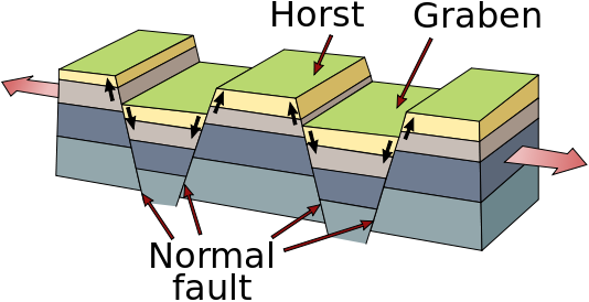
Saturday's flyby was designed primarily to measure Rhea's gravity field, mission scientists said, but Cassini also managed to take 12 pictures of the frigid moon's battered, pockmarked surface, including one that showcases a mysterious long, curving fracture called a graben.

Rhea is the second-largest of Saturn's 60-odd known moons, with a diameter of 949 miles (1528 km).

It's far smaller than the ringed planet's biggest natural satellite, Titan, which at 3,200 miles (5,150 km) across is nearly 50 percent wider than Earth's moon.

Rhea was discovered in 1672 by the mathematician and astronomer Giovanni Domenico Cassini, who gave his name to the NASA mission currently studying the Saturn system.

In 2010, researchers determined that the moon has a wispy atmosphere dominated by oxygen and carbon dioxide.

Possibly the oxygen was blasted free from water ice on Rhea's surface by charged particles streaming from Saturn, scientists say, but the origin of the carbon dioxide is more mysterious.

The Cassini mission — a joint effort involving NASA, the European Space Agency and the Italian Space Agency — launched in 1997 and arrived at Saturn in 2004.

It has been studying the ringed planet and its many moons ever since, and will continue to do so on an extended mission until at least 2017.

Tuesday, July 27, 2010

ESA Envisat Images: Improve safety in icy Southern Ocean

An award-winning new website is using realtime imagery from ESA's Envisat satellite to provide a wealth of information on sea ice to aid safe passage through the treacherous waters of the Antarctic.

Although remote, the Southern Ocean is an increasingly busy route for sea traffic.

These seas are used more and more to conduct scientific research, transport freight, harvest fertile fishing grounds and carry tourists to experience one of Earth's last wildernesses.

However, ever-changing pack ice and icebergs pose a serious danger to marine safety – as demonstrated by the loss of the MS Explorer tourist ship in 2007

Owing to the remote and inhospitable nature of the Southern Ocean, satellite imagery offers the only real practical means of obtaining timely information on sea ice required for the safe passage of marine traffic. While safety may be a primary concern, so is cost, as sea ice can significantly delay passage times.

For some years, ESA has been providing these key data to aid navigation – but the 'Polar View' ice-monitoring service in the Antarctic has recently been greatly improved by a wealth of satellite images made accessible through a new interactive website.

Wednesday, February 17, 2010

Pictures taken through the ISS Cupola Windows


Icy Aral Sea picture taken by ISS Astronaut Soichi through the new Cupola window installed on the Node 3 Tranquility module.


Picture of Sakura-jima, Kagoshima, Japan. An active volcano!

You can connect to Astronaut Soichi and other NASA astronauts via Twitter. @Astro_Soichi