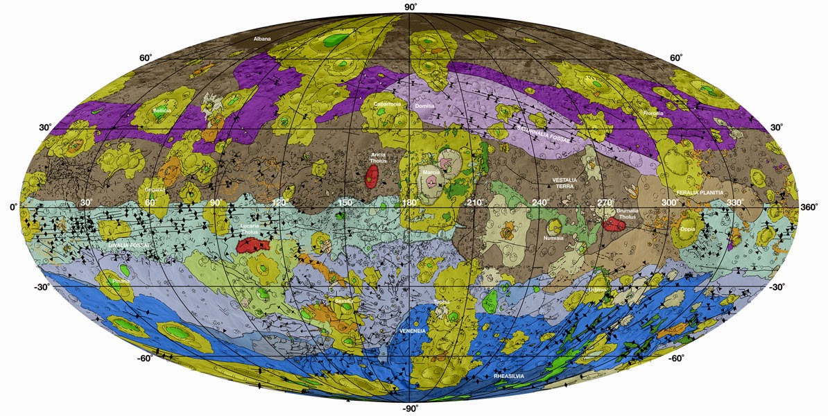
The new map of Vesta is a detailed geologic record of the asteroid.
Credit: NASA/JPL-Caltech/ASU
High-resolution new maps show the cratered, rocky surface of the huge asteroid Vesta in unprecedented detail, researchers say.
Images captured by NASA's Dawn spacecraft were woven together to create geologic maps of the giant asteroid Vesta.
The maps, the most detailed ones yet of of Vesta's surface features, serve as a geologic record of the asteroid that astronomers can compare to other planets and celestial bodies, researchers said.
Scientists combined 15 separate maps into one Vesta uber-map, which shows that meteorites have pummeled the asteroid since its formation about 10 million years after the birth of the solar system.
Astronomers can piece together Vesta's geologic timeline based on the sequence of meteorite impacts.
The brown colours on the map show the oldest and most heavily cratered areas on Vesta, while purple shows where Vesta was struck by two large impactors; the light purple and dark blue colors show the interior basins of the two massive impacts.
Greens and yellows show the youngest material on Vesta, which likely came from landslides or later meteorite strikes, researchers said.
A special camera onboard the Dawn spacecraft made the geologic maps possible. The camera uses seven different color filers that help analyze the different minerals covering Vesta's surface.
The photos were used to create 3D topographic models, which were then converted into maps of the surface.
It took over two years to sift through all the images and create the maps, said David Williams of Arizona State University, one of the lead scientists on the project.
The maps were published this week along with a series of papers in the journal Icarus.


No comments:
Post a Comment