Friday, January 31, 2014

NASA Earth Observatory: Sarychev Volcano Eruption View from Space - Video


On June 12, 2009, the International Space Station happened to be passing over the Sarychev Volcano just as it was beginning to erupt.

A newly released video based on several stunning snapshots taken by astronauts reveals the beauty and power of the erupting volcano.

Sarychev Peak, which rises to a height of 4,908 feet (about 1,500 meters), is the tallest peak on Matua Island in the northern part of the Kuril Islands, a Russian archipelago in the northwest Pacific Ocean.

The volcano, one of the most active volcanoes in the Kuril Island chain, erupted in 1989, 1986, 1976 and 1946.

The new volcano animation reveals the plume of ash and steam rising from Sarychev. The plume appears to be brown ash capped with a head of white steam, a result of air rising quickly in a strong updraft, before cooling and condensing.

"The plume was so immense that it cast a large shadow on the island," according to NASA Earth Observatory.

Spiderman robot spins draglines to cross open space

Spider-inspired robots carrying payloads descend on their draglines. 

Credit: Wang, et al. ©2014 IOP Publishing Ltd

Inspired by spiders' abilities to produce draglines and use them to move across open space, researchers have designed and built a robot that can do the same.

Similar to Spiderman shooting a dragline from his wrist, the robot produces a sticky plastic thread that it attaches to a surface, such as a wall or tree branch.

Then the robot descends the dragline, while simultaneously continuing to produce as much line as needed.

The mechanism could enable robots to move from any solid surface into open space without the need for flying.

The researchers, Liyu Wang, Utku Culha, and Fumiya Iida, at the Bio-Inspired Robotics Lab at ETH Zurich in Switzerland, have published a paper on the spider-inspired robot in a recent issue of Bioinspiration & Biomimetics.

"The dragline-forming robot is interesting because it implements a new concept: that a robot may accomplish a task by building structures to assist it," Wang told reporters.

"It is advantageous because the robot can flexibly vary the structure (in this case, the thickness of the dragline) according to environments or tasks that cannot be anticipated."


At first glance, the robot doesn't look much like a spider, since it is about 3 times larger and made of an assortment of metal, wires, and onboard batteries.

The source of its dragline material is a stick of thermoplastic adhesive (TPA), which functions similarly to a glue stick in a hot glue gun.

When the robot is ready to produce a dragline, the solid TPA stick is pushed through a heating cavity and out of a nozzle.

Two wheels located just beyond the nozzle help elongate and guide the dragline in the desired direction. The robot can form draglines with a thickness varying from 1 to 5 mm.

Since the hot TPA dragline is sticky, it can adhere to the solid surface from where the robot starts its journey into open space.

Once the dragline is stuck on the surface, the robot can begin descending down the dragline while producing more of it, mimicking the way that spiders fall down their draglines in a controlled way.

While spiders use a fourth pair of legs to move down their draglines, the robot relies on its two wheels for locomotion down the dragline.

More information: Liyu Wang, et al. "A dragline-forming mobile robot inspired by spiders." Bioinspir. Biomim. 9 (2014) 016006 (10pp). DOI: 10.1088/1748-3182/9/1/016006

DeepMind: Google acquires another AI organisation

The golden age of AI is upon us. Credit: kidpixo

All eyes turned to London this week, as Google announced its latest acquisition in the form of DeepMind, a company that specialises in artificial intelligence technologies.

The £400m pricetag paid by Google and the reported battle with Facebook to win the company over indicate that this is a firm well worth backing.

Although solid information is thin on the ground, you can get an idea of what the purchase might be leading to, if you know where to look.

Google has always been active in artificial intelligence and relies on the process for many of its projects.

Just consider the "driver" behind its driverless cars, the speech recognition system in Google Glass, or the way its search engine predicts what we might search for after just a couple of keystrokes.

Even the page-rank algorithm that started it all falls under the banner of AI. Acquiring a company such as DeepMind therefore seems like a natural step.

The big question is whether Google is motivated by a desire to help develop technologies we already know about or whether it is moving into the development of new technologies.

Google has the money and the drive to tackle the biggest questions in science, and developing computers that think like humans has, for a long time, been one of the biggest of them all.

Demis Hassabis
The headlines this week have described DeepMind as a "secretive start-up", but clues about what it gets up to at its London base can be gleaned from some of the research publications produced by the company's co-founder, Demis Hassabis.

Hassabis' three most recent publications all focus on the brain activity of human participants as they undergo particular tasks.

He has looked into how we take advantage of our habitat, how we identify and predict the behaviour of other people and how we remember the past and imagine the future.

As humans, we collect information through sensory input and process it many times over using abstraction.

We extract features and categorise objects to focus our attention on the information that is relevant to us.

When we enter a room we quickly build up a mental image of the room, interpret the objects in the room, and use this information to assess the situation in front of us.

The people at Google have, until now, generally focused on the lower-level stages of this information processing.

They have developed systems to look for features and concepts in online photos and street scenes to provide users with relevant content, systems to translate one language to another to enable us to communicate, and speech recognition systems, making voice control on your phone or device a reality.

The processes Hassabis investigates require these types of information processing as prerequisites.

Only once you have identified the relevant features in a scene and categorised objects in your habitat can you begin to take advantage of your habitat.

Only once you have identified the features of someone's face and recognised them as a someone you know can you start to predict their behaviour.

And only once you have built up vivid images of the past can you extrapolate a future.

Other recent acquisitions by Google provide further pieces to the puzzle.

Ray Kurzweil
It has recently appointed futurist Ray Kurzweil, who believes in search engines with human intelligence and being able to upload our minds onto computers, as its director of engineering.

And the purchase of Boston Dynamics, a company developing ground breaking robotics technology, gives a hint of its ambition.

Google is also getting into smart homes in the hope of more deeply interweaving its technologies into our everyday lives.

DeepMind could provide the know-how to enable such systems to exhibit a level of intelligence never seen before in computers.

Combining the machinery Google already uses for processing sensory input with the ideas under investigation at DeepMind about how the brain uses this sensory input to complete high-level tasks is an exciting prospect. It has the potential to produce the closest thing yet to a computer with human qualities.

Building computers that think like humans has been the goal of AI ever since the time of Alan Turing.

Progress has been slow, with science fiction often creating false hope in people's minds. But these past two decades have seen unimaginable leaps in information processing and our understanding of the brain.

Now that one of the most powerful companies in the world has identified where it wants to go next, we can expect big things. Just as physics had its heyday in the 20th century, this century is truly the golden age of AI.

NASA Messenger: Volcanoes on Mercury

NASA Messenger: Lava-flooded craters and large expanses of smooth volcanic plains on Mercury’s surface. 

Credit: NASA

Mercury has long been a mystery to scientists.

Until recently, knowledge of the planet was limited to the grey, patchy landscape revealed by the Mariner 10 probe, NASA's first mission to Mercury in the mid-1970s.

Mariner 10's photographs showed little detail of how the surface was formed. Like Venus, Earth and Mars, it was clear that Mercury's rough crust reflected millions of years of aerial bombardment by comets and meteorites.

Gaps in our understanding of the innermost planet have included some basic knowledge such as the planet's geology, how it was formed and evolved, and whether its interior was still active.

But now NASA's return mission, MESSENGER, is allowing scientists to confront the full complexity of Mercury's surface.

Amid the countless craters caused by meteor collisions, the landscape has marks that were not made by such collisions.

Using the increased resolution of MESSENGER's cameras, scientists have identified previously hidden volcanic activity, which changes what we know about the planet's formation, and even the history of our solar system.

The detailed pictures showed that Mercury seemed to have smooth, rimless depressions that were obviously not produced by meteor impacts.

They were surrounded by bright, reddish material, believed to have been left by pyroclastic flows – indicating that the depressions were volcanic vents.

The presence of pyroclastic material – which is composed of volcanic ash – showed that the eruptions had been explosive.

In some cases, the debris had been ejected more than 50km from the volcanic vents themselves. This is a remarkable distance, as it means that Mercury's volcanoes must have been much more powerful than previously thought.

Mariner 10
The force of an eruption is determined by volatile gases beneath the planet's surface.

Initially dissolved in magma, as they reach the surface, these gases rapidly swell and shred the magma into tiny shards called pyroclasts.

This means that, in general, the more volatiles there are in the magma feeding an eruption, the more explosive it will be.

To shoot debris so far, the magma in Mercury's crust would need to have been brimming with volatile gases.

The latest signs of volcanic deposits from MESSENGER suggest that nearly 1.5% of the parent magma may have been occupied by volatiles.

For gases this is a large fraction, because as they rise towards the surface their volume increases dramatically.

Thursday, January 30, 2014

Solar Dynamics Observatory (SDO) Image: Lunar Transit

On Jan. 30, 2014, beginning at 8:31 a.m EST, the moon moved between NASA’s Solar Dynamics Observatory (SDO), and the sun, giving the observatory a view of a partial solar eclipse from space. 

Such a lunar transit happens two to three times each year. 

This one lasted two and one half hours, which is the longest ever recorded. 

When the next one will occur is as of yet unknown, due to planned adjustments in SDO's orbit.

Image Credit: NASA/SDO


A rainbow of lunar transits as seen by NASA's Solar Dynamics Observatory (SDO)

The observatory watches the sun in many different wavelengths of light, shown here as different colour.

Image Credit: NASA/SDO

DigitalGlobe IKONOS-2 Images: Sochi Winter Olympics Sites From Space

This DigitalGlobe satellite image shows the 2014 Winter Olympics village in Sochi, Russia

Image Credit: DigitalGlobe

Here's a view of the Olympics only the astronauts can get.

New satellite imagery shows the sprawling sporting venues and slopes that will host the world's best athletes next week when the 2014 Winter Olympic Games in Sochi, Russia begin.

The recent photos come from DigitalGlobe, a commercial company based in Colorado that provides high-resolution images of the planet, using a variety of satellites, including IKONOS-2.


Ikonos-2 is an imaging satellite of GeoEye (formerly Space Imaging Inc., before the acquisition by ORBIMAGE) providing high-resolution imagery on a commercial basis. 

With Ikonos-2, a new era of 1m spatial resolution imagery began for spaceborne instruments in the field of civil Earth observation. 

The Ikonos satellite system was built by LMMS (Lockheed Martin Missiles & Space) of Sunnyvale, CA (USA).

Image Credit: ESA

This DigitalGlobe satellite image shows the 2014 Winter Olympics event slopes in Sochi, Russia

Both these images were collected Jan. 2, 2014. 

Image Credit: DigitalGlobe

NASA 2013 Astronaut Candidates Visit White House for State of STEM (SoSTEM) Address

NASA Astronaut Joe Acaba, center, moderates a panel discussion with NASA's 2013 astronaut candidates, from left, Christina M. Hammock, Andrew R. Morgan, Victor J. Glover, Jessica U. Meir, Tyler N. "Nick" Hague, Josh A. Cassada, Anne C. McClain, and Nicole Aunapu Mann

They are attending the annual White House State of Science, Technology, Engineering, and Math (SoSTEM) address, Wednesday, Jan. 29, 2014.

This event was held in the South Court Auditorium in the Eisenhower Executive Office Building on the White House complex in Washington.

Image Credit: NASA/Bill Ingalls

Wednesday, January 29, 2014

Climate Chnage: China Asian ozone pollution covers Pacific and US West Coast

China Asian pollution drifts east toward North America in 2010. 

In this picture Hawaii is denoted by the star.

Image: Nature Geoscience.

Air pollution from China and Asia has been rising for several decades but Hawaii had seemed to escape the ozone pollution that drifts east with the springtime winds.

Now a team of researchers has found that shifts in atmospheric circulation explain the trends in Hawaiian ozone pollution.

The researchers found that since the mid-1990s, these shifts in atmospheric circulation have caused China and Asian ozone pollution reaching Hawaii to be relatively low in spring but rise significantly in autumn.

The study, led by Meiyun Lin, an associate research scholar in the Program in Atmospheric and Oceanic Sciences (AOS) at Princeton University and a scientist at the National Oceanic and Atmospheric Administration's (NOAA) Geophysical Fluid Dynamics Laboratory, was published in Nature Geoscience.

"The findings indicate that decade-long variability in climate must be taken into account when attributing U.S. surface ozone trends to rising China and Asian emissions," Lin said.

Although protective at high altitudes, ozone near the Earth's surface is a greenhouse gas and a health-damaging air pollutant. The longest record of ozone measurements in the U.S. dates back to 1974 in Hawaii.

Over the past few decades, emissions of ozone precursors in China and Asia has tripled, yet the 40-year Hawaiian record revealed little change in ozone levels during spring, but a surprising rise in autumn.

Through their research, Lin and her colleagues solved the puzzle. "We found that changing wind patterns 'hide' the increase in China and Asian pollution reaching Hawaii in the spring, but amplify the change in the autumn," Lin said.

Using chemistry-climate models and observations, Lin and her colleagues uncovered the different mechanisms driving spring versus autumn changes in atmospheric circulation patterns.

The stronger transport of China and Asian pollution to Hawaii during autumn since the mid-1990s corresponds to a positive pattern of atmospheric circulation variability known as the Pacific-North American pattern (PNA).

"This study not only solves the mystery of Hawaiian ozone changes since 1974, but it also has broad implications for interpreting trends in surface ozone levels globally," Lin said.

"Characterizing shifts in atmospheric circulation is of paramount importance for understanding the response of surface ozone levels to a changing climate and evolving global emissions of ozone precursors," she said.

More information: Tropospheric ozone trends at Mauna Loa Observatory tied to decadal climate variability; Nature Geoscience (2014) doi:10.1038/ngeo2066

Satellite images detect underwater volcanic eruptions

Degassing lava erupts onto the seafloor at NW Rota-1 volcano, creating a billowing cloudy plume that is extremely acidic, and is full of carbon dioxide and sulfur. 

Credit: Woods Hole Oceanographic Institution (WHOI)

Oregon State University scientists have discovered how to pinpoint the time and place of underwater volcanic eruptions using satellite images.

Volcanic eruptions on the ocean floor can spew large amounts of pumice and fine particles, as well as hot water that brings nutrients to the surface, resulting in plumes of algae.

The plumes are picked up as shades of green in satellite images.

Robert O'Malley
"Some volcanic eruptions take place hundreds of feet below water and show no changes to the sea surface to the naked eye," said Robert O'Malley, an OSU research assistant in botany and plant pathology in OSU's College of Agricultural Sciences.

"It's amazing an orbiting satellite can detect color changes that indicate an eruption has taken place. Many times you can't spot an eruption if you were floating over it in a boat."

Underwater volcanic eruptions are rarely detected, so little is known about them, according to Mike Behrenfeld, an OSU expert in marine algae and and one of the researchers on the project.

"Satellite measurements of the planet are made every day," Behrenfeld said, "so this new method provides another tool for spotting these dramatic events that affect life in the oceans."

O'Malley and Behrenfeld developed a process for analyzing low-resolution images to show evidence of eruptions, which can extend over thousands of square miles, by matching five known eruptions with data from NASA satellites.

"We measured sunlight going into the ocean interacting with particles consistent with underwater volcanic eruptions," said O'Malley.

"From there, we found we could connect color data with documented eruptions. Now we have a better idea of what to look for in the data when we don't know about the eruption first."

Next, the researchers plan to test how well their method works as eruptions are happening. Further study will also focus on the depth at which eruptions can be detected.

The study was published in the journal Remote Sensing of the Environment.

More information: Read the study here: ir.library.oregonstate.edu/xmlui/handle/1957/45229

The Grand Tack model: 'Rogue' asteroids may be normal

Credit: NASA/JPL-Caltech

To get an idea of how the early solar system may have formed, scientists often look to asteroids.

These relics of rock and dust represent what today's planets may have been before they differentiated into bodies of core, mantle, and crust.

In the 1980s, scientists' view of the solar system's asteroids was essentially static: Asteroids that formed near the sun remained near the sun; those that formed farther out stayed on the outskirts.

But in the last decade, astronomers have detected asteroids with compositions unexpected for their locations in space: Those that looked like they formed in warmer environments were found further out in the solar system, and vice versa. Scientists considered these objects to be anomalous "rogue" asteroids.

But now, a new map developed by researchers from MIT and the Paris Observatory charts the size, composition, and location of more than 100,000 asteroids throughout the solar system, and shows that rogue asteroids are actually more common than previously thought.

Particularly in the solar system's main asteroid belt—between Mars and Jupiter—the researchers found a compositionally diverse mix of asteroids.

The new asteroid map suggests that the early solar system may have undergone dramatic changes before the planets assumed their current alignment.

For instance, Jupiter may have drifted closer to the sun, dragging with it a host of asteroids that originally formed in the colder edges of the solar system, before moving back out to its current position.

Jupiter's migration may have simultaneously knocked around more close-in asteroids, scattering them outward.

Francesca DeMeo
"It's like Jupiter bowled a strike through the asteroid belt," says Francesca DeMeo, who did much of the mapping as a postdoc in MIT's Department of Earth, Atmospheric and Planetary Sciences.

"Everything that was there moves, so you have this melting pot of material coming from all over the solar system."

DeMeo says the new map will help theorists flesh out such theories of how the solar system evolved early in its history.

She and Benoit Carry of the Paris Observatory have published details of the map in Nature.

The compositional diversity seen in this new asteroid map may add weight to a theory of planetary migration called the Grand Tack model.

This model lays out a scenario in which Jupiter, within the first few million years of the solar system's creation, migrated as close to the sun as Mars is today.

During its migration, Jupiter may have moved right through the asteroid belt, scattering its contents and repopulating it with asteroids from both the inner and outer solar system before moving back out to its current position—a picture that is very different from the traditional, static view of a solar system that formed and stayed essentially in place for the past 4.5 billion years.

"That [theory] has been completely turned on its head," DeMeo says. "Today we think the absolute opposite: Everything's been moved around a lot and the solar system has been very dynamic."

DeMeo adds that the early pinballing of asteroids around the solar system may have had big impacts on Earth.

For instance, colder asteroids that formed further out likely contained ice. When they were brought closer in by planetary migrations, they may have collided with Earth, leaving remnants of ice that eventually melted into water.

"The story of what the asteroid belt is telling us also relates to how Earth developed water, and how it stayed in this Goldilocks region of habitability today," DeMeo says.

More information: Paper: dx.doi.org/10.1038/nature12908

Russia's NORD device may travel to Mars 2020

NORD will help Mars 2020 rover figure out how humans can best use the red planet's resources and which parts of Mars are the most suitable habitats for humans in terms of minerals.

A device created by Russian scientists is bidding for a chance to travel to Mars aboard NASA's Mars 2020 rover.

In about five months or so, it will be clear whether NORD, the brainchild of the Moscow-based Space Research Institute, will participate in the mission.

NASA launched a competition for Mars 2020 research proposals in September. By now, the application submission is already over.

Mars 2020 is due to succeed its elder brother, Curiosity MSL, which has been exploring the red planet since August 2012. The new rover will be based heavily on the design of Curiosity.

The landing system and the chassis will be recreated without any additional engineering. This, NASA says, will reduce technical risks and make the project cheaper.

The main aim of the Curiosity mission was to find traces of past life-supporting environments on Mars. The goal has been achieved. Mars 2020 will look for traces of past life in those once-habitable environments.

Curiosity is equipped with DAN, a Russian-made neutron detector. DAN, or Dynamic Albedo of Neutrons, measures the energy of neutrons leaking from the ground.

It can detect water content as low as one-tenth of one percent as deep as 20 inches.

If water is present, liquid or frozen, hydrogen atoms slow the neutrons down.

These slower neutrons are measured by DAN.

"NORD has no generator. We replaced it with a gamma spectrometer designed to measure natural radiation on Mar's surface and analyze the chemical composition of Martian soil in areas explored by the rover," Igor Mitrofanov, an IKI laboratory chief, told reporters.

NORD will help Mars 2020 rover figure out how humans can best use the red planet's resources and which parts of Mars are the most suitable habitats for humans in terms of minerals.

The rock and soil samples collected by Nord will be stored inside Mars 2020 for several years until a new spacecraft arrives and takes them over.

It will then have to blast off to Earth - a complicated task, much more difficult than even blasting off from Moon, as it requires a rocket powerful enough to escape Mars' gravity.

Scientific evidence reveals extent space missions damage human immune systems

Russian Cosmonaut Yelena Serova

Some speculate that space trips involve the development of "heat shock" proteins, which cling to Toll path receptors and cut down the immune system' detectors for finding pathogens. 

The end result is a small reaction to a possibly huge pathogen risk.

Evidence is coming to light just how much space missions take a toll on humans' immune systems.

At least 29 cases of infectious diseases being contracted on board a spacecraft were reported on during a 2012 study that looked into 106 flights and 742 crew members.

Head colds, fungal infections, and gastroenteritis were just some of the ailments that overtook the participants of the study.

What may be worse is the fact that they are million miles away from home and do not get to have sufficient bed-rest or comfort foods while under the weather.

It could be noted as quite an oddity, that space illness does not get the hype that it most likely deserves.

"The immune system can go on the fritz in space: wounds heal more slowly; infection-fighting T-cells send signals less efficiently; bone marrow replenishes itself less effectively; killer cells- another key immune system player-fight less energetically," states a 2012 Nasa article in Time.

In space, pathogens enjoy an easy time growing strong and creating a resistance wall to antimicrobials.

Specifically, herpes and staph have been reported as thriving in gravity-free environments of a spacecraft that are in extremely sterile conditions.

One particular study, which was released this week, checked out the space-born Drosophila flies.

Specimens of this type are often examined because of how close in comparison the flies' immune system is to that of humans.

It was discovered that in the instance of fungal infections microgravity wiped out the immune's response.

The researchers also studied the centrifuge-induced hypergravity, discovering that the flies' immune responses to fungi heighten as gravity increases way beyond the normal range.

On a lighter note, the immune response in the space flies to bacteria was mentioned as being "robust".

Induced gravity through the use of centrifuge seems to be the best bet at solving immune system errors, an idea thought of as resourceful for keeping on top of bone and muscle mass.

Increasing astronauts' immunity would be a plus for their experience on space missions.

It also raises the question regarding the health of Space Tourists.

Read more about Space medicines and threats to astronauts' health 

NASA MABEL: Laser Lidar technology reveals how ice measures up

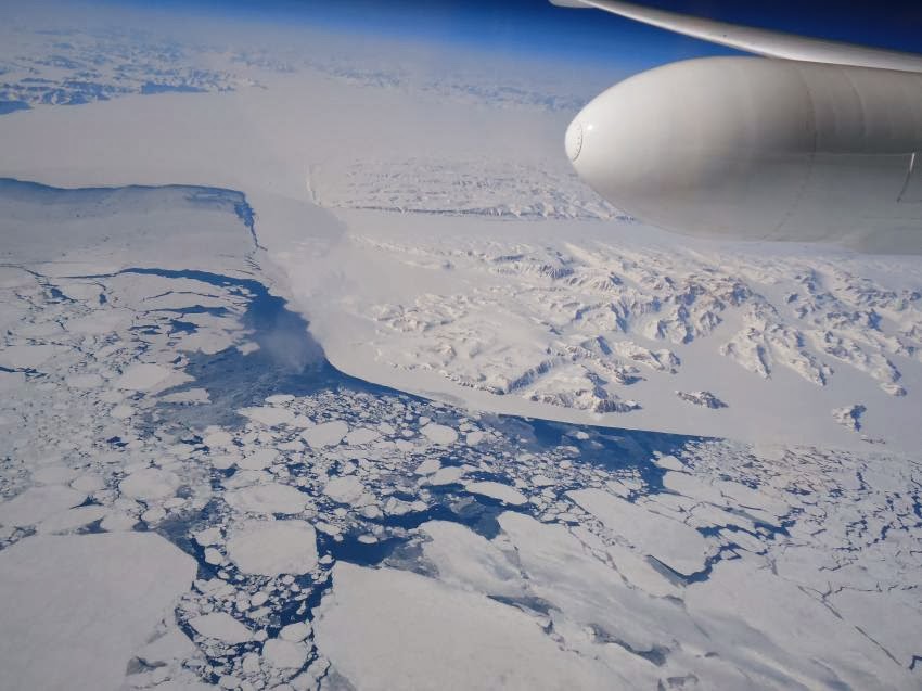
NASA's Multiple Altimeter Beam Experimental Lidar flew over Southwest Greenland's glaciers and sea ice to test a new method of measuring the height of Earth from space. 

Credit: NASA/Tim Williams

New results from NASA's MABEL campaign demonstrated that a photon-counting technique will allow researchers to track the melt or growth of Earth's frozen regions.

When a high-altitude aircraft flew over the icy Arctic Ocean and the snow-covered terrain of Greenland in April 2012, it was the first polar test of a new laser-based technology to measure the height of Earth from space.

Aboard that aircraft flew the Multiple Altimeter Beam Experimental Lidar (MABEL), which is an airborne test bed instrument for NASA's ICESat-2 satellite mission slated to launch in 2017.

Both MABEL and ICESat-2's ATLAS instrument are photon counters – they send out pulses of green laser light and time how long it takes individual light photons to bounce off Earth's surface and return.

ICESat-2's ATLAS instrument
That time, along with ATLAS' exact position from an onboard GPS, will be plugged into computer programs to tell researchers the elevation of Earth's surface – measuring change to as little as the width of a pencil.

This kind of photon-counting technology is novel for satellites; from 2003 to 2009, ICESat-1's instrument looked at the intensity of a returned laser signal, which included many photons.

So getting individual photon data from MABEL helps scientists prepare for the vast amounts of elevation data they'll get from ICESat-2.

"Using the individual photons to measure surface elevation is a really new thing," said Ron Kwok, a senior research scientist at NASA's Jet Propulsion Laboratory in Pasadena, Calif.

"It's never been done from orbiting satellites, and it hasn't really been done much with airborne instruments, either."

Ron Kwok
ICESat-2 is tasked with measuring elevation across Earth's entire surface, including vegetation and oceans, but with a focus on change in the frozen areas of the planet, where scientists have observed dramatic impacts from climate change.

There, two types of ice – ice sheets and sea ice – reflect light photons in different patterns.

Ice sheets and glaciers are found on land, like Greenland and Antarctica, and are formed as frozen snow and rain accumulates.

Sea ice, on the other hand, is frozen seawater, found floating in the Arctic Ocean and offshore of Antarctica.

MABEL's 2012 Greenland campaign was designed to observe a range of interesting icy features, said Bill Cooke, MABEL's lead scientist at NASA's Goddard Space Flight Center in Greenbelt, Md.

With the photon counts from different surfaces, other scientists could start analyzing the data to determine which methods of analyzing the data allow them to best measure the elevation of Earth's surface.

MABEL, short for "Multiple Altimeter Beam Experimental Lidar," serves as an ICESat-2 simulator. 

Credit: NASA /Kelly Brunt

"We wanted to get a wide variety of target types, so that the science team would have a lot of data to develop algorithms," Cooke said.

"This was our first real dedicated science mission."

The flights over the ocean near Greenland, for example, allowed researchers to demonstrate that they can measure the height difference between open water and sea ice, which is key to determining the ice thickness.

MABEL can detect enough of the laser light photons that bounce off Earth surface and return to the instrument, and programs can then make necessary elevation calculations, Cooke said.

Bill Cooke
"Part of what we're doing with MABEL is to demonstrate ICESat-2's instrument is going to have the right sensitivity to do the measurements," Cooke said. "You can do this photon counting if you have enough photons."

In an article recently published in the Journal of Atmospheric and Oceanic Technology, Kwok and his colleagues showed how to calculate elevation from MABEL data, and do so over different types of ice – from open water, to thin, glassy ice, to the snow-covered ice.

Tuesday, January 28, 2014

NASA AQUA Satellite: Tropical system affecting Mozambique's Nampula Province

NASA's Aqua satellite passed over the Mozambique Channel on January 28 at 10:35 UTC/5:35 a.m. EST and saw some of the thunderstorms had high cloud tops, where temperatures exceeded -63F/-52C (purple). 

Credit: NASA JPL, Ed Olsen

NASA's Aqua satellite captured infrared data on a developing area of tropical low pressure known as System 91S that was brushing the Nampula Province of Mozambique on January 28.

Nampula is a province in northern Mozambique and its eastern coast runs along the Mozambique Channel of the Southern Indian Ocean.

When NASA's Aqua satellite passed over the Mozambique Channel on January 28 at 10:35 UTC/5:35 a.m. EST the Atmospheric Infrared Sounder instrument (AIRS) captured infrared data on the clouds associated with System 91S.

AIRS showed some of the thunderstorms surrounding the low-level center of circulation had high cloud tops, where temperatures exceeded -63F/-52C, a threshold that indicates strong storms and potentially heavy rainmakers.

The Joint Typhoon Warning Center noted that animated multi-spectral satellite imagery showed that the low-level center was consolidating and that there were bands of thunderstorms wrapping into the center - a sign of strengthening.

System 91S was centered near 15.4 south and 41.6 east, about 810 nautical miles northeast of Maputo, Mozambique.

Maximum sustained winds are near the threshold for depression status, currently as high as 30 knots. The low is over warm enough waters to support further development.

ESA Sentinel-1A radar deployment - Video


Testing the deployment of the Sentinel-1A radar antenna (in fast motion) in the cleanroom at Thales Alenia Space in Cannes, France.

As the satellite is designed to operate in orbit, it is hung from a structure during tests to simulate weightlessness.

The Synthetic Aperture Radar (SAR), will provide an all-weather day-and-night supply of imagery for services such as the monitoring of Arctic sea-ice extent, routine sea-ice mapping, surveillance of the marine environment, monitoring land-surface for motion risks and mapping to support humanitarian aid and crisis situations.

Sentinel-1A – the first satellite built for the Copernicus environmental monitoring programme – is foreseen for launch this spring from Europe's spaceport in Kourou, French Guiana.

Monday, January 27, 2014

Green Bank Telescope (GBT): River of Hydrogen flowing through space

This composite image contains three distinct features: the bright star-filled central region of galaxy NGC 6946 in optical light (blue), the dense hydrogen tracing out the galaxy's sweeping spiral arms and galactic halo (orange), and the extremely diffuse and extended field of hydrogen engulfing NGC 6946 and its companions (red). 

The new GBT data show the faintly glowing hydrogen bridging the gulf between the larger galaxy and its smaller companions. 

This faint structure is precisely what astronomers expect to appear as hydrogen flows from the intergalactic medium into galaxies or from a past encounter between galaxies. 

Credit: D.J. Pisano (WVU); B. Saxton (NRAO/AUI/NSF); Palomar Observatory -- Space Telescope Science Institute 2nd Digital Sky Survey (Caltech); Westerbork Synthesis Radio Telescope (WSRT)

D.J. Pisano
Using the National Science Foundation's Robert C. Byrd Green Bank Telescope (GBT), astronomer D.J. Pisano from West Virginia University has discovered what could be a never-before-seen river of hydrogen flowing through space.

This very faint, very tenuous filament of gas is streaming into the nearby galaxy NGC 6946 and may help explain how certain spiral galaxies keep up their steady pace of star formation.

"We knew that the fuel for star formation had to come from somewhere. So far, however, we've detected only about 10 percent of what would be necessary to explain what we observe in many galaxies," said Pisano.

"A leading theory is that rivers of hydrogen – known as cold flows – may be ferrying hydrogen through intergalactic space, clandestinely fueling star formation. But this tenuous hydrogen has been simply too diffuse to detect, until now."

Spiral galaxy NGC 6946
Spiral galaxies, like our own Milky Way, typically maintain a rather tranquil but steady pace of star formation.

Others, like NGC 6946, which is located approximately 22 million light-years from Earth on the border of the constellations Cepheus and Cygnus, are much more active, though less-so than more extreme starburst galaxies.

This raises the question of what is fueling the sustained star formation in this and similar spiral galaxies.

Earlier studies of the galactic neighborhood around NGC 6946 with the Westerbork Synthesis Radio Telescope (WSRT) in the Netherlands have revealed an extended halo of hydrogen (a feature commonly seen in spiral galaxies, which may be formed by hydrogen ejected from the disk of the galaxy by intense star formation and supernova explosions).

A cold flow, however, would be hydrogen from a completely different source: gas from intergalactic space that has never been heated to extreme temperatures by a galaxy's star birth or supernova processes.

Using the GBT, Pisano was able to detect the glow emitted by neutral hydrogen gas connecting NGC 6946 with its cosmic neighbours. This signal was simply below the detection threshold of other telescopes.

The GBT's unique capabilities, including its immense single dish, unblocked aperture, and location in the National Radio Quiet Zone, enabled it to detect this tenuous radio light.

Astronomers have long theorized that larger galaxies could receive a constant influx of cold hydrogen by syphoning it off other less-massive companions.

In looking at NGC 6946, the GBT detected just the sort of filamentary structure that would be present in a cold flow, though there is another probable explanation for what has been observed.

It's also possible that sometime in the past this galaxy had a close encounter and passed by its neighbours, leaving a ribbon of neutral atomic hydrogen in its wake.

If that were the case, however, there should be a small but observable population of stars in the filaments.

Further studies will help to confirm the nature of this observation and could shine light on the possible role that cold flows play in the evolution of galaxies.

Journal Reference: D. J. Pisano. GREEN BANK TELESCOPE OBSERVATIONS OF LOW COLUMN DENSITY H I AROUND NGC 2997 AND NGC 6946. The Astronomical Journal, 2014; 147 (3): 48 DOI: 10.1088/0004-6256/147/3/48

ISS Astronauts repeat spacewalk to complete Urthecast camera job

Two Russian space station astronauts took a spacewalk Monday to complete a camera job left unfinished last month.

Oleg Kotov
Oleg Kotov and Sergey Ryazanskiy quickly got one of two commercially provided cameras installed outside the International Space Station, a task requiring multiple power connections.

Everything checked out well, unlike the spacewalk last month.

The two men worked so hard that Russian Mission Control outside Moscow urged them to "get your breath."

"We'll force ourselves to rest," one of the spacewalkers replied in Russian.

The astronauts had hooked up the Earth-observing cameras during a spacewalk after Christmas but ground controllers received no data from the cameras, and the spacewalkers had to haul everything back in.

The problem was traced to indoor cabling and fixed, according to NASA.

Sergey Ryazanskiy
This time, after the spacewalkers reattached the high-definition camera to the outside of the Russian portion of the space station, good electrical connectivity was reported between the instrument and Russian Mission Control.

NASA spokesman Rob Navias said Russian flight controllers were pleased with the results.

Next, Kotov and Ryazanskiy tackled the medium-resolution camera.

Images from these new cameras will be distributed by the Canadian company that owns them, UrtheCast Corp.

The cameras were launched to the space station in November in a deal between UrtheCast and the Russian Space Agency.

UrtheCast will post video on its website and sell images. The company expects it will take three months to calibrate the cameras, and that the system should be fully operational by summer.

The four other space station astronauts—two Americans, one Japanese and another Russian—monitored the spacewalk from inside.

Jansky Very Large Array (VLA): Solving a 30-year-old problem in massive star formation

This false-colour Very Large Array image of the ionized gas in the star forming region Sgr B2 Main was used to detect small but significant changes in brightness of several of the sources. 

The spots and filaments in this image are regions of ionized gas around massive stars. 

The changes in brightness detected support a model that could solve a 30-year-old question in high mass star formation. 

Credit: NRAO /Agnes Scott College

An international group of astrophysicists has found evidence strongly supporting a solution to a long-standing puzzle about the birth of some of the most massive stars in the universe.

Young massive stars, which have more than 10 times the mass of the Sun, shine brightly in the ultraviolet, heating the gas around them, and it has long been a mystery why the hot gas doesn't explode outwards.

Now, observations made by a team of researchers using the Jansky Very Large Array (VLA), a radio astronomy observatory in New Mexico, have confirmed predications that as the gas cloud collapses, it forms dense filamentary structures that absorb the star's ultraviolet radiation when it passes through them. As a result, the surrounding heated nebula flickers like a candle.

The findings were published recently in The Astrophysical Journal Letters.

"Massive stars dominate the lives of their host galaxies through their ionizing radiation and supernova explosions," said Mordecai-Mark Mac Low, a curator in the American Museum of Natural History's Department of Astrophysics and an author on the paper.

"All the elements heavier than iron were formed in the supernova explosions occurring at the ends of their lives, so without them, life on Earth would be very different."

Observations of the massive star forming region Sgr B2 were made with the Karl G. Jansky Very Large Array (VLA) in 1989 and 2012. 

The VLA has been operational since 1980 and received a major upgrade that was completed in 2011. 

Credit: NRAO/AUI

Stars form when huge clouds of gas collapse. Once the density and temperature are high enough, hydrogen fuses into helium, and the star starts shining.

The most massive stars, though, begin to shine while the clouds are still collapsing.

Their ultraviolet light ionizes the surrounding gas, forming a nebula with a temperature of 10,000 degrees Celsius. Simple models suggest that at this stage, the gas around massive stars will quickly expand.

But observations from the VLA radio observatory show something different: a large number of regions of ionized hydrogen (so-called HII regions) that are very small.

"In the old theoretical model, a high-mass star forms and the HII region lights up and begins to expand."

Chris De Pree
"Everything was neat and tidy," said lead author Chris De Pree, a professor of astronomy and director of the Bradley Observatory at Agnes Scott College.

"But the group of theorists I am working with were running numerical models that showed accretion was continuing during star formation, and that material was continuing to fall in toward the star after the HII region had formed."

More information: arxiv.org/abs/1312.7768

Cloud Bands Over the Western Sahara Desert, Mauritania

This photograph of cloud bands over southern Mauritania was taken from the International Space Station with an oblique angle such that the cloud shadows are a prominent part of the view. 

Beneath the clouds, the plateau of dark sedimentary rocks appears as a ragged, near-vertical escarpment (image top right). 

Isolated remnants of the plateau appear as dark mesas (flat-topped hills) across the top and near the center of the image.

The escarpment is about 250 meters high, with a field of orange-colored dunes at the base (image upper right).

Prevailing winds in this part of the Sahara Desert blow from the northeast. (Note that north is to the right.)

The wavy dunes are aligned transverse (roughly right angles) to these winds. The sand that makes the dunes is blown in from a zone immediately upwind (just out of the bottom of the image), where dry river beds and dry lakes provide large quantities of mobile sand.

This pattern is typical in the western Sahara Desert, where plateau surfaces are mostly dune free and dune fields are located in the surrounding lowlands.

Larger rivers deposit sandy sediment on the few occasions when they flow, sometimes only once in decades.

The image was taken by the ISS Expedition 38 crew and it has been cropped and enhanced to improve contrast, with lens artifacts removed.

Image Credit: NASA Earth Observatory

Extraterrestrial Intelligence: The Challenge of Comprehending E.T.'s IQ

A tiny jellyfish with green-glowing, fluorescent tentacles and red fluorescence in its body, owing to the chlorophyll in gobbled-up algae. 

Could we detect any evidence of intelligent signaling in such a creature if it were an alien species? 

Credit: Mikhail Matz, Islands in the Stream 2002, NOAA-OER

Although we often ponder the possible otherworldly morphology of extraterrestrials, a harder exercise is conceiving alien intelligences.

An alien might have four limbs, just like we humans or it might sport 17 tentacles, depending on evolutionary pressures.

We can observe, quantify and describe such things. But how can we truly gauge the workings of an alien mind?

A new paper, publishing in Acta Astronautica in February, offers a preliminary exercise meant to get us to think outside our own box in assessing alien intellect.

The exercise is called COMPLEX, which stands for "COmplexity of Markers for Profiling Life in EXobiology."

The project compares various non-human intelligences—including animals, microbes and machines—to each other (rather than humans) and across several categories of behavior and mental capability.

Denise Herzing
"The goal of COMPLEX would be to prepare ourselves for assessing other species if we find life in space," said Denise Herzing, the study's author and a biologist at Florida Atlantic University.

The research could be critical to astrobiology, which relies heavily on understanding Earthlings to gauge what's possible on other planets.

Across the dizzying array of Earth's biota, "intelligence" is an awfully tricky thing to pin down.

Historically, we've often defined intelligence in other beings based on how much it resembles our own.

We collect sound patterns from whales that could qualify as language, seize upon rudimentary tool use by crows, and admire the social complexity of elephant societies.

Viewing these non-human intelligences through a human lens, however, might be shortchanging these creatures' intellectual abilities.

Furthermore, when applied to non-Earthly life forms, our bias towards human intelligence's characteristics might really miss the mark.

Denise Herzing's background has well-prepared her for such an astrobiological undertaking. She is the research director and founder of the Wild Dolphin Project, an organization that has studied a dolphin pod for nearly three decades to learn about the animals' behaviours, social structure and more.

Many scientists consider dolphins (technically, porpoises; "dolphin" is a common name given to the animal) among the most intelligent creatures on Earth, perhaps on par with non-human primates.

Read the full article here

More information: Denise L Herzing, "Profiling nonhuman intelligence: An exercise in developing unbiased tools for describing other "types" of intelligence on earth," Acta Astronautica, Volume 94, Issue 2, February 2014, Pages 676-680, ISSN 0094-5765, dx.doi.org/10.1016/j.actaastro.2013.08.007