Showing posts with label GOCE. Show all posts

Wednesday, November 26, 2014

ESA GOCE: Monitoring Ocean currents

The ocean currents and their speeds (in cm/s) derived from ESA's GOCE data. 

During the mission’s final year, its super-low orbit was lowered even further to obtain improved measurements of Earth’s gravity field, from which information on ocean currents was derived. 

Buoys floating in the oceans were used to validate the above map, proving that this GOCE-based model is more accurate than any other model based on space-based data to date. 

Credit: ESA


The mean dynamic topography (MDT, in cm) of the world’s oceans in the highest resolution ever achieved from space-based data. 

MDT is calculated by taking the mean sea-surface height measured by satellites like Envisat, and subtracting the gravity model from GOCE

Red areas show where water levels are above the surface of the gravity model, while blue depicts areas where the water is below. From this, scientists calculated the speed of ocean currents.

A year after the satellite reentered the atmosphere, scientists using data from the GOCE satellite have made a breakthrough in our understanding of ocean currents.

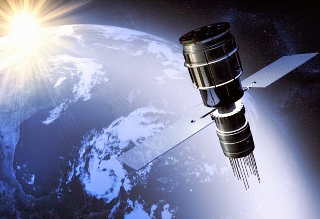
The Gravity field and steady-state Ocean Circulation Explorer (GOCE), mapped variations in Earth’s gravity with unrivalled precision, resulting in the most accurate shape of the ‘geoid’ – a hypothetical global ocean at rest – ever produced.

While the mission is well known for its gravity measurements, the second mission objective as an ‘ocean circulation explorer’ has reached a milestone.

Using GOCE data, scientists have produced the most accurate model of ocean current speeds to date.

To do this, the GOCE geoid was subtracted from the mean sea-surface height measured over a 20-year period by satellites including ESA’s veteran Envisat.

In 2011, GOCE delivered a model of the 'geoid' pictured here. At the time, it was the most accurate ever produced. 

The colours in the image represent deviations in height (–100 m to +100 m) from an ideal geoid. 

The blue shades represent low values and the reds/yellows represent high values. 

Credit: ESA

The result shows the mean dynamic topography of the ocean surface, showing higher- and lower-than-average water levels. Based on this map, ocean currents and their speeds were calculated and validated using in situ buoys.

The result shows that this GOCE-based model is more accurate than any other model based on space data to date.

“The accurate estimate of ocean surface currents, as provided today by the combination of GOCE and altimetry data, is crucial for the better understanding of the ocean dynamics,” said Marie-Hélène Rio from the Institute of Atmospheric Sciences and Climate of the Italian National Research Council.

“In particular, the assimilation of this information into operational ocean monitoring and forecasting systems will provide highly valuable new insight into the present and future state of the ocean.”

This was just one of many GOCE results presented today at the opening of the 5th International GOCE User Workshop at the UNESCO Headquarters in Paris, France.

Friday, September 26, 2014

ESA GOCE and NASA GRACE detect Gravity Anomaly in Antarctic Ice Loss

Changes in Earth’s gravity field resulting from loss of ice from West Antarctica between November 2009 and June 2012 (mE = 10–12 s–2). 

 A combination of data from ESA’s GOCE mission and NASA’s Grace satellites shows the ‘vertical gravity gradient change’. 

Credit: ESA

Although not designed to map changes in Earth's gravity over time, ESA's extraordinary satellite has shown that the ice lost from West Antarctica over the last few years has left its signature.

Artist rendering of ESA's GOCE satellite in orbit. 

Credit: ESA

More than doubling its planned life in orbit, GOCE spent four years measuring Earth's gravity in unprecedented detail.

Scientists are now armed with the most accurate gravity model ever produced.

This is leading to a much better understanding of many facets of our planet, from the boundary between Earth's crust and upper mantle to the density of the upper atmosphere.

The strength of gravity at Earth's surface varies subtly from place to place owing to factors such as the planet's rotation and the position of mountains and ocean trenches.

Changes in the mass of large ice sheets can also cause small local variations in gravity.

Recently, the high-resolution measurements from GOCE over Antarctica between November 2009 and June 2012 have been analysed by scientists from the German Geodetic Research Institute, Delft University of Technology in the Netherlands, the Jet Propulsion Lab in USA and the Technical University of Munich in Germany.

Remarkably, they found that the decrease in the mass of ice during this period was mirrored in GOCE's measurements, even though the mission was not designed to detect changes over time.

Using gravity data to assess changes in ice mass is not new.

The NASA, DLR (Germany) Grace satellite, which was designed to measure change, has been providing this information for over 10 years.

However, measurements from Grace are much coarser than those of GOCE, so they cannot be used to look at features such as Antarctica's smaller 'catchment basins'.

For scientific purposes, the Antarctic ice sheet is often divided into catchment basins so that comparative measurements can be taken to work out how the ice in each basin is changing and discharging ice to the oceans. Some basins are much bigger than others.

By combining GOCE's high-resolution measurements with information from Grace, scientists can now look at changes in ice mass in small glacial systems, offering even greater insight into the dynamics of Antarctica's different basins.


They have found that that the loss of ice from West Antarctica between 2009 and 2012 caused a dip in the gravity field over the region.

In addition, GOCE data could be used to help validate satellite altimetry measurements for an even clearer understanding of ice-sheet and sea-level change.

Using gravity data to assess changes in ice mass is not new. The NASA, DLR (Germany) Grace satellite, which was designed to measure change, has been providing this information for over 10 years.

However, measurements from Grace are much coarser than those of GOCE, so they cannot be used to look at features such as Antarctica's smaller 'catchment basins'.

For scientific purposes, the Antarctic ice sheet is often divided into catchment basins so that comparative measurements can be taken to work out how the ice in each basin is changing and discharging ice to the oceans. Some basins are much bigger than others.

By combining GOCE's high-resolution measurements with information from Grace, scientists can now look at changes in ice mass in small glacial systems, offering even greater insight into the dynamics of Antarctica's different basins.

They have found that that the loss of ice from West Antarctica between 2009 and 2012 caused a dip in the gravity field over the region.

In addition, GOCE data could be used to help validate satellite altimetry measurements for an even clearer understanding of ice-sheet and sea-level change.

Using 200 million measurements collected by ESA’s CryoSat mission between January 2011 and January 2014, researchers from the Alfred Wegener Institute in Germany have discovered that the Antarctic ice sheet is shrinking in volume by 125 cubic kilometres a year. 

The study, which was published in a paper published on 20 August 2014 in the European Geosciences Union’s Cryosphere journal, also showed that Greenland is losing about 375 cubic kilometres a year. 

Credit: ESA

ESA's CryoSat satellite, which carries a radar altimeter, has recently shown that since 2009 the rate at which ice is been lost from the West Antarctic Ice Sheet every year has increased by a factor of three.

And, between 2011 and 2014, Antarctica as a whole has been shrinking in volume by 125 cubic kilometres a year.

Johannes Bouman from the German Geodetic Research Institute said, "We are now working in an interdisciplinary team to extend the analysis of GOCE's data to all of Antarctica.

"This will help us gain further comparison with results from CryoSat for an even more reliable picture of actual changes in ice mass."

This new research into GOCE's gravity data revealing ice loss over time is being carried out through ESA's Earth Observation Support to Science Element.

Sunday, August 3, 2014

ESA GOCE: Lifetime of gravity measurements heralds new beginning

ESA's GOCE mission has delivered the most accurate model of the 'geoid' ever produced, which will be used to further our understanding of how Earth works. 

The colours in the image represent deviations in height (-100 m to +100 m) from an ideal geoid. 

The blue shades represent low values and the reds/yellows represent high values. 

A precise model of Earth's geoid is crucial for deriving accurate measurements of ocean circulation, sea-level change and terrestrial ice dynamics. 

The geoid is also used as a reference surface from which to map the topographical features on the planet. 

In addition, a better understanding of variations in the gravity field will lead to a deeper understanding of Earth's interior, such as the physics and dynamics associated with volcanic activity and earthquakes. 

Image courtesy ESA/HPF/DLR.

Although ESA's GOCE satellite is no more, all of the measurements it gathered during its life skirting the fringes our atmosphere, including the very last as it drifted slowly back to Earth, have been drawn together to offer new opportunities for science.

Carrying the first 3D gravity sensor in space, this state-of-the-art satellite measured Earth's gravity with unprecedented accuracy.

GOCE's four years in orbit resulted in a series of four gravity models, each more accurate than the last.

These models have been used to generate corresponding 'geoids' - the surface of a global ocean moulded by gravity alone.

Shaped by differences in gravity, the geoid is a crucial reference for understanding ocean circulation, sea-level change and ice dynamics.

From a mission that just keeps giving, a fifth model has now been produced. It incorporates data collected throughout the satellite's 42-month operational life.

The previous geoid, released in March 2013, was based on 27 months of measurements.

The satellite was designed to orbit at an extremely low altitude of 255 km to gain the best possible gravity measurements.

At the end of 2012, low fuel consumption allowed operators to extend its life and start to lower the satellite a further 31 km for even more accurate measurements.

This was at the very limit of its capability but maximised the return for science.

After more than doubling its planned life in orbit, the satellite ran out of fuel and drifted back into the atmosphere in November 2013.

The fifth gravity model and geoid, which ESA has recently made available, includes these final precious measurements, right up until the satellite finally stopped working and ironically succumbed to the force it was designed to measure.

Although the satellite is no longer in orbit, scientists now have the best possible information to hand about Earth's gravity, effectively a new beginning for the mission.

GOCE has already shed new light on different aspects of Earth and surpassed its original scope in a number of ways.

It is being used to understand how oceans carry huge quantities of heat around the planet and to develop a global height reference system.

It has provided information about atmospheric density and winds, mapped the boundary between Earth's crust and upper mantle, and used to understand what is going on in these layers far below our feet.

GOCE's achievements also include mapping a scar in Earth's gravity caused by the 2011 Japanese earthquake.

Changes in Earth’s gravity field resulting from the earthquake that hit Japan on 11 March 2011 (mE=10-12s-2). 

A combination of data from ESA’s GOCE mission and the NASA–German Grace satellite, shows the ‘vertical gravity gradient change’. The 'beachball' marks the epicentre.

Credit: ESA

The ultimate geoid model and gravity data will be used for years to come for a deeper understanding of Earth.

ESA's GOCE Mission Manager, Rune Floberghagen, said, "We are very happy with the results of the final, super-low altitude phase of our mission.

"In fact, efforts made by the mission team and by scientists to secure flight operations at these extreme altitudes and to process the data have resulted in a doubling of the information content and a very significant increase in spatial resolution.

"Indeed, our new 'Release 5 solutions' go well beyond the ambitious objectives we had when the GOCE project started.

"Scientists worldwide now have a satellite-based gravity field model at hand that will remain the de facto standard for many years to come."

Monday, February 17, 2014

Kosmos-1220: Russian satellite burns up in Earth atmosphere

The Kosmos-1220 was launched into by Russia in 1980 and classified as defunct the same year. 

Russian officials warned it will re-enter the earth's atmosphere on Sunday February 16, however officials say they don't know exactly where it will land.

Fragments of the defunct Russian Kosmos-1220 reconnaissance satellite have reportedly burned up in the atmosphere.

Kosmos-1220, a defunct Russian satellite was expected to crash back down to Earth today and was said to poses a "very real danger" if it fell on land.

Officials said parts of the Kosmos-1220 satellite fell out of orbit and re-entered the planet's atmosphere at high speeds.

Colonel Alexei Zolotukhin said the satellite fragments would most likely scatter into the Pacific Ocean.

But he accepted that the location of the spread of debris could be anywhere with officials having no control over the satellite.

"As of February 7, 2014 the fragments are expected to fall on February 16," Colonel Zolotukhin told Russian news agency Ria Novosti.

"The exact impact time and location of the fragments from the Kosmos-1220 satellite may change due to external factors."

Kosmos-1220 was launched in 1980 and briefly used by Soviet ships to monitor enemy naval forces before being taken out of service the same year.

Similar uncontrolled descents – such as the November 2013 re-entry of the European Space Agency’s GOCE satellite – have crashed harmlessly into the ocean.

But in 1978, a different decommissioned Kosmos 954 satellite crashed into an unoccupied part of Canada, spreading radioactive debris and leading to a lengthy clean-up.

And in 2009, a third Kosmos 2251 satellite crashed at over 26,000 miles per hour with a U.S. Iridium telecommunications satellite, sending thousands of bits of space junk into orbit.

Friday, February 7, 2014

ESA SWARM: Trio Heading for new heights - Video

The magnetic field and electric currents in and around Earth generate complex forces that have immeasurable impact on every day life. 

The field can be thought of as a huge bubble, protecting us from cosmic radiation and charged particles that bombard Earth in solar winds. 

Credit: ESA/ATG medialab

Some tricky manoeuvres are now under way to steer ESA's trio of Swarm satellites into their respective orbits so that they can start delivering the best-ever survey of our magnetic field.
Since the Swarm constellation was launched last November, engineers have been busy putting the satellites through their paces to make sure that the craft and instruments are working correctly.

This commissioning phase is an essential part of the mission before it starts providing data to further our understanding of the complex and constantly changing magnetic field.

Essential to life, the magnetic field protects us from cosmic radiation and charged particles that bombard Earth in solar winds.

Since the intensity of solar activity is currently lower than anticipated, the original plan of where to place the satellites at the beginning of science operations has been reviewed recently by the scientific community and experts in ESA.

Low solar activity means the satellites experience lower atmospheric drag, as clearly demonstrated by ESA's GOCE mission.

Swarm is tasked with measuring and untangling the different magnetic signals that stem from Earth's core, mantle, crust, oceans, ionosphere and magnetosphere.

Launched together, the three identical Swarm satellites were released into adjacent orbits at an altitude of 490 km.

The satellites may be identical, but to optimise sampling in space and time their orbits are different – a key aspect of the mission.

The data acquired from different locations can be used to distinguish between the changes in the magnetic field caused by the Sun's activity and those signals that originate from inside Earth.

The result for Swarm is a slightly different orbit configuration that will save satellite fuel at the beginning of the mission and offer a better return for science at a later stage.

Two satellites are now being lowered to an altitude of about 462 km and an inclination of 87.35°. They will orbit almost side by side, about 150 km apart as they pass over the equator. Over the life of the mission they will both descend to about 300 km.

The third satellite is being placed in a higher orbit of 510 km and at a different inclination of 87.75°, slightly closer to the pole.

Swarm is ESA’s first Earth observation constellation of satellites. 

The trio of identical satellites are designed to identify and measure precisely the different magnetic signals that make up Earth's magnetic field. 

The electrical field instrument, positioned at the front of each satellite, measures plasma density, drift and acceleration in high resolution to characterise the electric field around Earth. 

Credit: ESA/ATG medialab

Ralf Bock
The mission's System Engineer, Ralf Bock, said, "We are taking the satellites to their new heights through careful thrust and aim to achieve the constellation for science operations around mid-April."

Karim Bouridah, the System Manager, added, "We are also continuing to fine-tune the satellite sensors, such as the new electric field instrument."

Each satellite carries a novel instrument to measures the velocity, direction and temperature of incoming ions.

This information will be used to calculate the electric field near the satellite, an important counterpart to the magnetic field for studying processes in the upper atmosphere.

In fact, Swarm is the first mission to make these global, multipoint measurements.

Johnathan Burchill from the University of Calgary explains, "Spanning more than an orbit, the images in this movie demonstrate the capability of the instrument to operate under a wide range of plasma conditions."

Friday, December 6, 2013

ESA GOCE: Earth's gravity scarred by earthquake

Changes in Earth's gravity field resulting from the earthquake that hit Japan on 11 March 2011 (mE=10-12s-2). 

A combination of data from ESA's GOCE mission and the NASA-German Grace satellite, shows the 'vertical gravity gradient change'. 

The 'beachball' marks the epicentre.  

Image courtesy DGFI /TU Delft.

ESA's GOCE satellite has revealed that the devastating Japanese earthquake of 2011 left its mark in Earth's gravity - yet another example of this extraordinary mission surpassing its original scope.

GOCE mapped Earth's gravity with unrivalled precision for over four years, but nobody really expected the data to show changes over time.

Now, careful analysis shows the effects of the 9.0 earthquake that struck east of Japan's Honshu Island on 11 March 2011 are clearly visible in GOCE's gravity data.

Large earthquakes not only deform Earth's crust, but can also cause tiny changes in local gravity.

The strength of gravity varies from place to place on our planet's surface and it was GOCE's task to map these variations very precisely.

There are a number of reasons why values of gravity differ, but one is a consequence of material inside Earth being inhomogeneous and unevenly distributed.

Since earthquakes shift around rock and other material tens of km below the surface, they also cause small changes in the local gravity.

Earthquakes under oceans, as in the 2011 Japanese quake, can also change the shape of the sea bed. This displaces water and changes the sea level, which in turn also affects gravity.

After more than doubling its planned life in orbit, the satellite recently ran out of fuel and reentered the atmosphere, largely disintegrating in the process.

Although it is no longer in orbit, the real mission is only just starting because scientists will be analysing the data for years to come to help understand many aspects of our world.

Information from GOCE is being used to understand how oceans transport huge quantities of heat around the planet and to develop a global height reference system, for example.

The mission has already shed new light on different aspects of Earth - from atmospheric density and winds, to mapping the boundary between the crust and upper mantle, and to understand geodynamic processes occurring in these layers far below our feet.

In a surprising discovery earlier this year unrelated to gravity changes, the satellite's accelerometer and ion thruster also revealed that GOCE had 'felt' sound waves in space from the Japanese quake.

Friday, November 8, 2013

ESA GOCE Gravity research satellite re-enters Earth's Atmosphere

The European Space Agency says its GOCE research satellite crashed to Earth on Sunday night with 25% of it falling as debris.

European satellite met its fiery doom in Earth's atmosphere late Sunday (Nov. 10), succumbing to the same gravitational pull of the planet that it spent the last four years mapping like never before.


The European Space Agency's GOCE satellite fell from space Sunday at 7 p.m. EST (0000 Nov. 11 GMT) while flying on a path that would take it over Siberia, the Western Pacific Ocean, the eastern Indian Ocean and Antarctica, ESA officials said.

"As expected, the satellite disintegrated in the high atmosphere and no damage to property has been reported," ESA officials wrote in a statement.

GOCE was launched in 2009 to map the Earth's gravitational field. It ran out of fuel last month, ending the mission.

Thursday, September 12, 2013

ESA GOCE: 'Ferrari of space' set to fall to Earth

Undated artist's impression of the Gravity Ocean Circulation Explorer satellite

Dubbed the "Ferrari of space" for its sleek, finned looks, it will shortly run out of fuel and fall to Earth after a successful mission, the European Space Agency (ESA) says.

A science satellite dubbed the "Ferrari of space" for its sleek, finned looks will shortly run out of fuel and fall to Earth after a successful mission, the European Space Agency (ESA) says.

Launched in 2009, the satellite—a hi-tech craft designed to monitor gravity and ocean circulation—is likely to break up in mid-October, its mission manager told reporters.

The Gravity Ocean Circulation Explorer (GOCE) orbits at an extremely low altitude of just 260 kilometres (160 miles), where there are lingering molecules of atmosphere.

To reduce drag, it has an arrow-like octagonal shape and two fins to provide extra aerodynamic stability, a departure from the box-like form of satellites that operate in the complete vacuum of space.

It stays aloft thanks to an ion engine that began with a stock of 41 kilos (90.2 pounds) of fuel and is now down to about two kilos (4.4 pounds), Rune Floberghagen said from an ESA symposium in Edinburgh, Scotland.

"We are facing the situation where the electrical propulsion system which keeps the spacecraft flying at this extremely low altitude will stop working somewhere between the end of September and the beginning of November—the best engineering prediction is in the middle, somewhere in the 16th or 17th October," he said.

Most of the 5.3-metre (17.2-foot) spacecraft will break up and burn when it tumbles to an altitude of 75 to 80 kilometres, he said.

According to re-entry analysis, about 250 kilos of its one-tonne mass will survive, hitting the surface in a trail of "between 40 and 50 fragments" extending over 900 kilometres, he said.

It was impossible right now to say where the trail would be, as the re-entry is uncontrolled, Floberghagen said.

The first global gravity model based on GOCE satellite data was presented at ESA’s Living Planet Symposium. 

Based on only two months of data, from November and December 2009, it illustrates the excellent capability of GOCE to map tiny variations in Earth’s gravity field.

Floberghagen explained that it was only in 2008, after GOCE was designed and built, that an international agreement required research satellites to have propulsion enabling a targeted re-entry that leads to a breakup over the ocean, thus reducing the risk of impacting inhabited areas.

"It is much less than other (uncontrolled) re-entries, it is a very small aircraft in fact. We should put this into perspective and not over-dramatise what is happening here," he said, adding that ESA was advising national authorities on the upcoming event.

Floberghagen said the fuel was supposed to last 20 months.

But the mission has been hugely helped by extremely low solar activity, which also reduces the density of air molecules at this height.

As a result, the 350-million-euro ($465-million) mission, after teething problems, has lasted twice has long as scheduled.

"Everyone is extremely happy with this mission, both in our ability to monitor Earth's gravity field, and also the spinoff achievements, our ability to understand and use the payload onboard," said Floberghagen.

"The science achievements have been rather remarkable and we have demonstrated a lot of new technologies," he said.

Wednesday, November 21, 2012

ESA GOCE Satellite: Comes Closer to Earth to work

A European gravity-mapping satellite orbiting about 340 miles closer to Earth than any other satellite is to be brought even lower and closer, officials say.

The Gravity Field and Steady-State Ocean Circulation Explorer, or GOCE, launched by the European Space Agency in 2009, is to have its orbit lowered by 12 miles to improve the resolution of its data-gathering instruments, ESA officials said.

Controllers have been reducing the height of the satellite's orbit by about 1,000 feet a day since August.

The move is not without its risks, as GOCE will have to fight atmospheric drag to stay aloft and maintain the stability needed to measure Earth's gravity.

But the improvement in accuracy should be worth it, the ESA said.

"The science benefit that you get from decreasing the altitude and thereby increasing the spatial resolution of the data, and also the precision of what you can measure, is quite spectacular," mission manager Rune Floberghagen told the BBC.

"We will get about a 35 percent increase in the quality of the data."

GOCE is equipped with super-sensitive instrumentation to measure the subtle variations in the pull of gravity across the surface of the Earth.

Tuesday, November 20, 2012

ESA GOCE: Earth's Gravity Fields Mapped

ESA's GOCE mission has delivered the most accurate model of the 'geoid' ever produced.

Red corresponds to points with higher gravity, and blue to points with lower gravity.

CREDIT: ESA/HPF/DLR

It's already made the most detailed map yet of Earth's gravity fields, but the GOCE satellite isn't done yet: Now it's lowering its orbit and coming closer and closer to Earth to make an even better map.

The data from the GOCE satellite, which is run by the European Space Agency, is enormously useful to scientists like geologists and climatologists and to oil companies and government officials.

Measurements from the satellite have been used to visualize what is going on beneath the Earth's surface.

The satellite has helped track the underground movement of lava and detect changes in gravity caused by melting glaciers, and it has produced the first high-resolution map of the boundary between Earth's crust and mantle.

But by lowering its orbit from 158 miles (255 kilometers) high to 146 miles (235 km) — which is about 310 miles (500 km) lower than most Earth observation satellites — the satellite is likely to produce an even more accurate map, the ESA says.

The satellite is descending by about 980 feet (300 meters) a day and is slated to reach its new orbit in February.

The maps produced by the satellite show the "geoid" of the Earth, a hypothetical surface around the planet at which the planet's gravitational pull is the same everywhere.

Anything with mass has a gravity field that attracts objects toward it. The strength of this gravity field depends on the mass of the body. Since Earth's mass isn't spread out evenly, its gravity field is stronger in certain areas than in others.

The strength of Earth's gravity varies depending on the depth of an ocean trench or height of a mountain, as well as the density of material.

Over dense areas, where gravity is stronger, the geoid moves away from the real surface of the planet, and where gravity is weaker, the geoid moves closer to the real surface.

Mapping this geoid helps to conduct precise measurements of ocean circulation, sea-level changes and the mass of polar ice sheets, according to an ESA news release.

Monday, November 19, 2012

ESA GOCE: Gravity mapper surfs Earth's upper atmosphere


Europe's ultra-low-flying gravity-mapping satellite, Goce, is being manoeuvred even closer to the planet.

The arrow-shaped spacecraft has spent most of its mission at an altitude of 255km - that's about 500km below most other Earth-observing missions.

Engineers are now bringing it down by 20km to improve its data resolution.

But it will be a tricky operation. Goce will have to fight atmospheric drag to stay aloft and maintain the stability needed to measure Earth's gravity.

"The science benefit that you get from decreasing the altitude and thereby increasing the spatial resolution of the data, and also the precision of what you can measure, is quite spectacular," explained mission manager Dr Rune Floberghagen. (Interviewed here)

"We will get about a 35% increase in the quality of the data," he reported.

GOCE: The Gravity Field and Steady-State Ocean Circulation Explorer was launched in 2009.

It is part of a series of innovative research satellites developed by the European Space Agency (Esa).

It carries super-sensitive instrumentation to detect the tiny variations in the pull of gravity across the surface of the planet.

The maps it produces can have very broad applications. The data is a key reference in civil engineering for relating heights measured at widely separated locations, and for the computer models that need to understand how the oceans move to forecast future changes in climate.

Recent successes include producing the first global high-resolution map of the boundary between the rocks of the Earth's crust and its mantle - the famous Mohorovicic (or "Moho") discontinuity, which lies tens of kilometres below the planet's surface.

Tuesday, March 13, 2012

High-Res Show Crust-Mantle Boundary - Moho, Where Is Earth's Mantle?

This map shows the global Mohorovičić discontinuity, better known as Moho, based on data from the GOCE satellite.

CREDIT: GEMMA project

Beneath the Earth's crust, the outermost hard shell that makes up just 1 percent of the volume of the planet, lies a hot, viscous layer of rock called the mantle.

Together, the crust and upper portion of the mantle. called the lithosphere, are where most important geological processes occur, such as mountain-building, earthquakes and the source of volcanoes.

The slow churning and overturning of the mantle is what drives the movements of Earth's tectonic plates.

New methods of observation using satellites are helping scientists learn more about this important layer of the Earth's inner and outer layers and where it begins under different regions of the planet.

Andrija Mohorovičić
Until just a century ago, we didn’t know Earth has a crust. In 1909, Croatian seismologist Andrija Mohorovičić found that at about 50 km underground there is a sudden change in seismic speed.

Ever since, that boundary between Earth’s crust and underlying mantle has been known as the Mohorovičić discontinuity, or Moho.

Even today, almost all we know about Earth’s deep layers comes from two methods: seismic and gravimetric.

Seismic methods are based on observing changes in the propagation velocity of seismic waves between the crust and mantle.

Gravimetry looks at the gravitational effect due to the density difference caused by the changing composition of crust and mantle.

But the Moho models based on seismic or gravity data are usually limited by poor data coverage or data being only available along single profiles.

GEMMA Project
GEMMA’s Moho map is based on the inversion of homogenous well-distributed gravimetric data.

For the first time, it is possible to estimate the Moho depth worldwide with unprecedented resolution, as well as in areas where ground data are not available.

This will offer new clues for understanding the dynamics of Earth’s interior, unmasking the gravitational signal produced by unknown and irregular subsurface density distribution.

GEMMA is being carried out by Italian scientist Daniele Sampietro and is funded by the Politecnico di Milano and ESA’s Support To Science Element under the Changing Earth Science Network initiative.

This initiative supports young scientists at post-doctoral level in ESA Member States to advance our knowledge in Earth system science by exploiting the observational capacity of ESA missions

Read more at the ESA Goce website

Friday, March 4, 2011

4th International GOCE User workshop

The European Space Agency (ESA) is organising the 4th in a series of International GOCE User Workshops from 31 March to 1 April 2011 at the Technische Universität München (TUM), Germany.

It is intended to provide potential users of GOCE data products with the opportunity to obtain the latest information on satellite performance as well as details regarding ground segment operations, data products and user services. 

It will allow users to learn about product content and quality and the outcome of the data calibration and validation. This Workshop is seeking the presentation of new results based on GOCE data in all application areas. 

Two months prior to the Workshop, the European Space Agency will release the second generation gravity field solutions based on GOCE data.

Further details available on the GOCE Portal

ESA GOCE Delivers

The first geoid based on only two months of GOCE data, from November and December 2009, shows the excellent capability of the satellite to map tiny variations in Earth’s gravity.

The geoid is the shape of an imaginary global ocean dictated by gravity in the absence of tides and currents. It is a crucial reference for accurately measuring ocean circulation, sea-level change and ice dynamics – all affected by climate change.

An accurate model of the geoid is also important for surveying and geodesy, and for studying Earth interior processes.

Credits: ESA

More information on the ESA Portal

Wednesday, September 29, 2010

ESA's GOCE Operational again


Following recovery from a glitch that prevented ESA’s GOCE gravity mission from sending any scientific data to the ground, the satellite has been gently brought back down to its operational altitude and resumed normal service – delivering the most detailed gravity data to date.

Data from GOCE will result in a unique model of the ‘geoid’, which is the surface of an ideal global ocean at rest. It is a crucial reference for accurately measuring ocean circulation, sea-level change and ice dynamics – all affected by climate change. Volker Liebig,

Director of ESA’s Earth Observation Programmes, said," I am very happy that the scientific measurements now continue and we can profit from the current low solar activity and measure the best-ever geoid." 

To observe the strongest gravity signal possible, the Gravity field and steady-state Ocean Explorer (GOCE) orbits at an exceptionally low altitude: just 255 km above Earth, skimming the fringes of our atmosphere. However, when the telemetry problem was discovered in July, operators raised GOCE’s orbit to 263 km while experts set about fixing it.

The reason for this was to safeguard the sophisticated xenon ion engines, which gently compensate for atmospheric drag in the satellite’s normal low orbit. The thrusters help to keep the satellite stable in ‘free fall’ to prevent any buffeting from the residual air at this low altitude, which could drown out the gravity data.

The telemetry problem was resolved earlier this month and operators have spent the last three weeks gently bringing GOCE back down to the very precise altitude of 254.9 km – within 10 m!

The first global gravity model based on GOCE satellite data was presented at ESA’s Living Planet Symposium.

Based on only two months of data, from November and December 2009, it illustrates the excellent capability of GOCE to map tiny variations in Earth’s gravity field.

Credits: ESA – GOCE High Level Processing Facility

Now back in the correct orbit with all systems fully functional, GOCE is back to its job of mapping Earth’s gravity with unprecedented accuracy and resolution.

ESA’s GOCE Mission Manager, Rune Floberghagen said, "After working hard to resolve the problem we experienced with the telemetry transmission, it certainly feels good to have the satellite back doing its job of measuring of the gravity field."