Showing posts with label frozen. Show all posts

Monday, June 30, 2014

What is beneath the cracked surface of Pluto's moon Charon?

An artist’s concept of Pluto as viewed from the surface of one its moons. 

Pluto is the large disk at the center of the image. Charon is the smaller disk to the right. 

Credit: NASA, ESA and G. Bacon (STScI)

Is there evidence of an ocean-past or present-waiting to surprise us on Charon?

It isn't impossible. In fact, it might be likely.

What used to be the smallest planet in our solar system has, comparatively, the biggest moon.

Pluto, now classified as a dwarf planet, has a moon, Charon, almost 1/8th its own mass and almost half its physical volume.

Our Moon, by comparison, has about 1% of the Earth's mass and only 2% of its volume.

Charon is so large compared to Pluto that some astronomer's consider the two to be a sort of binary dwarf-planet system, as opposed to a moon-and-planet system.

Both Charon and our Moon are believed to have formed in the same way: when they were knocked off their parent planets.

Enormous collisions liquified parts of the Earth and Pluto. The debris was thrown into orbit where it later cooled.

In the process of cooling into solid bodies around the Earth and Pluto, the Moon and Charon became locked to their parent planets' orbits.

That locking of the planets to moons results in tides: here on Earth, on the Moon, and, we believe, on Pluto and Charon.

An analysis by scientists at Goddard suggests that tides on Pluto and Charon could have been especially high as Charon cooled.

This is because the part of Pluto knocked into orbit didn't get very far. Charon formed incredibly close to Pluto: only 19,000 km (12,000 miles) away.

By comparison, our Moon is currently 384,000 km (238,855 mi) from Earth. Initially, the orbit might not have been very circular, either: it might have been more eccentric or elliptical-shaped.

Eccentrically-moving, close-by Charon would have pulled on Pluto, and Pluto would have pulled back, resulting in heating of both planets and, maybe, an ocean under Charon's ice shell.

Alyssa Rhoden
Depending on exactly how Charon's orbit evolved, particularly if it went through a high-eccentricity phase, there may have been enough heat from tidal deformation to maintain liquid water beneath the surface of Charon for some time," said Alyssa Rhoden of NASA's Goddard Space Flight Center in Greenbelt, Maryland.

"Using plausible interior structure models that include an ocean, we found it wouldn't have taken much eccentricity (less than 0.01) to generate surface fractures like we are seeing on Europa."

Artist impression of the New Horizons spacecraft as it approached Jupiter en route to Pluto. 

Credit: NASA

On icy moons like Europa and Enceladus, tidal forces exerted by their parent planets cause massive surface cracks to form.

Those cracks are easily appreciated by passing spacecraft. According to Rhoden and colleagues' model, Charon's surface should be similarly cracked.

We expect to see evidence of this fractured surface geology as the New Horizons spacecraft approaches Pluto. New Horizons will pass directly over Pluto and Charon, briefly, on July 15th 2015.

Charon was discovered thirty-five years ago, in 1978, but well-photographed for the first time by New Horizons in 2013.

With the 2015 close-up just around the corner, scientists are working swiftly to make best use of surface photographs returned by the spacecraft.

New Horizons will give us the ability to resolve objects as small as a football field on part of the surface of Pluto and Charon.

With pictures of that detail and models such as this one, we may be able to look backwards in time to determine details about both bodies, such as how thick their ice shells were when they formed.

Studying patterns of fractures in Charon's surface is critical to building accurate models of the ice shell and layers beneath.

"Our model predicts different fracture patterns on the surface of Charon depending on the thickness of its surface ice, the structure of the moon's interior and how easily it deforms, and how its orbit evolved," said Rhoden.

"By comparing the actual New Horizons observations of Charon to the various predictions, we can see what fits best and discover if Charon could have had a subsurface ocean in its past, driven by high eccentricity."

The oceans of certain icy moons with surface fractures are considered to be places where extraterrestrial life might be found.

Like Charon, Europa and Enceladus are very cold and very distant from the sun. In all three cases, the formation and maintenance of life would depend upon a reliable energy source as well as elements that can participate in the chemistry of life, such as carbon, nitrogen, and phosphorus.

New Horizons Long Range Reconnaissance Imager (LORRI) composite image showing the detection of Pluto’s largest moon, Charon. 

When these images were taken on July 1 and July 3, 2013, the New Horizons spacecraft was still about 550 million miles (880 million kilometers) from Pluto.

On July 14, 2015, the spacecraft is scheduled to pass just 7,750 miles (12,500 kilometers) above Pluto’s surface, where 
LORRI will be able to spot features about the size of a football field. 

Credit: NASA /Johns Hopkins University Applied Physics Laboratory /Southwest Research Institute (SRI)

It is unknown if a potential ocean on Charon may have harbored these ingredients or if the ocean there existed for long enough for life to form.

The same questions apply to any ancient ocean on any moon in our Solar System or any other. The first step on Charon is to find the fractures, and then go looking for the warmth that liquid water.

"Since it's so easy to get fractures, if we get to Charon and there are none, it puts a very strong constraint on how high the eccentricity could have been and how warm the interior ever could have been," said Rhoden.

"This research gives us a head start on the New Horizons arrival, what should we look for and what can we learn from it. We're going to Pluto and Pluto is fascinating, but Charon is also going to be fascinating."

Sunday, February 23, 2014

NASA MODIS Image: US Great Lakes Frozen

The Moderate Resolution Imaging Spectroradiometer (MODIS) on NASA's Aqua satellite captured this image on Feb. 19, 2014. 

Credit: NASA

A deep freeze has settled in over the Great Lakes this winter and a new image released by NASA shows the astonishing extent of the ice cover as seen from space.

NASA's Aqua satellite captured this image of the lakes on the early afternoon of Feb. 19, 2014.

At the time, 80.3 percent of the five lakes were covered in ice, according to the Great Lakes Environmental Research Laboratory (GLERL), part of the National Oceanic and Atmospheric Administration (NOAA).

Earlier this month, ice cover over the Great Lakes hit 88 percent for the first time since 1994.

Typically at its peak, the average ice cover is just over 50 percent, and it only occasionally passes 80 percent, according to NASA's Earth Observatory.

A false colour image of the frigid Great Lakes on Feb. 19, 2014. 

Credit: NASA

Cold temperatures that have persisted in the region are largely responsible for this year's thick layer of ice, but cryospheric scientist Nathan Kurtz, of NASA's Goddard Space Flight Center, told the Earth Observatory that "secondary factors like clouds, snow and wind also play a role."

And some lakes are more frozen than others.

Nathan Kurtz
While the ice cover over Lake Erie, Lake Superior and Lake Huron is approaching 100 percent, Lake Ontario is only around 20 percent frozen and Lake Michigan is about 60 percent covered, according to the latest update from GLERL.

NASA researchers also put together a false-colour image combining shortwave infrared, near infrared and red wavelengths to pick out ice from other elements that look white in visible-wavelength images like snow, water and clouds. In this image, ice appears pale blue, and the thicker it is the brighter it looks.

Open water, meanwhile, is shown in navy, snow is blue-green and clouds appear either white or blue-green, according the Earth Observatory.

Tuesday, December 10, 2013

East Antarctic temp plummets to -95C

East Antarctica has set a global record for soul-crushing cold, according to newly analysed data.

The remote region plunged as low as minus 94.7C (minus 135.8F) in August 2010, the Nasa satellite data revealed.

Then on July 31 this year, it came close again, at minus 92.9C (minus 135.3F). The old record was minus 89.2C (minus 128.6F).

Ice scientist Ted Scambos, at the US National Snow and Ice Data Centre, announced the cold facts at the American Geophysical Union scientific meeting in San Francisco.

"It's more like you'd see on Mars on a nice summer day in the poles," Mr Scambos said. "I'm confident that these pockets are the coldest places on Earth."

However, it will not be in the Guinness Book of World Records because these were satellite-measured figures, not from thermometers, he added.

"Thank God, I don't know how exactly it feels," Mr Scambos said.

Most of the time researchers need to breathe through a snorkel that brings air into the coat through a sleeve and warms it up "so you don't inhale by accident" the cold air, Mr Scambos said.

Waleed Abdalati, an ice scientist at the University of Colorado and Nasa's former chief scientist, and Mr Scambos said this is likely to be an unusual random reading in a place that has not been measured much before and could have been colder or hotter in the past and we would not know.

"It does speak to the range of conditions on this Earth, some of which we haven't been able to observe," Mr Abdalati said.

Monday, November 25, 2013

Significant amount of methane is escaping from the East Siberian Arctic Shelf

Main bathymetric features of the Arctic Ocean, taken mainly from Weber 1983 'Maps of the Arctic Basin Sea Floor: A History of Bathymetry and its Interpretation' on a base of a screenshot taken from the Nasa WorldWind software. 

Credit: Mikenorton / Wikipedia

A combined team of U.S. and Russian researchers has found that large amounts of methane are bubbling up from the subsea permafrost along the East Siberian Shelf.

In their paper published in the journal Nature Geoscience, the team describes research they've conducted over several years from fishing vessels in the Laptev Sea and other areas along the shelf along with the results of measurements they've made.

North of Russia lies the Arctic Ocean, over time, parts of it have been given different names—one of those the Laptev Sea, lies north of Siberia, and is bounded by peninsulas on both sides.

The sea normally freezes in the winter and thaws in the summer, but the water remains so cold that the seafloor has, at least until recent years, remained frozen.

The researchers in this latest effort have been monitoring the amount of methane released into the sea as the subsea permafrost melts in the summer.

The melting of the subsea permafrost in the Arctic Ocean can't be blamed on modern humans—it's been slowly warming down there for thousands of years—it's just recently however, reached the point where it melts in the summer just enough to allow the methane in it to seep out and bubble up into the sea column above.

The researchers have been seeing record levels of methane in the both seawater and permafrost core samples they've been collecting over the past several years (they also use sonar to measure the density of bubbles emanating into the seawater).

Worse, they have found that methane levels drop dramatically during storms.

This means, the researchers report, that all that methane in the seawater is whipped into the atmosphere, adding to the other greenhouse gasses that are contributing to global warming.

The researchers note that their measurements contradict predictions by others that a massive "pulse" of methane will very soon add as much as 50 billion tonnes of methane to the atmosphere, causing a dramatic spike in global air temperatures.

Instead, they suggest, it appears more likely that the methane will continue to bubble up slowly, contributing to greenhouse gases much as is happening currently—though they do caution that its possible global warming could cause more or bigger storms in the Arctic Ocean, releasing methane on a bigger scale.

More information: Ebullition and storm-induced methane release from the East Siberian Arctic Shelf, Nature Geoscience (2013) DOI: 10.1038/ngeo2007

Thursday, March 7, 2013

Frozen Android phones give up data secrets

Freezing an Android phone can help reveal its confidential contents, German security researchers have found.

The team froze phones for an hour as a way to get around the encryption system that protects the data on a phone by scrambling it.

Google introduced the data scrambling system with the version of Android known as Ice Cream Sandwich.

The attack allowed the researchers to get at contact lists, browsing histories and photos.

Cold start 
Android's data scrambling system was good for end users but a "nightmare" for law enforcement and forensics workers, the team at Erlangen's Friedrich-Alexander University (FAU) wrote in a blogpost about their work.

To get around this, researchers Tilo Muller, Michael Spreitzenbarth and Felix Freiling from FAU put Android phones in a freezer for an hour until the device had cooled to below -10C.

The trio discovered that quickly connecting and disconnecting the battery of a frozen phone forced the handset into a vulnerable mode.

This loophole let them start it up with some custom-built software rather than its onboard Android operating system. The researchers dubbed their custom code Frost - Forensic Recovery of Scrambled Telephones.

The Frost software helped them copy data on a phone that could then be analysed on a separate computer.

A chilled phone also helped their hacking project. Data fades from memory much more slowly when chips are cold which allowed them to grab the encryption keys and speed up unscrambling the contents of a phone.

PhD student Tilo Muller told the BBC that the attack generally gave them access to data that had been put in memory as users browsed websites, sent messages or shared pictures.

The researchers tested their attack against a Samsung Galaxy Nexus handset as it was one of the first to use Android's disk encryption system. However, they said, other phones were just as likely to be vulnerable to the attack. The team are planning further tests on other Android handsets.

While the "cold boot" attack had been tried on desktop PCs and laptops, Mr Muller said the trio were the first to try it on phones.

"We thought it would work because smartphones are really small PCs," he said. "but we were quite excited that the trick with the freezer worked so well."

The German research group is now working on defences against the attack that ensures encryption keys are never put in vulnerable memory chips. Instead they are only used in the memory directly attached to a phone's processor.

Tuesday, October 16, 2012

Moon Water: Scientists Consider Solar Wind as Origin

Glass beads within moon rocks suggest that water seen on the lunar surface originates from the solar wind, researchers say.

These findings suggest that other airless bodies in the solar system may also possess water on their surfaces, investigators added.

Arguments raged for years as to whether the moon harboured frozen water or not.

Recent findings confirmed that water does wet the moon, although its surface remains drier than any desert on Earth.

"With the cost of $25,000 for taking one pint of water to the moon, it is essential that we develop processes of producing water from the materials on the moon," said the study's lead author, Yang Liu, at the University of Tennessee at Knoxville. "This is paramount to human settlement of the moon in the near future."

"This water would be of most value as rocket fuel — liquid hydrogen and liquid oxygen," Liu added.

"Until the recent discovery of water in and on the moon, this was going to be a very energy-intensive endeavor to separate these elements from the lunar rocks and soil."

"Now we have ready sources of water that can be consumed by plants and humans, but also broken up into its constituent elements — oxygen and hydrogen. Thus, we could use the moon as a jump-board for missions to Mars and beyond."

Monday, January 30, 2012

NASA's Dawn: Does Asteroid Vesta Have Water Ice?


Astronomers from NASA have discovered a giant asteroid - Vesta - that is expected to have water ice. They believe Vesta may have stayed frozen for billions of years. This is contrary to earlier Earth-based observations that the surface of the Vesta is dry.

The information was transmitted from NASA's Dawn spacecraft, which entered into orbit around Vesta in July.

The asteroid is reportedly the second largest object in the asteroid belt between Mars and Jupiter and is approximately 480km (300 miles) in diameter. It doesn't have a permanent shadow because its axis is tilted to roughly 27 degrees, meaning the asteroid sees seasons similar to the ones we experience on Earth. As a result, almost every part of Vesta's surface is expected to see the Sun, at some point during the year.

The average temperature on Vesta is, however, around minus 190 degrees Fahrenheit... the reason why water ice is able to survive in the soil.

According to the astronomers, the presence of water ice on Vesta gives us an idea about the tiny world's formation and evolution, its history of bombardment by comets and its interaction with the environment in surrounding space. Furthermore, the fact that Vesta may have reserves of water ice could lead to a greater understanding of the solar system.

Meanwhile, the Dawn is also investigating the role of water in the evolution of planets, by studying Vesta and Ceres... two bodies in the asteroid belt that are considered remnant protoplanets (young planets whose growth was interrupted when Jupiter formed).

The spacecraft is looking for water using the Gamma Ray and Neutron Detector (GRaND) spectrometer, a data collection process well suited to the Dawn's current low orbit position.

"On average, it's colder at Vesta's poles than near its equator, so in that sense, they are good places to sustain water ice," said Timothy Stubbs from NASA's Goddard Space Flight Center, "But they also see sunlight for long periods of time during the summer seasons, which isn't so good for sustaining ice. So if water ice exists in those regions, it may be buried beneath a relatively deep layer of dry regolith."

"Hopefully, we'll know in the next few months whether the GRaND spectrometer sees evidence for water ice in Vesta's regolith. This is an important and exciting time in planetary exploration," he added.

"Our perceptions of Vesta have been transformed in a few months as the Dawn spacecraft has entered orbit and spiraled closer to its surface," said Lucy McFadden, a planetary scientist at NASA Goddard, "More importantly, our new views of Vesta tell us about the early processes of solar system formation. If we can detect evidence for water beneath the surface, the next question will be is it very old or very young, and that would be exciting to ponder."

Monday, January 16, 2012

Antarctic lake drilling mission edges closer

An ambitious plan to explore a vast lake trapped beneath the Antarctic ice is a step closer to becoming reality.

An advance party has braved freezing temperatures to set up vital equipment and supplies at Lake Ellsworth.

The project by UK engineers to drill through the two-mile-thick ice-sheet is scheduled for the end of the year.

The aims are to search for signs of life in the waters and to extract sediments from the lake floor to better understand the past climate.

It is is one of the most challenging British scientific projects for years.

The task is so complex that preparations have had to be spread over two Antarctic summer seasons.

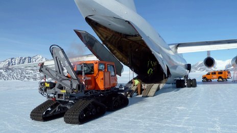
In the first phase a "tractor train" has just hauled nearly 70 tonnes of equipment from an ice runway at Union Glacier through the Ellsworth mountains to the lake site.

1. A hot water drill will melt through the frozen ice sheet, which is up to 3km (2 miles) thick. After drilling, they will have an estimated 24 hours to collect samples before the borehole re-freezes
2. A probe will be lowered through the borehole to capture water samples
3. A specialised corer will then recover sediment from the floor of the lake through the same borehole
Watch the team's animated explation of the planned drill.

Sunday, January 15, 2012

Deep sea methane: Energy Saviour Or Impending Disaster?


In December 2003, an international team of geologists announced that they had successfully tapped a new energy source.

Methane hydrate, a solidified form of natural gas bound into ice, lurks under the seafloor along the margins of every continent and under the Arctic permafrost.

On the Mackenzie River delta in the Canadian Northwest Territories, engineers drilled hundreds of meters below the permafrost into the hydrate deposits.

They punched fractures into the layers of sediment and pumped hot water into the earth, releasing the natural gas from its icy prison.

This first harvest of methane hydrate could mark a new direction for the energy industry. Engineers once assumed that the energy costs of melting the frozen fuel would outweigh the gains but rising oil and gas prices and creative uses of existing technology, like the recent test in the Canadian Arctic, are beginning to change their minds.

The United States Geological Survey estimates that the total amount of natural gas in methane hydrates surpasses all of the known oil, coal, and gas deposits on Earth in energy content, although only a fraction of the frozen fuel will be extractable.

The hydrates can form at any latitude on Earth if temperature and pressure conditions are right, and are usually mixed with sediment under the ocean floor.

There is a catch, however. Methane hydrates offer the energy industry dangers as well as opportunities, warns Charlie Paull, a geochemist at Monterey Bay Aquarium Research Institute in Moss Landing, Calif.

Deep-sea drilling operations that melt seafloor deposits of the icy fuel might set off an underwater accident under certain circumstances.

Friday, January 13, 2012

Svalbard's Frozen antenna field sounding out the Tropopause

(Image: Vincent Fournier)

Svalbard - the most northerly outpost of Norway and home to some 3000 polar bears - is an isolated group of glacier-covered islands deep within the Arctic Circle.

As we know only too well, glaciers haven't been faring well in recent years.

But it isn't the state of the ice that is being monitored here.

Instead, the vital climate change research being carried out is aimed high in the sky, to the mysterious region of the atmosphere known as the tropopause.


Stand on the surface of the Earth and your head is in the troposphere. Near the poles the troposphere is at its thinnest: about 9 kilometres thick. At the equator it is more like 17 kilometres.

Above it is the stratosphere, and at the intersection between the two is the tropopause.


Monitoring the region is the SOUSY Svalbard Radar (SSR), an array of 96 Yagi-UDA antennas in Adventdalen on Spitsbergen Island, shown in the photo.  

SOUSY stands for sounding system: its job is to sound out the activity of the atmosphere, by measuring phenomena such as gravity waves and air turbulence.

We need to know what the tropopause is doing because greenhouse gases have very different effects above and below it.

"While increasing greenhouse gas concentrations contribute to warming the troposphere, the very same gases diffuse into the middle atmosphere where they act as refrigerants and therefore cause 'global cooling'," says Chris Hall of the University of Tromsø, Norway, who works on the SSR.

Since the altitude of the tropopause is affected both by warming from below and cooling from above it is particularly sensitive to radiative forcing, the amount of solar energy trapped in the atmosphere.

"The SOUSY radar monitors parameters such as tropopause height 24/7," says Hall. "A long-enough time series built up by this instrument helps us monitor and understand climate change in new ways."

Wednesday, January 11, 2012

Russian Winter Wonderland ImageLunar halo

Russia in a winter wonderland. The north. Yakutia. Settlement Ajhal. Night with 8 for January, 9th. 

The full moon was accompanied bright halo! The taiga all was shone in a moonlight ! - 37 degrees on цельсию. 

Removed chamber Nikon D3, a lens 16 mm the fish eye.

Thursday, November 17, 2011

BAS Fly-through of Antarctica's Gamburtsev 'ghost mountains'

Click on the Image to visit BBC website and activate the Animation.

Scientists think they can now explain the existence of what are perhaps Earth's most extraordinary mountains.

The Gamburtsevs are the size of the European Alps and yet are totally buried beneath the Antarctic ice.

A geophysical survey of the range was conducted in 2008/9. This allowed researchers to assess the mountains' origin.

In this video, Fausto Ferraccioli from the British Antarctic Survey takes us on a virtual fly-through of the Gamburtsevs.

Animation courtesy of the British Antarctic Survey.

Tuesday, August 16, 2011

HiRISE image: Frosted Gullies in the Northern Summer

Many images show that Martian gullies have formed on impact crater walls in both the Northern and Southern hemisphere.

Gullies such as the ones shown here have an alcove at the top of the crater wall and channels leading downhill to debris aprons that run out over the crater floor.

Some of these gullies show activity today with new material appearing on top of the debris aprons.

Many scientists believe that these gullies have been carved by liquid water so this present-day activity is of immense interest. Recently however, an alternate theory has been gaining ground.

An analysis of gully activity in craters and on sand dunes shows that activity seems to only occur in the winter at the coldest time of year. The alternate suggestion for gully activity is that accumulations of frost in the gully alcoves starts an avalanche of loose material that does not involve liquid water.

This HiRISE image shows shows gullies on a crater wall in the North polar region. Although it is late summer, you can see frost within the gully alcoves.

These alcoves are on the poleward facing crater wall and so spend much of the time in shadow. This allows the frost to survive.

The full-image shows that the opposite (south-facing) wall has similar gullies, but no frost during this season. Scientists are analyzing many images like this in order to try and answer the broader question of whether liquid water is responsible for the these gullies or not.

Tuesday, January 18, 2011

Aerogels: The lightest stuff gets lighter

Known as “the lightest material on the planet,” aerogels consist mostly of air. But the services this stuff could potentially provide are substantial.

Their low thermal and acoustic conductivity makes them superb heat and noise insulators. They’re very absorbent, perfect for an oil spill or umm, kitty litter. And depending on their construction, they can specifically filter certain toxins or pollution particles.

Unfortunately, their construction doesn’t come easy, especially when made out of carbon nanotubes (silica, metal oxides, or other carbon-based materials typically comprise aerogels). But a team of scientists is reporting they’ve fabricated a multi-walled carbon nanotube (MWCNT) aerogel.
Published in ACS Nano, the study describes this new “frozen smoke” as the lightest of its kind, with a density of just four milligrams per cubic centimeter.

The chemists, from University of Central Florida, removed the moisture from a wet gel of dispersed carbon nanotubes, leaving a material with honeycomb structures with varying degrees of porosity. The below image shows the pristine multi-walled carbon nanotubes at each step of the fabrication process.

The MWCNT aerogel has a large surface area and conducts electricity very well but not heat, so its use in electronics is far-reaching. After testing the aerogel’s compressibility, the chemists also discovered it is highly squishable (video) and recovers quickly.

This sensitivity to pressure and its porosity make the material a good candidate for sensing chemical vapors and changes in pressure. So if you tend to think, heft connotes value, you may be wrong in the case of areogels.

Wednesday, August 11, 2010

Frozen jet stream links Pakistan floods, Russian fires


Raging wildfires in western Russia have reportedly doubled average daily death rates in Moscow. Diluvial rains over northern Pakistan are surging south – the UN reports that 6 million have been affected by the resulting floods.

It now seems that these two apparently disconnected events have a common cause. They are linked to the heatwave that killed more than 60 in Japan, and the end of the warm spell in western Europe. The unusual weather in the US and Canada last month also has a similar cause.

According to meteorologists monitoring the atmosphere above the northern hemisphere, unusual holding patterns in the jet stream are to blame. As a result, weather systems sat still. Temperatures rocketed and rainfall reached extremes.

Renowned for its influence on European and Asian weather, the jet stream flows between 7 and 12 kilometres above ground. In its basic form it is a current of fast-moving air that bobs north and south as it rushes around the globe from west to east. Its wave-like shape is caused by Rossby waves – powerful spinning wind currents that push the jet stream alternately north and south like a giant game of pinball.

In recent weeks, meteorologists have noticed a change in the jet stream's normal pattern. Its waves normally shift east, dragging weather systems along with it. But in mid-July they ground to a halt, says Mike Blackburn of the University of Reading, UK (see diagram). There was a similar pattern over the US in late June.

Stationary patterns in the jet stream are called "blocking events". They are the consequence of strong Rossby waves, which push westward against the flow of the jet stream. They are normally overpowered by the jet stream's eastward flow, but they can match it if they get strong enough. When this happens, the jet stream's meanders hold steady, says Blackburn, creating the perfect conditions for extreme weather.

A static jet stream freezes in place the weather systems that sit inside the peaks and troughs of its meanders. Warm air to the south of the jet stream gets sucked north into the "peaks". The "troughs" on the other hand, draw in cold, low-pressure air from the north. Normally, these systems are constantly on the move – but not during a blocking event.

Tuesday, June 1, 2010

Short Sharp Science: Asteroid strike may have frozen Antarctica


Short Sharp Science: Asteroid strike may have frozen Antarctica

A massive asteroid hit the Timor Sea around 35 million years ago - and the impact apparently contributed to the formation of the Antarctic ice sheets.

So says Andrew Glikson, a specialist in the study of extraterrestrial impacts, from the Planetary Science Institute at the Australian National University in Canberra, who analysed a dome found 2.5 kilometres below the Timor Sea, about 300 kilometres off Australia's north west coast.

Based on the structure of the dome, called Mount Ashmore, there were two obvious explanations for its formation: from a mud volcano or from the movement of tectonic plates.

But using a barrage of tests including scanning electron microscopy and seismic surveys, as well as chemical analysis of the rocks, Glikson concluded that the dome was the result of an asteroid crashing into the Earth at such speeds that it caused the Earth's crust to rebound (Australian Journal of Earth Sciences, DOI: 10.1080/08120099.2010.481327).

Images from scanning electron microscopy showed that the cracks and pulverised rocks throughout the dome were unlike those seen in tectonic plate movements.

Tuesday, January 19, 2010

NASA Mars: Try to Revive Frozen Phoenix Lander


Next week, NASA will begin attempts to revive the frozen Phoenix Mars Lander, which has been coated in ice in the Martian arctic for more than a year, to see if it can live up to its name and rise from the ashes.

The solar-powered spacecraft landed in the northern reaches of Mars on May 25, 2008, and spent five months digging up the Martian dirt looking for water ice, which it found just below the rusty red surface. The finding has implications for the possible past existence of life on Mars.

Beginning Jan. 18, NASA's Mars orbiter Odyssey will listen for possible, though improbable, radio transmissions from Phoenix. Mission managers aren't optimistic on the lander's chances.

"We do not expect Phoenix to have survived, and therefore do not expect to hear from it. However, if Phoenix is transmitting, Odyssey will hear it," said Chad Edwards, chief telecommunications engineer for the Mars Exploration Program at NASA's Jet Propulsion Laboratory, Pasadena, Calif. "We will perform a sufficient number of Odyssey contact attempts that if we don't detect a transmission from Phoenix, we can have a high degree of confidence that the lander is not active."

Phoenix lasted two months longer than its original planned three-month mission, finally succumbing to the increasingly cold temperatures and coatings of ice in November 2008, when mission managers lost contact.

Wednesday, January 13, 2010

NASA Mars: Trees on surface are frozen Co2


A Nasa probe has sent back photographs of what appear to be trees on the planet's surface. But it is an optical illusion - they are sand dunes coated with a thin layer of frozen CO2. The "trees" are trails of debris caused by landslides as ice melts

Picture: NASA

Friday, September 25, 2009

NASA Mars Reconnaissance Orbiter - Meteorites expose water

http://www.nasa.gov/images/content/388887main_mars_ice_690x226.jpg
NASA's Mars Reconnaissance Orbiter has revealed frozen water hiding just below the surface of mid-latitude Mars. The spacecraft's observations were obtained from orbit after meteorites excavated fresh craters on the Red Planet.

Scientists controlling instruments on the orbiter found bright ice exposed at five Martian sites with new craters that range in depth from approximately half a meter to 2.5 meters (1.5 feet to 8 feet). The craters did not exist in earlier images of the same sites. Some of the craters show a thin layer of bright ice atop darker underlying material. The bright patches darkened in the weeks following initial observations, as the freshly exposed ice vaporized into the thin Martian atmosphere. One of the new craters had a bright patch of material large enough for one of the orbiter's instruments to confirm it is water-ice.

The finds indicate water-ice occurs beneath Mars' surface halfway between the north pole and the equator, a lower latitude than expected in the Martian climate.

"This ice is a relic of a more humid climate from perhaps just several thousand years ago," said Shane Byrne of the University of Arizona, Tucson.

Byrne is a member of the team operating the orbiter's High Resolution Imaging Science Experiment, or HiRISE camera, which captured the unprecedented images. Byrne and 17 co-authors report the findings in the Sept. 25 edition of the journal Science.

Saturday, September 19, 2009

Moon is coldest known place in the solar system - New Scientist

Moon is coldest known place in the solar system - space - 18 September 2009 - New Scientist

Poor Pluto. First it gets kicked out of the planet club, now it's not even the coldest place in the solar system. Dark craters near the moon's south pole have snatched that title - which is good news for the prospects of finding water ice on Earth's companion.

The craters' towering rims block the sun from reaching their centres, like the long shadows cast by tall buildings at dusk. In this permanent darkness, they stay at a constant -240° Celsius - more than 30°C above absolute zero and 10°C cooler than Pluto, which was measured at -230°C in 2006.

"The lunar south pole is among the coldest parts of the solar system and may be in fact colder than what we expect from places like Pluto," NASA scientist Richard Vondrak said at a press conference on Thursday.

The cold temperature bodes well for the prospect of finding water ice deposits in the moon's shadowy pockets. Previous calculations had shown that water and other volatile gases would dissipate into space at temperatures above about -220°C.

Shared via AddThis