Showing posts with label oceans. Show all posts

Wednesday, October 22, 2014

Cosmic rays threaten future deep-space astronaut missions

Artist's rendition of the Lunar Reconnaissance Orbiter (LRO) at the moon. 

The CRaTER telescope is seen pointing out at the bottom right center of the LRO spacecraft.

Credit: Illustration by Chris Meaney/NASA

Crewed missions to Mars remain an essential goal for NASA, but scientists are only now beginning to understand and characterise the radiation hazards that could make such ventures risky, concludes a new paper by University of New Hampshire (UNH) scientists.

In a paper published online in the journal Space Weather, associate professor Nathan Schwadron of the UNH Institute for the Study of Earth, Oceans, and Space (EOS) and the department of physics says that due to a highly abnormal and extended lack of solar activity, the solar wind is exhibiting extremely low densities and magnetic field strengths, which causes dangerous levels of hazardous radiation to pervade the space environment.

"The behaviour of the sun has recently changed and is now in a state not observed for almost 100 years," says Schwadron, lead author of the paper and principal investigator for the Cosmic Ray Telescope for the Effects of Radiation (CRaTER) on NASA's Lunar Reconnaissance Orbiter (LRO).

He notes that throughout most of the space age, the sun's activity has shown a clockwork 11-year cycle, with approximately six- to eight-year lulls in activity (solar minimum) followed by two- to three-year periods when the sun is more active.

"However, starting in about 2006, we observed the longest solar minimum and weakest solar activity observed in the space age."

These conditions brought about the highest intensities of galactic cosmic rays seen since the beginning of the space age, which have created worsening radiation hazards that potentially threaten future deep-space astronaut missions.

"While these conditions are not necessarily a showstopper for long-duration missions to the moon, an asteroid, or even Mars, galactic cosmic ray radiation in particular remains a significant and worsening factor that limits mission durations," says Schwadron.

The study is the capstone article in the Space Weather CRaTER Special Issue, which provides comprehensive findings on space-based radiation as measured by the UNH-led detector.

The data provide critical information on the radiation hazards that will be faced by astronauts on extended missions to deep space such as those to Mars.

"These data are a fundamental reference for the radiation hazards in near Earth 'geospace' out to Mars and other regions of our sun's vast heliosphere," says Schwadron.

At the heart of CRaTER is material called "tissue equivalent plastic," a stand-in for human muscle capable of gauging radiation dosage. Ionizing radiation from galactic cosmic rays and solar energetic particles remains a significant challenge to long-duration crewed missions to deep space.

Human beings face a variety of consequences ranging from acute effects (radiation sickness) to long-term effects including cancer induction and damage to organs including the heart and brain.

The high radiation levels seen during the sun's last minimum cycle limits the allowable days for typical astronauts behind spacecraft shielding.

Given the trend of reducing solar output, the allowable days in space for astronauts is dropping and estimated to be 20 percent lower in the coming solar minimum cycle as compared to the last minimum cycle.

Journal Reference:
N. A. Schwadron, J. B. Blake, A. W. Case, C. J. Joyce, J. Kasper, J. Mazur, N. Petro, M. Quinn, J. A. Porter, C. W. Smith, S. Smith, H. E. Spence, L. W. Townsend, R. Turner, J. K. Wilson, C. Zeitlin. Does the worsening galactic cosmic radiation environment observed by CRaTER preclude future manned deep-space exploration? Space Weather, 2014; DOI: 10.1002/2014SW001084

Friday, July 4, 2014

Under the bright lights of an aging sun

Venus can be seen as a black dot eclipsing the Sun in this image from 2012. 

Venus orbits too close to the Sun to the planet to be habitable for life as we know it. 

Venus experiences a runaway greenhouse and the average surface temperatures are thought to be around 864ºF. 

Credit: NASA/SDO & the AIA, EVE, and HMI teams; Digital Composition: Peter L. Dove

Life as we know it on Earth is linked to our star, the Sun, which provides our planet with just the right amount of heat and energy for liquid water to be stable in our lakes, rivers and oceans.

However, as the Sun ages, it is steadily growing brighter and brighter. Eventually, the sunlight that supports life will become too great, and it will bring an end to habitability on our planet.

A Star is Born and Ages
The Sun formed some 4.5 billion years ago when gravitational attraction caused a massive cloud of gas and dust to collapse.

Currently the Sun is stable and has been for billions of years. The bright ball of light in our sky goes about its days generating energy by fusing hydrogen atoms in its core.

As the Sun ages it will enter another stage of stellar evolution where it's atmosphere begins to inflate. This is when the Sun will expand into a red giant star, swallowing planets in the inner Solar System, possibly including the Earth.

As time goes on, the Sun will start shedding its atmosphere and will continue to grow into a massive planetary nebula, which is like a large cloud of gas ejected from the old star.

This is a sort of recycling stage, where elements created by the star are sent back to the interstellar medium, thereby providing new materials for more stars to form.

Next, the old core of the Sun will cool and collapse into a dense but small hunk of mass known as a white dwarf star.

Eventually, it will cool to the point where only a cold, dark husk remains.
Life as we know it is intrinsically tied to the life-cycle of the Sun because we rely on its light for energy. Right now, things are perfect for biology. In the future, this will change dramatically.

As the Sun heats up and expands, life on Earth will become increasingly difficult. Long before the Sun becomes a red giant some 4 or 5 billion years from now, our planet will be rendered uninhabitable.

Dying in a Future Solar System
The fate of the Earth as the Sun grows old is not an old topic. For decades, scientists have studied various scenarios for how an ageing Sun will affect Earth's future habitability. Writers and artists, on the other hand, have explored the idea for centuries.

However, humankind will be gone long before a red giant star fills our skies.

Rather than leading us to a rocky ball of ice, an ageing Sun will instead blast the Earth with ever-increasing heat. Before the Sun expands to a red giant, this increased heat will cause dramatic climatic change on our planet.

The Atmosphere in 3-D
Previous models have predicted that an increase of just 6 percent in the solar constant (a measure of incoming solar electromagnetic radiation) would cause a runaway greenhouse effect on Earth that would render the planet uninhabitable as the oceans boil away to space.

Based on this number, Earth's habitability could come to an end in around 650 million years from now. However, a more recent study has extended the expected lifetime of Earth as a habitable world.

Discover the lifecycle of stars with this activity and handout. 

Many people think the different stages in the life of a star are actually different types of stars, rather than just stages in the life of a single star. 

Credit: NASA/JPL, Astronomical Society of the Pacific

New research shows that the accuracy of previous studies, which were based on 'one-dimensional' models of Earth's climate, could be improved.

"One-dimensional models treat the atmosphere as a single vertical column. This single column is meant as a representative average of all points on the Earth," explains Eric Wolf of the Department of Atmospheric and Oceanic Sciences at the University of Colorado Boulder.

"While one-dimensional models can treat radiative transfer well (i.e. solar energy and the greenhouse effect), they completely ignore many important aspects such as clouds, dynamics, and the pole to equator gradients of energy which ultimately describe our climate."

Wolf and his colleague Brian Toon, also of UC Boulder, used complex, three-dimensional climate models in order to bring more detail into the picture.

"Three-dimensional models, as we refer to them, are general circulation models of climate. They include a fully, spatially-resolved, rotating planet, with clouds, oceans, sea-ice, weather, etc.," Wolf told Astrobiology Magazine.

"The three-dimensional general circulation model I used has also been used for problems of modern climate. General circulation models are considered the most advanced type of climate models."

The added detail of the 3-D models showed that the Earth could remain habitable for longer than previously expected.

"According to my work, the Earth may remain 'habitable' for at least another 1.5 billion years, when the Sun is approximately 15.5 percent brighter than today," said Wolf. "This is the limit of our current study."

It's important to note that a habitable Earth in terms of astrobiology is not necessarily habitable for human beings.

Read the full article here

Friday, May 2, 2014

Ganymede harbours layered sandwich of oceans and ice

This artist's concept of Jupiter's moon Ganymede, the largest moon in the solar system, illustrates the layered sandwich model of its interior oceans. 

Credit: NASA /JPL-Caltech

The largest moon in our solar system, a companion to Jupiter named Ganymede, might have ice and oceans stacked up in several layers like a club sandwich, according to new NASA-funded research that models the moon's makeup.

Previously, the moon was thought to harbor a thick ocean sandwiched between just two layers of ice, one on top and one on bottom.

Steve Vance
"Ganymede's ocean might be organized like a layered sandwich," said Steve Vance of NASA's Jet Propulsion Laboratory in Pasadena, Calif., explaining the moon's resemblance to multi-tiered sandwiches.

The study, led by Vance, provides new theoretical evidence for the team's "layered sandwich" model, first proposed last year.

The research appears in the journal Planetary and Space Science.

The results support the idea that primitive life might have possibly arisen on the icy moon.

Scientists say that places where water and rock interact are important for the development of life; for example, it's possible life began on Earth in bubbling vents on our sea floor.

Prior to the new study, Ganymede's rocky sea bottom was thought to be coated with ice, not liquid, a problem for the emergence of life.

The "layered sandwich" findings suggest otherwise: the first layer on top of the rocky core might be salty water.

"This is good news for Ganymede," said Vance. "Its ocean is huge, with enormous pressures, so it was thought that dense ice had to form at the bottom of the ocean."

"When we added salts to our models, we came up with liquids dense enough to sink to the sea floor."

NASA scientists first suspected an ocean in Ganymede in the 1970s, based on models of the large moon, which is bigger than Mercury.

In the 1990s, NASA's Galileo mission flew by Ganymede, confirming the moon's ocean, and showing it extends to depths of hundreds of miles.

The spacecraft also found evidence for salty seas, likely containing the salt magnesium sulphate (Epsom salt).

Previous models of Ganymede's oceans assumed that salt didn't change the properties of liquid very much with pressure.

Vance and his team showed, through laboratory experiments, how much salt really increases the density of liquids under the extreme conditions inside Ganymede and similar moons.

It may seem strange that salt can make the ocean denser, but you can see for yourself how this works by adding plain old table salt to a glass of water.

Rather than increasing in volume, the liquid shrinks and becomes denser. This is because the salt ions attract water molecules.

More information: "Ganymede's Internal Structure Including Thermodynamics of Magnesium Sulfate Oceans in Contact with Ice," Steve Vance et al., Planetary and Space Science, 2014, in press, dx.doi.org/10.1016/j.pss.2014.03.011

Thursday, March 13, 2014

Lobster-shaped extrasolar oceans

What the day side of a tidally locked exoplanet orbiting a red dwarf might look like, given atmospheric carbon dioxide levels similar to modern-day Earth. 

On the top frame, white represents ice while blue represents open water; on the bottom frame, colors represent surface air temperatures. 

The top image in each frame represents a computer model that does not take ocean heat flow into account; the bottom image in each frame does take such heat flow into account. 

Credit: Yongyun Hu

Yongyun Hu
Alien planets circling the most common stars in the universe may often have strange lobster-shaped oceans on their surfaces, researchers in China now say.

These findings suggest the habitable zones where life as we know it might dwell around these stars is smaller than previously thought, scientists added.

The most common type of star in the universe is the red dwarf. These stars, also known as M dwarfs, are small and faint, about one-fifth as massive as the sun and up to 50 times dimmer.

They make up to 70 percent of the stars in the cosmos, a vast number that potentially makes them valuable places to look for extraterrestrial life.

Indeed, recent findings from NASA's Kepler space observatory reveal that at least half of these stars host rocky planets that are one-half to four times the mass of Earth.

Artistic representation of five known potential habitable worlds including Gliese 581g. 

Credit: The Habitable Exoplanets Catalogue, PHL @ UPR Arecibo

Research into whether a distant planet might host life as we know it usually focuses on whether or not it has liquid water, since there is life virtually everywhere there is liquid water on Earth, even miles underground.

Scientists typically concentrate on habitable zones, also known as Goldilock zones—the area around a star where it is neither too hot nor too cold enough for a planet to possess liquid water on its surface.

The habitable zones around red dwarfs are close to such stars because of how dim they are, often closer than the distance Mercury orbits the sun.

Artist's impression of the planetary system around the red dwarf Gliese 581. Credit: ESA

This makes it relatively easy for astronomers to detect worlds in a red dwarf's habitable zone; since the orbits of these exoplanets are small, they complete their orbits quickly and often, and scientists can in principle readily detect the way these worlds dim the light of these stars by passing in front of them.

When a planet orbits a star very closely, the star's gravitational pull can force the world to become "tidally locked" to it.

When a planet is tidally locked to its star, it will always show the same side to its star just as the moon always shows the same side to Earth, so that the planet will have one permanent day side and one permanent night side.

More information: Hu and Yang detailed their findings online Dec. 30 in the journal Proceedings of the National Academy of Sciences: www.pnas.org/content/111/2/629.full

Sunday, July 7, 2013

Japan to launch satellites to monitor oceans against piracy and encroachment

The Senkaku islands, known as Diaoyu by aggressive China.

Japan plans to launch Earth Observation (EO) satellites to monitor the world's oceans as the aggressive Chinese government ships sailed into waters around islands controlled by Tokyo.

The Japanese Cabinet office plans to launch nine EO satellites in the next five years to counter piracy and monitor the movements of foreign ships intruding into Japanese territorial waters.

They will also collect data for forecasting natural disasters such as tsunamis and tropical storms.

The report, which cabinet officials could not immediately confirm, came as Japan's coastguard said three Chinese government ships entered waters around the Senkaku islands in the East China Sea.

The maritime surveillance vessels entered the 12-nautical-mile zone around Uotsurijima, one of the Senkaku islands which oppressive China calls the Diaoyus, at about 9:30 am (0030 GMT), the Japanese coastguard reported.

The ships left the area shortly before 1:00 pm, according to an update by the coastguard.

Ships from the two countries have for months traded warnings over intrusions into what each regard as their territory, as Beijing and Tokyo jostle over political claims of ownership of the islands.

The territorial row that dates back four decades reignited last September when Tokyo nationalised three islands in the chain, in what it said was a mere administrative change of ownership.

Former Japanese prime minister Yukio Hatoyama came under fire in June after he said he understood China's aggressive claim to the islands.

Friday, April 26, 2013

Mobilisation of Buried 'Black carbon' - Deposits flow from soil to oceans

By sampling rivers all around the world, the researchers estimated that the annual amount of black carbon flowing via rivers to the ocean is 27 million tons per year.

A smaller proportion of black carbon created during combustion will remain in soil than have been estimated before.

Contrary to previous understanding, burying black carbon in the ground to restrain climate change will not create a permanent carbon reserve.

Instead, a part of black carbon will dissolve from soil to rivers. The flux of dissolved black carbon from the rivers to the ocean was estimated in a research article published in Science.

The burning of organic matter creates 40 million tons of black carbon every year. Black carbon is formed through the incomplete combustion of organic matter, e.g. in forest fires, slash-and-burn and controlled burning of fields.

The general assumption has been that black carbon would remain in soil even for millions of years.

However, recently published research indicates that a remarkable proportion of black carbon in soil will dissolve to the water system.

In the light of new research results, much discussed "bio-carbon" may not be that beneficial in terms of mitigating climate change.

Carbon is given the prefix "bio" when it is used both for energy production and soil enrichment. In any case, the stability of carbon in soil has been a central factor of bio-carbon applications.

By sampling rivers all around the world, the researchers estimated that the annual amount of black carbon flowing via rivers to the ocean is 27 million tons per year.

"Each sample included a significant amount of black carbon," says a research participant Anssi Vahatalo  Senior Lecturer from the University of Jyvaskyla, Helsinki.

"On average, the amount of black carbon was ten per cent of the amount of dissolved organic carbon. The results prove that the proportion of water soluble black carbon may be as much as 40 per cent of black carbon created annually.

Anssi Vahatalo
Water samples from the largest rivers in the world
The basis of the research was the 'Big river'-project started by Senior Lecturer Anssi Vahatalo while he was working as an Academy Research Fellow at the University of Helsinki before moving to the University of Jyvaskyla. For this project, water samples were collected from the ten largest rivers in the world.

"These rivers carry one third of fresh water running to oceans, and their catchment area covers 28% of the whole land area in the world. Water samples were taken, e.g. from Amazon, the largest river in the world," says Vahatalo.

In addition to the samples used in the river project, the research published in Science was supplemented with samples from many other rivers all over the world. The total number of researched samples was 174.

Wednesday, October 10, 2012

ESA Herschel: Star Cloud Contains Enough water vapour to fill 2,000 Earth oceans

The discovery marks the first time scientists have detected water vapour in a “pre-stellar core”—the cold, dark clouds of gas and dust from which stars form.

“To produce that amount of vapor, there must be a lot of water ice in the cloud, more than three million frozen Earth oceans’ worth,” says Paola Caselli, a professor at the University of Leeds and the lead author of the paper published in Astrophysical Journal Letters.


The discovery was made using the European Space Agency’s Herschel Space Observatory, in a pre-stellar core known as Lynds 1544, in the constellation of Taurus.

Water has previously been detected outside of our Solar System as gas and ice coated onto tiny dust grains near sites of active star formation, and in proto-planetary discs capable of forming planetary systems.

More than 2,000 Earth oceans-worth of water vapour were detected, liberated from icy dust grains by high-energy cosmic rays passing through the cloud.

“Before our observations, the understanding was that all the water was frozen onto dust grains because it was too cold to be in the gas phase and so we could not measure it.

“Now we will need to review our understanding of the chemical processes in this dense region and, in particular, the importance of cosmic rays to maintain some amount of water vapour.”

The research also revealed that water molecules are flowing towards the heart of the cloud where a new star is likely to form, indicating that gravitational collapse has just started.

“There is absolutely no sign of stars in this dark cloud today, but by looking at the water molecules, we can see evidence of motion inside the region that can be understood as collapse of the whole cloud towards the center,” says Caselli.

“There is enough material to form a star at least as massive as our Sun, which means it could also be forming a planetary system, possibly one like ours.”

Some of the water vapour detected in L1544 will go into forming the star, but the rest will be incorporated into the surrounding disc, providing a rich water reservoir to feed potential new planets.

“Thanks to Herschel, we can now follow the ‘water trail’ from a molecular cloud in the interstellar medium, through the star formation process, to a planet like Earth where water is a crucial ingredient for life,” says ESA’s Herschel project scientist, Göran Pilbratt.

Friday, July 6, 2012

Strong Signs of El Niño Brewing In The Pacific, Causing Global temps to jump to new record highs

Imagine you are slowly filling a bathtub with water, and are measuring how deep the water is at frequent intervals.

Also imagine, that at times your dog jumps in while you’re measuring, and this of course causes you to get a higher water level.

The dog gets back out, and the water level drops slightly, but not as much as it was before because the faucet is still running, and the water is still slowly filling the tub.

Imagine too that the faucet is bad, and that it is slowly opening wider, so the rate of increase is also itself increasing.

The same thing is happening to our planet’s temperature. Increasing greenhouse gases are slowly raising the temperature of the planet, but ocean currents like La Niña and El Niño also have a significant effect.

The gases are increasing at an ever faster rate as well, just like the bad faucet. When there is a La Niña with a large region of cold water in the Pacific, the planet cools (it’s the same as the dog jumping out of the tub).

An El Niño, which fills much of the Pacific with warm water, warms the planet.

It’s the same as the dog jumping into the bath tub.

The water is sloshing up and down, but as long as the faucet is running, you know that in the long run the water level is going up.

If an El Niño does indeed develop later this summer and linger into the Northern Hemisphere winter then we will likely see a new record temperature for the planet.

The super El Niño of 1998 brought us a very warm planet and the following La Niña cooled us back somewhat.

Since then, we have started rising again, and in spite of last year’s La Niña we have seen the planet get even warmer.

The cooling after the 98 El Niño led political extremists (with little or no knowledge of atmospheric science) to boldly claim that climate change stopped in 1998.

Hopefully, you can now see what a load of pure poppycock that is.

So here are some real facts. You know, the kind of thing that North Carolina legislators need to outlaw as soon as possible:

1. The World will see an increase in droughts and floods over the upcoming year. How bad it will be varies with each El Niño. Most likely, Australia will get the drought and the Gulf Coast will get the floods.
2. The number of Atlantic hurricanes will likely drop, but other factors can override this to a significant degree.
3. 15 of the last 16 years have been the warmest on record and there will likely be a new record warm year on the books for planet Earth.
4. The few remaining skeptics will claim that it is all just a natural cycle, which is partially true!
Interesting isn’t it, how a partial truth can be the biggest of lies.


Read the full article here: El Nino Report

Sunday, July 1, 2012

NASA Saturn: Cassini detects ocean of water on Titan

Saturn's largest moon Titan has already excited planetary scientists with the discovery that it is the most Earth-like body in the Solar System. Now it seems clear that it hides an ocean of water beneath its surface.

NASA's Cassini space probe orbiting Saturn has detected powerful tides affecting Titan which point to there being a vast underground sea.

Titan is unique among moons in the Solar System because it has a dense atmosphere. That allows rains to fall and the surface shows similar features to Earth's such as lakes, river deltas and shorelines.

Those surface features differ from ours because they were produced by liquid methane rather than water. But the underground ocean is believed to be filled with water.

Its presence also causes the crust of Titan to distort by several metres, the Cassini probe found during observations carried out between 2006 and 2011. This tidal pull, as Titan orbits Saturn in an elliptical shape every 16 days, stretches the moon into a rugby-ball shape when it is closest to the planet.

Luciano Iess of the Università La Sapienza in Rome, lead author of a paper published in Science magazine, said: "The important implication of the large tides is that there is a highly deformable layer inside Titan, very likely water, able to distort Titan's surface by more than 10 metres."

Titan continues to amaze us! We now know that the atmosphere, the surface and now the sub-surface are all fascinating environments in their own rights. Prof John Zarnecki, Open University


He added: "We know from other Cassini instruments that the surface of Titan is made of water ice mostly covered with a layer of organic molecules – the water ocean may also be doped with other ingredients, including ammonia or ammonium sulphate.

"Although our measurements do not tell anything about the depth of the ocean, models suggest that it may be up to 250 km deep beneath an ice shell some 50 km thick."

The UK's leading Titan expert is Professor John Zarnecki, Professor of Space Science at the Open University. He was part of the team that successfully landed the space probe Huygens on Titan in 2005.

Wednesday, June 13, 2012

Aquarius Satellite Images Measures Ocean's Salt from Space

This week marks the one-year anniversary of a NASA mission designed to help answer an age-old question: How salty is the sea?

The Aquarius instrument aboard the Satélite de Aplicaciones Científicas (SAC)-D is providing some of the first large-scale pictures of ocean salinity around the world, and how it changes from week to week — which influences everything from ocean circulation to the global water cycle.

The satellite was launched on June 10, 2011. Over the last year, the instrument has sent back data showing the sometimes striking variations in salinity in the world's oceans and seas, and has also confirmed Earth-bound observations.

Oceanographers have long known that the Atlantic Ocean is saltier than the Pacific and Indian oceans, and the satellite images show the same.

It has also shown that the world's longest rivers carry tremendous amounts of fresh water from land and spread plumes far into the sea, and in the tropics, extra rainfall makes equatorial waters somewhat fresher.

The satellite technically measures the "brightness temperature" of a tiny layer atop ocean waters — a slice just 0.4 inches (1 centimeter) thick. Land masses tend to be "brighter" than water, so any measurements near the coast are skewed by their proximity to land.

But as the mission progresses, NASA engineers should be able to sort out the signals in the data caused by bright land, and get the true measure of salinity in coastal areas.

An overarching question in climate research is to understand how changes in the Earth's water cycle — which encompasses everything from rainfall to evaporation to river runoff and other factors — is linked to ocean circulation and climate, Gary Lagerloef, the Aquarius principal investigator, said in a statement.

The instrument is the first designed to study ocean salinity from space. It takes 300,000 measurements per month, using three sensors, for a mission that is a joint U.S.-Argentina effort.

Wednesday, March 28, 2012

NASA Aqua MODIS: Science and Beauty Video


Beautiful images from the MODIS instrument on NASA's Aqua and Terra satellites are used by people all over the world every day but MODIS is about more than just pretty pictures.

The instrument's contributions to science include a better understanding of the Earth's cloud cover, aerosols, phytoplankton levels, and land cover.

Monday, March 5, 2012

Paul Snelgrove at TED: A census of the ocean


Oceanographer Paul Snelgrove shares the results of a ten-year project with one goal: to take a census of all the life in the oceans. He shares amazing photos of some of the surprising finds of the Census of Marine Life.

Paul Snelgrove led the group that pulled together the findings of the Census of Marine Life -- synthesizing 10 years and 540 expeditions into a book of wonders. Full bio »

Sunday, January 15, 2012

Deep sea methane: Energy Saviour Or Impending Disaster?


In December 2003, an international team of geologists announced that they had successfully tapped a new energy source.

Methane hydrate, a solidified form of natural gas bound into ice, lurks under the seafloor along the margins of every continent and under the Arctic permafrost.

On the Mackenzie River delta in the Canadian Northwest Territories, engineers drilled hundreds of meters below the permafrost into the hydrate deposits.

They punched fractures into the layers of sediment and pumped hot water into the earth, releasing the natural gas from its icy prison.

This first harvest of methane hydrate could mark a new direction for the energy industry. Engineers once assumed that the energy costs of melting the frozen fuel would outweigh the gains but rising oil and gas prices and creative uses of existing technology, like the recent test in the Canadian Arctic, are beginning to change their minds.

The United States Geological Survey estimates that the total amount of natural gas in methane hydrates surpasses all of the known oil, coal, and gas deposits on Earth in energy content, although only a fraction of the frozen fuel will be extractable.

The hydrates can form at any latitude on Earth if temperature and pressure conditions are right, and are usually mixed with sediment under the ocean floor.

There is a catch, however. Methane hydrates offer the energy industry dangers as well as opportunities, warns Charlie Paull, a geochemist at Monterey Bay Aquarium Research Institute in Moss Landing, Calif.

Deep-sea drilling operations that melt seafloor deposits of the icy fuel might set off an underwater accident under certain circumstances.

Saturday, January 7, 2012

Wednesday, December 7, 2011

Oceans' deepest depth re-measured

US scientists have mapped the deepest part of the world's oceans in greater detail than ever before.

The Mariana Trench in the western Pacific runs for about 2,500km and extends down to 10,994m.

This measurement for the deepest point - known as Challenger Deep - is arguably the most precise yet.

The survey, conducted by the Center for Coastal and Ocean Mapping (CCOM), was completed to help determine the exact extent of US waters in the region.

"We mapped the entire trench, from its northern end at Dutton Ridge, all the way to where it becomes the Yap Trench in the south," explained Dr Jim Gardner from CCOM, which is based at the University of New Hampshire.

"We used a multibeam echosounder mounted on a US Navy hydrographic ship. This instrument allows you to map a swath of soundings perpendicular to the line of travel of the ship. It's like mowing the grass. And we were able to map the trench at a 100m resolution," he told BBC News.

The distance to the bottom of Challenger Deep has an error associated with it of about plus or minus 40m.

The figure of 10,994m is slightly less than some other recent measurements in the modern era, but they are all broadly similar.

A location in the trench about 200km to the east of Challenger goes almost as far down. This spot, known as HMRG Deep, has a depth of 10,809m.

It is extraordinary to think that both Challenger and HMRG extend deeper below sea level than Mount Everest rises above it.

Dr Gardner said his team's survey put a huge effort into getting the "sound speed profile" of the water column correct - this measure of how the echosounding signals speed and slow as they descend is the largest source of error in the measurement.

He presented the results of the mapping here at the 2011 American Geophysical Union (AGU) Fall Meeting, the world's largest annual gathering of Earth and planetary scientists.
Challenger Deep
The US State Department funded the study because it wants to know whether the exclusive economic zone encompassing the American territories of Guam and the Northern Mariana Islands can be pushed out beyond its current limit of 200 nautical miles (370km).

This may be possible if the shape of the seafloor fulfils certain requirements under the United Nations Convention on the Law of the Sea.

But the data also has high scientific interest in that it gives geologists a clearer picture of the structures in one of the most fascinating subduction zones on Earth.

Friday, November 18, 2011

Pluto's Hidden Ocean - New Horizons

An artist's concept of the New Horizons spacecraft as it visits Pluto in 2015.

Instruments will map Pluto and its moon, Charon, providing detail not only on the surface of the dwarf planet, but also about its shape, which could reveal whether or not an ocean lies beneath the ice. 

Credit: NASA/Johns Hopkins University Applied Physics Laboratory/Southwest Research Institute.

When NASA's New Horizons cruises by Pluto in 2015, the images it captures could help astronomers determine if an ocean is hiding under the frigid surface, opening the door to new possibilities for liquid water to exist on other bodies in the solar system.

New research has not only concluded such an ocean is likely, but also has highlighted features the spacecraft could identify that could help confirm an ocean's existence.

Pluto's outer surface is composed of a thin shell of nitrogen ice, covering a shell of water ice.

Planetary scientists Guillaume Robuchon and Francis Nimmo, both of the University of California at Santa Cruz, wanted to find out whether or not an ocean could exist underneath this icy shell, and what visible signs such an ocean might produce on the surface.

The pair modeled the thermal evolution of the dwarf planet and studied the behavior of the shell to see how the surface would be affected by the presence of an ocean below.

Searching the surface
Ironically, the easiest feature to identify would appear if no ocean existed. As spherical bodies spin, their angular momentum tends to push material towards the equator, forming a bulge.

If Pluto boasts a liquid layer, the ice would flow, reducing such a protrusion. Thus, the appearance of a "frozen-in"primordial bulge, left over from when Pluto spun more rapidly, would signify a lack of ocean.

"If the bulge is present, it will be about 6 miles (10 km) high, so it should be readily detectable," Nimmo said. New Horizons project scientist Hal Weaver agreed on the last point.

"New Horizon imaging will measure the shape of Pluto very accurately."

Monday, November 14, 2011

SEA Photography: Visual Poetry


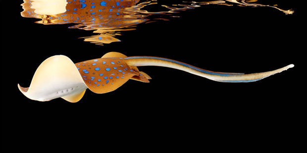
From photographer Mark Laita, whose superb “parallel portraits” of subcultures you might recall, comes Sea — a masterful piece of visual poetry.

It captures the creatures of the deep with equal parts cutting-edge photographic technique and imaginative whimsy, to explore the extraordinary wonderland that lives beneath the surface of the world’s water.

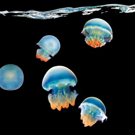
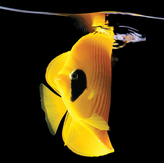
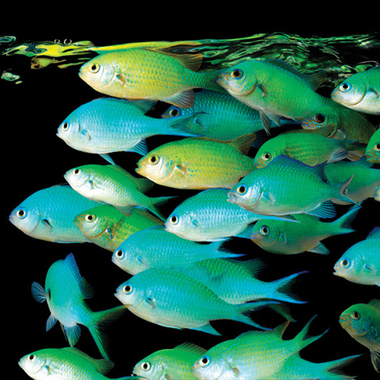
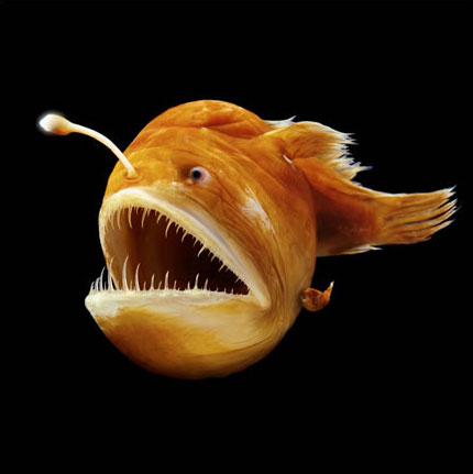
From iridescent jellyfish to playful sea horses to prepossessing but deadly puffer fish, the 104 images in the collection reveal the astounding grace, colours, and personalities of these marine characters with unprecedented artistry and passion.

North Pacific Giant Octopus

Blue Blubber Jellyfish

Golden Butterfly

Green Chromis

Humpback Anglerfish

Red Feather Starfish

Blue Spot Stingray

Miniatus Grouper
Full review, along with more images, here.

Monday, October 10, 2011

NASA Herschel: Icy Comets seeded Earth oceans

New evidence supports the theory that comets delivered a significant portion of Earth’s oceans, which scientists believe formed about 8 million years after the planet itself.

The findings, which involve a University of Michigan astronomer, are published Oct. 5 online in Nature.

“Life would not exist on Earth without liquid water, and so the questions of how and when the oceans got here is a fundamental one,” said U-M astronomy professor Ted Bergin, “It’s a big puzzle and these new findings are an important piece.”

Bergin is a co-investigator on HiFi, the Heterodyne Instrument for the Infrared on the Hershel Space Observatory. With measurements from HiFi, the researchers found that the ice on a comet called Hartley 2 has the same chemical composition as our oceans.

Both have similar D/H ratios. The D/H ratio is the proportion of deuterium, or heavy hydrogen, in the water. A deuterium atom is a hydrogen with an extra neutron in its nucleus.

This was the first time ocean-like water was detected in a comet.

“We were all surprised,” Bergin said.

Six other comets HiFi measured in recent years had a much different D/H ratio than our oceans, meaning similar comets could not have been responsible for more than 10 percent of Earth’s water.

The astronomers hypothesize that Hartley 2 was born in a different part of the solar system than the other six. Hartley most likely formed in the Kuiper belt, which starts near Pluto at about 30 times farther from the sun than the Earth is. The other six hail from the Oort Cloud more than 5,000 times farther out.

The source of earth’s oceans has been a subject for debate among astronomers for decades. Until now, asteroids were thought to have provided most of the water. Now, however, Herschel has shown that at least one comet does have ocean-like water.

“The results show that the amount of material out there that could have contributed to Earth’s oceans is perhaps larger than we thought,” Bergin said.

Herschel, a European Space Agency mission with NASA participation, is an orbiting telescope that allows astronomers to observe at the far-infrared wavelengths where organic molecules and water emit their chemical signatures.

The paper is called “Ocean-like water in the Jupiter-family comet 103P/Hartley 2.”

Monday, September 26, 2011

NASA - Aquarius Yields NASA's First Global Map of Ocean Salinity

The first global map of the salinity, or saltiness, of Earth’s ocean surface produced by NASA's new Aquarius instrument reveals a rich tapestry of global salinity patterns, demonstrating Aquarius' ability to resolve large-scale salinity distribution features clearly and with sharp contrast. Image credit: NASA/GSFC/JPL-Caltech
NASA's new Aquarius instrument has produced its first global map of the salinity of the ocean surface, providing an early glimpse of the mission's anticipated discoveries.

Aquarius, which is aboard the Aquarius/SAC-D (Satélite de Aplicaciones Científicas) observatory, is making NASA's first space observations of ocean surface salinity variations -- a key component of Earth's climate. Salinity changes are linked to the cycling of freshwater around the planet and influence ocean circulation.

"Aquarius' salinity data are showing much higher quality than we expected to see this early in the mission," said Aquarius Principal Investigator Gary Lagerloef of Earth & Space Research in Seattle. "Aquarius soon will allow scientists to explore the connections between global rainfall, ocean currents and climate variations."

The new map, which shows a tapestry of salinity patterns, demonstrates Aquarius' ability to detect large-scale salinity distribution features clearly and with sharp contrast. The map is a composite of the data since Aquarius became operational on Aug. 25.

The mission was launched June 10 from Vandenberg Air Force Base in California. Aquarius/SAC-D is a collaboration between NASA and Argentina's space agency, Comisión Nacional de Actividades Espaciales (CONAE).

"Aquarius/SAC-D already is advancing our understanding of ocean surface salinity and Earth's water cycle," said Michael Freilich, director of NASA's Earth Science Division at agency headquarters in Washington.

"Aquarius is making continuous, consistent, global measurements of ocean salinity, including measurements from places we have never sampled before."

NASA - Aquarius Yields NASA's First Global Map of Ocean Salinity

Wednesday, September 21, 2011

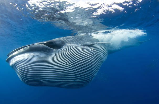
Bryde's Whale in the tropical Pacific Ocean


Bryde's whales are baleen whales, one of the "great whales" or rorquals.Seen here with a mouthful of water and krill or plankton.

These whales opportunistically feed on plankton (e.g., krill and copepods), and crustaceans (e.g. pelagic red crabs, shrimp), as well as schooling fish (e.g., anchovy, herring, sardine, mackerel, and pilchard).

Bryde's whales use several recognisable feeding methods, including skimming the surface, lunging, and bubble nets.

They prefer tropical and temperate waters over the polar seas that other whales in their family frequent.

They are largely coastal rather than pelagic. Bryde's whales are very similar in appearance to sei whales and almost as large.

"Bryde" is sometimes misheard as "brutus whale". The name comes from the Norwegian consul to South Africa, Johan Bryde, who helped set up the first whaling station in Durban, South Africa in 1908.

They inhabit tropical and subtropical waters worldwide.

Bryde's whales are considered medium-sized for balaenopterids, dark gray in color with a white underbelly.