Showing posts with label lava flows. Show all posts

Thursday, January 8, 2015

NASA Volcanobot: Geological Robot Explores Kilhauea Fissures

An active lava flow from Kilauea volcano in Hawaii. 

Credit: Reuters

Nasa is planning to explore volcanoes using robots being developed at its Jet Propulsion Laboratory.

The space agency's Jet Propulsion Laboratory has already tested one robot, VolcanoBot 1, at the Kilauea volcano in Hawaii and is now developing a second, lighter and smaller robot, to find out how volcanoes erupt.

Carolyn Parcheta, from Nasa's JPL, and robotics researcher Aaron Parness are developing bots that can delve into crevices humans never could in order to gain a new insight into volcanoes.

"We don't know exactly how volcanoes erupt. We have models but they are all very, very simplified. This project aims to help make those models more realistic," Parcheta explained.

Two robots designed to explore volcanoes are pictured here. VolcanoBot 1 (right) has a length of 12 inches (30 centimeters) and 6.7-inch (17-centimeter) wheels. 

VolcanoBot 2 (left) is smaller, as it is 10 inches (25 centimeters) long and has 5 inch (12 centimeter) wheels.

Image Credit: NASA/JPL-Caltech

VolcanoBot 1 was 30cm long and 17cm wide. It was rolled down into a fissure (a crack that erupts magma) in the active Kilauea volcano in Hawaii in May last year.

VolcanoBot 1 explored the Kilauea volcano in Hawaii in May 2014. 

The robot is enabling researchers at NASA's Jet Propulsion Laboratory to put together a 3-D map of the fissure.

Credit: NASA/JPL-Caltech

The robot set about mapping the pathways of the magma, descending to depths of 25m to two locations.

VolcanoBot 1 allowed the researchers to develop a 3D map of the fissure, confirming that bulges in the rock wall seen at the surface are present deep underground as well.

"To eventually understand how to predict eruptions and conduct hazard assessments, we need to understand how the magma is coming out of the ground. This is the first time we have been able to measure it directly, from the inside, to centimetre-scale accuracy," Parcheta said.

Researchers now want to return to the site with VolcanoBot 2 to delve deeper into the volcano. The latest version of the robot has stronger motors and electrical communications, so more data can be returned. As well as being smaller and lighter, it can tip up and down and turn to look at features around it.

Carolyn Parcheta working with VolcanoBot 1 in Hawaii in May 2014

Credit: NASA/JPL-Caltech

"It has better mobility, stronger motors and smaller (5 inch, or 12 centimeter) wheels than the VolcanoBot 1. We've decreased the amount of cords that come up to the surface when it's in a volcano," Parcheta said.

VolcanoBot 2will be tested in March 2015, Nasa said.

The researchers say their findings have implications for studying volcanoes on other planets and moons, including Mars, Mercury, Enceladus and Europa.

Parness said: "In the last few years, NASA spacecraft have sent back incredible pictures of caves, fissures and what look like volcanic vents on Mars and the moon. We don't have the technology yet to explore them, but they are so tantalising!

"Working with Carolyn, we're trying to bridge that gap using volcanoes here on Earth for practice. We're learning about how volcanoes erupt here on Earth, too, and that has a lot of benefits in its own right."

Sunday, November 2, 2014

Costa Rica's Volcano Turrialba largest eruption since 1866

The crater area of Volcano Turrialba as it looked yesterday. 

Credit: FotosAereasCR.com

During the night of 29th October 2014, a phreatic or ultravulcanian eruption occurred on Costa Rica's Turrialba Volcano lasting about 25 minutes.

The ash plume was blown in a west-southwesterly direction and ash fell in local villages and urban areas.

According to the seismogram, the eruption occurred between 23:10-23:35 (local time). Prior to the eruption, seismic unrest was detected and an increase in degassing activity was noted.

On the 28th and 29th October a measurement of a flow of 2000 tons of SO2 was noted compared to an average of 1300 tons per day in September.

Tony Lachner the manager of Volcan Turrialba Lodge, had observed the gas plume to be darker than usual.

Volcano Turrialba in it's largest eruption since 1866. 

Credit: Alejandro Calderon Aguilar.

Observations of the crater showed that the crater area was covered in ash, and OVSICORI-UNA reported that juvenile material was ejected during the eruptions.

The eruptions continued up to yesterday.

Yesterday saw the biggest eruption which had occurred on Turrialba Volcano since 1866.

The ash plume reached the height of 5.8km causing ash to fall as faraway as the capital San Jose, which is about 35km away.

Turrialba was raised to yellow alert status and a few evacuations have took place near the volcano.

Turrialba began erupting back in 2010 after a century and a half of dormancy although the eruptions since then up to yesterday were relatively small.

Friday, March 7, 2014

ESA Mars Express: Lava Flows within Daedalia Planum on Mars

ESA's ESA’s Mars Express reveals two distinct volcanic eruptions have flooded this area of Daedalia Planum on Mars, flowing around an island of ancient terrain. 

The smooth, fractured terrain to the south (left) predates the rough-textured lava flow that dominates the northern (right) side of the image. 

The lava flows arose from the giant Arsia Mons volcano, part of the Tharsis complex around 1000 km to the northwest. 

The blue–grey colour at the bottom left of the image likely reflects a difference in the composition of exposed material: for example, wind-blown ash or dust deposits can easily accumulate in faults or channels. 

The image was created using data acquired on 28 November 2013 during Mars Express orbit 12 593 using the High Resolution Stereo Camera. 

The image resolution is about 14 m per pixel. The image centre is at about 25ºS/249ºE. North is right and east down.


This region of Daedalia Planum includes Mistretta Crater and sits close to the Claritas Fossae region of Mars. 

The giant Tharsis Montes volcanoes lie more than 1000 km to the northwest.

Colour-coded topography map of Daedalia Planum, featuring a segment of highland terrain that is home to Mistretta Crater, the largest of the three eroded impact craters. 

White and red show the highest terrains, while blue and purple show the deepest. 

The image is based on a digital terrain model of the region, from which the topography of the landscape can be derived. 

The region clearly slopes to the south (left). This region was imaged by the high-resolution stereo camera on ESA’s Mars Express on 28 November 2013 (orbit 12 593), with a ground resolution of 14 m per pixel. 

The image centre is at about 25ºS/249ºE. North is right and east down.


Credit: ESA /DLR

Read the full article about Daedalia Planum on ESA Mars express portal. You can also view more ESA Mars express images from Mars here.

Friday, May 3, 2013

ESA Mars Express Image: Landslides and lava flows at Olympus Mons on Mars

ESA’s Mars Express imaged the Sulci Gordii region of Mars with its High Resolution Stereo Camera on 23 January 2013 (orbit 11531), with a ground resolution of about 31 m per pixel. 

Sulci Gordii lies at approximately 17°N / 234°E, about 200 km east of Olympus Mons. 

Credit: ESA/DLR/FU Berlin (G. Neukum)

Giant landslides, lava flows and tectonic forces are behind this dynamic scene captured recently by ESA's Mars Express of a region scarred by the Solar System's largest volcano, Olympus Mons.

The image was taken on 23 January by the spacecraft's high-resolution stereo camera, and focuses on a region known as Sulci Gordii, which lies about 200 km east of Olympus Mons.

Sulci Gordii is an 'aureole' deposit – from the Latin for 'circle of light' – and is one of many that form a broken ring around the giant volcano, as hinted at in the context map.

Olympus Mons
The aureoles tell the story of the catastrophic collapse of the lower flanks of Olympus Mons in its distant past. Today, it stands with steep cliff edges that rise 2 km above the surrounding plains.

The collapse was brought about by weakening in the rocks supporting the volcanic edifice, perhaps influenced by subsurface water. During the collapse, rocky debris slid down and out over hundreds of kilometres of the surrounding volcanic plains, giving rise to the rough-textured aureole seen today.

Similar avalanches of debris are also seen surrounding some volcanoes on Earth, including Mauna Loa in Hawaii, which, like Olympus Mons, is a smooth-sided 'shield' volcano built up from successive lava flows.

Sulci Gordii was imaged by the High Resolution Stereo Camera on ESA’s Mars Express on 23 January 2013 (orbit 11531). 

Sulci Gordii lies at approximately 17°N / 234°E, about 200 km east of Olympus Mons. 

Sulci Gordii is one of many similar features that form a broken ring around the volcano, formed during giant collapse and landslide events on the flanks of Olympus Mons. 

Credit: NASA MGS MOLA Science Team

The smooth plains surrounding Sulci Gordii suggest that the massive landslide was later partially buried by lava flows.

The characteristic corrugated appearance of the 'sulci' – a geological term used to describe roughly parallel hills and valleys on Mars – likely resulted during the landslide as material slid away from the volcano and became compressed or pulled apart as it travelled across the surface.

Over time, erosion of weaker material between the peaks accentuated this effect.

The corrugated effect is best seen in the close-up perspective views. Zooming in on these images reveals that the hills and ridges are also covered by fine wind-blown dust, and that many small-scale landslides have occurred down the sides of the valleys between them.

Similarly, on close inspection of the smooth plains, subtle ripples in the martian dust blanket can be seen. Here, thin undulating dunes have been whipped into shape by the prevailing wind.

Close-up of the ‘sulci’ features that define Sulci Gordii. Sulci are roughly parallel sets of ridges and valleys likely formed through tectonic and erosional processes. 

A prominent fault line extends along the left side of the image, while smooth lava plains overlay parts of the sulci. 

Credit: ESA/DLR/FU Berlin (G. Neukum)

Numerous sinuous channels and jagged fracture networks also crisscross the scene, in particular at the southern (left) end of the main image and in close-up in the perspective view above.

The channels range in length from around 50 km to 300 km and were probably widened by short-lived lava flows, or perhaps even by water.

An impressive sight on the left side of the perspective view is a sinuous channel that is suddenly truncated by a tectonic fault. Another channel running across the centre foreground clearly has a complex fracturing history.

In rougher terrain towards the south (top centre-right of the main image), tectonic forces have torn apart the martian crust, most clearly visible in the colour-coded topography map.

By studying complex regions like this – and by comparing them to similar examples here on Earth – planetary scientists learn more about the geological processes that dominated ancient Mars, when it was an active planet.

Just as on Earth, the scene at Sulci Gordii tells us that volcanoes can suffer dramatic collapses that transport vast quantities of material across hundreds of kilometres, where it is subsequently sculpted by wind, water and tectonic forces.

Friday, March 1, 2013

Feb 2013 video: Mount Etna erupts from 'new crater'


Europe's most famous active volcano has been erupting, sending plumes of ash into the air.

The activity at Mount Etna on the island of Sicily was reported to be taking place at a new crater at a height of 2,900m (9,500ft).

It is part of a series of eruptions, but the ash is not thought to have disrupted flights at the nearby Catania airport.

Thursday, September 20, 2012

MARS HiRise: Unusual Crater with Lava Flows Near Arsia Mons - YouTube


This image was targeted to look at lava flows in east Daedalia Planum. The flows here have different brightnesses (reflectivity) which may indicate different compositions. (Audio by Tre Gibbs. Enhanced colour images are approx. 1 km across). http://www.uahirise.org/ESP_017347_1585

Thursday, August 23, 2012

Tungurahua Volcano, Ecuador, puts on a fiery show

Tungurahua volcano has been very active the past days, with continous ash emissions and occasional large explosions producing ash plumes up to 32,000 ft (ca. 10 km) altitude.

IG scientists on an overflight observed strombolian activity from the inner summit crater which has filled with fresh lava.

At the time of updating, tremor and seismic activity have decreased somewhat.

Saturday, June 16, 2012

Lava Flows: Kilauea volcanic eruption

Lava Spew
Credit: NASA

Kilauea continues to earn its reputation as one of Earth's most active volcanoes. Since January 1983, Kilauea has erupted continuously, coating much of the southeast coast of Hawaii's Big Island in fresh lava, which glows red in this satellite image.

The center of the eruption is Pu'u O'o — a crater southeast of Kilauea's summit.

From here, the molten rock flows through lava tubes down Kilauea's steep slopes. The lava emerges on the pali (a Hawaiian word for cliff) and on the coastal plain, further down the mountainside.

Monday, April 9, 2012

Elysium Planitia Image: The Elephant on Mars

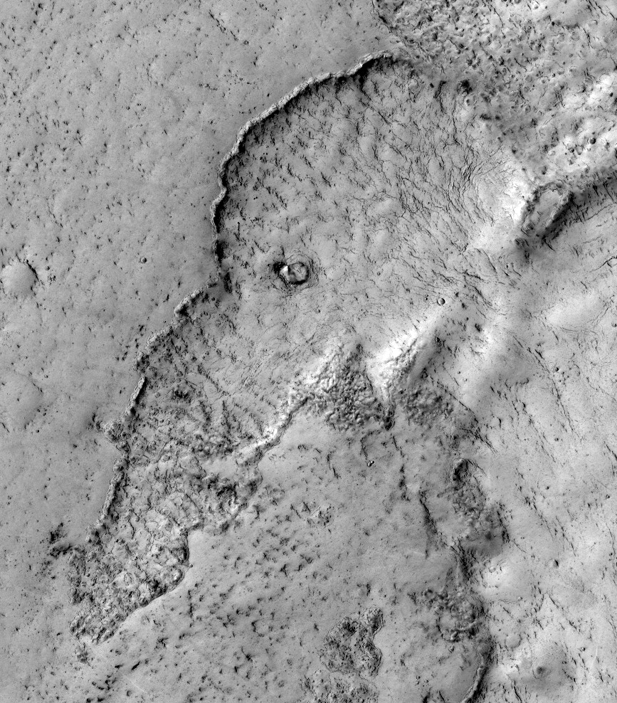
This observation highlights terrain that looks like an elephant. This is a good example of the phenomena "pareidolia," where we see things e.g. such as animals, that aren't really there.

Actually, this image covers the margin of a lava flow in Elysium Planitia, the youngest flood-lava province on Mars.

Flood lavas cover extensive areas, and were once thought to be emplaced extremely rapidly, like a flood of water.

Most lava floods on Earth are emplaced over years to decades, and this is probably true for much of the lava on Mars as well.

An elephant can walk away from the slowly advancing flow front. However, there is also evidence for much more rapidly flowing lava on Mars, a true flood of lava. In this instance, maybe this elephant couldn't run away fast enough.

Image: NASA/JPL/University of Arizona

Thursday, April 5, 2012

NASA MARS HiRISE: Elephants and Floods of Lava

This Mars HiRise observation highlights terrain that looks like an elephant.

This is a good example of the phenomena "pareidolia," where we see things (such as animals) that aren't really there.

Actually, this image covers the margin of a lava flow in Elysium Planitia, the youngest flood-lava province on Mars.

Flood lavas cover extensive areas, and were once thought to be emplaced extremely rapidly, like a flood of water.

Most lava floods on Earth are emplaced over years to decades, and this is probably true for much of the lava on Mars as well. An elephant can walk away from the slowly advancing flow front.

However, there is also evidence for much more rapidly flowing lava on Mars, a true flood of lava. In this instance, maybe this elephant couldn't run away fast enough.

Note: the sub-image is not map-projected, so approximate North is down.

Friday, February 10, 2012

Mount Etna Eruption, Sicily, Italy

Mount Etna spews lava on the southern Italian island of Sicily. Mount Etna is Europe's tallest and most active volcano.


Tuesday, August 23, 2011

Water Evidence for Mars Floods has dried up!

Lava, not water, may have carved the biggest channels on Mars.

Ever since NASA's Mariner 9 spacecraft beamed back the first images of the channels in the 1970s, most people have assumed they were created by massive floods. 

David Leverington of Texas Tech University in Lubbock says flowing water would have left behind much more sediment than is seen. There are also few minerals that form in liquid water present.

Lava, however, is known to have carved big channels on the moon. And Leverington points out that some of the channels on Mars start on the flanks of volcanoes and end in large deposits of solidified lava (Geomorphology, DOI: 10.1016/j.geomorph.2011.05.022).

Kelin Whipple of Arizona State University (ASU) in Tempe agrees that lava probably carved the huge channels, such as Kasei Valles (shown). He says the study calls into question the case for huge volumes of water – and possibly an ocean – on ancient Mars.

Phil Christensen, also at ASU, says clays and fans of sediment still point to the existence of smaller Martian lakes and riversMovie Camera. These would be better places to search for life, he says, because they would have held water for longer periods than the giant channels, where floods – if there ever were any – would have been fleeting. "Lakes and deltas are probably the places people are going to look for life," he says.
Monday, August 15, 2011

Lava, not water, said cause of Mars beds

A U.S. researcher says large, river-like channels seen on Mars were created not by water but by massive, fast-moving lava flows of a type we don't see on Earth.

Geoscience Professor David Leverington at Texas Tech University says what we interpret as the largest ancient riverbeds on Mars most likely were created by low-viscosity lava flows that ravaged the planet's surface.

Leverington says recent high-resolution photographs and mineralogical data support his theory for why lava is a much more likely culprit for creating the largest class of the outflow channels and canyons, some of which stretch up to 1,800 miles.

The channels superficially resemble channels on Earth formed by floods from giant glacial lakes, he says, but the Martian canyons do not feature obvious river deposits and don't terminate in delta-like, sediment-laden mouths, such as at the end of the Mississippi River.

Instead, he says, they fade into vast plains composed of volcanic basalt.

"We see abundant evidence for past eruptions of lava at the heads of these large systems, for flows along these systems and for extraordinarily large volumes of lava at the mouths of these systems," he said Thursday in a university release, noting the characteristics are very similar to what is seen at volcanic channels on the moon and Venus.

"There's really no known process for the rapid eruption of large amounts of water from aquifers to form channels that are thousands of miles long," he said. "We do have evidence of this happening through past volcanic processes on the moon and Venus."

Friday, January 22, 2010

ESA - Observing the Earth - Congo receives help from space after volcano eruption - images

ESA - Observing the Earth - Congo receives help from space after volcano eruption

Mount Nyamulagira
Congo receives help from space after volcano eruption
On 2 January, Mount Nyamulagira in the Democratic Republic of Congo erupted, spewing lava from its southern flank and raising concerns that the 100 000 people in the town of Sake could be under threat.

Fears were also triggered in Goma as rumours circulated that an eruption was imminent at the nearby Nyiragongo volcano, which devastated the city in 2002.

Following the eruption, scientists and local authorities have been using a long series of space images from ESA’s Envisat, together with seismic and helicopter data, to monitor the situation and calm fears of the local population.

Dr Nicolas d’Oreye of GORISK, which is in Congo assisting the Goma Volcano Observatory to collect and process satellite observations and field data, said the satellite images are very useful for managing the crisis.

"As well as helping to validate information from different datasets, the satellite images are providing invaluable information about the situation, such as the details about the lava flow and the fact that the Nyiragongo volcano is not showing any signs of abnormal activity.

Path of lava flow

Path of lava flow
"This has been of great importance for the local authorities and the Goma Volcano Observatory, who are holding daily crisis meetings, to reassure the local population and humanitarian agencies that Nyiragongo will be unaffected by the eruption of Nyamulagira."

Goma, the capital of the North Kivu province, is situated along the southern margin of the lava fields from these volcanoes. Lava from the Nyamulagira (height 3058 m) eruption has been flowing in a direction south and southwest of the volcano, raising concerns that lava could cover the Goma and Sake road within weeks, causing widespread chaos and threatening the local economy.

"Lava flows from Nyamulagira are usually not a direct threat for the population and the infrastructure except when it develops southwards, as it is in this case," explained Dr d’Oreye, a senior scientist at the Geophysics/Astrophysics Department of the National Museum of Natural History in Luxembourg. "In this situation, it is crucial to monitor the flow size, direction and speed for the authorities to be able to make timely decisions."

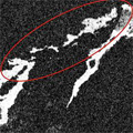
Lava flows can be mapped by comparing satellite radar images acquired before and after the eruption. In the images, old lava appears bright white. If an area appears white in before images and black in after images, then the ground has changed between acquisitions by the flow of new lava.