Showing posts with label erosion. Show all posts

Monday, August 4, 2014

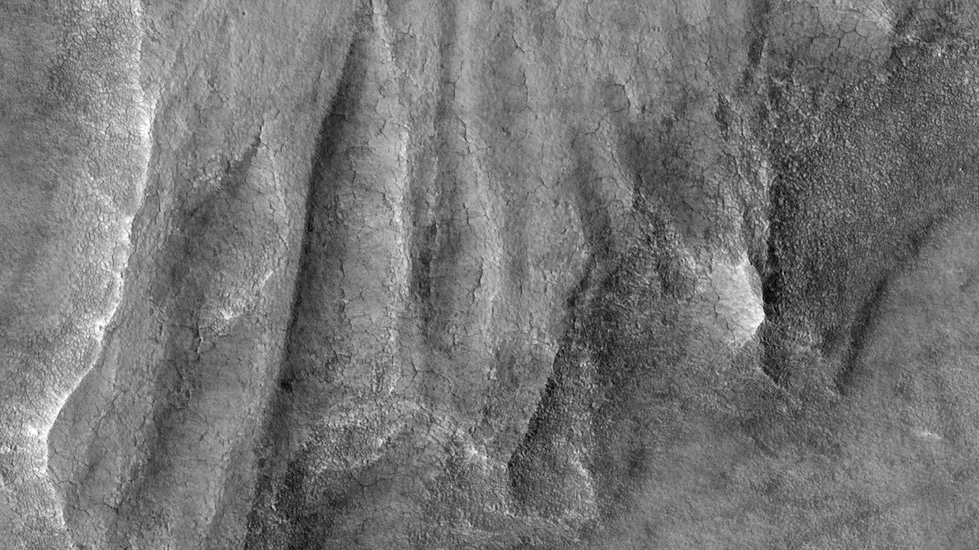
NASA Mars MRO HiRise Image: A Pedestal Crater

Credit: Nasa /JPL /University of Arizona

This HiRISE image shows what is termed a pedestal crater, so-called because the level of the surface adjacent to the crater is elevated relative to the surface of the surrounding terrain.

The raised surface has patterns and a general outline resembling what ejecta would look like after being thrown out from the crater by the impact.

This impact probably occurred at a time when the surface of the whole scene was at the level of the raised surface.

The ejecta landed on the part of this surface close to the crater. Erosion then removed material in the rest of the scene while the impact ejecta shielded the area around the crater, protecting the ground under it from eroding and keeping it high.

The eroded, or “missing”, terrain in the rest of the scene may have contained ice. Lobe shapes at the base of the raised ejecta and polygons (visible when zoomed in) on the surface both suggest the pedestal material may have, or may still, contain ice.

The pattern of ejecta is asymmetric around the crater, suggesting the impactor may have hit the ground traveling from the north-east.

Thursday, September 27, 2012

NASA Mars Rover Curiosity: Image of Rock Outcrop named Link

This set of images compares the Link outcrop of rocks on Mars (left) with similar rocks seen on Earth (right).

The image of Link, obtained by NASA's Curiosity rover, shows rounded gravel fragments, or clasts, up to a couple inches (few centimeters), within the rock outcrop.

Erosion of the outcrop results in gravel clasts that fall onto the ground, creating the gravel pile at left.

The outcrop characteristics are consistent with a sedimentary conglomerate, or a rock that was formed by the deposition of water and is composed of many smaller rounded rocks cemented together.

A typical Earth example of sedimentary conglomerate formed of gravel fragments in a stream is shown on the right.

An annotated version of the image highlights a piece of gravel that is about 0.4 inches (1 centimeter) across.

It was selected as an example of coarse size and rounded shape. Rounded grains (of any size) occur by abrasion in sediment transport, by wind or water, when the grains bounce against each other.

Gravel fragments are too large to be transported by wind. At this size, scientists know the rounding occurred in water transport in a stream.

The name Link is derived from a significant rock formation in the Northwest Territories of Canada, where there is also a lake with the same name.

Scientists enhanced the color in the Mars image to show the scene as it would appear under the lighting conditions we have on Earth, which helps in analyzing the terrain. The Link outcrop was imaged with the 100-millimeter Mast Camera on Sept. 2, 2012, which was the 27th sol, or Martian day of operations.

Image Credit: NASA/JPL-Caltech/MSSS and PSI

Thursday, June 7, 2012

ESA Mars Express: Kalocsa Crater shows evidence for climate evolution


ESA’s Mars Express has provided images of a remarkable crater on Mars that may show evidence that the planet underwent significant periodic fluctuations in its climate due to changes in its rotation axis.

On 19 June 2011, Mars Express pointed its high-resolution stereo camera at the Arabia Terra region of Mars, imaging the Danielson and Kalocsa craters.

Danielson crater is named after the late George E Danielson, who was instrumental in the development of many spacecraft cameras flown to Mars. Seen to the right (north) in the image, it is the larger crater, roughly 60 km across.

Kalocsa crater lies in the centre of the image and is smaller, about 33 km in diameter and a kilometre shallower than Danielson. It is named after a town in Hungary famed for its astronomical observatory.

 Danielson crater, like many in the Arabia Terra region, is filled with layered sediments, which in this instance have been heavily eroded over time.

Within the crater are peculiarly layered buttes, known as yardangs.

Yardangs are streamlined hills carved from bedrock or any consolidated or semi-consolidated material by abrasive dust and sand particles carried in the wind.

They are seen on Earth in desert regions, with notable examples in North Africa, Central Asia and Arizona in the United States.

In the case of Danielson crater, it is believed that sediments were cemented by water, possibly from an ancient deep groundwater reservoir, before being eroded by the wind.

The orientation of the yardangs leads scientists to theorise that strong north–northeasterly winds (from the lower right in the image) both deposited the original sediments and then caused their subsequent erosion in a later drier period of martian history.

A 30 km-long field of darker dunes can be seen bisecting the yardangs and is thought to have formed at a later epoch.

The crater floor of Danielson shows evidence for a series of alternating sedimentary layers with roughly uniform thickness and separation.

Some scientists believe that this indicates periodic fluctuations in the climate of Mars, triggered by regular changes in the planet’s axis of rotation. The different layers would have been laid down during different epochs.

By marked contrast, Kalocsa crater shows a completely different topography.

Here, no layered sediments are seen. This is thought to be due to the higher altitude of its floor, with the crater not tapping in to the suspected underlying ancient water reservoir.

Another hypothesis is that this crater is younger than its neighbour, created when water was not present anymore.

Download a 3D Anaglyph Image of  Danielson and Kalocsa here