Showing posts with label HiRise Image. Show all posts

Friday, August 15, 2014

NASA MRO Image: Rolling Boulder on Mars Leaves Visible Trail

NASA's Mars Reconnaissance Orbiter (MROspotted the trail from an oblong boulder (bottom right) that rolled down a slope on the Red Planet. 

The image was taken on July 3, 2014.

Credit: NASA/JPL-Caltech/Univ. of Arizona

The agency's Mars Reconnaissance Orbiter (MROcurrently orbiting the Red Planet has spotted the trail left behind after a tall boulder tumbled down a Martian slope.

The Mars rock's misshapen prints are clearly visible in the spacecraft's view from orbit.

While NASA unveiled the MRO spacecraft's black and white view of the rocky road on Wednesday (Aug. 13), the image was actually captured on July 3.

By looking at the large rock's shadow, scientists at NASA have calculated that the boulder is about 20 feet tall (6 meters) and 11.5 feet wide (3.5 m).

The SUV-sized boulder ended its roll pointed straight up on its axis, according to NASA officials.

NASA's Mars Reconnaissance Orbiter snapped this view, showing the the trail left by a rolling boulder that tumbled down the side of a slope, on July 3, 2014. 

Credit: NASA /JPL-Caltech/Univ. of Arizona

"The boulder's trail down the slope is about one-third of a mile (about 500 meters) long," NASA officials wrote in an image description.

"The trail has an odd repeating pattern, suggesting the boulder could not roll straight due to its shape."

Scientists used MRO's High Resolution Imaging Science Experiment, (HiRISE), camera to take the Mars boulder photo.

The space agency's Mars Reconnaissance Orbiter launched to space in 2005 and has been orbiting the Red Planet in 2006.

The spacecraft has beamed back some amazing images of the Martian surface including pictures of the Spirit rover and Viking landers. NASA's probe has also witnessed dust devils and avalanches from its place in orbit.

In October, MRO will also have a chance to monitor Mars' close brush with a comet set to fly by the Red Planet.

NASA has started to adjust the orbits of spacecraft at Mars to prepare them for their encounter with Comet Siding Spring and ensure that they will be safe from any ill effects that could be caused by the comet.

"MRO will monitor Mars' atmosphere for possible temperature increases and cloud formation, as well as changes in electron density at high altitudes," NASA officials said in a statement.

"The MRO team also plans to study gases in the comet's coma. Along with other MRO observations, the team anticipates this event will yield detailed views of the comet’s nucleus and potentially reveal its rotation rate and surface features."

Monday, August 4, 2014

NASA Mars MRO HiRise Image: A Pedestal Crater

Credit: Nasa /JPL /University of Arizona

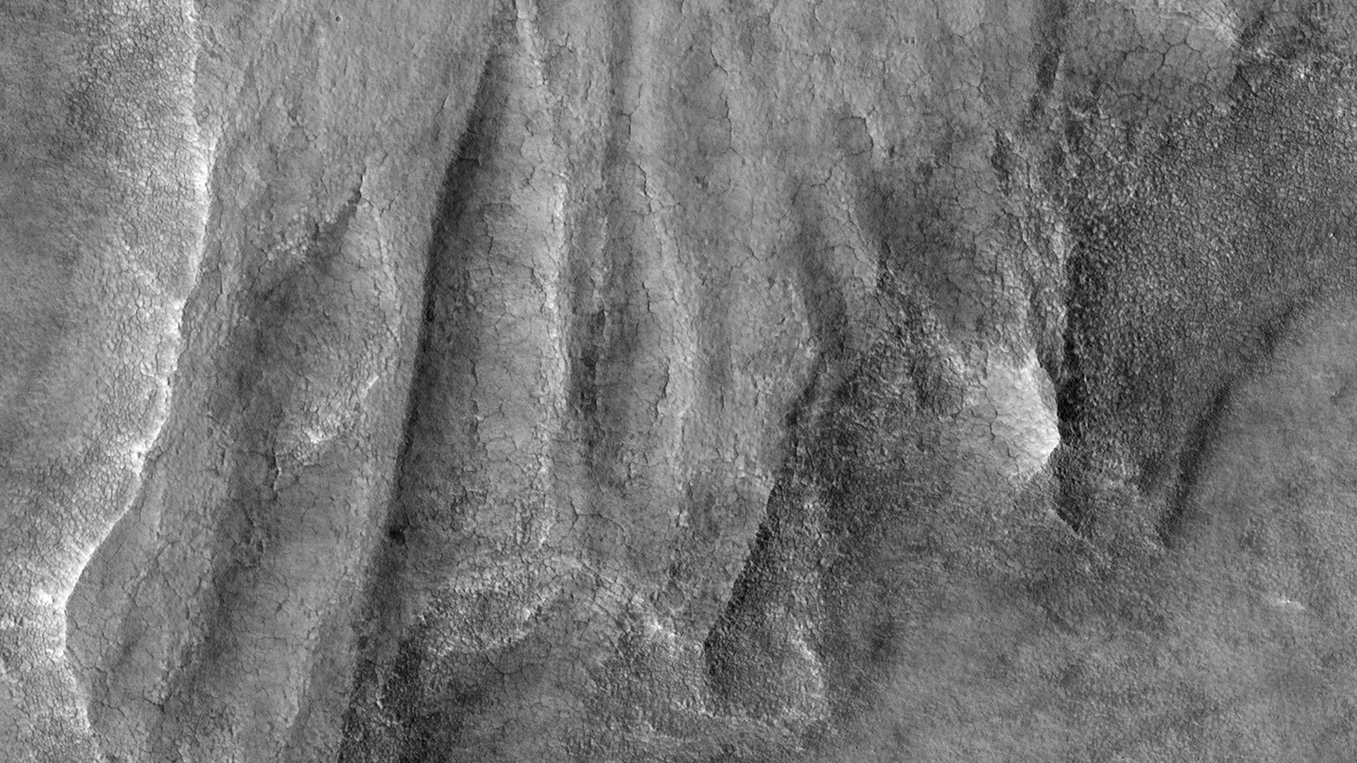
This HiRISE image shows what is termed a pedestal crater, so-called because the level of the surface adjacent to the crater is elevated relative to the surface of the surrounding terrain.

The raised surface has patterns and a general outline resembling what ejecta would look like after being thrown out from the crater by the impact.

This impact probably occurred at a time when the surface of the whole scene was at the level of the raised surface.

The ejecta landed on the part of this surface close to the crater. Erosion then removed material in the rest of the scene while the impact ejecta shielded the area around the crater, protecting the ground under it from eroding and keeping it high.

The eroded, or “missing”, terrain in the rest of the scene may have contained ice. Lobe shapes at the base of the raised ejecta and polygons (visible when zoomed in) on the surface both suggest the pedestal material may have, or may still, contain ice.

The pattern of ejecta is asymmetric around the crater, suggesting the impactor may have hit the ground traveling from the north-east.

NASA Mars MRO HiRise Image: Late winter on south-facing slopes

Image Credit: NASA MRO.

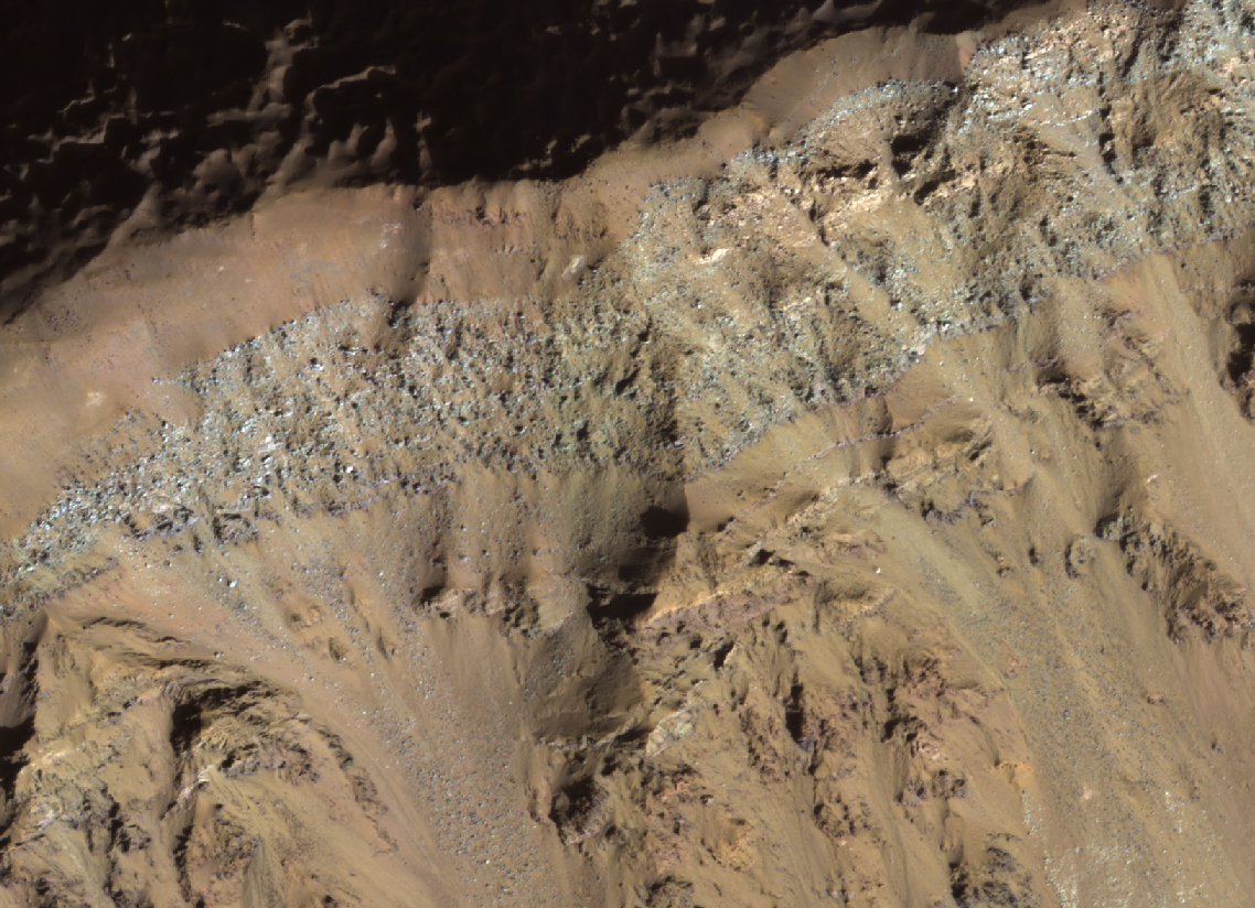
An image of Mars taken by the HiRISE instrument on NASA's Mars Reconnaissance Orbiter shows frost or ice (white areas) persisting in late winter only on south-facing slopes that have not received much direct sunlight.

Ridges between gully alcoves receiving more light appear reddish and mostly free of frost. New gully activity is not readily detectible in this image.

In some years, the frost (up to roughly 3.3 feet or 1 meter thick) triggers avalanches, although not in most years.

The frost here consists of mostly carbon dioxide (dry ice), but also contains small amounts of water ice.

Thursday, March 6, 2014

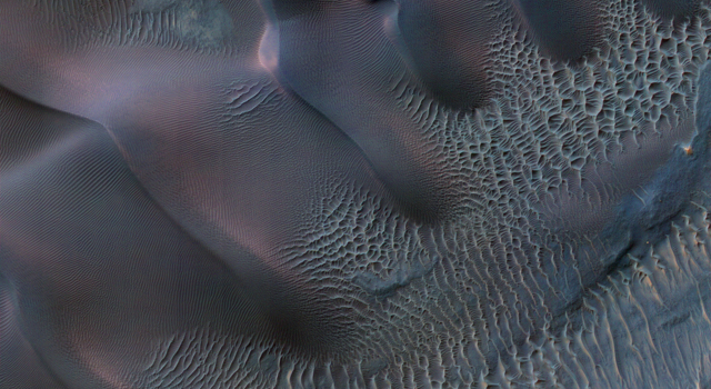
NASA Mars Reconnaissance Orbiter HiRise Image: Martian Sand Dunes in Spring

Mars’ northern-most sand dunes are beginning to emerge from their winter cover of seasonal carbon dioxide (dry) ice. 

Dark, bare south-facing slopes are soaking up the warmth of the sun.

The steep lee sides of the dunes are also ice-free along the crest, allowing sand to slide down the dune. 

Dark splotches are places where ice cracked earlier in spring, releasing sand. Soon the dunes will be completely bare and all signs of spring activity will be gone.

This image was acquired by the HiRISE camera aboard NASA's Mars Reconnaissance Orbiter on Jan. 16, 2014. 

The University of Arizona, Tucson, operates the HiRISE camera, which was built by Ball Aerospace & Technologies Corp., Boulder, Colo. 

NASA's Jet Propulsion Laboratory, a division of the California Institute of Technology in Pasadena, manages the Mars Reconnaissance Orbiter Project for the NASA Science Mission Directorate, Washington.

Image Credit: NASA/JPL-Caltech/Univ. of Arizona

Caption: Candy Hansen

Thursday, February 20, 2014

NASA Mars orbiter HiRise Image: Opportunity Rover on Murray Ridge

Credit: NASA/JPL-Caltech/Univ. of Arizona

A new image from a telescopic camera orbiting Mars shows NASA's Mars Exploration Rover Opportunity at work on "Murray Ridge," without any new impact craters nearby.

The Feb. 14 view from the High Resolution Imaging Science Experiment (HiRISE) camera on NASA's Mars Reconnaissance Orbiter (MRO) is above.

Rover tracks from Opportunity, as well as the rover itself, are visible.

A rock, dubbed "Pinnacle Island," appeared in January 2014 next to Opportunity where it had been absent a few days earlier.

After that, researchers using HiRISE planned this observation to check the remote possibility that a fresh impact by an object from space might have excavated a crater near Opportunity and thrown this rock to its new location. No fresh impact site is seen in the image.

Meanwhile, observations by the rover solved the Pinnacle Island mystery by finding where the rock had been struck, broken and moved by a rover wheel.

Murray Ridge is part of the western rim of Endeavour Crater, an impact scar that is billions of years old and about 14 miles (22 kilometers) in diameter.

Monday, February 17, 2014

Mars MRO HiRise Image: Sand dune formation Mawrth Vallis

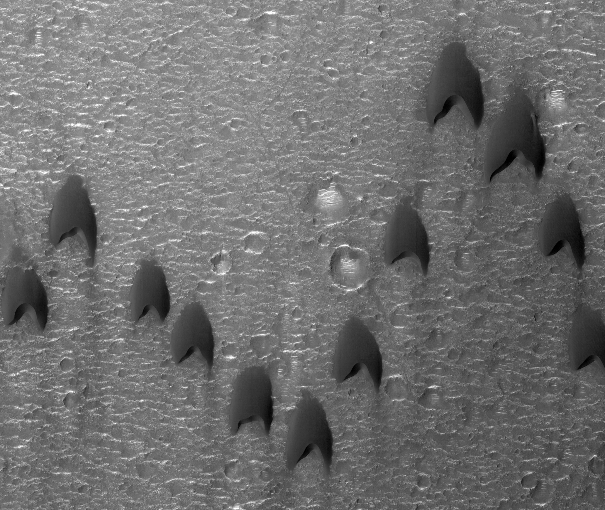
Mars Reconnaissance Orbiter (MRO) flying above the red planet spotted these dunes with its HiRise camera

This is an intriguing formation of sand dunes in a crater near Mawrth Vallis. 

The “V” formation greatly boosts the efficiency and range of flying birds, because all except the first fly in the upward motion of air--called upwash--from the wingtip vortices of the bird ahead. 

For dune fields, the spacing of individual dunes arises as a function of sand supply, wind speed, and topography. 

Trekkies may notice a resemblance to the shape of classic Star Trek uniform insignias. 

Image released Feb. 13, 2014.

Sunday, April 28, 2013

NASA Mars Curiosity Rover: MRO HiRise Traverse Map, Sol 130

This map traces where NASA's Mars rover Curiosity drove between landing at a site subsequently named "Bradbury Landing," and the position reached during the mission's 130th Martian day, or sol, (Dec. 17, 2012). 

The inset shows the most recent legs of the traverse in greater detail.

Credit: NASA /JPL-Caltech /Univ. of Arizona

The rover entered a shallow depression called "Yellowknife Bay" with a drive of about 86 feet (26.1 meters) on Sol 125 (Dec. 12). 

It subsequently drove about 108 feet (32.8 meters) on Sol 127 (Dec. 14) and about 18 feet (5.6 meters) on Sol 130.


Yellowknife Bay 
Yellowknife Bay is a potential location for selection of the first target rock for Curiosity's hammering drill. 

The ground in this basin is a different type of terrain from the terrain Curiosity crossed getting there from Bradbury Landing. 

Nighttime observations from orbit indicate that the ground in the basin retains daytime heating better than the terrain around Bradbury Landing does, a property called high thermal inertia.


Bradbury Landing
The mapped area is within Gale Crater and north of the mountain called Mount Sharp in the middle of the crater. 

After the first use of the drill, the rover's main science destination will be on the lower reaches of Mount Sharp. 


The base image from the map is from the High Resolution Imaging Science Experiment Camera (HiRISE) in NASA's Mars Reconnaissance Orbiter.


Tuesday, August 7, 2012

NASA HiRise Image: MARS Rover Curiosity on Surface of Mars

Another stunning photograph from space shows NASA’s Curiosity rover sitting safely on the surface of Mars.

Taken with the Mars Reconnaissance Orbiter’s HiRISE camera, the picture captures incredible details of the surface along with the robotic components that helped Curiosity stick its landing.

“This is like the crime scene photo here,” said Sarah Milkovich (@milkysa), HiRISE investigation scientist during a NASA press conference Aug. 7.

Zooming in close, black streaks can be seen where the rover’s rockets disturbed bright surface dust, revealing darker soil underneath.

Researchers have used these streak patterns to infer Curiosity’s orientation, which matches up nicely with information from the rover’s first pictures on the surface.

Down and to the right is the rover’s heat shield, which protected the probe as it plummeted through the Martian atmosphere. It is sitting about 4000 feet from Curiosity on the surface.

The backshell and parachute — over to the lower left in the image — sit about 2000 feet from the rover while the sky crane, which gently lowered the rover to the ground, is above and to the left about 2100 feet from Curiosity.

NASA engineers will continue poring over the photo for clues of exactly how Curiosity’s complex landing sequence unfolded.

Friday, June 22, 2012

NASA HiRise Image: Mars Impact Crater

This enhanced-colour image from March 2012 of a region of Mars near Nili Fossae shows part of the ejecta from an impact crater and contains some of the best exposures of ancient bedrock on Mars.

The impact broke up already diverse rocks types and mixed them together to create this wild jumble of colours, each representing a different type of rock.


Carbonates are commonly formed on Earth by marine organisms; the origin of these carbonates on Mars is unknown, but probably involved liquid water.

This image was taken along with the CRISM instrument, also onboard
the Mars Reconnaissance Orbiter (MRO), in what is called "ridealong" mode. 

This image was taken by the Mars Reconnaissance Orbiter's HiRISE camera.

Image Credit: NASA/JPL-Caltech/University of Arizona

Saturday, June 16, 2012

NASA Mars HiRISE Image: Wavy-Looking Layers in the North Polar Layered Deposits

These layers near the North Pole of Mars probably record global climate changes, similar to ice ages on Earth.

They appear wavy here either because flat-lying layers have been eroded into shallow valleys and ridges, or because the layers are not horizontal.

Some of these layers are truncated, or appear to pinch out against other layers, evidence of a period of erosion followed by continued deposition of new layers.

The orientations of both the wavy-looking layers and the "unconformity" or erosional surface will be determined once this image and its stereo pair have been used to measure the surface topography.

Friday, April 27, 2012

NASA HiRISE Image: Folded Layers in Melas Chasma, Central Valles Marineris

There are folded layered deposits in the southern half of this image. How did this folding occur?

On Earth, rocks are commonly folded when deeply buried and subject to high heat and pressure, which can make any rock flow.

Such deep burial and re-exposure or exhumation, is unlikely at this location.

In general Mars has experienced much less vertical motion of geologic strata than on Earth. Another possibility is that these layers were soft and deformable near the surface, such as wet or icy sediments. There are other folded layers in the giant Hellas impact basin, such as ESP_025780_1415.

Please get out your 3D glasses for a look at the stereo anaglyph here.

Science Theme: Sedimentary/Layering Processes

Thursday, April 12, 2012

NASA MARS HiRISE: Terraces or Strata on a Crater Slope

This observation shows an interesting layered rock outcrop in the southeast Hellas Region.

One of the scientific goals is to look for bedding features that might give clues to what deposited the material: subaerial, subaqueous or polar-ice-like?

Structural features cut through the layered material and strata at this location. Could these features be faults or dikes? Additional images of this region may help us find out.

This caption is based on the original science rationale.

Find out more on the Mars HiRise site

Friday, April 6, 2012

NASA Mars HiRISE Image: Sunlight Reveals Layers in a Crater Wall

This image is of the rim of a crater. The sun is low in the sky (only 15 degrees above the horizon) and shining full on this crater wall (you can see that the area beyond the rim has got long shadows).

The sun is beautifully illuminating a series of layers exposed in the crater wall which have a variety of different colors.

Note: the subimage is non map-projected, so approximate North is down.

Thursday, March 8, 2012

NASA MARS HiRise Image: The Serpent Dust Devil

A towering dust devil casts a serpentine shadow over the Martian surface in this image acquired by the High Resolution Imaging Science Experiment (HiRISE) camera on NASA's Mars Reconnaissance Orbiter.

The scene is a late-spring afternoon in the Amazonis Planitia region of northern Mars.

The view covers an area about four-tenths of a mile (644 meters) across. North is toward the top.

The length of the dusty whirlwind's shadow indicates that the dust plume reaches more than half a mile (800 meters) in height. The plume is about 30 yards or meters in diameter.

A westerly breeze partway up the height of the dust devil produced a delicate arc in the plume. The image was taken during the time of Martian year when the planet is farthest from the sun.

Just as on Earth, winds on Mars are powered by solar heating. Exposure to the sun's rays declines during this season, yet even now, dust devils act relentlessly to clean the surface of freshly deposited dust, a little at a time.

This view is one product from an observation made by HiRISE on Feb. 16, 2012, at 35.8 degrees north latitude, 207 degrees east longitude.

Other image products from the same observation are at http://www.uahirise.org/ESP_026051_2160 .

Thursday, January 26, 2012

MARS HiRISE Image: Very Fresh Impact Crater Superposing a Wrinkle Ridge in Hesperia Planum

The ridge captured in this HiRISE image is called a wrinkle ridge.

This wrinkle ridge is located in Hesperia Planum, a region of over two million square kilometers (over 770,000 square miles) in the southern highlands of Mars.

It is located northwest of the Hellas basin and adjacent to Tyrrhena Patera and contains abundant orthogonal and intersecting wrinkle ridges.

Wrinkle ridges are long, winding topographic highs and are often characterized by a broad arch with superposed narrow asymmetric ridges. These features have also been identified on the Moon, Mercury, and Venus.

Their origin is attributed to horizontal compression or shortening of the crust due to faulting and folding. They commonly have asymmetrical cross sectional profiles and an offset in elevation on either side of the ridge.

Superposing or located on top of the wrinkle ridge, is a very fresh impact crater. We can tell that this crater is fresh because of its relatively sharp or crisp rim and unmodified shape.

If you look closely, you can see faint rays of relatively fine material, boulders, and smaller secondary craters radiating from the crater and superposing the wrinkle ridge and older surrounding craters.

NASA Mars orbiter HiRise Image: Wind's handiwork

Some images of stark Martian landscapes provide visual appeal beyond their science value, including a recent scene of wind-sculpted features from the High Resolution Imaging Science Experiment (HiRISE) camera on NASA's Mars Reconnaissance Orbiter.

The scene shows dunes and of various shapes and sizes inside an impact crater in the Noachis Terra region of southern Mars.

Patterns of dune erosion and deposition provide insight into the sedimentary history of the area.

The has been examining Mars with six science instruments since 2006.

Now in an extended mission, the orbiter continues to provide insights about the planet's ancient environments and about how processes such as wind, and seasonal frosts are continuing to affect the Martian surface today.

This mission has returned more data about Mars than all other orbital and surface missions combined.

More than 20,600 images taken by HiRISE are available for viewing on the instrument team's website: http://hirise.lpl.arizona.edu .

Each observation by this telescopic camera covers several square miles, or square kilometers, and can reveal features as small as a desk.

More information: For more information about the Mars Reconnaissance Orbiter, see http://www.nasa.gov/mro .

Friday, January 13, 2012

NASA MARS HiRISE Image: Aram Chaos

The Southern cap rock in Aram Chaos is situated in the Martian equatorial region, to the east of the Tharsis region.

In Ancient Greek, "chaos" meant an emptiness or void, the gap that existed between the heavens and the earth; here, we use the word to describe terrain that is jumbled and "confused."

As the image shows us, Aram Chaos is actually a heavily eroded impact crater, with material on the floor that is blocky in contrast to some of the surrounding terrain.

This would be an interesting area to explore and to send a rover, because we think that water might have existed in the underground as ice.

Read more about the Science Theme: Geologic Contacts/Stratigraphy

Thursday, January 12, 2012

MARS HiRISE: Banded Wall Outcrop in Ius Chasma

This area was covered in a well known MOC image of October 1997 (AB1-01303) that shows what appears to be layered rock, deep below the Martian surface.

At the time, this was considered to be revolutionary and seemed to contradict the general view of the upper crust of Mars as being a lunar-like "megaregolith."

Later coverage of this outcrop area by MOC is not particularly good and the CTX (Context Camera) coverage doesn't improve on spatial resolution much.

However, experience with other HiRISE images suggests the "layering" will be less obvious at sub-meter-per-pixel scales, but nonetheless we'll see some interesting things.

This was thought to be an important area for the development of some post-Viking views of Mars. This underscores how much technology has changed since the 1970s.

Read more and see more HiRise image details here

Wednesday, December 14, 2011

MARS HiRISE: Faults in Ius Chasma

Ius Chasma is one of many steep-sided interconnected depressions (chasmata) that comprise Valles Marines, the largest canyon system in the Solar System.


The chasma is approximately 900 kilometers long and is located in western Valles Marineris.

The floor of Ius Chasma is between 8 to 10 kilometers deep and is divided by a prominent east-west trending ridge known as Geryon Montes.

The region in this image is located (approximately 7.8 degrees S, 279.5 degrees E) on the floor of Ius Chasma.

A variety of light and medium-toned terrains and layered units of different rock types comprise the chasma floor.


Prominent faults of various sizes have displaced and deformed these layered units and outcrops, some in a spectacular fashion.

The ejecta of small fresh-appearing impact craters formed in the light-toned units reveal the existence of a darker (likely basaltic) underlying substrate.

Linear dunes are located on top of the lighter-tone outcropping units and are ubiquitous on the chasma floor.

These dunes are oriented in a north-south direction and indicate prevailing westerly winds through the canyon.

Wednesday, November 30, 2011

MARS HiRise: Bright and Dark Terrain in Noctis Labyrinthus

Bright and Dark Terrain in Noctis Labyrinthus

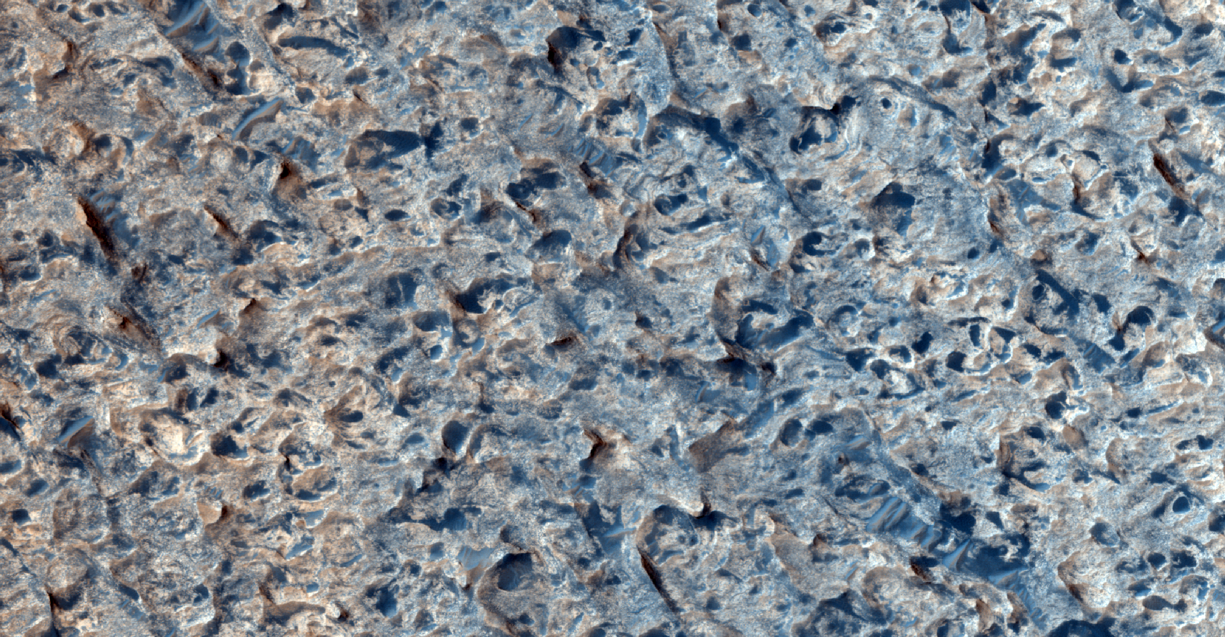
To view more of the latest images visit the HiRise website