Showing posts with label topography. Show all posts

Saturday, July 12, 2014

ESA Mars Express HRSC Image: Hellespontus Montes topography image

Credit: ESA

This is a colour-coded topography map of a portion of the western rim of the Hellas basin.

The crater shown in the upper left is on the periphery of this larger impact basin.

The edge of the Hellas basin is traced by a string of rocky peaks known as the Hellespontus Montes, revealed as the red/white ridge in this topography map thanks to their height.

White and red show the highest terrains, while blue and purple show the deepest.

The image is based on a digital terrain model of the region, from which the topography of the landscape has been derived.

The image was created using data acquired with the High Resolution Stereo Camera on ESA’s Mars Express on 13 January 2014 during orbit 12 750. North is to the right, east is up.

Monday, February 17, 2014

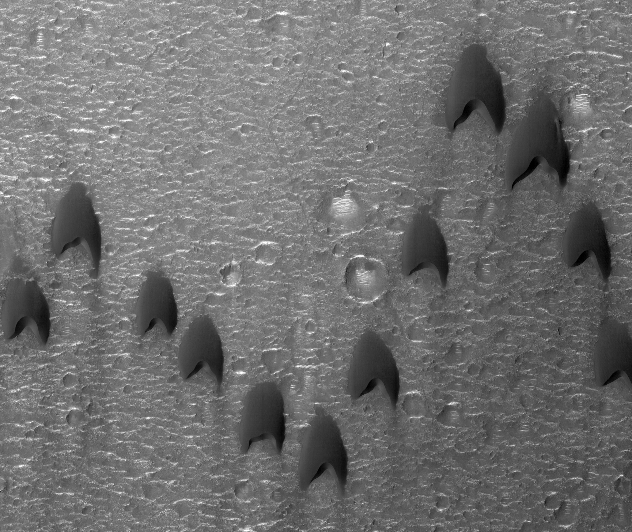
Mars MRO HiRise Image: Sand dune formation Mawrth Vallis

Mars Reconnaissance Orbiter (MRO) flying above the red planet spotted these dunes with its HiRise camera

This is an intriguing formation of sand dunes in a crater near Mawrth Vallis. 

The “V” formation greatly boosts the efficiency and range of flying birds, because all except the first fly in the upward motion of air--called upwash--from the wingtip vortices of the bird ahead. 

For dune fields, the spacing of individual dunes arises as a function of sand supply, wind speed, and topography. 

Trekkies may notice a resemblance to the shape of classic Star Trek uniform insignias. 

Image released Feb. 13, 2014.

Saturday, September 29, 2012

NASA Mars HiRISE Image: Topography of a Flood Carved Channel

This image is part of a stereo pair that allows one to look at the walls of a flood carved channel in 3D.

By examining the walls in such detail, we hope to understand the process by which the channel was carved.

For example, in this location, there are a series of benches or terraces high up on the channel wall.

By looking at the topography it should be possible to tell if;
  1. these are produced by sediments being left at these elevations, 
  2. the erosive fluid dropped in stages and thus did more erosion at certain levels, or 
  3. the wall of the channel was slumping inward as a series of landslides.
This is a stereo pair with ESP_028196_1840.

Saturday, June 16, 2012

NASA Mars HiRISE Image: Wavy-Looking Layers in the North Polar Layered Deposits

These layers near the North Pole of Mars probably record global climate changes, similar to ice ages on Earth.

They appear wavy here either because flat-lying layers have been eroded into shallow valleys and ridges, or because the layers are not horizontal.

Some of these layers are truncated, or appear to pinch out against other layers, evidence of a period of erosion followed by continued deposition of new layers.

The orientations of both the wavy-looking layers and the "unconformity" or erosional surface will be determined once this image and its stereo pair have been used to measure the surface topography.