Showing posts with label HiRISE. Show all posts

Friday, January 16, 2015

UK Space Agency Announce discovery of Beagle-2 on Mars

Following a lengthy and protracted briefing by the UK Space Agency, they finally acknowledged the discovery of the Beagle 2 on Mars by the HiRise camera on MRO.
The UK Agency seemed to feel the need to promote their apparent expertise and kudos before breaking the news before showing off the grainy images.


This is one of the images shown at the briefing. It is far from clear but we are assured it contains the component parts of the UK's failed Beagle 2.
More than 11 years after UK Mars probe Beagle 2 was lost, believed crashed, space scientists are set to reveal new findings about what hapened to the spacecraft.

Mystery surrounds exactly what will be disclosed by experts from the European Space Agency and the underfunded, struggling, UK Space Agency at the English National Academy of Science, known as the Royal Society in London on Friday, but it has raised hopes that orbiting spacecraft around Mars might have located the debris of the Beagle 2.

The probe was the brainchild of the eccentric, mutton-chopped Professor Colin Pillinger, of the UK’s Open University, who died suddenly in May 2014 from a brain haemorrhage.

Beagle 2 was carried to Mars by ESA’s Mars Express which remains in orbit to this day performing valuable surveys of the planet.

Beagle was due to land on Christmas Day 2003, but nothing was ever heard from the tiny craft.

Experts later concluded that its parachute had failed in the extra thin atmosphere and it hit the ground too hard.

Months later, Colin called an impromptu press conference, convinced that he had identified a speck in a photo of the martian surface as his lost probe, but later higher-resolution imagery from a NASA orbiter showed there was nothing.

This recent announcement would indicate that this time there is hope that something really has been spotted.

The panel at Friday’s announcement will include Beagle 2’s mission manager Professor Mark Sims, Dr John Bridges of Leicester University’s Space Research Centre, the European Space Agency’s director of science and robotic exploration Alvaro Giménez, and David Parker, of Durham University and the underfunded UK Space Agency.

A recent image from the HiRise camera on the NASA MRO. 

Credit: NASA, JPL, University of Arizona

All are remaining tight-lipped about what will be revealed, but interestingly, Dr Bridges is a member of the team working with the HiRISE camera aboard NASA's Mars Reconnaissance Orbiter, which is the only imager powerful enough to pick out the debris of Beagle 2, or any other probe, from orbit.

John Zarnecki, Emeritus Professor of Space Science, and Professor Pillinger’s former colleague, told reporters: “I don’t know what they will announce. All one can think of is that they might have got an image of the probe, but if Beagle 2 is in a thousand pieces, it is unlikely that we will have found the pieces.”

“When dear old Colin was alive, he imagined he could see the Beagle 2 in single pixels. None of us could see it, he was the only one who could. So if they really have found it this time, it would be wonderful.”

Professor Zarnecki, who headed the OU’s Planetary and Space Sciences department, said that finding Beagle 2 would be an important event, but there was no chance that it could still work.

He said: “The probe will be dead. There could be no battery life and it would have frozen probably. Electronic materials and components don’t like the cold of Mars very much.”

“The main thing is that it could tell us something about how and why it failed. We’re not going to get anything scientific out of it now, but anything we can learn about how and why it failed informs our designs for the future.

“One of the reasons why space missions on the whole are so successful is that we do learn from experience. It is similar to why flying by plane is so safe - we learn from failures.”

Professor Zarnecki had his own experiment on Beagle 2, a tiny device to measure temperature, air pressure, and wind-speed and direction, “like a weather station, but a fancy one”, he said.

Wednesday, December 17, 2014

MARS HiRise Map: Signs of Ancient Mars Lakes and Quakes

Long ago, in the largest canyon system in our solar system, vibrations from "marsquakes" shook soft sediments that had accumulated in Martian lakes.

The shaken sediments formed features that now appear as a series of low hills apparent in a geological map based on NASA images.

The map was released by the U.S. Geological Survey (USGS).

This map of the western Candor Chasma canyon within Mars' Valles Marineris is the highest-resolution Martian geological map ever relased by USGS.

It is derived from images taken by the High Resolution Imaging Science Experiment (HiRISE) camera on NASA's Mars Reconnaissance Orbiter (MRO), which reveal details smaller than a desk.

"This new map shows that at the time these sediments were deposited, a part of west Candor Chasma, specifically Condor Colles, contained numerous shallow, spring-fed lakes," said map author Chris Okubo of the USGS Astrogeology Science Center, Flagstaff, Arizona.


"These lakes helped to trap wind-blown sand and dust, which accumulated over time and formed the extensive sedimentary deposits we see today."

The wet sediments experienced seismic shaking in "marsquakes" related to movement along several large geological faults in the area. A series of low hills resulted.

Valles Marineris is more than 2,500 miles (4,000 kilometers) long. The conditions under which sedimentary deposits in it formed have been an open issue for decades.

Possibilities proposed have included accumulation in lakebeds, volcanic eruptions under glaciers within the canyons, and acculation of wind-blown sand and dust.

The map is available for download here. Additional information about the map is available here.

Tuesday, September 30, 2014

MARS Nili Patera: Sandblasting winds shift Mars' sand dunes

Migration orientation of sand ripples laying on top of Martian dunes in the Nili Patera area.

Sand ripple migration is tracked from the comparison of satellite images of the dune field acquired at different time. 

Credit: Francois Ayoub, Caltech

High winds are a near-daily force on the surface of Mars, carving out a landscape of shifting dunes and posing a challenge to exploration, scientists said Tuesday.

Wind has long been known to be a factor in the Red Planet's topography and climate, creating dust storms that can be visible to astronomers on Earth.

But data about the strength, frequency and origin of winds has been sketchy, and many specialists had expected that gusts strong enough to move sand would be rare on a planet with such a thin atmosphere.

"We observed that martian sand dunes are currently migrating and that their migration speed varies with the season, which is at odds with the common view of a static martian landscape and very rare sand-moving winds," study co-author Francois Ayoub of the California Institute of Technology's planetary sciences division told AFP.

Ayoub and a joint US-British team of scientists measured the displacement of sand ripples on a dozen satellite images taken of a 40-square-kilometre (15-square-mile) area in the Nili Patera dune field over one Mars Year.

"From these measurements, we estimated the sand flux and its seasonal variability," said Ayoub.

Next, they calculated the wind speed and strength required to move the sand, and the frequency.

"Winds on Mars can be strong and can reach hurricane speed (more than 120 kilometres per hour or 75 miles per hour)," Ayoub said.

"In our study area, sand-moving wind occurs almost daily" throughout much of the year, he added.

Understanding the characteristics of Mars' winds would allow scientists to make predictions about the rate of erosion of the landscape and about the martian climate, which is heavily influenced by dust in the atmosphere, and the data may aid future rover missions from Earth.

"An accurate prediction of the wind and sand load is important to avoid the rover to be 'sandblasted' without being prepared for it," explained Ayoub.

"The (NASA) rover Curiosity, which is about to cross an active dune field in Gale crater will most probably have to sustain sand blows."

"From a scientific point of view, these findings could indicate areas on Mars deserving more attention from observation orbiters for their peculiar wind/sand/erosion behaviours."

The study was published in the journal Nature Communications.

More information: Threshold for sand mobility on Mars calibrated from seasonal variations of sand flux, Nature Communications 5, Article number: 5096, dx.doi.org/10.1038/ncomms6096

Friday, September 12, 2014

NASA Cassini HiRise Image: Transverse aeolian ridges (TARs) - Windblown dunes

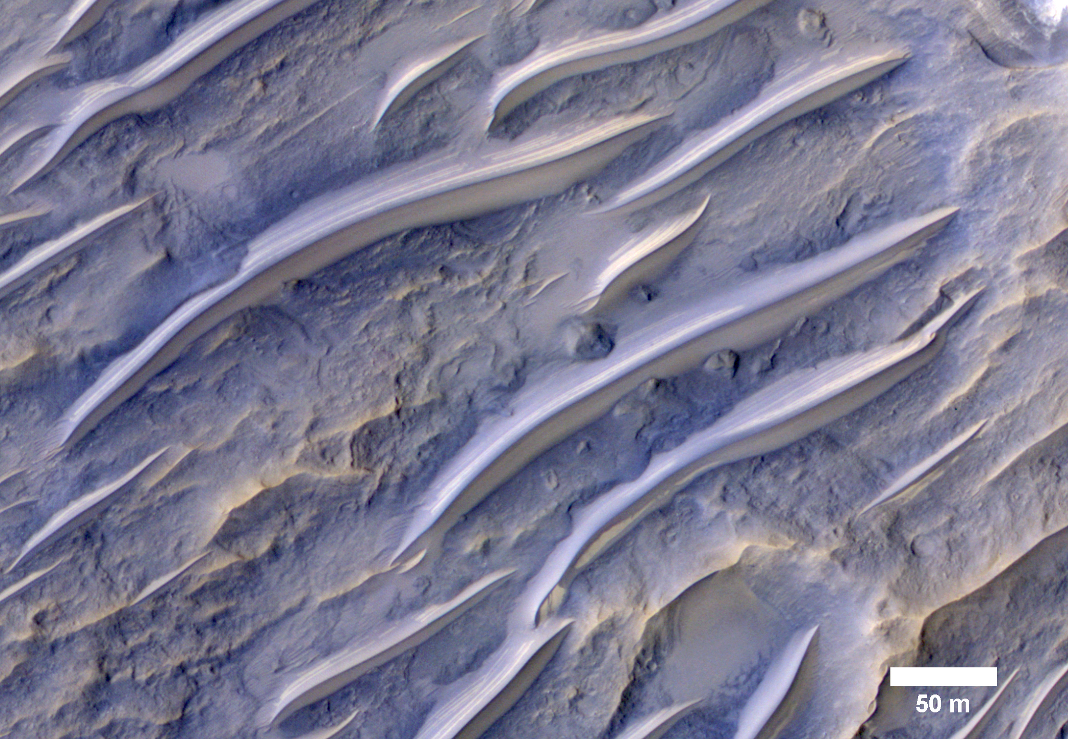
A NASA Cassini HiRise image of the tropics of Mars showing the "Transverse aeolian ridges," or TARs, consisting of small ripples shaped by the wind. 

Credit: Nasa Cassini HiRise / University of Arizona

The tropics of Mars are commonly littered with small bright ripples that were somehow shaped by the wind.

Called "transverse aeolian ridges", or TARs, the features stand up to 6 meters tall and are spaced a few tens of meters apart.

They are typically oriented transverse to modern day wind directions, and often found in channels and crater interiors.

The physical process that produces these features is still mysterious. Most TARs display no evidence of internal structure, so it is difficult to discern exactly how they were formed.

While validating a HiRISE digital terrain model of the area, Sarah Mattson of the University of Arizona discovered these rare banded TARs in Iapygia, south of Syrtis Major.

These features resemble TARs elsewhere on Mars, except that they show bands or layers on their northwest faces but fewer or none on the southeast sides.

One possible interpretation of this strange layering is that these particular TARs are made up of wedge-shaped layers, as shown in the schematic cross-section illustrating the inferred structure of the TARs.

If this hypothesis is correct, it implies that the ripples grew vertically over time, as material accreted at the crests of the ridges. It also suggests that the banded slopes faced upwind.

This observation might provide a valuable clue to the formation of TARs elsewhere on Mars, if they have a similar internal structure but that structure cannot be seen because they are made up of homogeneous materials that are uniform in colour.

Written by: Paul Geissler

Saturday, July 12, 2014

NASA MARS MRO HiRise: Further Evidence of Dry Ice Gullies

Credit: NASA/JPL/University of Arizona.

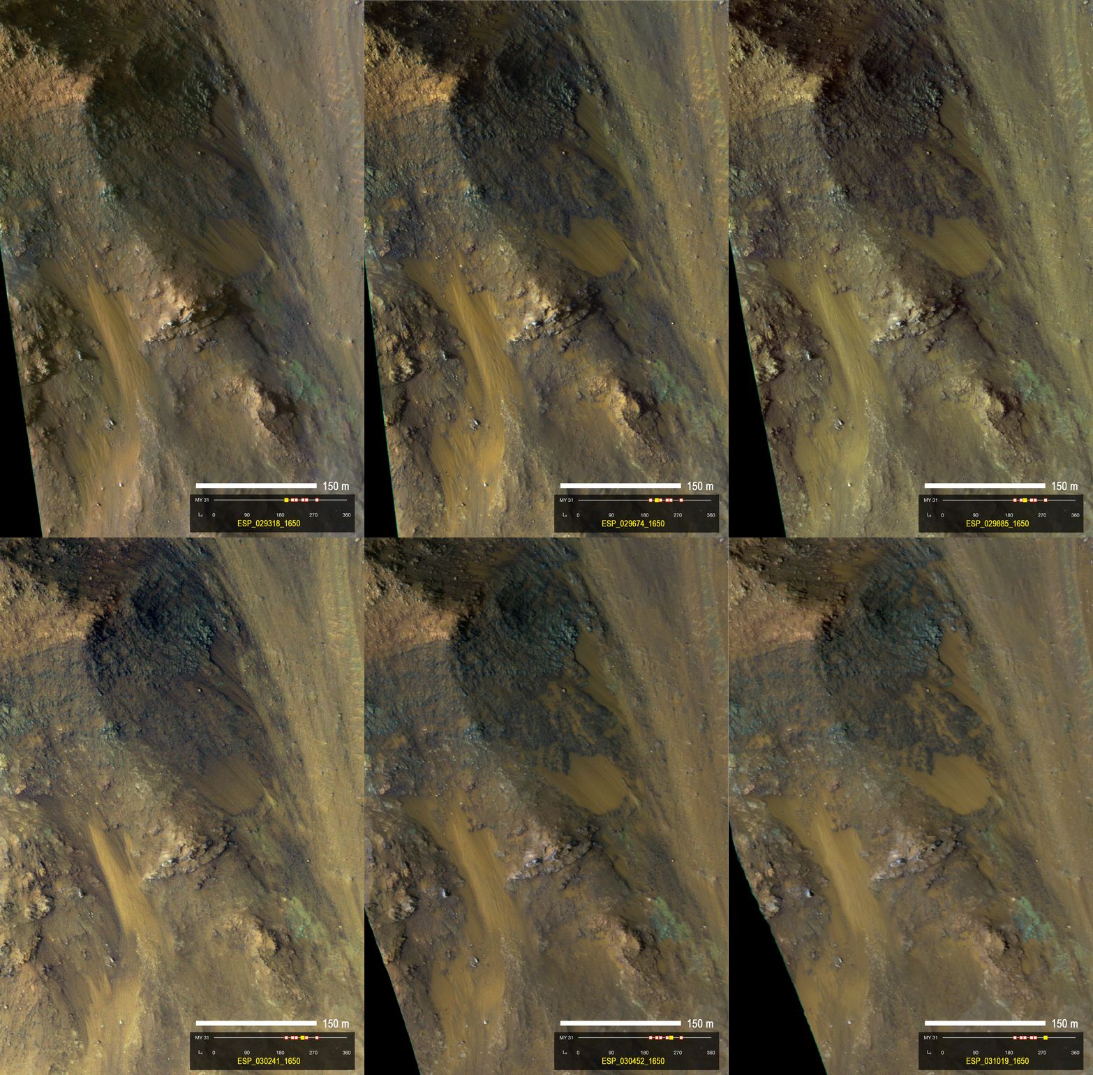
Repeated high-resolution observations made by NASA's Mars Reconnaissance Orbiter (MRO) indicate the gullies on Mars' surface are primarily formed by the seasonal freezing of carbon dioxide, not liquid water.

The first reports of formative gullies on Mars in 2000 generated excitement and NASA Spacecraft Observes Further Evidence of Dry Ice Gullies on Mars because they suggested the presence of liquid water on the Red Planet, the eroding action of which forms gullies here on Earth.

Mars has water vapour and plenty of frozen water, but the presence of liquid water on the neighbouring planet, a necessity for all known life, has not been confirmed.

This latest report about gullies has been posted online by the journal Icarus.

"As recently as five years ago, I thought the gullies on Mars indicated activity of liquid water," said lead author Colin Dundas of the U.S. Geological Survey's (USGS) Astrogeology Science Center in Flagstaff, Arizona.

"We were able to get many more observations, and as we started to see more activity and pin down the timing of gully formation and change, we saw that the activity occurs in winter."

Dundas and collaborators used the High Resolution Imaging Science Experiment (HiRISE) camera on MRO to examine gullies at 356 sites on Mars, beginning in 2006.

Thirty-eight of the sites showed active gully formation, such as new channel segments and increased deposits at the downhill end of some gullies.

Using dated before-and-after images, researchers determined the timing of this activity coincided with seasonal carbon-dioxide frost and temperatures that would not have allowed for liquid water.

Frozen carbon dioxide, commonly called dry ice, does not exist naturally on Earth, but is plentiful on Mars.

It has been linked to active processes on Mars such as carbon dioxide gas geysers and lines on sand dunes plowed by blocks of dry ice.

One mechanism by which carbon-dioxide frost might drive gully flows is by gas that is sublimating from the frost providing lubrication for dry material to flow.

Another may be slides due to the accumulating weight of seasonal frost buildup on steep slopes.

The findings in this latest report suggest all of the fresh-appearing gullies seen on Mars can be attributed to processes currently underway, whereas earlier hypotheses suggested they formed thousands to millions of years ago when climate conditions were possibly conducive to liquid water on Mars.

"Much of the information we have about gully formation, and other active processes, comes from the longevity of MRO and other orbiters," said Serina Diniega, co-author of the paper.

"This allows us to make repeated observations of sites to examine surface changes over time."

More Information: Long-term monitoring of martian gully formation and evolution with MRO/HiRISE: DOI: 10.1016/j.icarus.2014.05.013

Friday, June 6, 2014

MRO HiRISE: Giant Sandy Draa Landform on Mars

Sandy landforms formed by the wind, or aeolian bedforms, are classified by the wavelength--or length--between crests. 

Image Credit: NASA /JPL /University of Arizona

On Mars, we can observe four classes of bedforms (in order of increasing wavelengths): ripples, transverse aeolian ridges (known as TARs), dunes, and what are called “draa.” All of these are visible in this Juventae Chasma image.

Ripples are the smallest bedforms (less than 20 meters) and can only be observed in high-resolution images commonly superposed on many surfaces.

TARs are slightly larger bedforms (wavelengths approximately 20 to 70 meters), which are often light in tone relative to their surroundings.

Dark-toned dunes (wavelengths 100 meters to 1 kilometer) are a common landform and many are active today.

What geologists call “draa” is the highest-order bedform with largest wavelengths (greater than 1 kilometer), and is relatively uncommon on Mars.

Here, this giant draa possesses steep faces or slip faces several hundreds of meters tall and has lower-order superposed bedforms, such as ripples and dunes.

A bedform this size likely formed over thousands of Mars years, probably longer.

This image was acquired by the HiRISE camera on board NASA's Mars Reconnaissance Orbiter on Jan. 6, 2014.

The University of Arizona, Tucson, operates the HiRISE camera, which was built by Ball Aerospace & Technologies Corp., Boulder, Colo.

NASA's Jet Propulsion Laboratory, a division of the California Institute of Technology in Pasadena, manages the Mars Reconnaissance Orbiter Project for the NASA Science Mission Directorate, Washington.

Friday, May 2, 2014

NASA MRO HiRISE: Active Dune Field on Mars

Nili Patera is one of the most active dune fields on Mars. 

As such, it is continuously monitored with the HiRISE (High Resolution Imaging Science Experiment) camera, a science instrument aboard NASA's Mars Reconnaissance Orbiter, with a new image acquired about every six weeks.

Image Credit: NASA /JPL-Caltech /Univ. of Arizona

By monitoring the sand dune changes, we can determine how winds vary seasonally and year-to-year. This observation is one of the more recent Nili images, acquired on March 1, 2014.

Compared to an image acquired on Nov. 22, 2012, changes are obvious.


The ripples on the dunes have moved, as well some of the dune boundaries, such as the one at upper left. New landslides on the central dune's lee face are apparent.

Such changes, in just 16 months (and finer scale changes have been seen in just a couple of weeks), demonstrate the effectiveness of wind in modifying the Martian landscape.

HiRISE is one of six instruments on NASA's Mars Reconnaissance Orbiter. The University of Arizona, Tucson, operates the orbiter's HiRISE camera, which was built by Ball Aerospace & Technologies Corp., Boulder, Colo.

Monday, April 14, 2014

NASA Mars HiRise: Study of Aeolis Dorsa and Halcyon times

This NASA image obtained by the Mars HiRISE camera March 13, 2014 shows a sand dune field in a Southern highlands crater on Mars

Cold and dry today, Mars was previously warm and wet but possibly only at intervals, a study published on Sunday suggests.

Scientists have long puzzled over what happened to the water, the precious stuff of life, on the Red Planet.

Unmanned spacecraft have sent home tantalising images of gouged canyons, valleys and sedimentary deltas, while landers have found hydrous rocks, all suggesting Mars at one time hosted hundreds of kilometres (miles) of rivers and lakes.

Today, though, Mars is too cold and the pressure of its carbon-dioxide atmosphere way too low for liquid H2O to exist. If you tried to pour water on its surface, it would simultaneously freeze and vapourise.

So when did Mars host liquid water? And what happened to it?
In a study published in the journal Nature Geoscience, planetary geologist Edwin Kite of the California Institute of Technology takes a new stab at the riddle.

Edwin Kite
Kite and his team measured craters, left on the Martian surface by asteroid collisions, to gain an idea of its past atmospheric pressure.

The principle behind their calculation is this: the thicker the atmosphere, the bigger the space rock has to be to survive the friction of contact with it.

Conversely, a thinner atmosphere means that smaller rocks are able to survive the descent and whack the surface.

Aeolis Dorsa
Kite's team looked at 319 craters in Aeolis Dorsa, a 3.6-billion-year-old region that shows evidence of past rivers to get an indication.

Mystery of flowing water They calculated that these craters were formed when Mars had atmospheric pressure of up to 0.9 bar.

This pressure is 150 times greater than that of today and intriguingly close to that of the water-rich Planet Earth at sea level.

The bad news, though, is that Mars is far more distant from the Sun than Earth and at that far-off time, our star was much less bright than now.

As a result, Mars would have required pressures of at least five bar for its surface to keep above the freezing point of water. It seems to have lacked a long-lasting thick atmosphere during its river period.

"If Mars did not have a stable multi-bar atmosphere at the time that the rivers were flowing—as suggested by our results—then a warm and wet CO2/H2O greenhouse is ruled out, and long-term average temperatures were most likely below freezing," said the study.

Sanjoy Som
This throws up other possible explanations for the water, said Sanjoy Som of NASA Ames Research Center in a commentary published in the same journal.

One is that the water was high in acidity and salt content, giving it a lower freezing point and enabling it survive as a liquid in lower air pressure.

Another is that greenhouse gases from volcanic eruptions helped Mars, for a while, to have a denser atmosphere that enabled the water to flow.

Another possibility is "transient intervals" of denser atmosphere caused by the planet's tilt, said Som.

Like a child's top that is slightly off centre, Mars tilts slowly around its axis of spin.

It takes 120,000 years to complete one axial revolution, a timescale that leads to major changes in the amount of sunlight reaching its poles, whose water either froze to form ice-sheets or warmed to "reinflate" the atmosphere and form rivers that flowed at kinder times.

More information: Nature paper: Low palaeopressure of the martian atmosphere estimated from the size distribution of ancient craters, www.nature.com

Thursday, March 20, 2014

NASA Mars MRO HiRISE Image: Formation of a new gully channel on a crater-wall slope

This pair of before (left) and after (right) images from the High Resolution Imaging Science Experiment (HiRISE) camera on NASA's Mars Reconnaissance Orbiter (MRO) documents the formation of a substantial new channel on a Martian slope between Nov. 5, 2010, and May 25, 2013. 

Credit: NASA /JPL-Caltech /Univ. of Arizona 

A comparison of images taken by the High Resolution Imaging Science Experiment (HiRISE) camera on NASA's Mars Reconnaissance Orbiter (MRO) in November 2010 and May 2013 reveal the formation of a new gully channel on a crater-wall slope in the southern highlands of Mars.

Gully or ravine landforms are common on Mars, particularly in the southern highlands.

This pair of images shows that material flowing down from an alcove at the head of a gully broke out of an older route and eroded a new channel.

The dates of the images are more than a full Martian year apart, so the observations did not pin down the Martian season of the activity at this site.

Before-and-after HiRISE pairs of similar activity at other sites demonstrate that this type of activity generally occurs in winter, at temperatures so cold that carbon dioxide, rather than water, is likely to play the key role.

The location is on the inner wall of a crater at 37.45 degrees south latitude, 222.95 degrees east longitude, in the Terra Sirenum region.

Gully or ravine landforms are commonly found in the mid-latitudes on Mars, particularly in the southern highlands.

These features typically have an alcove at the upper end, feeding into a channel and an apron of debris that has been carried from above.

Researchers using HiRISE have discovered many examples of gully activity likely driven by seasonal carbon-dioxide frost (dry ice).

The changes visible by comparing the 2010 and 2013 observations at this site formed when material flowing down from the alcove broke out of an older route, eroded a new channel and formed a deposit on the apron.

Although this pair of observations does not pin down the season of the event, locations HiRISE has imaged more often demonstrate that this sort of event generally occurs in winter, when liquid water is very unlikely.

Despite their resemblance to water-formed ravines on Earth, carbon dioxide may play a key role in the formation of many Martian gullies.

Tuesday, March 11, 2014

Mars name-a-crater scheme runs into trouble: IAU Stops sales

This NASA handout image released February 5, 2014 shows a dramatic, fresh impact crater, captured by the High Resolution Imaging Science Experiment (HiRISE) camera on NASA's Mars Reconnaissance Orbiter on November 19, 2013

The world's paramount astronomical authority on Tuesday slapped down a bid to hawk the names of Mars' craters, saying the Red Planet's monickers are not up for sale.

"Such initiatives go against the spirit of free and equal access to space, as well as against internationally recognised standards," the Paris-based International Astronomical Union (IAU) said in a press release.

"Hence no purchased names can ever be used on official maps and globes."

IAU spokesman Lars Lindberg Christensen told reporters the move came after US crowdsourcing website Uwingu said the public could name craters on its map of Mars for a fee.

Founded in 1919, the IAU holds the official mission of naming all planets, satellites, comets and asteroids in the Solar System.

The topographical features of Mars, named after the Roman god of war, for instance, carry Latin names like "mons" for mountain and "planitia" for plain.

In half a century, the union has named only a thousand of the estimated half-a-million craters on Mars, each decided in a cautious vetting process.

Large craters wider than 60 kilometres (37.5 miles) have been named after deceased scientists, explorers and writers who have added to Martian lore.

Smaller ones carry the names of Earthly cities with populations of fewer than 100,000.

Name game
Uwingu said the money generated through its scheme, launched two weeks ago, will be used as "grants for space researchers, educators, and entrepreneurs in this time of government cutbacks".

Prices range from $5 to (3.6 euros) to $5,000, depending on the size of the crater, and the website lists a $10-million goal for 2014.

Those who purchase a name will have it listed on Uwingu's database, which also includes monickers already given by the IAU. The purchase only gives rights to the entry in the database, not to the crater itself.

"Once you've completed the checkout process, your name is accepted," says the website.

"And unless it's later found to be profane, pejorative, or otherwise offensive (in which case it'll be removed), it'll remain approved."

In an article posted Monday on the specialist website The Space Review, Uwingu's founders, planetary scientists Alan Stern and Mark Sykes, said 7,000 craters had been named by people in 78 countries in 10 days.

The IAU said the public can get involved in naming when a space agency or the discoverer of a new feature or object asks for ideas.

"This was the case for NASA's Magellan Venus mapping mission launched in 1989: the public was invited to offer names of women who had made outstanding or fundamental contributions to their fields, for the names of Venusian craters," it said.

"A more recent example was the naming of the two most recently discovered satellites of Pluto in 2013, which was the result of a public vote."

The moons were named after a many-headed guard dog, Kerberos, and an underworld goddess, Styx, in Greek mythology.

Monday, February 10, 2014

NASA MRO HiRise: Flowing water on Mars difficult to prove

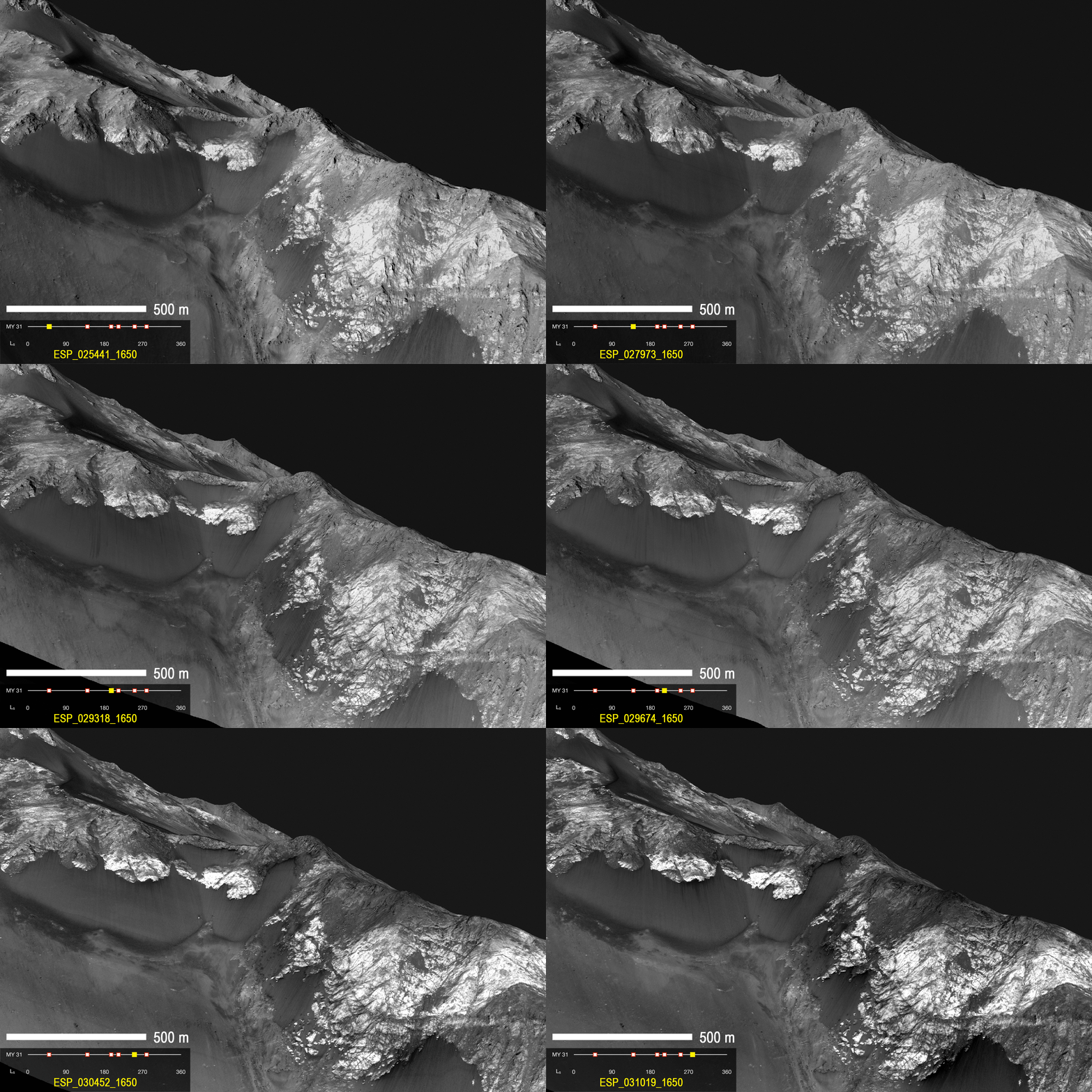
Dark flow-like features called Recurring Slope Lineae emanating from bedrock exposures at Palikir crater on Mars during southern summer. 

These flows are observed to form and grow during warm seasons when surface temperature is hot enough for salty ice to melt, and fade or completely disappear in cold season. 

Arrows point to bright, smooth fans left behind by flows. 

Credit: NASA/JPL

Martian experts have known since 2011 that mysterious, possibly water-related streaks appear and disappear on the planet's surface.

Georgia Institute of Technology Ph.D. candidate Lujendra Ojha discovered them while an undergraduate at the University of Arizona.

Lujendra Ojha
These features were given the descriptive name of recurring slope lineae (RSL) because of their shape, annual reappearance and occurrence generally on steep slopes such as crater walls.

Ojha has been taking a closer look at this phenomenon, searching for minerals that RSL might leave in their wake, to try to understand the nature of these features: water-related or not?

Ojha and Georgia Tech Assistant Professor James Wray looked at 13 confirmed RSL sites using Compact Reconnaissance Imaging Spectrometer for Mars (CRISM) images.

They didn't find any spectral signature tied to water or salts. But they did find distinct and consistent spectral signatures of ferric and ferrous minerals at most of the sites.

The minerals were more abundant or featured distinct grain sizes in RSL-related materials as compared to non-RSL slopes.

"We still don't have a smoking gun for existence of water in RSL, although we're not sure how this process would take place without water," said Ojha.

"Just like the RSL themselves, the strength of the spectral signatures varies according to the seasons. The signatures are stronger when it's warmer and less significant when it's colder."

The research team also notes that the lack of water-related absorptions rules out hydrated salts as a spectrally dominant phase on RSL slopes.

For example, ferric sulfates have been found elsewhere on Mars and are a potent antifreeze.

If such salts are present in RSL, then they must be dehydrated considerably under exposure to the planet's conditions by the time CRISM observes them in the mid-afternoon.

Dark elongated streaks called Recurring Slope Lineae observed in HiRISE images of Mars. 

The RSL form on sun facing slopes during warm season and fade during cold season. 

Credit: NASA/JPL

The findings were recently published in Geophysical Research Letters, and the Georgia Tech duo's newest paper, published in the journal Icarus, indicates that predicting where RSL will appear is, at best, a guessing game.

Ojha, Wray, and several Arizona-based colleagues looked at every image gathered by the High Resolution Imaging Science Experiment (HiRISE) from March to October of 2011.

They hunted for areas that were ideal locations for RSL formation: areas near the southern mid-latitudes on rocky cliffs. They found 200, but barely any of them had RSL.

"Only 13 of the 200 locations had confirmed RSL," said Ojha. "There were significant differences in abundance and size between sites, indicating that additional unknown factors such as availability of water or salts may play a crucial role in RSL formation."

Comparing their new observations with images taken in previous years, the team also found that RSL are much more abundant some years than others. Water on Mars today seems elusive at best – there one year, gone the next.

"NASA likes to 'follow the water' in exploring the red planet, so we'd like to know in advance when and where it will appear," Wray said.

"RSL have rekindled our hope of accessing modern water, but forecasting wet conditions remains a challenge."

Ojha and Wray are also among several co-authors on another RSL-related paper published this month in Nature Geoscience.

Wednesday, February 5, 2014

NASA MRO HiRise Image: Mars dramatic, fresh impact crater

A dramatic, fresh impact crater dominates this image taken by the High Resolution Imaging Science Experiment (HiRISE) camera on NASA's Mars Reconnaissance Orbiter on Nov. 19, 2013.

Image Credit: NASA/JPL-Caltech/Univ. of Arizona

Space rocks hitting Mars excavate fresh craters at a pace of more than 200 per year, but few new Mars scars pack as much visual punch as one seen in a NASA image released today.

The image from the High Resolution Imaging Science Experiment (HiRISE) camera on NASA's Mars Reconnaissance Orbiter shows a crater about 100 feet (30 meters) in diameter at the center of a radial burst painting the surface with a pattern of bright and dark tones.

It is available online at uahirise.org/ESP_034285_1835 and www.nasa.gov/jpl/mro/martian-impact-crater-pia17932.

The scar appeared at some time between imaging of this location by the orbiter's Context Camera in July 2010 and again in May 2012.

 Based on apparent changes between those before-and-after images at lower resolution, researchers used HiRISE to acquire this new image on Nov. 19, 2013.

The impact that excavated this crater threw some material as far as 9.3 miles (15 kilometers).

JPL is a division of the California Institute of Technology in Pasadena. HiRISE is operated by the University of Arizona, Tucson.

The instrument was built by Ball Aerospace & Technologies Corp., Boulder, Colo. Malin Space Science Systems, San Diego, built and operates the Context Camera.

For more information about the Mars Reconnaissance Orbiter, which has been studying Mars from orbit since 2006, visit http://www.nasa.gov/mro .

Wednesday, January 1, 2014

Sunday, December 1, 2013

NASA MARS HiRise Image: Jupiter from Mars

The HiRISE camera is the most powerful telescope to have left Earth orbit. 

As such, it is capable of some interesting astronomical observations. 

This image of Jupiter and its major satellites was acquired to calibrate the pointing and color response of the camera. 

An oversight in planning this unusual observation put the focus mechanism in the wrong location, blurring the image. 

This does not detract from the calibration objectives, but makes the raw image less aesthetic.

To compensate, the image has been "sharpened" on the ground by Dennis Gallagher, the HiRISE chief optical designer. 

With this sharpening, and because Mars is closer to Jupiter than Earth is, this image has comparable resolution as the Hubble Space Telescope's pictures of Jupiter. 

The colours are not what is seen by the human eye because HiRISE is able to detect light with a slightly longer wavelength than we can (that is, the infrared). 

While there is no standard observation geometry, this image was acquired on 11 January 2007, 2102 spacecraft event time to be precise.

Image: NASA/JPL/University of Arizona

Wednesday, November 6, 2013

NASA MARS HiRise Image: dark and dusty avalanche

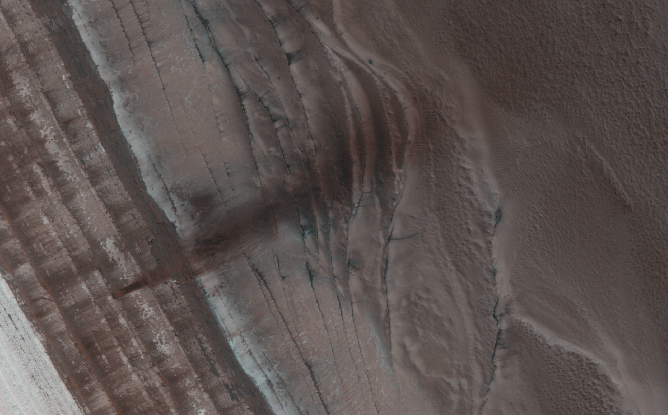
Fallen soil and dust stains an icy cliffside on Mars. 

Credit: NASA/JPL/University of Arizona

Mars may be geologically inactive but that doesn't mean there's nothing happening there—seasonal changes on the Red Planet can have some very dramatic effects on the landscape, as this recent image from the HiRISE camera shows!

When increasing light from the springtime Sun warms up the sides of sheer cliffs made from countless layers of water and carbon dioxide ice near Mars' north pole, some of that CO2 ice sublimes, sending cascades of loose soil and dust down to the terraced base below.

This uncovered material stains the frost-covered polar surface dark, outlining the paths of avalanches for HiRISE to easily spot from orbit. (See the original HiRISE image here.)

Circling Mars since March 2006, the HiRISE camera aboard NASA's Mars Reconnaissance Orbiter has even captured some of these polar landslides in action.

The rust-colored avalanche shown above has fallen hundreds of meters from the middle of a layered ice deposit, spreading nearly a kilometer across the frozen ridges at the base of the cliff. The view was acquired on Sept. 13, 2013.

Check out a video explaining this view and the processes that created it below, narrated by Phil Plait (aka the Bad Astronomer).

Thursday, May 16, 2013

NASA Mars HiRISE: Camera reveals Two hundred impacts each year

This image shows one of many fresh impact craters spotted by the UA-led HiRISE camera, orbiting the Red Planet on board NASA's Mars Reconnaissance Orbiter since 2006. 

Credit: NASA /JPL-Caltech /MSSS /UA

Scientists using images from NASA's Mars Reconnaissance Orbiter, or MRO, have estimated that the planet is bombarded by more than 200 small asteroids or bits of comets per year forming craters at least 12.8 feet (3.9 meters) across.

Researchers have identified 248 new impact sites on parts of the Martian surface in the past decade, using images from the spacecraft to determine when the craters appeared.

The 200-per-year planet-wide estimate is a calculation based on the number found in a systematic survey of a portion of the planet.

The University of Arizona's High Resolution Imaging Science Experiment, or HiRISE camera, took pictures of the fresh craters at sites where before and after images had been taken.

This combination provided a new way to make direct measurements of the impact rate on Mars and will lead to better age estimates of recent features on Mars, some of which may have been the result of climate change.

"It's exciting to find these new craters right after they form," said Ingrid Daubar of the UA, lead author of the paper published online this month by the journal Icarus.

"It reminds you Mars is an active planet, and we can study processes that are happening today."

These asteroids or comet fragments typically are no more than 3 to 6 feet (1 to 2 meters) in diameter.

Space rocks too small to reach the ground on Earth cause craters on Mars because the Red Planet has a much thinner atmosphere.

MRO has been examining Mars with six instruments since 2006. Daubar is an imaging targeting specialist who has been on the HiRISE uplink operation s team from the very beginning.

She is also a graduate student in the UA's department of planetary science and plans on graduating with her doctorate in spring 2014.

Leslie Tamppari
"There are five of us who help plan the images that HiRISE will take over a two-week cycle," she explained.

"We work with science team members across the world to understand their science goals, help select the image targets and compile the commands for the spacecraft and the camera."

"The longevity of this mission is providing wonderful opportunities for investigating changes on Mars," said MRO Deputy Project Scientist Leslie Tamppari of NASA's Jet Propulsion Laboratory in Pasadena, Calif.

Thursday, April 25, 2013

Mars HiRise: Ancient Rocks of the Isidis Basin and Libya Montes Exposed and Preserved by Hashir Crater

The focus of this HiRISE observation is the inner portion of the approximately 9-kilometer diameter Hashir Crater.

Hashir is located at 84.56 degrees east, 3.63 degrees north within the transition from the vast Isidis Basin plains (Isidis Planitia) to the great circumferential mountains of Libya Montes (i.e., the ancient and dissected mountains raised-up from the Isidis-forming event).

Hashir is of particular interest to scientists because there are several spectral units that are characteristic of the Isidis Basin/Libya Montes region that are exposed or preserved within it.

Hashir and its surroundings have been spectrally characterized by multiple orbiting spectrometers spanning almost 25 years, including: Phobos 2-ISM, MGS-TES, MO-THEMIS, MEx-OMEGA and most recently by MRO-CRISM.

The results from the analysis of these data indicate the presence of surface materials rich in olivine, pyroxene, clays (Fe/Mg-smectites) and carbonate.

The latter two are of particular interest as they were likely formed by alteration of the ancient basaltic rocks through interactions with water.

The Fe/Mg-phyllosilicates and carbonate are often associated with olivine in CRISM and HiRISE images because these alteration minerals are observed where the olivine-rich lavas have been eroded away.

This 3D perspective image of Hashir Crater was generated by combining color from CRISM with the high-resolution of a gray-scale HiRISE RED image draped over a HiRISE stereo derived digital terrain model (DTM) with a 3x vertical enhancement.

This close-up view from the south (looking north) illustrates the occurrence of the pyroxene-bearing caprock in blue on top of olivine-bearing layered bedrock in green, which in turn overlies a Fe/Mg-smectite-bearing unit in red.

The hilly red unit is interpreted to be the central uplift of Hashir Crater, which are rocks uplifted and exposed by the crater-forming event.

The blue and green units are more recent lava flows or impact melt deposits from Isidis that filled in Hashir after it formed and have been since eroded back by the high winds in the Libya Montes region.

Saturday, March 16, 2013

NASA HiRise MRO Image: Mars Landforms

This image was taken by the High Resolution Imaging Science Experiment (HiRISE) flying onboard the Mars Reconnaissance Orbiter mission.

Gully landforms like those in this image are found in many craters in the mid-latitudes of Mars.

Changes in gullies were first seen in images from the Mars Orbiter Camera in 2006, and studying such activity has been a high priority for HiRISE.

Many examples of new deposits in gullies are now known.

This image shows a new deposit in Gasa Crater, in the Southern mid-latitudes. The deposit is distinctively blue in enhanced-color images.

This image was acquired in southern spring, but the flow that formed the deposit occurred in the preceding winter.

Current gully activity appears to be concentrated in winter and early spring, and may be caused by the seasonal carbon dioxide frost that is visible in gully alcoves in the winter.

Image Credit: NASA/JPL/University of Arizona

Monday, February 25, 2013

Mars Surface: Fit for human habitation?

NASA's Hubble Space Telescope snapped this shot of Mars on Aug. 26, 2003, when the Red Planet was 34.7 million miles from Earth.

The picture was taken just 11 hours before Mars made its closest approach to us in 60,000 years.

CREDIT: NASA/ESA

While Mars was likely a more hospitable place in its wetter, warmer past, the Red Planet may still be capable of supporting microbial life today, some scientists say.

Ongoing research in Mars-like places such as Antarctica and Chile's Atacama Desert shows that microbes can eke out a living in extremely cold and dry environments, several researchers stressed at "The Present-Day Habitability of Mars" conference held here at the University of California Los Angeles this month.

And not all parts of the Red Planet's surface may be arid currently — at least not all the time. Evidence is building that liquid water might flow seasonally at some Martian sites, potentially providing a haven for life as we know it.

"We certainly can't rule out the possibility that it's habitable today," said Alfred McEwen of the University of Arizona, principal investigator for the HiRise camera aboard NASA's Mars Reconnaissance Orbiter spacecraft.

Surface water on Mars
McEwen discussed some intriguing observations by HiRise, which suggest that briny water may flow down steep Martian slopes during the local spring and summer.

Sixteen such sites have been identified to date, mostly on the slopes of the huge Valles Marineris canyon complex, McEwen said.
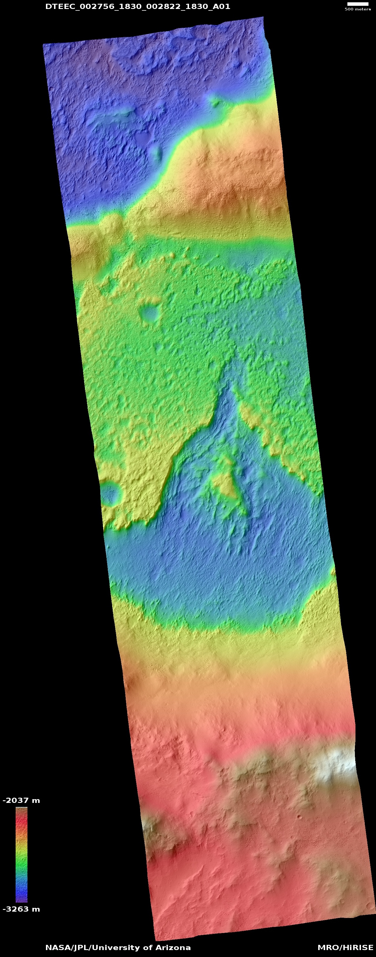
The tracks seem to repeat seasonally as the syrupy fluids descend along weather-worn pathways.

While the brines may originate underground, Caltech's Edwin Kite noted, there is an increasing suspicion that a process known as deliquescence — in which moisture present in the atmosphere is gathered by compounds on the ground, allowing it to become a liquid — may be responsible.

Astrobiologists are keen to learn more about these brines, for not much is known about them at the moment.

"Briny water on Mars may or may not be habitable to microbes, either from Earth or from Mars," McEwen said.

Valles Marineris on Mars