Showing posts with label Mars Reconnaissance Orbiter. Show all posts

Tuesday, January 13, 2015

Mars HiRise Image: UK's ill-fated Mars Probe Beagle 2 may have been spotted

More than 11 years after UK Mars probe Beagle 2 was lost, believed crashed, space scientists are set to reveal new findings about what hapened to the spacecraft.

Mystery surrounds exactly what will be disclosed by experts from the European Space Agency and the underfunded, struggling, UK Space Agency at the English National Academy of Science, known as the Royal Society in London on Friday, but it has raised hopes that orbiting spacecraft around Mars might have located the debris of the Beagle 2.

The probe was the brainchild of the eccentric, mutton-chopped Professor Colin Pillinger, of the UK’s Open University, who died suddenly in May 2014 from a brain haemorrhage.

Beagle 2 was carried to Mars by ESA’s Mars Express which remains in orbit to this day performing valuable surveys of the planet.

Beagle was due to land on Christmas Day 2003, but nothing was ever heard from the tiny craft.

Experts later concluded that its parachute had failed in the extra thin atmosphere and it hit the ground too hard.

Months later, Colin called an impromptu press conference, convinced that he had identified a speck in a photo of the martian surface as his lost probe, but later higher-resolution imagery from a NASA orbiter showed there was nothing.

This recent announcement would indicate that this time there is hope that something really has been spotted.

The panel at Friday’s announcement will include Beagle 2’s mission manager Professor Mark Sims, Dr John Bridges of Leicester University’s Space Research Centre, the European Space Agency’s director of science and robotic exploration Alvaro Giménez, and David Parker, of Durham University and the underfunded UK Space Agency.

A recent image from the HiRise camera on the NASA MRO. 

Credit: NASA, JPL, University of Arizona

All are remaining tight-lipped about what will be revealed, but interestingly, Dr Bridges is a member of the team working with the HiRISE camera aboard NASA's Mars Reconnaissance Orbiter, which is the only imager powerful enough to pick out the debris of Beagle 2, or any other probe, from orbit.

John Zarnecki, Emeritus Professor of Space Science, and Professor Pillinger’s former colleague, told reporters: “I don’t know what they will announce. All one can think of is that they might have got an image of the probe, but if Beagle 2 is in a thousand pieces, it is unlikely that we will have found the pieces.”

“When dear old Colin was alive, he imagined he could see the Beagle 2 in single pixels. None of us could see it, he was the only one who could. So if they really have found it this time, it would be wonderful.”

Professor Zarnecki, who headed the OU’s Planetary and Space Sciences department, said that finding Beagle 2 would be an important event, but there was no chance that it could still work.

He said: “The probe will be dead. There could be no battery life and it would have frozen probably. Electronic materials and components don’t like the cold of Mars very much.”

“The main thing is that it could tell us something about how and why it failed. We’re not going to get anything scientific out of it now, but anything we can learn about how and why it failed informs our designs for the future.

“One of the reasons why space missions on the whole are so successful is that we do learn from experience. It is similar to why flying by plane is so safe - we learn from failures.”

Professor Zarnecki had his own experiment on Beagle 2, a tiny device to measure temperature, air pressure, and wind-speed and direction, “like a weather station, but a fancy one”, he said.

Monday, October 20, 2014

NASA's Mars Odyssey spacecraft watches comet flyby

Artist's concept of NASA's Mars Odyssey spacecraft

Credit: NASA/JPL-Caltech

The longest-lived robot ever sent to Mars came through its latest challenge in good health, reporting home on schedule after sheltering behind Mars from possible comet dust.

NASA's Mars Odyssey was out of communications with Earth, as planned, while conducting observations of comet C/2013 A1 Siding Spring on Sunday, Oct. 19, as the comet flew near Mars.

The comet sped within about 88,000 miles (139,500 kilometers) of Mars, equivalent to about one-third of the distance between Earth and Earth's moon.

Mars Odyssey had performed a maneuver on Aug. 5 to adjust the timing of its orbit so that it would be shielded by Mars itself during the minutes, around 1 p.m. PDT (4 p.m. EDT) today, when computer modeling projected a slight risk from high-velocity dust particles in the comet's tail.

"The telemetry received from Mars Odyssey this afternoon confirms not only that the spacecraft is in fine health but also that it conducted the planned observations of comet C/2013 A1 Siding Spring within hours of the comet's closest approach to Mars," said Odyssey Mission Manager Chris Potts of NASA's Jet Propulsion Laboratory, Pasadena, Calif., speaking from mission operations center at Lockheed Martin Space Systems, Denver.

THEMIS
Comet C/2013 A1 Siding Spring observations were made by the orbiter's Thermal Emission Imaging System (THEMIS).

Resulting images are expected in coming days after the data is downlinked to Earth and processed.

THEMIS is also scheduled to record a combined image of the comet and a portion of Mars later this week.

In addition, the Odyssey mission is using the spacecraft's Neutron Spectrometer (NS) and the Russian-made, High Energy Neutron detector (HEND) to assess possible effects on Mars' atmosphere of dust and gas from the comet.

Three NASA Mars orbiters, two Mars rovers and other assets on Earth and in space are studying comet Siding Spring.

This comet is making its first visit this close to the sun from the outer solar system's Oort Cloud, so the concerted campaign of observations may yield fresh clues to our solar system's earliest days more than 4 billion years ago.

Following the comet flyby, operations teams have also confirmed the good health of NASA's Mars Reconnaissance Orbiter and of NASA's Mars Atmosphere and Volatile EvolutioN (MAVEN) orbiter.

Mars Odyssey has worked at the Red Planet longer than any other Mars mission in history.

NASA launched the spacecraft on April 7, 2001, and Mars Odyssey arrived at Mars Oct. 24, 2001.

Besides conducting its own scientific observations, the mission provides a communication relay for robots on the Martian surface.

Sunday, October 19, 2014

NASA's Mars Reconnaissance Orbiter safely watches Comet Siding Spring FlyBy

NASA's Mars Reconnaissance Orbiter, which has sent home more data about Mars than all other missions combined, is also now providing data about a comet that buzzed The Red Planet today (Oct. 19).

The orbiter continues operating in good health after sheltering behind Mars during the half hour when high-velocity dust particles from comet C/2013 A1 Siding Spring had the most chance of reaching the paths of Mars orbiters.

The Comet Siding Spring C/2013 A1 is indicated on this image as it passes Mars, seen here shining brightly on the bottom left.

Credit: Slooh

maintained radio communications with Earth throughout the comet's closest approach, at 11:27 a.m. PDT (2:27 p.m. EDT), and the peak dust-risk period centered about 100 minutes later.

"The spacecraft performed flawlessly throughout the comet flyby," said Mars Reconnaissance Orbiter Project Manager Dan Johnston of NASA's Jet Propulsion Laboratory, Pasadena, California. "It maneuvered for the planned observations of the comet and emerged unscathed."

Following the critical period of dust flux, the orbiter is communicating at 1.5 megabits per second with NASA's Deep Space Network.

It remained on Side A of its two redundant computers, and all subsystems are working as expected.

The remainder of the NASA Mars orbiters, Mars Express and ISRO's MOM, appear to be in good health and unaffected by the comet flyby.

An artist impression of the passing of Comet Siding Spring as seen by Curiosity Rover on Mars.

Credit: SLOOH

NASA, ESA and ISRO Satellites and Rovers observe Mars atmosphere and Comet Siding Spring


This artist's concept illustration depicts the Comet Siding Spring (2013 A1) flyby Mars and illustrates some of the NASA, ESA and ISRO satellites positioned to record the event.

Credit: Nasa, ESA

A comet the size of a small mountain is about to skim past Mars, and NASA hopes its spacecraft will be able to photograph the once-in-a-million-years encounter.

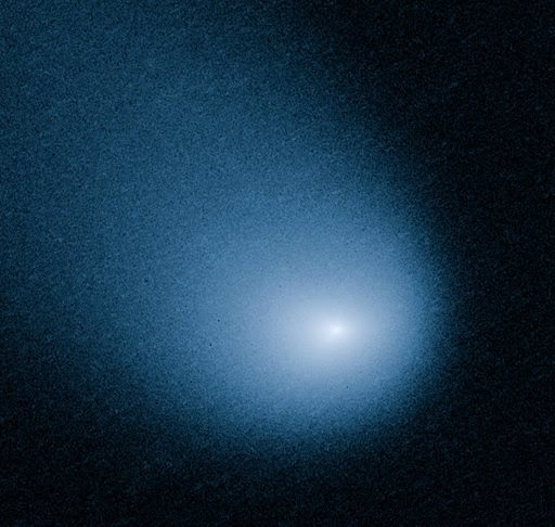
This March 27, 2014 image provided by NASA, ESA, and J.-Y. Li shows comet C/2013 A1, also known as Siding Spring, as captured by Wide Field Camera 3 on NASA's Hubble Space Telescope. 

Credit: AP Photo /NASA, ESA, J.-Y. Li

The comet, known as Siding Spring (C/2013 A1), is set to hurtle past Mars at a close distance of about 88,000 miles (141,600 kilometers).

The closest pass is expected to happen Sunday at 2:27 pm (1827 GMT).

Astronomers do not expect it will come any where near colliding with Mars, but they do hope it will be close enough to reveal clues about the origins of the solar system.

That is because the comet is believed to have originated billions of years ago in the Oort Cloud, a distant region of space at the outskirts of the solar system.

"Comets such as C/2013 A1 are essentially dirty icy snowballs with rocks and dust embedded in frozen gasses," said Dan Brown, an astronomy expert at Nottingham Trent University.

"It is on its first run towards the center of our solar system and its material is virtually unchanged by the rays of the sun and can give us an insight to the material composition of our early solar system 4.6 billion years ago."

Fast and powdery
The comet is flying through space at a breakneck speed of 122,400 miles per hour.

Another interesting thing about the comet, about a mile wide in diameter, is that it is only about as solid as a pile of talcum powder.

Illustration of the trajectory of Siding Spring, which will come close to Mars on Sunday.

NASA has manuevered its Mars orbiters to the far side of the planet so they won't be damaged by the comet's high-speed debris.

Even as the Mars Reconnaissance Orbiter, Mars Odyssey and MAVEN have been repositioned to avoid hazardous dust, scientists hope they will be able to capture a trove of data about the flyby for Earthlings to study.

NASA's two rovers, Curiosity and Opportunity, will turn their cameras skyward and send back pictures of the comet's pass in the coming days, weeks and months, the US space agency said.

"The orbiters will keep a close eye on the show," said Rebecca Johnson, editor of StarDate magazine.

"They'll study the comet itself, which is a small chunk of ice and rock. They'll also study the cloud of gas and dust around the comet, as well as its long tail," she said.

"And they'll measure how the gas and dust interact with the Martian atmosphere."

The comet has traveled more than one million years to make its first pass by Mars, and will not return for another million years, after it completes its next long loop around the sun.

The comet was discovered by Robert McNaught at ANU's Siding Spring Observatory in January 2013.

Its flyby of Mars is not likely to be visible to sky watchers on Earth.

But the encounter is of great interest to scientists, particularly since there are so many spacecraft on and around Mars to record it.

"As it zips toward the sun, it gives scientists a chance to see a relic from the distant past, a snowball that preserves the same ingredients that gave birth to our own world," said Johnson.

This image shows just how many satellites and probes humanity has sent to Mars. Some more successful than others, and we still have much to learn about our near neighbour.

Thursday, October 9, 2014

NASA Science Fleet: Comet Siding Spring C/2013 A1


Credit: NASA

NASA's extensive fleet of science assets, particularly those orbiting and roving Mars, have front row seats to image and study a once-in-a-lifetime comet flyby on Sunday, Oct. 19.

Comet C/2013 A1, also known as comet Siding Spring, will pass within about 87,000 miles (139,500 kilometers) of the Red Planet, less than half the distance between Earth and our moon and less than one-tenth the distance of any known comet flyby of Earth.

Siding Spring's nucleus will come closest to Mars around 2:27 p.m. EDT, hurtling at about 126,000 mph (56 kilometers per second).

This proximity will provide an unprecedented opportunity for researchers to gather data on both the comet and its effect on the Martian atmosphere.

"This is a cosmic science gift that could potentially keep on giving, and the agency's diverse science missions will be in full receive mode," said John Grunsfeld, astronaut and associate administrator for NASA's Science Mission Directorate in Washington.

"This particular comet has never before entered the inner solar system, so it will provide a fresh source of clues to our solar system's earliest days."

Siding Spring came from the Oort Cloud, a spherical region of space surrounding our sun and occupying space at a distance between 5,000 and 100,000 astronomical units.

It is a giant swarm of icy objects believed to be material left over from the formation of the solar system.

Siding Spring will be the first comet from the Oort Cloud to be studied up close by spacecraft, giving scientists an invaluable opportunity to learn more about the materials, including water and carbon compounds, that existed during the formation of the solar system 4.6 billion years ago.

Some of the best and most revealing images and science data will come from assets orbiting and roving the surface of Mars.

Mars Atmosphere and Volatile EvolutioN (MAVEN)
In preparation for the comet flyby, NASA maneuvered its Mars Odyssey orbiter, Mars Reconnaissance Orbiter (MRO), and the newest member of the Mars fleet, Mars Atmosphere and Volatile EvolutioN (MAVEN), to reduce the risk of impact with high-velocity dust particles coming off the comet.

The period of greatest risk to orbiting spacecraft will start about 90 minutes after the closest approach of the comet's nucleus and will last about 20 minutes, when Mars will come closest to the center of the widening trail of dust flying from the comet's nucleus.

"The hazard is not an impact of the comet nucleus itself, but the trail of debris coming from it. Using constraints provided by Earth-based observations, the modeling results indicate that the hazard is not as great as first anticipated."

"Mars will be right at the edge of the debris cloud, so it might encounter some of the particles, or it might not," said Rich Zurek, chief scientist for the Mars Exploration Program at NASA's Jet Propulsion Laboratory (JPL) in Pasadena, California.

The atmosphere of Mars, though much thinner that Earth's, will shield NASA Mars rovers Opportunity and Curiosity from comet dust, if any reaches the planet. Both rovers are scheduled to make observations of the comet.

NASA's Mars orbiters will gather information before, during and after the flyby about the size, rotation and activity of the comet's nucleus, the variability and gas composition of the coma around the nucleus, and the size and distribution of dust particles in the comet's tail.

Observations of the Martian atmosphere are designed to check for possible meteor trails, changes in distribution of neutral and charged particles, and effects of the comet on air temperature and clouds.

MAVEN will have a particularly good opportunity to study the comet, and how its tenuous atmosphere, or coma, interacts with Mars' upper atmosphere.

Earth-based and space telescopes, including NASA and ESA's iconic Hubble Space Telescope, also will be in position to observe the unique celestial object.

The agency's astrophysics space observatories, Kepler, Swift, Spitzer, Chandra, and the ground-based Infrared Telescope Facility on Mauna Kea, Hawaii, also will be tracking the event.

NASA's asteroid hunter, the Near-Earth Object Wide-field Infrared Survey Explorer (NEOWISE), has been imaging, and will continue to image, the comet as part of its operations, and the agency's two Heliophysics spacecraft, Solar TErrestrial RElations Observatory (STEREO) and Solar and Heliophysics Observatory (SOHO), also will image the comet.

The agency's Balloon Observation Platform for Planetary Science (BOPPS), a sub-orbital balloon-carried telescope, already has provided observations of the comet in the lead-up to the close encounter with Mars.

Images and updates will be posted online before and after the comet flyby. Several pre-flyby images of Siding Spring, as well as information about the comet and NASA's planned observations of the event, are available online.

Tuesday, August 19, 2014

ESA's Mars Express: Hellas basin - deep down

Credit: ESA/DLR/FU Berlin

Scarring the southern highlands of Mars is one of the Solar System's largest impact basins: Hellas, with a diameter of 2300 km and a depth of over 7 km.

Hellas is thought to have formed between 3.8 and 4.1 billion years ago, when a large asteroid hit the surface of Mars.

Since its formation, Hellas has been subject to modification by the action of wind, ice, water and volcanic activity.

Impact craters have also since pock-marked this vast basin floor, two of which are the focus of this image, taken by the High Resolution Stereo Camera (HiRise) on ESA's Mars Express on 17 December 2013. The ground resolution is about 15 metres per pixel.

These craters lie in the deepest, western portion of Hellas, and such a clear view is unusual because dust clouds typically obscure the basin floor. Indeed, this region seems to be covered by a thick blanket of dust.

The larger of the two craters is about 25 km across. A flow of material appears to have been transported from the top left of the scene and into the crater.

Zooming in to the smooth mound and the area immediately around it reveals interesting textures that likely resulted from this flow.

Flow features are also seen outside of the craters, and in particular, at the centre left of the image near the top of the frame.

Material also seems to have cascaded from the larger crater's rim and into a neighbouring smaller crater, at the far left of the image.

The morphology of many features in the Hellas Basin and its surroundings strongly suggests the presence of ice and glaciers.

For example, in the foreground and around the crater rim, polygons of patterned ground are visible which indicates the presence of water, this pattern occurs when fine grained and porous wet soil freezes.

Indeed, in the deepest parts of the basin, the atmospheric pressure is about 89% higher than at the surface, which may even offer conditions suitable for water.

Radar images from NASA's Mars Reconnaissance Orbiter suggest that some craters in Hellas might contain water-ice glaciers several hundred metres thick, buried under layers of dust.

Friday, August 15, 2014

NASA MRO Image: Rolling Boulder on Mars Leaves Visible Trail

NASA's Mars Reconnaissance Orbiter (MROspotted the trail from an oblong boulder (bottom right) that rolled down a slope on the Red Planet. 

The image was taken on July 3, 2014.

Credit: NASA/JPL-Caltech/Univ. of Arizona

The agency's Mars Reconnaissance Orbiter (MROcurrently orbiting the Red Planet has spotted the trail left behind after a tall boulder tumbled down a Martian slope.

The Mars rock's misshapen prints are clearly visible in the spacecraft's view from orbit.

While NASA unveiled the MRO spacecraft's black and white view of the rocky road on Wednesday (Aug. 13), the image was actually captured on July 3.

By looking at the large rock's shadow, scientists at NASA have calculated that the boulder is about 20 feet tall (6 meters) and 11.5 feet wide (3.5 m).

The SUV-sized boulder ended its roll pointed straight up on its axis, according to NASA officials.

NASA's Mars Reconnaissance Orbiter snapped this view, showing the the trail left by a rolling boulder that tumbled down the side of a slope, on July 3, 2014. 

Credit: NASA /JPL-Caltech/Univ. of Arizona

"The boulder's trail down the slope is about one-third of a mile (about 500 meters) long," NASA officials wrote in an image description.

"The trail has an odd repeating pattern, suggesting the boulder could not roll straight due to its shape."

Scientists used MRO's High Resolution Imaging Science Experiment, (HiRISE), camera to take the Mars boulder photo.

The space agency's Mars Reconnaissance Orbiter launched to space in 2005 and has been orbiting the Red Planet in 2006.

The spacecraft has beamed back some amazing images of the Martian surface including pictures of the Spirit rover and Viking landers. NASA's probe has also witnessed dust devils and avalanches from its place in orbit.

In October, MRO will also have a chance to monitor Mars' close brush with a comet set to fly by the Red Planet.

NASA has started to adjust the orbits of spacecraft at Mars to prepare them for their encounter with Comet Siding Spring and ensure that they will be safe from any ill effects that could be caused by the comet.

"MRO will monitor Mars' atmosphere for possible temperature increases and cloud formation, as well as changes in electron density at high altitudes," NASA officials said in a statement.

"The MRO team also plans to study gases in the comet's coma. Along with other MRO observations, the team anticipates this event will yield detailed views of the comet’s nucleus and potentially reveal its rotation rate and surface features."

Tuesday, June 3, 2014

NASA MRO: Lava, not water, formed canyons on Mars

The Grand Canyon of Mars – Valles Marineris. Credit: NASA,Viking Project,USGS, CC BY

The canyon-like scars which line Mars' crust are seen by many as evidence for liquid water but a study now suggests that a different kind of fluid, one much less hospitable to life, may actually have carved these features.

On Mars, the most striking topography occurs around the equator. The planet's low latitudes are dominated by the Tharsis plateau, which hosts several towering volcanoes.


Not far off sits the solar system's largest, Olympus Mons. Near the Eastern fringe, however, things start to get deep.

There the land dives into a winding maze of valleys and river-like "outflow channels", the former including the 4000km-long Valles Marineris, the "Grand Canyon" of Mars, which exceeds its terrestrial namesake in every dimension.

These great gouges are widely thought to have been formed, at least in part, by flowing water. But according to recently published research, they could have had a very different genesis, linked to the volcanoes to the West.

Explosive erosion
A paper by Giovanni Leone of the Swiss Federal Institute of Technology, published in the Journal of Volcanology and Geothermal Research, suggests that the martian valleys and outflow channels were in fact formed mostly by lava flows, which erupted from the Tharsis plateau in the planet's distant past.

To draw this conclusion, Leone scrutinised thousands of images from NASA's Mars Reconnaissance Orbiter (MRO) spacecraft, which has been orbiting the planet since 2006.

This allowed him to map the floors of the equatorial valleys and outflow channels at an extremely high resolution of up to 25cm per pixel.

These images appear to show extensive lava flows draping the floors of many of the valleys and channels. Around 90% of the floors look to be covered either by lava or by lava-related landslides.

Valles Marineris 

Credit: G. Neukum/ESA/Mars Express/DLR, CC BY

The morphology of the lava flows Leone encountered suggest that the lava actually incised the valleys and channels in the first place.

The MRO images seem to show that channels formed by the freshly erupted lava were later deepened and widened by the passage of liquid rock.

This type of erosion, Leone argues, can explain the existence of the valleys and outflow channels without the need to invoke significant amounts of liquid water.

The valleys and outflow channels are believed to be many billion years old. Leone believes the lava would have been emitted by now-vanished volcanoes somewhere on the Tharsis plateau, forerunners of the region's (relatively juvenile) modern volcanoes.

Leone believes that every stage of this volcanic erosion process is visible in the MRO images. The first stage, he concludes, can be seen in the locations closest to today's Tharsis volcanoes, at the western end of Valles Marineris. Here lava tunnels seem to have collapsed, forming "pit chains" – long curvilinear depressions in the crust.

Further east, where the terrain deepens, the pit chains seem to have been further eroded, by the injection of yet more lava, into more extensive channels – first into "fossae" and later into larger "chasmata".

The MRO images showed relatively little evidence for the past presence of liquid water in the valleys and outflow channels, which can be inferred by the presence of "light toned deposits" in the images. This, Leone believes, adds further weight to the theory that these features are igneous in origin.

Friday, March 14, 2014

NASA Mars HiRise Image:

Mars Reconnaissance Orbiter (MRO) spacecraft shows a sand dune field in a Southern highlands crater on the red planet. 

The sun lay only 5 degrees above the horizon when the spacecraft captured this image, producing deep shadows, with dune crests sticking up sharply into the sunlight. 

The bright patches which appear bluish in enhanced color arise from seasonal frost accumulating as this hemisphere approaches winter. 

Credit: NASA HiRISE

Thursday, March 6, 2014

NASA Mars Reconnaissance Orbiter HiRise Image: Martian Sand Dunes in Spring

Mars’ northern-most sand dunes are beginning to emerge from their winter cover of seasonal carbon dioxide (dry) ice. 

Dark, bare south-facing slopes are soaking up the warmth of the sun.

The steep lee sides of the dunes are also ice-free along the crest, allowing sand to slide down the dune. 

Dark splotches are places where ice cracked earlier in spring, releasing sand. Soon the dunes will be completely bare and all signs of spring activity will be gone.

This image was acquired by the HiRISE camera aboard NASA's Mars Reconnaissance Orbiter on Jan. 16, 2014. 

The University of Arizona, Tucson, operates the HiRISE camera, which was built by Ball Aerospace & Technologies Corp., Boulder, Colo. 

NASA's Jet Propulsion Laboratory, a division of the California Institute of Technology in Pasadena, manages the Mars Reconnaissance Orbiter Project for the NASA Science Mission Directorate, Washington.

Image Credit: NASA/JPL-Caltech/Univ. of Arizona

Caption: Candy Hansen

Tuesday, December 31, 2013

ESA Mars Express Image: Juventae Chasma

Intriguing mounds of light-toned layered deposits sit inside Juventae Chasma, surrounded by a bed of soft sand and dust.

The origin of the chasma is linked to faulting associated with volcanic activity more than 3 billion years ago, causing the chasma walls to collapse and slump inwards, as seen in the blocky terrain in the right-hand side of this image.

At the same time, fracturing and faulting allowed subsurface water to spill out and pool in the newly formed chasm. 

Observations by ESA’s Mars Express and NASA’s Mars Reconnaissance Orbiter (MRO) show that the large mounds inside the chasma consist of sulphate-rich materials, an indication that the rocks were indeed altered by water.

The mounds contain numerous layers that were most likely built up as lake-deposits during the Chasma’s wet epoch. 

But ice-laden dust raining out from the atmosphere – a phenomenon observed at the poles of Mars – may also have contributed to the formation of the layers.

While the water has long gone, wind erosion prevails, etching grooves into the exposed surfaces of the mounds and whipping up the surrounding dust into ripples. 

The image was taken by the high-resolution stereo camera on ESA’s Mars Express on 4 November 2013 (orbit 12 508), with a ground resolution of 16 m per pixel. 

Credits: ESA/DLR/FU Berlin (G. Neukum)

Tuesday, December 10, 2013

NASA's Mars Reconnaissance Orbiter: Coprates Chasma dark streaks indicative of water

A portion of the Coprates Chasma showing dark streaks on generally north-facing slopes in northern summer and southern winter. 

Coprates Chasma is a huge canyon that forms part of the Valles Marineris system

Credit: Nature Geoscience | Alfred McEwen et al.

Dark seasonal streaks on slopes near the Martian equator may be a sign of flowing salt water on Mars, liquid runoff that melts and evaporates during the planet's warmer months, scientists say.

NASA's Mars Reconnaissance Orbiter spotted the dark streaks on Mars as they formed and grew in the planet's late spring and summer seasons, when the Martian equatorial region receives the most sunlight.

The streaks then faded the next season as cooler temperatures prevailed.

These seasonally occurring flows — known as Recurring Slope Lineae — were previously seen on Martian slopes at mid-latitudes, but the MRO spacecraft has now detected them near the equator of the Red Planet.

While there have been no direct detections of liquid water, the new findings hint at a surprisingly active water cycle on Mars today, said study leader Alfred McEwen, a professor of planetary geology at the University of Arizona in Tucson.

"Now we've found them in equatorial regions," McEwen told reporters. "This is more surprising, given peoples' expectations that the equatorial region was completely dry."

"It suggests there may be much more water in the near-surface crust than we imagined before."

Map of the confirmed locations of dark streaks, or recurring slope lineae, on Mars.

Credit: Nature Geoscience | Alfred McEwen et al

Tuesday, November 12, 2013

NASA Mars orbiter passes big data milestone

Artist concept of Mars Reconnaissance Orbiter. Credit: NASA/JPL

NASA's Mars Reconnaissance Orbiter, which has overhauled understanding of the Red Planet since 2006, has passed 200 terabits in the amount of science data returned.

The data returned by the mission alone is more than three times the total data returned via NASA's Deep Space Network for all the other missions managed by NASA's Jet Propulsion Laboratory, Pasadena, Calif., over the past 10 years.

While the 200 terabits number includes all the data this orbiter has relayed to Earth from robots on the surface of Mars, about 99.9 percent of the volume has come from the six science instruments aboard Mars Reconnaissance Orbiter.

The 200 terabits are equivalent to the data volume in three nonstop months of high-definition video. The number does not include the engineering data that specialists operating the orbiter from JPL and Lockheed Martin Space Systems, Denver, use for monitoring its health and performance.

The spacecraft pours data Earthward using a dish antenna 10 feet (3 meters) across and a transmitter powered by 215 square feet (20 square meters) of solar cells.

Multiple sessions each day with giant dish antennas of the Deep Space Network in California, Spain and Australia enable Earth to receive such a torrent of data from the orbiter.

"The sheer volume is impressive, but of course what's most important is what we are learning about our neighbouring planet," said JPL's Rich Zurek, the project scientist for the Mars Reconnaissance Orbiter.

The orbiter's instruments have examined Mars from subsurface to atmosphere in unprecedented detail.

One instrument has provided images revealing features as small as a desk in surface areas equivalent to one-third of the United States (1.92 percent of Mars' surface).

Another has covered areas equivalent to about 82 percent of Earth's land area (83.6 percent of Mars' surface), with resolution showing features smaller than a tennis court.

These cameras have viewed many areas repeatedly, providing three-dimensional information from stereo and revealing several types of landscape changes over time.

Other instruments identify surface minerals, probe underground layers, examine cross-sections of the atmosphere and track weather globally.

Sand dunes such as those seen in this image have been observed to creep slowly across the surface of Mars through the action of the wind. 

Credit: NASA/JPL-Caltech/Univ. of Arizona

"The mission has taught us about three very different periods of Mars history," Zurek said.

Its observations of the heavily cratered terrains of Mars, the oldest on the planet, show that different types of ancient watery environments formed water-related minerals.

Some of these would have been more favourable for life than others.

In more recent times, water appears to have cycled as a gas between polar ice deposits and lower-latitude deposits of ice and snow.

Extensive layering in ice or rock probably took hundreds of thousands to millions of years to form.

The present climate is also dynamic, with volatile carbon dioxide and, possibly, flows of briny water forming dark streaks that are observed to appear in the warmest seasons and places and fade in colder weather.

"Mars Reconnaissance Orbiter has shown that Mars is still an active planet, with changes such as new craters, avalanches and dust storms," Zurek said. "Mars is a partially frozen world, but not frozen in time."

Each of the 200 trillion bits of science data from the orbiter has followed a complex path, aided by sophisticated software to make it feasible for a small team to handle tens of billions of new bits daily and get the data products to the appropriate scientists.

Tuesday, June 11, 2013

NASA Mars MRO Hi-Rise: Martian Dunes Have Tracks of Dry-Ice Sleds

Several types of downhill flow features have been observed on Mars. 

This image from the High Resolution Imaging Science Experiment (HiRISE) camera on NASA's Mars Reconnaissance Orbiter is an example of a type called "linear gullies." 

Credit: NASA/JPL-Caltech/Univ. of Arizona

NASA research indicates hunks of frozen carbon dioxide -- dry ice -- may glide down some Martian sand dunes on cushions of gas similar to miniature hovercraft, plowing furrows as they go.

 Researchers deduced this process could explain one enigmatic class of gullies seen on Martian sand dunes by examining images from NASA's Mars Reconnaissance Orbiter (MRO) and performing experiments on sand dunes in Utah and California.

"I have always dreamed of going to Mars," said Serina Diniega, a planetary scientist at NASA's Jet Propulsion Laboratory in Pasadena, Calif., and lead author of a report published online by the journal Icarus.

"Now I dream of snowboarding down a Martian sand dune on a block of dry ice."

The hillside grooves on Mars, called linear gullies, show relatively constant width -- up to a few yards, or meters, across -- with raised banks or levees along the sides.

Unlike gullies caused by water flows on Earth and possibly on Mars, they do not have aprons of debris at the downhill end of the gully.

Instead, many have pits at the downhill end. "In debris flows, you have water carrying sediment downhill, and the material eroded from the top is carried to the bottom and deposited as a fan-shaped apron," said Diniega.

"In the linear gullies, you're not transporting material. You're carving out a groove, pushing material to the sides."

Images from MRO's High Resolution Imaging Science Experiment (HiRISE) camera show sand dunes with linear gullies covered by carbon-dioxide frost during the Martian winter.

The location of the linear gullies is on dunes that spend the Martian winter covered by carbon-dioxide frost.

By comparing before-and-after images from different seasons, researchers determined that the grooves are formed during early spring.

Some images have even caught bright objects in the gullies. Scientists theorize the bright objects are pieces of dry ice that have broken away from points higher on the slope.

According to the new hypothesis, the pits could result from the blocks of dry ice completely sublimating away into carbon-dioxide gas after they have stopped traveling.

"Linear gullies don't look like gullies on Earth or other gullies on Mars, and this process wouldn't happen on Earth," said Diniega.

"You don't get blocks of dry ice on Earth unless you go buy them." That is exactly what report co-author Candice Hansen, of the Planetary Science Institute in Tucson, Ariz., did.

Hansen has studied other effects of seasonal carbon-dioxide ice on Mars, such as spider-shaped features that result from explosive release of carbon-dioxide gas trapped beneath a sheet of dry ice as the underside of the sheet thaws in spring.

She suspected a role for dry ice in forming linear gullies, so she bought some slabs of dry ice at a supermarket and slid them down sand dunes.

That day and in several later experiments, gaseous carbon dioxide from the thawing ice maintained a lubricating layer under the slab and also pushed sand aside into small levees as the slabs glided down even low-angle slopes.

The outdoor tests did not simulate Martian temperature and pressure, but calculations indicate the dry ice would act similarly in early Martian spring where the linear gullies form.

Although water ice, too, can sublimate directly to gas under some Martian conditions, it would stay frozen at the temperatures at which these gullies form, the researchers calculate.

"MRO is showing that Mars is a very active planet," Hansen said. "Some of the processes we see on Mars are like processes on Earth, but this one is in the category of uniquely Martian."

Hansen also noted the process could be unique to the linear gullies described on Martian sand dunes.

"There are a variety of different types of features on Mars that sometimes get lumped together as 'gullies,' but they are formed by different processes," she said.

"Just because this dry-ice hypothesis looks like a good explanation for one type doesn't mean it applies to others."

To see images of the linear gullies and obtain more information about MRO, visit: http://www.nasa.gov/mro

For more about HiRISE, visit: http://hirise.lpl.arizona.edu .

Monday, December 10, 2012

NASA Mars Rovers: Opportunity Continues to Cover New Ground

While many obsessed over speculation that NASA’s newest Mars rover, Curiosity, had dug up signs of life, but it had not, it is the agency’s older, smaller jalopy, Opportunity, that has been exploring a more intriguing plot of Martian real estate. 

“This is our first glimpse ever at conditions on ancient Mars that clearly show us a chemistry that would have been suitable for life,” Steven W. Squyres, the principal investigator for Opportunity, said at a news conference last week at a meeting of the American Geophysical Union. 

Opportunity could be sitting on rocks chock-full of organic molecules but the rover and the scientists back on Earth would never know. Unlike Curiosity, Opportunity is not carrying instruments that can detect those kinds of molecules. 

But the scientists are not complaining. Everything from Opportunity over the past eight years has been a bonus for a mission that was to have ended long ago. 

Opportunity landed on Mars in January 2004, for what was supposed to be a three-month mission. Yet the rover continues operating in good condition. 

Its twin rover, Spirit, died in 2010, stuck in a sand trap and unable to point its solar arrays in the correct direction to survive winter, outliving its planned lifetime by almost six years.

Last year, Opportunity arrived at a 14-mile-wide crater named Endeavour, where NASA’s Mars Reconnaissance Orbiter has spotted clays from above. Clays generally form in the presence of water.

On Sol 3146 (Nov. 29, 2012), Opportunity using the Rock Abrasion Tool (RAT) performed a grind of the surface target "Sandcherry."

This was followed with an image mosaic collected by the Microscopic Imager (MI) and then a placement of the Alpha Particle X-ray Spectrometer (APXS) for an overnight integration. 

On Sol 3151 (Dec. 4, 2012), the rover moved just 9 inches (23 centimeters) to reach some new surface targets.

The clay signal pointed to a hill, which the scientists named after Jacob Matijevic, an engineer on the rover team who died this year.

As Opportunity approached, “We started seeing things that looked really, really different,” Dr. Squyres said. 

The most common rock there was light-coloured, fine-grained, very soft, and nothing like any that Opportunity had come across before.

“It is right in the sweet spot of where the clay signature is present,” Dr. Squyres said. “It has got to be the clay-bearing stuff.”

But when the rover looked at the elements in the rock, it was the same mix of elements in a typical Martian rock. “What’s unusual is that it’s not unusual,” Dr. Squyres said. “This puzzled us at first. I was expecting something dramatic and instead what you see here kind of looks like average Mars.”

Another instrument could have identified minerals in the rock, but the radioactive cobalt it relies on has long decayed away.

If Curiosity were at the Endeavour crater, its instruments could directly look for the carbon-based molecules known as organics that are the building blocks of life. 

Unfortunately, Curiosity, which landed in August, is more than 5,000 miles away exploring a different crater where clays have also been spotted from orbit  and it is still months away from reaching Matijevic.

Sunday, November 25, 2012

NASA Mars HiRise Image: MRO Captures Dark Sand Cascades

They might look like trees on Mars, but they're not.

Groups of dark brown streaks have been photographed by the Mars Reconnaissance Orbiter on melting pinkish sand dunes covered with light frost.

The above image was taken near the North Pole of Mars.

At that time, dark sand on the interior of Martian sand dunes became more and more visible as the spring Sun melted the lighter carbon dioxide ice.

When occurring near the top of a dune, dark sand may cascade down the dune leaving dark surface streaks -- streaks that might appear at first to be trees standing in front of the lighter regions, but cast no shadows.

Objects about 25 centimeters across are resolved on this image spanning about one kilometer.

Close ups of some parts of this image show billowing plumes indicating that the sand slides were occurring even when the image was being taken.

Wednesday, October 17, 2012

NASA Mars MRO Image: Ice Flows in Crater Greg


Computer models used to forecast climate change on Earth have been validated on Mars, astronomers reported.

In this orbital photo from Nasa's Mars Reconnaissance Orbiter show ice flow features in ancient riverbeds on the south wall of crater Greg.

These computer programs accurately predicted Martian glaciers and other features on Earth's next-door planetary neighbour.

Picture: REUTERS/NASA/JPL

Friday, September 14, 2012

NASA MRO Monitors Poles: 'Dry Ice' Snowflakes fall

Researchers have calculated that carbon dioxide snow particles on Mars are roughly the size of a human red blood cell. 

Martian snow is depicted in this artist's rendering as a mist or fog that eventually settles to the surface. 

CREDIT: NASA, Christine Daniloff/MIT News

A spacecraft orbiting Mars has detected carbon dioxide snow falling on the Red Planet, making Mars the only body in the solar system known to host this weird weather phenomenon.

The snow on Mars fell from clouds around the planet's south pole during winter about five years ago during the Martian winter spanning 2006 and 2007, with scientists discovering it only after sifting through observations by NASA's Mars Reconnaissance Orbiter (MRO).

The Martian south pole hosts a frozen carbon dioxide, "dry ice," cap year-round, and the new discovery may help explain how it formed and persists, researchers said.

"These are the first definitive detections of carbon-dioxide snow clouds," lead author Paul Hayne, of NASA's Jet Propulsion Laboratory (JPL) in Pasadena, Calif., said in a statement.

"We firmly establish the clouds are composed of carbon dioxide — flakes of Martian air — and they are thick enough to result in snowfall accumulation at the surface."

The find means Mars hosts two different kinds of snowfall. In 2008, NASA's Phoenix lander observed water-ice snow — the stuff we're familiar with here on Earth — falling near the Red Planet's north pole.

Hayne and his team studied data gathered by MRO's Mars Climate Sounder instrument during the Red Planet's southern winter in 2006-2007.

This instrument measures brightness in nine different wavelengths of visible and infrared light, allowing scientists to learn key characteristics of the particles and gases in the Martian atmosphere, such as their sizes and concentrations.

The research team examined measurements the Mars Climate Sounder made while looking at clouds — including one behemoth 300 miles (500 kilometers) wide — from directly overhead, and from off to the side.

Observations by NASA's Mars Reconnaissance Orbiter have detected carbon-dioxide snow clouds on Mars and evidence of carbon-dioxide snow falling to the surface. 

Deposits of small particles of carbon-dioxide ice are formed by snowfall from carbon-dioxide clouds. 

This map shows the distribution of small-grain carbon-dioxide ice deposits formed by snowfall over the south polar cap of Mars. 

It is based on infrared measurements by the Mars Climate Sounder instrument on the Mars Reconnaissance Orbiter. Image released September 11, 2012. 

CREDIT: NASA/JPL-Caltech


 These combined observations clearly revealed dry-ice snow falling through the Red Planet's skies, researchers said.

"One line of evidence for snow is that the carbon-dioxide ice particles in the clouds are large enough to fall to the ground during the lifespan of the clouds," said co-author David Kass, also of JPL.

"Another comes from observations when the instrument is pointed toward the horizon, instead of down at the surface."

"The infrared spectra signature of the clouds viewed from this angle is clearly carbon-dioxide ice particles, and they extend to the surface," Kass added.

"By observing this way, the Mars Climate Sounder is able to distinguish the particles in the atmosphere from the dry ice on the surface."