

Credit: NASA/JPL
NASA's next Mars lander, now under construction, will probe the inner workings and early stages of the Red Planet's development billions of years ago.
The InSight mission (Interior exploration using Seismic Investigations, Geodesy and Heat Transport), a NASA Discovery Program spacecraft, is built to respond to highly focused scientific goals.
"Things are coming together," said Stu Spath, InSight program manager here at Lockheed Martin Space Systems Company, the aerospace firm building the Mars spacecraft for its 2016 liftoff.
 |
| NASA Phoenix Mars Lander |
In many ways, InSight is a technological kissing cousin to the NASA Phoenix Mars Lander of 2008, which was equipped to investigate ice and soil on Mars's far-northern region.
InSight's will mirror the Phoenix mission in its blistering entry into the Martian atmosphere; parachute deployment; self-controlled, powered descent; and gentle meeting with the planet's surface on three outstretched landing legs.
"The lander structurally looks extremely similar to Phoenix," Spath told reporters. However the new craft's internal electronics, such as its power distribution unit and command and data handling hardware, have been updated.
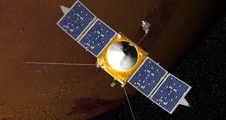 |
| Mars Atmosphere and Volatile Evolution mission (MAVEN) |

Credit: Lockheed Martin
Two chief instruments
The InSight mission will last a Mars year, or roughly two Earth years.
That is 630 days longer than the Phoenix mission lasted, which means that the lander will have to endure a wider range of environmental conditions on the Martian landscape, Spath said.
InSight will study a different aspect of planetary history with instruments never previously used on Mars, Spath said.
The Mars lander's scientific payload consists of two chief instruments:
The Seismic Experiment for Interior Structure provided by the French Space Agency.
A Heat Flow and Physical Properties Package provided by the German Space Agency.
Additionally, the Rotation and Interior Structure Experiment (RISE), led by the Jet Propulsion Laboratory (JPL), will use the lander's X-band radio system to make ultra-precise measurements of planetary rotation.
Wind and temperature sensors from Spain's Centro de Astrobiologia and a pressure sensor will monitor weather at the landing site. A lander magnetometer will measure magnetic disturbances caused by the Martian ionosphere.

Credit: NASA/JPL
Come together
"It is very exciting, seeing the flight hardware start to come together," said Bruce Banerdt, the principal investigator for the InSight mission to Mars at the Jet Propulsion Laboratory (JPL) in Pasadena, California.
"At the same time, this is a very nerve-wracking period in the project, as testing of our instruments and spacecraft subsystems uncover subtle design and manufacturing problems that inevitably occur, and that must be corrected in the short time, just over one and a half years, before launch," Banerdt told reporters.
The cost of the InSight mission, excluding the launch vehicle and related services, is capped at $425 million in 2010 dollars.
California to Mars
An upcoming milestone for the project, in aerospace lingo, is Assembly, Test, and Launch Operations (ATLO), Spath said.
That evaluation begins in early November. Next June, the InSight spacecraft will face a suite of critical tests, with ship and shoot dates in December of 2015 and March of 2016, respectively, Spath said.
After those tests, InSight won't see a speedy sendoff from Florida.
Rather, the lander will travel to Vandenberg Air Force Base in California, where a United Launch Alliance Atlas 5 rocket will give the craft a boost.
This will be the first interplanetary mission ever to launch from California, although in 1994, the joint Ballistic Missile Defense Organization/NASA Clementine spacecraft that studied the moon and an asteroid headed off from that launch area.
Once Mars-bound, InSight will fly a quick trip. After roughly 6.5 months in transit, the craft will stick a landing in the southern Elysium region of Mars in September 2016.
The specific touchdown zone is still under discussion, with Mars researchers making use of super-sharp imagery from the NASA Mars Reconnaissance Orbiter's High Resolution Imaging Science Experiment (HiRISE) to decide InSight's precise destination.


