

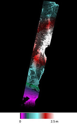
Each coloured fringe is caused by a change in distance between the ground and the satellite of about 3cm.
The extent of the ground deformation in the interferogram shows that the fault slip which occurred in this earthquake continues further north than the extent of the mapped rupture at the surface.
Credit: Copernicus data (2014) /ESA/PPO.labs-Norut–COMET-SEOM Insarap study
Scientists have used a new Earth-observation satellite called Sentinel-1A to map the ground movements caused by the earthquake that shook up California's wine-producing Napa Valley on 24 August 2014.
This is the first earthquake to be mapped by the European Space Agency's (ESA) new satellite and demonstrates the capabilities of the Centre for the Observation and Modelling of Earthquakes, Volcanoes and Tectonics (COMET) in analysing its observations quickly.

COMET scientists are building a system that will routinely provide results for all continental earthquakes, as well as mapping the slow warping of the ground surface that leads to earthquakes."

Sentinel-1A was launched on 3 April 2014, but it only reached its final operational orbit on 7 August. The pre-earthquake image was acquired on that day.
By comparing it with an image acquired on 31 August, COMET collaborators Dr Yngvar Larsen, from the research institute Norut in Norway, and Dr Petar Marinkovic, from PPO.labs in the Netherlands, created a map of the surface deformation, called an 'interferogram', caused by the magnitude 6.0 earthquake.

Austin Elliott, a PhD student at the University of California, Davis, who has been among the team mapping the earthquake rupture on the ground said: "The data from satellites are invaluable for completely identifying the surface break of the earthquake, deformation maps from satellite imagery guide us to places where rupture has not yet been mapped."
Although the Sentinel-1 satellite system, which will also include the future Sentinel-1B satellite, is still being tested and commissioned, ESA was able to ensure data covering the earthquake were acquired, and provide this to the science team rapidly.
When the Sentinel-1 constellation is fully operational, the average time delay between an earthquake and a radar acquisition will only be a few days, which will mean the results will also be useful for helping with humanitarian responses on the ground.
The interferogram clearly confirms that the West Napa Fault was responsible for the earthquake. This fault had not been identified as being particularly hazardous prior to the event.


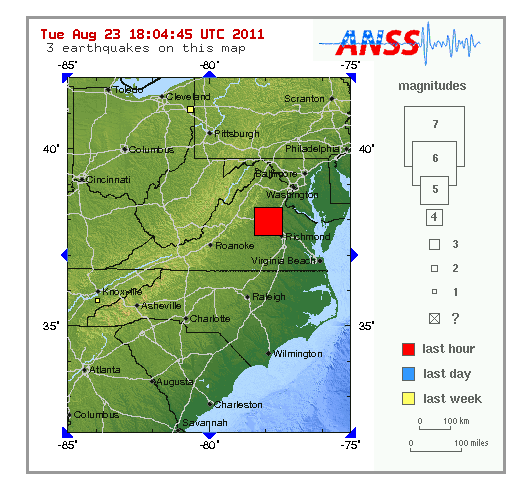
 Since at least 1774, people in central Virginia have felt small earthquakes and suffered damage from infrequent larger ones.


