Showing posts with label GMES. Show all posts

Friday, August 1, 2014

ESA Fifty Years of European Cooperation in Space

A new book by eminent historian John Krige details fifty years of European collaboration in space, from the origins of the space programmes of the early 1960s, to the many activities and rich complexity of ESA today.

The book, Fifty years of European cooperation in space: Building on its past, ESA shapes the future, charts the early moves by pioneering European scientific statesmen and governments to establish not one, but two organisations, European Space Research Organisation (ESRO) for science and later applications, and European Launcher Development Organisation (ELDO) for launchers.

The tight financial constraints on ESRO, the tribulations of ELDO's launcher, and a major tilt towards close technological cooperation with NASA in the early 1970s led to the formation of a single organisation in 1975, the European Space Agency, ESA.

EADS Ariane-5
As ESA embarked on developing a new European launcher under French leadership (EADS Ariane), and a human-rated laboratory for scientific experiments to fit in the US Space Shuttle's cargo bay under German leadership (Spacelab), its science programme was put on a secure institutional footing and it launched a number of applications programmes.


Early sketch of ESA Spacelab
The 1980s were marked by the spectacular success of Ariane, the consolidation of a human presence in space through Spacelab and collaboration in the International Space Station (ISS), the development of a new framework for rationalising space science and bruising disputes over engaging users to operate application satellites.

The global upheavals of the 1990s, the interest of the private sector in space, and an awareness of the value of space-based systems to civil society and military action on the ground obliged ESA to refashion itself again.

Russian Soyuz TMA-9M
New partnerships were forged. ESA's launcher fleet was expanded to include the Russian Soyuz and the Italian-led Vega.

A single European Astronaut Corps was created, and major new programmes for Earth observation; Copernicus - Global Monitoring for Environment and Security (GMES) and the European GPS satellite navigation (Galileo) were created in cooperation with the European Union.

The history of Europe's presence in space is above all a history of political will, of industrial development, and of the consolidation of extensive scientific, technological and managerial competencies to construct a global space power; one that could compete and collaborate from a position of strength with the US and the USSR/Russia, while adapting to the changing demands of a new geopolitical world order in the 21st century.

Fifty years of European cooperation in space: Building on its past, ESA shapes the future (EAN/ISBN: 97820701020297) is published by Les Editions Beauchesne (June 2014).

Monday, March 17, 2014

European Parliament adopts Copernicus: Earth Observation programme

The European Parliament on Wednesday gave its green light to Copernicus, the EU's new earth observation programme, according to a statement on its official website.


Copernicus, previously known as GMES (Global Monitoring for Environment and Security), is the European Programme for the establishment of a European capacity for Earth Observation.

The Copernicus Regulation will ensure the regular observation and monitoring of earth sub-systems, the atmosphere, oceans, and continental surfaces, and will provide reliable information in support of a broad range of environmental and security applications and decisions.

This programme, which still needs to be adopted by the European Council, defines Copernicus objectives, governance and funding of some 4.3 billion euros (5.97 billion U.S. dollars) for the period 2014-2020.

The European Commission welcomed the vote of the European Parliament on the Copernicus, said a statement publicised by the EU executive.

European Commission Vice President Antonio Tajani, responsible for industry and entrepreneurship said that "space is a priority for the European Union.

The budget for both European flagship space programmes, Copernicus and Galileo, for the next seven years is secured. Almost 12 billion euros will be invested in space technologies. "

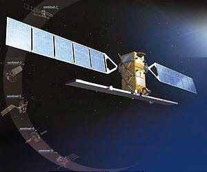
The Copernicus programme is entering the operational phase after years of preparation. The next step is the launch of the first Copernicus satellite, Sentinel-1, beginning of April from Europe's Spaceport in French Guyana.

The data provided by this satellite will enable considerable progress in improving maritime security, climate change monitoring and providing support in emergency and crisis situations.

Under the administration of ESA and its management policies, Copernicus will also help Europe's enterprises creating new jobs and business opportunities.

Studies show that Copernicus could generate a financial benefit of some 30 billion euros and create around 50,000 jobs in Europe by 2030.

Friday, December 7, 2012

ESA GMES the European Embattled GMES Faces up to Good and Bad News

The Sentinel 3 satellite is part of the GMES constellation. 

Credit: ESA artist's concept.

Europe’s broad environment-monitoring system is facing a 35 percent cut to its seven-year budget as its putative owner, the European Union (EU), struggles with its members about financing, European government and industry officials said.

For the Global Monitoring for Environment and Security (GMES) (video) program, the good news is that the 27-nation union’s executive commission has reinserted the satellite-based system into its multi-annual financial framework, which covers spending between 2014 and 2020.

In mid-2011 the commission had proposed to fund GMES separately, in ways that several governments and prospective GMES users said would put the entire program at risk.

The 20-nation European Space Agency (ESA), which is building the initial GMES satellites, called Sentinels, continues to have trouble persuading its governments to continue the work in the absence of a firm EU commitment to pay to operate the system.

While the most recent budget indications are that the European Commission will assume ownership of GMES and fund the program’s operations, no formal commitment has been made and will not be made until the commission’s overall budget stalemate is resolved.

Attending the European Space Solutions conference and exhibition here Dec. 3-5, government and industry officials said the bad news for GMES is that the commission now proposes to spend about 3.8 billion euros ($5 billion) on the program over the seven-year budget period, and not the 5.8 billion euros originally proposed.

Officials said that given the continued discord among European Union governments about the trillion-euro seven-year budget, and especially its agricultural-support payments, the GMES budget is not yet stabilized.

A final budget is now not expected until early 2013.

An industry official said one way the program might stretch its available funding is to stagger the launches of the first Sentinel satellites. 

The Sentinel 1, Sentinel 2 and Sentinel 3 radar and optical Earth observation satellites were expected to be ordered in batches of three to achieve economies of scale among the prime contractors and assure GMES users that there would be no interruption to the flow of satellite data in the coming years.

“What we can do, if necessary, is reduce the in-orbit redundancy that had been built into the original manufacturing schedule for the Sentinels,” the industry official said. 

“This does involve adding risk to the program in the event of a launch failure or an in-orbit failure. But it is one way to cope with the budget cuts that are now being discussed.”

The three-day conference here, organized by the U.K. Space Agency and the European Commission, put a spotlight on the wide applications expected for GMES in agriculture, border control, pollution monitoring, resource management and even public health.

Numerous officials here pointed out the irony of the fact that even as GMES’s relevance appears to be growing with each new example of climate change, its budget is taking such a substantial hit.

Friday, November 23, 2012

ESA DLR: EDRS space network ready to go ahead

The design of Europe’s data relay satellite system – EDRS - has been completed and approved.

This marks the moment when it moves ahead with a green light from its first customer, the Global Monitoring for Environment and Security initiative from the European Union (GMES).

EDRS will provide a telecommunications network that is fast, reliable and seamless, making real-time information from satellites available on demand.

EDRS will be the first commercially operated data relay system to deliver services to the Earth observation community.

It is being built through a Public–Private Partnership (PPP) between ESA and Astrium Services, using payloads carried by two satellites in geostationary orbit, hovering 36 000 km above the Equator, where their speed matches Earth’s rotation.

Data transmitted from satellites in lower orbits to either of these EDRS payloads can then be relayed to the ground.

The payload includes a laser terminal developed by TESAT of Germany to transmit up to 1.8 gigabits per second over distances in excess of 40 000 km, between the lower satellites and EDRS in geostationary orbit.

A design review board of senior members from ESA, Astrium and the DLR German Aerospace Center approved the entire system design: from the satellites to the support that will be required from the ground.

The industrial organisation is fully in place with all subcontracts negotiated and ESA’s partner Astrium Services ready to begin production.

“EDRS is a fantastic breakthrough for Europe, from the innovative laser communication terminal technology, which is the heart of EDRS, to the provision of operational services by 2014 through a PPP that combines the best from European space companies with the national and European space institutions,” says Magali Vaissiere, director of ESA’s Telecommunications and Integrated Applications Directorate.

The first of the two EDRS payloads will be carried on the Eutelsat-EB9B satellite, starting operation in 2014, built by Astrium and positioned at 9°E over the Equator.

The second satellite, planned for launch in 2016, will carry the second EDRS payload as well as the Hylas-3 payload from the UK’s Avanti Communications. This satellite will be built by Germany’s OHB using the SmallGEO platform, currently under development by OHB under ESA contract.

Wednesday, August 1, 2012

DLR: GMES Sentinel satellite

The ground segment for GMES (Global Monitoring for Environment and Security) is starting to take shape in Oberpfaffenhofen.

It will be the European data centre for GMES satellites Sentinel-1 and Sentinel-3.

"DLR's expertise in Earth observation, data repositories and data processing is fundamental for the successful establishment of the European data centre planned by ESA," explained Hansjörg Dittus, DLR Executive Board Member for Space Research and Technology.

On 24 July, Volker Liebig, ESA Director of Earth Observation, DLR's Hansjörg Dittus, and the director of DFD, Stefan Dech, signed a contract in Oberpfaffenhofen to establish a GMES Processing and Archiving Center (PAC).

"With its unique combination of research and engineering abilities, DFD has been a reliable partner of ESA for many years in designing and operating complex systems for the reception, processing and archiving of Earth observation data," emphasised Volker Liebig.

In 2013, data from Sentinel-1, and later also data from the Ocean and Land Colour Instrument (OLCI) on the Sentinel-3 satellites will be processed to yield information products that will be distributed to users and archived for the long term.

ESA is providing 13.6 million Euro over seven years to establish and operate the data centre. This new GMES data centre is, to a large extent, based on existing infrastructure.

The existing computer systems and national data archive at DLR will be expanded in the coming months to handle the additional data requirements of over two petabytes to be processed annually. T-Systems has been awarded a subcontract to expand the network infrastructure.

Friday, February 11, 2011

ESA e-GEOS Satellites locate seized Italian oil tanker

The Cosmo-SkyMed satellites, operated by the Italian space agency, have acquired the first images of the Italian oil tanker Savina Caylyn since it was hijacked earlier this week by Somali pirates in the Indian Ocean.

According to the satellite radar images, acquired by Italian space agency (ASI) and e-GEOS on Wednesday afternoon and early Thursday morning, the seized ship is about 330 km off the Somalia coast.

The 266-m long and 46-m wide vessel was about 800 km west of India when it was attacked on Tuesday. There has been no reported communication with the vessel and no information regarding the 22 crewmembers on board.

The techniques to rapidly locate and track this ship in open waters were developed and are currently operated as part of the MARISS (Maritime Security Service) project funded under ESA’s GMES Service Element.

MARISS provides pre-operational satellite-based maritime surveillance services for European waters, East Africa, the Caribbean and the Atlantic to support maritime law enforcement, anti-trafficking interventions and to protect shipping lanes.

Monday, July 5, 2010

ESA, EMSA and GMES join forces in disaster

European Maritime Security Agency, EMSA is a key user of satellite data. So, ESA takes into account their requirements, both in establishing mission requirements for future operational satellite missions and for instruments.
One of those being developed is for the Global Monitoring for Environment and Security (GMES) initiative, and it is used in establishing exploitation plans for data of current and future missions.

ESA also responsible for advising EMSA as to data available from its missions and from satellites operated by third parties for which ESA is granted rights of distribution.

While maritime transport is of fundamental importance to the world's economy, the devastation that can result from oil spills at sea is all too obvious – as the spill in the Gulf of Mexico currently demonstrates.

The availability of satellite data in near-realtime, particularly from radar such as the Advance Synthetic Aperture Radar on Envisat and in the future from the GMES Sentinel-1, is an essential way of monitoring such events. They provide wide area coverage and have the capability to detect oil slicks on the sea surface both in daylight and darkness, and through cloud.

This Agreement between ESA and EMSA and the resulting services takes significant steps in keeping European seas clean and safe.