Showing posts with label volcanic eruption. Show all posts

Sunday, October 19, 2014

Mount Sinabung volcanic eruption - images

Indonesia’s Mount Sinabung, which had lain dormant for over 400 years, has been intermittently erupting since September 15 last year, killing 15 people and forcing hundreds to flee their homes. According to the National Disaster Mitigation Agency, more than 3,000 residents are still displaced

Mount Sinabung spews pyroclastic smoke, seen from Tiga Pancur village in Berastagi, Karo district, North Sumatra, Indonesia. 

Credit: Ulet Ifansasti/Getty Images

Mount Sinabung spews pyroclastic smoke, seen from Tiga Pancur village on October 13, 2014 in Berastagi, Karo district, North Sumatra, Indonesia.

Mount Sinabung, which has lain dormant for over 400 years, has been intermittently erupting since September 15 last year, killing 15 people and forcing hundreds to flee their homes.

According to The National Disaster Mitigation Agency, more than 3,000 residents are still displaced.

Smoke and fumes swirl around a volcanic vent spouting red hot lava.

Sunday, March 9, 2014

NASA New Horizons: Volcanic Eruption Plume on Jupiter's moon Io - Video

Incredible footage of an eruption on Io, Jupiter’s third moon, considered the most volcanic place in the solar system, has been released by the US space agency.

The video, taken by the New Horizons spacecraft, pictures a drama that unfolded more than 6.2 million km away from Earth back in 2007. NASA only made it public on Tuesday.

Some 400 active volcanoes are situated on Io and they produce plumes as high as 500 kilometers above Io’s surface.

The latest eruption captured by the spacecraft saw plumes over 300 kilometers in height, according to NASA’s website.

The reason for the extreme volcanic activity on Io is that it’s “locked in a perpetual tug of war between the imposing gravity of Jupiter and the smaller, consistent pulls of its neighboring moons,” NASA explains.

As a result, Io’s orbit is distorted and it stretches.

This causes friction and intense heat inside the moon, which in turn triggers eruptions across its surface.

Saturday, February 15, 2014

Java's Mount Kelud eruption: 10KM defensive evacuation

Several airports have reopened on the Indonesian island of Java after being forced to close following the eruption of volcano Mount Kelud.

Correspondents say air quality has improved across Java, but cities and villages are still covered in a layer of dust and ash.

Tens of thousands remain in shelters, facing medicine and blanket shortages.

Mount Kelud, in Java's east, spewed ash and debris over a large area on Friday, killing three people.

The volcano had been rumbling for several weeks before it erupted.

Authorities said they were not expecting another major tremor, because the patterns showed volcanoes tended to quieten down after a large eruption.

Stream of ash
The transport ministry said airports in Malang, Cilacap and Semarang reopened on Saturday.

"We are now evaluating the status of other airports," spokesman Bambang Ervan said.

The airports shut down because of low visibility. There were also fears that debris could damage aircraft engines.

Some 75,000 people are estimated to have sought refuge in temporary shelters.

Many are unable to return to their homes because authorities have kept a 10km exclusion zone in place around the volcano.

Local reporters say the volcano alert remains at the highest level because officials do not want to take any chances.

Officials raised an alert on Thursday about an hour before the volcano erupted.

They urged people living in 36 villages within 10km of the volcano to evacuate.

Officials said two people died when their homes caved in under the weight of gravel and ash.

A 70-year-old man was killed when a wall collapsed while he was waiting to be evacuated.

Some of the evacuees tried to return to their houses on Friday morning to gather their possessions, but were forced to turn back by the stream of volcanic ash and rocks from the volcano.

The volcano last erupted in 1990, killing dozens of people. A powerful eruption in 1919 killed around 5,000 people.

Indonesia lies on the Ring of Fire, a series of geological fault-lines, prone to frequent earthquakes and volcanic eruptions.

There are about 130 active volcanoes in Indonesia.

Earlier this month, Mount Sinabung on the island of Sumatra erupted, killing at least 14 people and making many homeless.

Sunday, January 5, 2014

Indonesian volcanic eruption: Mount Sinabung forces evacuations

Indonesians look at the volcanic ash spewing up into the air from Mount Sinabung as it erupts in Karo, North Sumatra, on January 1, 2014

An Indonesian volcano that has erupted relentlessly for months shot volcanic ash into the air 30 times on Saturday, forcing further evacuations with more than 20,000 people now displaced, an official said.

Mount Sinabung on the western island of Sumatra sent rivers of lava flowing through an evacuation zone and columns of volcanic cloud up as high as 4,000 metres (13,000 feet), National Disaster Mitigation Agency (BNPB) spokesman Sutopo Purwo Nugroho said.

"Hot lava spewed from the volcano some 60 times, reaching up to five kilometres (three miles) southeast of the crater. This outpour is the biggest we've seen in all the recent eruptions," Nugroho said.

Authorities had already told residents in a five-kilometre radius of the volcano to evacuate, and Nugroho said an expanded evacuation zone may be considered.

The number of people who have now fled the rumbling volcano since it began erupting in September last year has risen to 20,331, Nugroho said.

Mount Sinabung is one of dozens of active volcanoes in Indonesia that straddle major tectonic fault lines, known as the Ring of Fire.

It had been quiet for around 400 years until it rumbled back to life in 2010, and again in September last year.

In August, five people were killed and hundreds evacuated when a volcano on a tiny island in East Nusa Tenggara province erupted.

Monday, August 26, 2013

Major volcanic eruption seen on Jupiter's moon Io

Voyager 1 acquired this image of Io on March 4, 1979. An enormous volcanic explosion can be seen silhouetted against dark space over Io’s bright limb. 

Credit: NASA/JPL

Recent observations of Jupiter's moon Io has revealed a massive volcanic eruption taking place 628,300,000 km (390,400,000 miles) from Earth. Io, the innermost of the four largest moons around Jupiter, is the most volcanically active object in the Solar System with about 240 active regions.

But this new one definitely caught the eye of Dr. Imke de Pater, Professor of Astronomy and of Earth and Planetary Science at the University of California in Berkeley.

She was using the Keck II telescope on Mauna Kea in Hawaii on August 15, 2013 when it immediately became apparent something big was happening at Io.

"When you are right at the telescope and see the data, this is something you can see immediately, especially with a big eruption like that," de Pater told reporters.

de Pater said this eruption is one of the top 10 most powerful eruptions that have been seen on this moon.

"It is a very energetic eruption that covers over a 30 square kilometer area," she said.

"For Earth, that is big, and for Io it is very big too. It really is one of the biggest eruptions we have seen."

She added the new volcano appears to have a large energy output. "We saw a big eruption in 2001, which was in the Surt region, which is well known as the biggest one anyone has ever seen," she said.

"For this one, the total energy is less but per square meter, it is bigger than the one in 2001, so it is very powerful."

While Io's eruptions can't be seen directly from Earth,infrared cameras on the Keck telescope (looking between 1 and 5 microns) have been able to ascertain there are likely fountains of lava gushing from fissures in the Rarog Patera region of Io, aptly named for a Czech fire deity.

While many regions of Io are volcanically active, de Pater said she's not been able to find any other previous activity that has been reported in the Rarog Patera area, which the team finds very interesting.

Ashley Davies of NASA's Jet Propulsion Laboratory in Pasadena, California and a member of the observing team told reporters that Rarog Patera was identified as a small, relatively innocuous hot spot previously in Galileo PPR data and possibly from Earth, but at a level way, way below what was seen on August 15, and reported in New Scientist.

de Pater and other astronomers will be taking more data soon with Keck and perhaps more telescopes to try and find out more about this massive eruption.

"We never know about eruptions – they can last hours, days months or years, so we have no idea how long it will stay active," she said, "but we are very excited about it."

No data or imagery has been released on the new eruption yet since the team is still making their observations and will be writing a paper on this topic.

Scientists think a gravitational tug-of-war with Jupiter is one cause of Io's intense vulcanism.

Thursday, January 10, 2013

Plosky Tolbachik Volcanic Eruption

An aerial view of Plosky Tolbachik, a volcanic complex on the Kamchatka Peninsula, far eastern Russia 

Picture: ITAR-TASS / Barcroft Media

Wednesday, January 9, 2013

Puyehue Volcanic Eruption in Chile

These photos show the dramatic effects of huge volcanic ash clouds being shot through by fierce lightning bolts at the recent Puyehue eruption in Chile.


Wednesday, January 2, 2013

EO-1 Advanced Land Imager (ALI): Tolbachik Volcanic eruption

Add caption
After more than a month of eruption, lava continues to flow from Tolbachik, one of many active volcanoes on Russia’s Kamchatka Peninsula. 

Image Credit: NASA Earth Observatory

The current eruption at Tolbachik began on Nov. 27, 2012.

Lava flowed up to 20 kilometers (12 miles) from a line of fissures on the volcano’s southern flank.

Since then, some of the lava has cooled enough to allow snow to accumulate.

Snow-covered lava flows appear gray in this natural-color satellite image. Fresher lava appears black. A faint orange glow at the head of the northern flow marks the location of an erupting fissure.

The image was collected on Dec. 22, 2012, by the Advanced Land Imager (ALI) on the Earth Observing-1 (EO-1) Satellite.

According to the Kamchatka Volcanic Eruption Response Team (KVERT) the eruption continued through Dec. 30, 2012.


Friday, October 12, 2012

NASA Aqua /Terra Satellite Image: Sicily and Mount Etna volcanic eruption

Credit: NASA

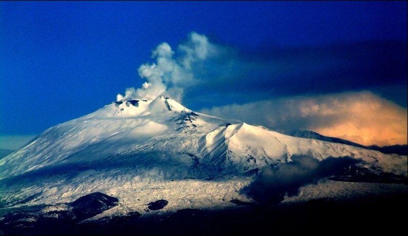
Italy's Mount Etna, one of the most active volcanoes on Earth, is spewing out plumes of bluish volcanic gas, as revealed in a recent satellite image.

The restive peak, located on the island of Sicily, has been erupting in spectacular fashion on and off since it ramped up activity in January 2011.

The mountain last spewed out fountains of glowing lava on April 24, and has been relatively quiet ever since.

Saturday, September 15, 2012

Guatemala Volcano Erupts, 33,000 Evacuated: Erupting Volcano Del Fuego


Guatemala Volcano Erupts & 33,000 Are Evacuated: Photos Of Erupting 'Volcan Del Fuego'

The Guatemala volcano "Volcan del Fuego" erupted Thursday, forcing some 33,000 locals to flee the area, emergency services said.

Ash and smoke were spewed into the sky as the volcano began to erupt. The volcano lies 25 miles southwest of Guatemala City and began to send a cloud of ash into the sky in the early afternoon, Sergio Cabanas, director of emergency response in Guatemala's CONRED emergency agency, told Reuters.

Nearly 8,000 people have already been evacuated and almost 23,000 are awaiting evacuation, he added.

Guatemala has four active volcanoes, Reuters said, and the 2010 eruption of Pacaya covered 25 miles of Guatemala City with ash. Airports were closed and hundreds of families were evacuated.

Cabanas additionally said that 17 villages near Guatemala City were evacuated in the biggest such operation the country has ever seen.

Although the volcano is just six miles from Antigua, a popular tourist destination, Antigua was not in the evacuation zone according to NBC News.

The "Volcano of Fire" has spewed lava that billowed 2,000 feet down its slope, BLIPPITT reported.

"A paroxysm of an eruption is taking place, a great volcanic eruption, with strong explosions and columns of ash," Gustavo Chicna, a volcanologist with the National Institute of Seismology, Vulcanology, Meteorology and Hydrology, said to BLIPPITT.

He said the ash from the volcano was nearly half an inch thick in some areas and the government's disaster agency added that homes and buildings were covered with ash miles away.

This is the fifth time Fuego has erupted this year, but its biggest eruption since 1999, a Guatemalan scientist told NBC News.

Teresa Marroquin, a Guatemalan Red Cross coordinator, told NBC News that the group has set 10 emergency shelters and is sending hygiene kits and water.

"There are lots of respiratory problems and eye problems," she said.

Chinca added that "it's almost in total darkness" near the living mountain.

Sunday, September 2, 2012

Kilauea: Tiny Gravity Changes Show Magma's Underground Movements

Kilauea's current eruption is still going strong after 29 years.

CREDIT: USGS/HVO.

The secret movements of magma deep inside a volcano can be detected by tracking the subtle changes in gravity they cause.

Surprising readings from a Hawaiian volcano have researchers hoping to better understand volcanic activity through gravity monitoring.

Continuous gravity measurements of active volcanoes are relatively rare, with most results coming from Mount Etna in Italy.

"One problem is the expense," researcher Michael Poland, a geophysicist at the U.S. Geological Survey's Hawaiian Volcano Observatory, explained.

"Gravity measurements have always been a really expensive endeavor. The big users are oil and mining companies."

Now scientists have monitored the gravity at Kīlauea, a popular tourist destination on Hawaii's Big Island, and discovered a regular cycle of fluctuations that suggest magma is churning a kilometer (0.6 miles) below the surface.

The way magma churns in underground chambers below volcanic vents is key to understanding how persistent volcanoes are, and whether or not they might catastrophically erupt in the future.

However, what goes on deep under the Earth's surface is difficult to monitor.

One way to peer underground is by looking at Earth's gravity, the researchers said. Anything that has mass has a gravity field that pulls objects toward it.

The strength of this field depends on the amount of mass. Since the Earth's mass is not spread out evenly, this means the strength of the planet's gravitational pull is stronger in some places and weaker in others.

As such, the flow of magma from one place to another can be detected from above.

Most active volcano

"KÄ«lauea is the world's most active volcano," Poland said. "It's erupted almost continuously since 1983. It's a natural 'lab volcano' ―a great place to try and study something like gravity measurements."

The researchers installed two continuous gravity meters at the summit of the volcano in 2010. One was about 1.2 miles (2 kilometers) northwest of the eruptive vent at the summit and recorded measurements every10 seconds, while the other was placed about 500 feet (150 meters) east and recorded data every second.

They detected gravity fluctuations that came in a cycle about 150 seconds long.

"There was no expectation for that kind of result," Poland reported. "That gravity oscillation came out of nowhere. It points to the idea that there's probably a lot of things going on in volcanoes, glaciers, wherever you look, but we haven't developed the tools to detect these sorts of things."

Sunday, August 19, 2012

NASA EO-1 Image: Overhead View of Batu Tara Volcanic Eruption

The Advanced Land Imager (ALI) aboard the Earth Observing-1 (EO-1) satellite captured an ash plume from one of the frequent eruptions of Indonesia's remote Batu Tara volcano on Aug. 15, 2012.

CREDIT: NASA

NASA's Earth Observing-1 (EO-1) satellite caught a crystal-clear image of a small ash plume emanating from a tiny volcanic Indonesian island.

The volcano, called Batu Tara, is located on the island of Pulau Komba, and has been experiencing frequent, mild eruptions since mid-2006, according to a NASA release.

While much of the island appears green thanks to tropical vegetation, one side of the island is noticeably free of plants and appears grayish.

This barren area is a scarp that drops from the summit of the volcano to the ocean, a distance of 2,454 feet (748 meters).

The scarp is created by the frequent eruptions, which send rocks and ash barreling down the slope.
The volcanic island is located in the Flores Sea and is part of the Lesser Sunda Islands.

The first recorded eruption of the volcano, which happened from 1847-52, produced explosions and lava flows, according to the Smithsonian Global Volcanism Program.

Batu Tara is a stratovolcano and the frequent eruptions is has experience recently are called Strombolian, after the archetypal Stromboli volcano in Italy.

Strombolian eruptions are intermittent and feature explosive activity and lava fountaining, sometimes sending so-called "volcano bombs" into the air.

Stromboli even has a scarp, called the Sciara del Fuoco, that resembles the one on Batu Tara.

Monday, July 16, 2012

NASA Aqua /Terra Satellite Image: Sicily and Mount Etna volcanic eruption

Mount Etna is Europe's most active volcano. Aqua captured this image of Etna erupting on Oct. 28, 2002.

The view of Earth from space has transformed our understanding of, as well as our admiration for, the planet.

The data and images collected by Earth-observing satellites have been used in thousands of scientific papers, helped us better respond to natural disasters, improved weather and climate forecasts, enlightened us about our impact on Earth and captivated us with beauty.

One of the stars of NASA's fleet of satellites is Aqua. The satellite is named for its ability to measure water vapour in the atmosphere, water in the oceans, as well as ice and snow.

When it was launched on May 4, 2002, scientists expected it to work for three to five years but its six instruments have been functioning perfectly for 10 years, gathering 29 million gigabytes of data in that time.

One of the most useful and impressive instruments aboard Aqua is the Moderate Resolution Imaging Spectroradiometer, which measures visible and infrared radiation, and produces truly amazing, incredibly beautiful images of Earth.

With funding for Earth-observing satellites on the decline, let's hope Aqua keeps going for 10 more years.