Showing posts with label Satellite Communications. Show all posts

Wednesday, November 28, 2012

Microsatellites aim to fill weather-data gap

The COSMIC radio-sounding satellites are ageing but may set the stage for a commercial system.

Credit: OSC/UCAR

Some orbiting satellites look up at the stars and most point down towards Earth but the satellites of the Constellation Observing System for Meteorology, Ionosphere and Climate (COSMIC) look sideways, across the curving horizon.

There, dozens of satellites that are part of the Global Positioning System (GPS) pop in and out of view at the edge of the planet. By tracking their radio signals, COSMIC can provide atmospheric data that enhance weather forecasts and climate models.

But the fleet, launched six years ago at a cost of US$100 million, is nearing the end of its life, with one satellite of the original six already defunct.

At a three-day workshop last month at the University Corporation for Atmospheric Research (UCAR) in Boulder, Colorado, researchers hailed the US–Taiwanese COSMIC as a pioneer and discussed plans for a commercial successor: a network of 24 micro­satellites dubbed the Community Initiative for Cellular Earth Remote Observation (CICERO).

Researchers say that the programme could help to address a gap in atmospheric data as the United States struggles to meet a 2016 launch date for the first spacecraft in its expensive Joint Polar Satellite System (JPSS).

The radio-sounding technique that both COSMIC and CICERO use is a “disruptive technology”, says Rick Anthes, a COSMIC scientist and former president of UCAR. “The impact is huge — especially the impact for the cost.”

GPS radio signals, picked up by Earth-bound receivers in everything from mobile phones to missiles, yield precise position information. But COSMIC puts them to a different use.

The signals travel at a known rate, but skimming through the planet’s atmosphere and back out to space bends the signals and delays them; COSMIC uses the length of the delay to measure the atmospheric density, which can provide information on changing characteristics such as temperature and moisture levels (see ‘Bending for data’). It makes many hundreds of these radio-occultation measurements each day.

Monday, October 1, 2012

ESA Ariane 5 ECA Lifts Indian European Telecom Satellites into Orbit

Europe’s Ariane 5 ECA rocket on Sept. 28 successfully placed Indian and European telecommunications satellites into transfer orbit, with both satellites reported healthy and on the way to final position.

In its 51st consecutive success and the fifth of seven liftoffs scheduled this year, the Ariane 5 ECA exceeded its previous record for the mass of payload deposited into geostationary transfer orbit.

GSAT-10
The two satellites — India’s GSAT-10 and Luxembourg-based SES’s Astra-2F — together weighed 9,367 kilograms at launch.

The adaptors and dispenser platform added slightly more than 800 kilograms, bringing the total mass separated in orbit to 10,177 kilograms.

The Arianespace consortium of Evry, France, and Ariane 5 prime contractor Astrium Space Transportation are making incremental improvements to Ariane 5.

In November, European Space Agency governments are expected to decide whether to complete development of a new upper stage that would further increase performance to geostationary orbit by about 20 percent starting in 2017.

Built for the Indian Space Research Organisation (ISRO), which is India’s space agency and doubles as its satellite operator and satellite services vendor, GSAT-10 weighed 3,400 kilograms at launch. It carries 12 C-band, six extended C-band and 12 Ku-band transponders, and is designed to operate for 15 years.

GSAT-10 also carries a navigation payload as part of India’s Gagan GPS augmentation system.

The United States, Europe and Japan have similar overlays, which validate signals delivered by the U.S. GPS constellation of satellites in medium Earth orbit through payloads on geostationary satellites operating 36,000 kilometers over the equator.

ISRO said in a Sept. 30 statement that the maneuvers to bring the satellite to final geostationary position were proceeding on schedule. GSAT-10 will be operated at 83 degrees east.

Astra-2F is the first of four SES satellites being built by EADS, Astrium Satellites of Europe to replace aging SES direct-broadcast spacecraft over Europe.

Astra-2F, weighing nearly 6,000 kilograms at launch, is designed to deliver 13 kilowatts of power to its Ku- and Ka-band payload. It will operate at 28.2 degrees east.

The Ka-band will be used as part of SES’s cautious entry into satellite-delivered consumer broadband service in Europe.

The company already has some 70,000 customers using Ku-band for broadband access, and is adding Ka-band to its new Astra satellites over Europe to test the waters for a higher-speed service.

Thursday, September 27, 2012

Phonesat: On-board mobile phone to power low-cost satellite

A University of Queensland staff member is sending a satellite into space more powerful than the Curiosity Rover which recently landed on Mars.

The satellite, which measures 10cm x 10cm, is controlled by an on-board Android mobile phone five times more powerful than its larger space-faring cousin.

It also has a camera four times more powerful.

Michael Kehoe, a UQ staff member with Information Technology Services (ITS) and a final year student of the School of Information Technology and Electrical Engineering (ITEE) recently completed a five-week internship with NASA in California.

He was tasked with designing a satellite that used a mobile phone as its on-board computer, as part of a NASA initiative, PHONESAT.

"This is a proof of concept that will be used for a range of later designs," said Mr Kehoe.

"The satellite uses an attitude determinate control system (ADCS) written by fellow UQ graduate Jasper Wolfe to stop the satellite from spinning and alter its path in orbit," he said.

"Because it uses a common mobile phone as its central processor, I've been able to incorporate some really fun ideas into the satellite.

I'll be able to take temperature, accelerometer and heading readings using the phone's sensors and photos using the phone's camera."

Despite being controlled by a mobile phone, the satellite is not able to phone home.

"Unfortunately there's no reception in space, so we'll be using a high-powered radio link to receive data from the satellite," said Mr Kehoe.

Tracking of the satellite is being set up in America with NASA and in Australia, with the assistance of ITEE.

Tracking equipment on top of the Parnell building will monitor the satellite from launch on November 25 to re-entry 12 days later.

The project provides a proof of concept for low cost, rapid design iteration space craft. Total component costs for the satellite are $7800, opposed to Curiosity's $2.5 billion.

"An example of why this is important can be seen in the Curiosity Rover which landed in August on Mars," said Mr Kehoe.

"Design work started eight years ago and used cutting-edge technology at the time, but by launch date a common mobile phone had more processing power and better camera.

If we can shorten the time it takes to build spacecraft, we can decrease cost and increase the quality of what goes into space."

More information: open.nasa.gov/plan/phonesat/

Wednesday, July 25, 2012

NASA MSL Curiosity Video "Seven Minutes of Terror" - Video

NASA MSL Mission Update

Today, Curiosity's two lithium ion rechargeable batteries are being recharged to 100 percent of capacity in preparation for entry, descent and landing.

The batteries, which have been maintained at a 70-percent state of charge during the cruise to Mars, are being recharged using power from Mars Science Laboratory's cruise-stage solar array.

The batteries enable Curiosity's power subsystem to meet peak power demands of rover activities when the demand temporarily exceeds the onboard multi-mission radioisotope thermoelectric generator (MMRTG) steady output level.

With a capacity of about 42 amp-hours each, the batteries are expected to go through multiple charge-discharge cycles per Martian day.

More NASA MSL Image Galleries

Color coding in this image of Mars represents differences in elevation, measured by the Mars Orbiter Laser Altimeter on NASA's Mars Global Surveyor. Briefing Images
› View gallery
Artist's concept of NASA's Mars Science Laboratory spacecraft approaching Mars Artist's Concepts
› View gallery
The backshell has been lowered into place over the Mars Science Laboratory rover Prelaunch Images
› View gallery

Sunday, July 8, 2012

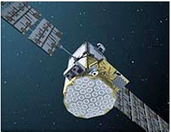
Europe's Satellites: Galileo pathfinder GIOVE-A retires

Galileo's Giove-A satellite. It remains operational and will still be maintained from SSTL's Mission Control Centre in Guildford, during which time SSTL will continue to collect data on the radiation environment in MEO

Surrey Satellite Technology Ltd (SSTL) has put the GIOVE-A satellite into retirement, ending a successful extended mission for the European Commission's Galileo satellite navigation programme under the supervision of the European Space Agency (ESA).

The first 'Galileo In-Orbit Validation Element', GIOVE-A, was launched on 28th December 2005 by Soyuz rocket from Baikonur in Kazakhstan, securing vital frequency filings with the International Telecommunications Union (ITU) on the 12th January 2006 that enabled the satellite navigation programme to proceed.

GIOVE-A was completed by SSTL within a record 29-month schedule from contract to launch for a budget of Euro 28m. Its original mission was extended, having already outlived its 27 month design life and been declared a full mission success by ESA in 2008.

The main objectives of the GIOVE-A mission were the on-board characterisation of a highly accurate prototype rubidium atomic clock, modeling the Medium Earth Orbit (MEO) radiation environment and the possible effects of radiation on future Galileo spacecraft, and of course the generation of the first Galileo navigation signals in space.

Those Galileo test signals from GIOVE-A have proved a very useful resource for manufacturers of Galileo receivers worldwide, allowing them to easily test their designs against a realistic version of the final Galileo navigation signal.

Now more than six years after launch, SSTL's operations team finally switched off the Galileo payload on 30th June.

The spacecraft has been manoeuvred about 100 kilometers higher than its operating orbit of 23,222 kilometers to make way for the first 22 Fully Operational Capability (FOC) satellites that are now being completed by OHB Technology and SSTL.

The satellite remains operational and will still be maintained from SSTL's Mission Control Centre in Guildford, during which time SSTL will continue to collect data on the radiation environment in MEO.

This document has been produced under funding of the European Union. The views expressed herein can in no way be taken to reflect the official opinion of the European Union and/or ESA.

The Full Operational Capability phase of the Galileo programme is managed and fully funded by the European Commission.

The Commission and ESA have signed a delegation agreement by which ESA acts as design and procurement agent on behalf of the Commission. "Galileo" is a trademark subject to OHIM application number 002742237 by EU and ESA.

Read more about GPS and satellite technology here

Friday, June 22, 2012

Controversial Investment: Chinese Firm CIC To Take Stake in European Eutelsat

China Investment Corp. (CIC) is buying a 7-percent stake in satellite fleet operator Eutelsat of Paris from Spain’s Abertis Telecom for 385.2 million euros ($500 million), a transaction that values Eutelsat at 5.5 billion euros, Abertis announced June 22.

Barcelona-based Abertis, which used to be Eutelsat’s biggest shareholder, has been gradually reducing its stake to refocus on investments in which it can gain a controlling interest.

In satellite telecommunications, Abertis has increased its ownership of satellite fleet operator Hispasat of Spain, in which it now has a 46.6 percent equity stake.

Abertis has long harboured ambitions to purchase a majority share of Hispasat but up to now the Spanish government, which through various state-owned entities owns around 26 percent of Hispasat, has declined to give its approval.

Abertis sold a 16 percent share of Eutelsat to several investors Jan. 13 in a transaction that valued Eutelsat at 6.1 billion euros. Abertis agreed to a six-month lockup of its remaining 15.35 percent holding, meaning it could not sell those shares until mid-July.

In its June 22 announcement, Abertis said Beijing-based CIC has agreed not to take ownership of the Eutelsat shares until the lockup period ends.

Eutelsat has been a profitable investment for Abertis since its initial acquisition in 2006. Its sale to CIC brings it a net capital gain of 237 million euros.

Abertis said it would “remain a Eutelsat shareholder, with a stake of 8.35 percent,” even though a minority ownership would appear to be at odds with Abertis’ stated goal of aiming for control of the assets its owns.

“Abertis keeps on reshuffling its holdings in the satellite infrastructure business, strengthening its commitment to growth, specifically targeting projects in which it can take an industry leadership role and a greater financial consolidation, as in the case of Hispasat,” Abertis said in the statement.

CIC, an aggressive Chinese sovereign-wealth fund, was formed in 2007 with a bond issue from China’s Ministry of Finance. The company used this to purchase $200 billion in China’s foreign-exchange reserves in strategically competitive infrastructure and rare-Earth mining corporations.

Although, in its 2010 annual report, issued in July 2011, CIC describes itself as “a financial investor. As such, it does not seek to control any sector or company,” Europe, Canada and the US are not convinced.

CIC’s investments in 2010 included minority stakes in power-utility AES Corp. of Arlington, Va., Chesapeake Energy of Oklahoma City and energy producer Penn West of Canada.

Given the U.S. government’s position on all things involving strategic space technology and China, the CIC acquisition may nonetheless raise issues.

Monday, April 23, 2012

Layer 8: DARPA building test bed for virtual satellite clusters

Scientists at the Defense Advanced Research Projects Agency (DARPA) will next month detail what technology they need to build a cluster of 4 wirelessly-interconnected satellites for a 6-month demonstration mission to launch in early to in mid-2015.

The testbed is yet another component of DAPRA's ambitious F6 program is intended to ultimately deploy what DARPA calls "fractionated modules" or individual small satellites that can act together as a traditional large spacecraft.

In such an environment, each module would support a unique capability, such as command and control, data handling, guidance, navigation and payload.

Modules could replicate the functions of other modules as well. Such modules can be physically connected once in orbit or remain nearby to each other in a loose formation, or cluster, harnessed together as a virtual satellite, DARPA stated.

Such architecture has the potential to significantly enhance the adaptability and survivability of satellites, while also shortening development time for complex space systems and reducing the barrier-to-entry for participation in the national security space industry, DARPA says.
DARPA says the F6 On-Orbit Demo Testbed will be made up of four satellite buses with a number of technical requirements including:
  • Host a Government-furnished Swift Broadband Satellite transceiver which utilizes the Broadband Global Area Network supported by the Inmarsat I-4 GEO constellation to provide persistent (near 24/7) on-demand broadband connectivity from the F6 demo cluster in low-earth orbit (LEO) to the ground network;
  • Supply and host a high-speed space-to-ground downlink transmitter and provide associated data exfiltration capability;
  • Supply and host a high-performance computing element that incorporates innovative and cost-effective processor architectures;
  • Host a Government-furnished mission sensor payload, while maximizing size, weight, power, and field-of-view capabilities.
The testbed satellites will need to hit on some important objectives such as:
1. The capability to perform semi-autonomous long-duration maintenance of a cluster and cluster network including the ability to add and remove modules;
2. The capability to securely share resources across the cluster network with real time guarantees and among payloads or users in multiple security domains;
3. The capability to autonomously reconfigure the cluster to retain safety and mission critical functionality in the face of network degradation or component failures;
4. The capability to perform a defensive cluster scatter and re-gather maneuver to rapidly evade a debris-like threat.

The testbed program will culminate in a 6-month on-orbit demo mission, with an estimated launch in early to mid-2015, DARPA said.  Details of the System F6 On-Orbit Demonstration Testbed will be shared on Thursday, May 3, 2012 in Arlington, VA.

The testbed announcement is but one part of the F6 program.  In November DARPA issued a call for computer chip and electronics manufacturers to help it build the wireless communication system is will use to facilitate F6.

From DARPA: "Essentially a network computing device, the F6 physically connects to and provides switching and routing functions between the spacecraft bus, the wireless inter-satellite transceivers, shared resource payloads (such as  high-powered computing, data storage, and other communications links) and mission payloads such as sensors.

 The F6 serves as the hardware platform running the software that enables cluster networking including the network protocol stack, real-time resource sharing middleware, cluster flight applications and mission-specific applications.

The F6 also provides cryptographic capability and other security features that enable a multi-level security environment. "

Small, wirelessly-networked, energy efficient systems with sophisticated security policies and powerful processors are commonplace in today's world.

They are not, however, state of the art in space, DARPA said.   "Today's space electronics are clunky," said Paul Eremenko, DARPA program manager in a statement.

"They provide limited processing speed and capability, they're bulky and power-hungry, and they are manufactured as bespoke, one-of-a-kind products."

DARPA has also detailed the system software that will let operators operate and control the F6 virtual satellite system.

The F6 Developer's Kit (FDK) is a set of open source interface standards, protocols, behaviors, and reference implementations thereof, necessary for any party, without any contractual relationship to any System F6 performer, to develop a new module that can fully participate in a fractionated cluster.

Wednesday, April 11, 2012

ESA SRON JAXA Astro-H: A New space telescope to explore the violent Universe

European astronomers will be able to explore the universe with a powerful new Japanese space telescope thanks to an agreement recently signed.

Officials from the European Space Agency (ESA) and the Japanese Aerospace Exploration Agency (JAXA) will cooperate in building and operating a satellite called Astro-H.

The orbiting observatory will watch the heavens with X-ray eyes, the latest in a number of space telescopes that can view this part of the spectrum beyond that of visible light. X-rays are emitted by extremely hot events at temperatures ranging from several million to several hundred million degrees Celsius.

Watching them will allow space scientists to observe some of the most extreme phenomena in the Universe including supernova explosions, neutron stars, black holes and the centres of active galaxies.

It will also help them to probe the large-scale structure of the Universe, including clusters of galaxies, and discover how it has evolved over billions of years. It will also help show how matter behaves in extreme gravitational fields.

JAXA’s Dr Tadayuki Takahashi, who invented the technology behind the camera, said: "We are aiming to quickly turn this technology to practical use."

The deal to work together on this exciting mission was signed last month by Professor Alvaro Giménez Cañete, ESA Director of Science and Robotic Exploration, and Dr Junjiro Onoda, Director General of the Japanese Institute of Space and Astronautical Science (ISAS).

ESA will provide JAXA with hardware components and support for operations and users. In return, astronomers at institutions in ESA countries will be granted observing time on the Astro-H mission.

NASA's Goddard Spaceflight Center is also contributing instrumentation to Astro-H, formerly known as NeXT, in collaboration with the University of Wisconsin.

The telescope is due to be launched in 2014 from the Tanegashima Space Centre in Southern Japan and will be placed in low-Eath orbit, which is high enough to be clear of the atmosphere which absorbs X-rays and makes them unobservable on the ground.

Astro-H will carry an array of spectrometers and imagers. But it also offers a prime example of how space science can have direct benefits to life back on Earth.

The spacecraft is being equipped with a gamma-ray detector that will observe the dying gasps of stars that go supernova.

The precision that this instrument is capable of will also be used on the ground to help Japan clean up contamination left by the Fukushima disaster after the massive earthquake in 2011.

Thursday, April 5, 2012

India To Launch Astriums Spot 6 Earth Observation Satellite

India’s ISRO PSLV rocket will launch the Spot 6 commercial Earth observation satellite for Astrium Services of Europe late this year under a contract announced April 3 by the Indian Space Research Organisation (ISRO).

The 800-kilogram satellite, intended to operate from a near-polar low Earth orbit at 694 kilometers in altitude, will be accompanied on the launch by several other payloads that ISRO did not identify.

EADS Astrium Services is building and launching the identical Spot 6 and 7 satellites using its own funds, with no assistance, nor any guarantee of future image purchases, by the French government.

Astrium officials have said they expect to spend about 300 million euros ($400 million) to build and launch the two spacecraft.

Spot 7 is scheduled for launch in 2014, with a launch vehicle yet to be announced.

Spot 6 and Spot 7 will replace the larger Spot 5 satellite, which was launched in 2002 and has been operating beyond its contracted in-orbit service life since 2008.

Spot 5 has been the principal revenue generator for Astrium Geo-Information Services, the Astrium Services division that commercializes Earth observation imagery.

Spot 6 and Spot 7 are expected to operate 180 degrees apart in low Earth orbit, much as the higher-resolution Pleiades satellites, the first of which was launched in December. The French government financed development of the two Pleiades satellites, and Astrium Geo-Information Services is commercializing Pleiades imagery.

Spot 6 and Spot 7 will be capable of distinguishing objects of 1.5 meters in diameter in black and white, and 6 meters in color. The images will have a swath width of 60 kilometers, like the previous Spot spacecraft, but will be more agile.

The satellites will be able to move the imager up to 45 degrees off nadir back and forth to capture views in front of and behind the satellite, and up to 35 degrees off nadir from side to side.

ISRO said the agreement between Astrium and ISRO’s Antrix commercial arm is part of a long-term cooperation agreement signed in September 2008.

The same collaborative accord covered the construction of the Hylas 1 Ka-band broadband satellite operated by Avanti Communications of London. ISRO and Antrix built the Hylas 1 satellite structure, or bus, with Astrium providing the telecommunications payload.

Monday, April 2, 2012

Square Kilometre ARRAY (SKA): Astron and IBM to Build Low-Power Exascale Supercomputer


IBM and Astron, the Netherlands Institute for Radio Astronomy, have collaborated to research on exascale computer systems that will help explore the origins of the universe.

The low-power exascale computer systems are targeted for the international Square Kilometre Array (SKA), an international project by Astron to build the world's largest and most sensitive radio telescope.

The supercomputer will collect data from the Square Kilometre Array (SKA), which requires processors that are a million times faster than today's fastest computers.

The supercomputer will reportedly be faster than the current world's fastest supercomputer, the K, that has 700,000 processor cores and a peak performance of 10 petaflops (thousand trillion floating point operations per second) - an exascale computer would be 100 times faster than that.

The initial 32.9 million euro project named Dome is a five-year collaboration with Astron and upon completion of building the telescope by 2024, it will be used to explore evolving galaxies, dark matter and even the very origins of the universe - dating back more than 13 billion years.

Ton Engbersen, IBM Research - Zurich explained: "If you take the current global daily Internet traffic and multiply it by two**, you are in the range of the data set that the Square Kilometre Array radio telescope will be collecting every day."

"This is Big Data Analytics to the extreme. With Dome we will embark on one of the most data intensive science projects ever planned, which will eventually have much broader applications beyond radio astronomy research," he added.

Scientists at Astron and IBM will also investigate the advanced accelerators and 3D stacked chips for more energy-efficient computing. They will also research on technologies to optimize large data transfers, as well as high-performance storage systems.

"Large research infrastructures like the SKA require extremely powerful computer systems to process all the data. The only acceptable way to build and operate these systems is to dramatically reduce their power consumption," said Marco de Vos, Managing Director of Astron.

"Dome gives us unique opportunities to try out new approaches in Green Supercomputing. This will be beneficial for society at large as well," he added.

Scientists from both IBM and Astron will work at the newly established Astron & IBM Center for Exascale Technology in Drenthe, the Netherlands. The construction of the super telescope is expected to begin in 2017.

Thursday, March 22, 2012

ESA TIGER Initiative: Managing our water resources from space

Satellite data-derived land cover of the Nile Basin based on ESA’s 2009 GlobCover map.

Credits: Nile Basin Initiative

Today is UN World Water Day, and satellite observations are indispensible for monitoring our water resources. ESA’s TIGER initiative is supporting Africa in monitoring precious water assets by exploiting satellite information.

The demand for water is growing inexorably. Access to water is vital – not only for drinking, but also for agriculture, energy and sanitation.

In certain regions of the world, water scarcity is caused by population growth, climate conditions and increasing climate variability, economic development or urbanisation.

At the sixth World Water Forum held last week in Marseille, France, experts from over 170 countries met to discuss solutions for sustainable water management.

Satellite observations of our planet were widely acknowledged as an indispensable tool for collecting information on available water resources.

This is especially true for areas like cross-boundary river basins, such as the Nile basin and its 11 countries.

Responding to this need for information on water, ESA’s TIGER initiative is running projects and building capacity to use space technology for managing water resources in direct partnership with several African and international organisations, such as the African Ministers’ Council on Water, UNESCO-IHP, African Water Facility, UN-ECA and the Canadian Space Agency.

Tuesday, March 20, 2012

First Scottish-built satellite UKube-1 to launch in 2013

One of the first satellite to be built in Scotland, by Clyde Space, is due to be launched next year.

UKube-1 is being built at the West of Scotland Science Park in Maryhill, Glasgow.

The United Kingdom Universal Bus Experiment, to give it its proper name, is a pilot programme from the UK Space Agency to test new technologies in space.

The underlying CubeSat concept came originally from America: to create a satellite 10cm by 10cm by 10cm.

That gives you a volume of just one litre, but that can contain a surprising amount of science in low Earth orbit.

It's a package which costs, by space exploration standards, relatively little to build and launch.

Several Scottish firms supply intellectual property to the space industry. One of them, Clyde Space, has a big presence in the CubeSat sector.

More than 600 CubeSats have been launched so far and the Glasgow firm has made components for 40% of them.

They have customers worldwide and - if your credit card can take the strain - you can order the innards of your very own satellite from their online CubeSat shop.

'Different possibilities'

They make components for other types of satellites too but their chief executive, Craig Clark, says he's seen the CubeSat concept expand far beyond its initial concept.

People often ask me what my job is and I tell them that I'm building satellites in Maryhill. Sometimes they laugh at me” Steven Kirk Clyde Space.

"A typical CubeSat mission was a student-built satellite that would maybe go beep or try something out that didn't cost a lot of money," he says.

"But now it's serving a need, maybe for more communications or images from space. If you can think of an application, there's a way of fitting it in a CubeSat. It really opens the mind to lots of different possibilities."

Those possibilities include CubeSats which aren't cubes: the basic modules can be stacked to produce double or triple decker designs.

UKube-1 is a three-cube platform. Three litres of orbital science overseen by the UK Space Agency.

It will be the first complete satellite to be assembled by Clyde Space.

Project manager Gillian Smith's job is to co-ordinate the company's own contributions to the satellite: power systems, solar panels and other hardware."But we're also managing the payload teams," she says.

"We've got four different payloads from different universities and organisations which will be on UKube-1."

Friday, March 16, 2012

George Clooney And The New Ethics Of Satellite Surveillance

George Clooney believes that he has found evidence of the Sudanese government murdering its own citizens.

Using images from space satellites, the Hollywood actor, with help from the Satellite Sentinel Project (SSP), documented crimes against humanity taking place in sub-Saharan Africa.

"It is absolutely without question a war crime that we saw firsthand," the actor told the Senate Foreign Relations Committee while presenting his findings on Wednesday.

While Clooney's efforts are patently good, are they ethical?

No project like this has ever been done before, and so Clooney and his partners are making the rules as they go, albeit rules within the strictures of international law.

SSP is a collaboration between the non-profit Enough Project, the Harvard Humanitarian Initiative and DigitalGlobe Inc. (NYSE: DG), a publicly-traded space imagery company. The whole enterprise is funded by Clooney and his Not on Our Watch organization.

"This is a collaboration that in itself is revolutionary. No one could do it alone," said Nathaniel Raymond, the Director of Operations for the SSP.

Using field reporting from the Enough Project and DigitalGlobe's satellite images, which are directed and interpreted by Harvard, SSP monitors what it sees as an ongoing humanitarian crisis in Sudan that started with the Second Civil War in 1983, bred the genocide in Darfur and essentially continued uninterrupted as it developed into the ethnic conflict surrounding South Sudan's independence.

Tuesday, March 13, 2012

NASA Completes First Robotic Satellite Servicing Demonstration at ISS

After months of delays, NASA’s international space station-based Robotic Refueling Mission (RRM) last week completed the first of six simulated satellite-servicing tasks scheduled for this year, the project’s lead said.

“We did a portion of the cooling valve removal activity,” Frank Cepollina, principal investigator for RRM at the Goddard Space Flight Center in Greenbelt, Md., reported.

“We checked out all the tools that we were going to use, put them in free space, observed the lighting conditions, that sort of thing. Then we proceeded to do the safety wire cutting.”

NASA began work on the RRM project in 2009. Engineers at Goddard built a custom set of satellite servicing tools and a mock-up spacecraft that includes valves, wires, thermal blankets and seals commonly found on commercial satellites.

The Goddard-built tools are affixed to the space station’s Canadian-built robotic arm, and simulated satellite servicing is performed by a human operator at the Johnson Space Center in Houston.

Between 2009 and its launch in 2011, NASA spent about $22.6 million on the project. The aim is to investigate whether robots can help extend the life of satellites that were designed to be disposable.

Cepollina estimated that from start to finish, the first RRM demonstration, performed on March 6, took just over 28 hours to complete.

Most of this time was spent ensuring that the servicing tools were ready for use, he said. The goal of the demonstration was to cut two safety wires.

The first wire took about an hour and a half to cut. The second took about an hour, Cepollina said.

A full report on the first RRM technology demonstration is in the works and will be presented at Goddard in the final week of May during the second International Workshop on On-Orbit Satellite Servicing.

Five more RRM technology demonstrations are scheduled for 2012. The next will take place in May, when the RRM operator will attempt to remotely remove a valve assembly from the mock-up satellite.

One of the higher-profile demonstrations is penciled in for July, when RRM operators will attempt to demonstrate robot-controlled satellite refueling.

The project’s final demonstration for 2012 is slated for December, Cepollina said.

Those dates, however, could slip, Cepollina said.

NASA Aqua MODIS Image: Clouds over Southern Greenland

Spectacular cloud streets surrounded southern Greenland in late winter, 2012.

The Moderate Resolution Imaging Spectroradiometer (MODIS) aboard NASA’s Aqua satellite captured this true-colour image on March 6, 2012.

Cloud streets are bands of cumulus clouds that form parallel to the low-level wind direction when conditions are right.

They form by convection, a process in which warm air rises and cold air sinks.

When the sun shines, moist air at the ground level begins to rise. As it rises, it cools and when moist air cools to a critical temperature water condenses onto tiny particles suspended in the atmosphere and clouds are formed.

Cloud streets form in the planetary boundary layer, within the lower one to three kilometers of the atmosphere, and can form over water or land.

Although beautiful when seen from below, when patterns stretch across hundreds of kilometers the view is best from above.

Aqua, as well as Terra, from their orbits at 705 kilometers above sea level, offer especially stunning looks at cloud patterns.

Sunday, March 11, 2012

Earth from Space: Algerian sands

This image shows the sandy and rocky terrain of the Sahara desert in western Algeria.

With the Mediterranean Sea almost 500 km away, the closest town to the area pictured here is Taghit in the Algerian province of Béchar.

The commercial Ikonos-2 satellite acquired this image on 23 April 2008 at a spatial resolution of 4 m.

ESA supports Ikonos-2 as a Third Party Mission, which means that the Agency uses its multi-mission European ground infrastructure and expertise to acquire, process and distribute data from the satellite to its wide scientific user community.

Credits: EUSI

Thursday, February 23, 2012

Scotland Space Scientific Research and Innovation is reaching for the stars

At last Scotland is being seen as playing a leading role in the space sector after decades of being the engineers, scientists and innovators that break down technological barriers in other countries' space programs.

The space sector contributes £5.6 billion to the UK economy, as well as supporting 68,000 high-value jobs. Not only that, it has soared above the recent economic headwinds, growing an average of 9 per cent each year since 1999.

Scotland-based companies are playing a key role in that success story. Clyde Space is leading the design and manufacture of the UKube-1 satellite – the UK’s first satellite commissioned by the UK Space Agency.

Other examples include Star-Dundee, which sells its data-handling test products to almost every international space agency, while Selex Galileo, in Edinburgh, is tapping into the market for European satellites.

Commercial success also goes hand in hand with globally recognised academic excellence, with the recent launch of the Space Glasgow research cluster by the UK Science Minister David Willetts.

Scotland is also involved with key instruments for the James Webb Space Telescope (JWST), which will replace Hubble Space telescope (HST), currently jointly managed by NASA and ESA.

But don’t think that space research is something that can only be applied out in the great beyond. In fact, on 6 March, Glasgow will host the second Scottish Space Symposium, exploring the theme of “Bringing space down to earth”. Download a copy of the Program here

Scottish Enterprise is supporting the event in partnership with University of Strathclyde to showcase the benefits of using space-based information and technologies.

For example, use of space-based data will allow Network Rail to improve safety by monitoring landslides remotely via satellite rather than sending engineers to remote locations.

Edinburgh-based Ecometrica is also using satellite data to monitor CO2 levels, putting them at the vanguard of carbon trading and tariffs which the EU is investigating placing on businesses as a means of tackling climate change.

So the Scottish Space Symposium will explore how businesses can benefit from terrestrial applications in such key fields as communications and transport. Science fact, as opposed to science fiction.

Monday, February 13, 2012

ESA Kourou: Successful Liftoff of Vega VV01


On 13 February 2012, the first Vega lifted off on its maiden flight from Europe's Spaceport in French Guiana.

For further information, please visit: www.esa.int/SPECIALS/Vega/

Credits line: ESA - S. Corvaja, 2012

Thursday, February 9, 2012

NASA GRACE: Global Warming Melts Billions of Tons of Ice Annually (VIDEO)


Researchers from NASA and the University of Colorado Boulder have discovered that glaciers and ice caps are shedding 150 billion tons of ice annually because of global warming. They discovered this using Gravity Recovery and Climate Experiment (GRACE) satellites.

The researchers measured ice loss percentages across all of Earth's ice reserves between 2003 and 2010, with particular emphasis on glaciers and ice caps outside of Greenland and Antarctica.

They discovered that these geological formations were shedding roughly 150 billion tons of ice annually. The most alarming conclusion was that ice caps and glaciers from within Greenland and Antarctica were shedding 385 billion tons (100 cubic miles) of ice every year.

Credit: NASA/JPL-Caltech/University of Colorado 

Average changes in ice thickness in centimeters per year from 2003 to 2010, as measured by NASA’s Grace satellites, in each of the world’s ice caps and glacier systems outside of Greenland and Antarctica. Blue represents ice mass loss, while red represents ice mass gain.

The study also suggested that mountains on the Asian continent - the Himalayas, the Pamir and the Tien Shan - were shedding approximately 4 billion tons of ice annually.

As strange as it may sound, this figure actually comes as a relief. Earlier ground-based estimates suggested ice loss in high Asian mountains may range up to 50 billion tons, annually.

The total ice loss from Greenland, Antarctica and all of Earth's glaciers and ice caps from 2003 to 2010 was about 4.3 trillion tons (1,000 cubic miles) which is about eight times the water volume of Lake Erie in the U.S.

These measurements were made with the NASA-developed GRACE satellite. GRACE was launched in 2002 and is a twin satellite that measure changes in the Earth's gravity field, as caused by regional changes in the planet's mass, including ice sheets, oceans and water stored in the soil and in underground aquifers.

"Earth is losing a huge amount of ice to the ocean annually, and these new results will help us answer important questions in terms of both sea rise and how the planet's cold regions are responding to global change," said John Wahr, a Professor at the University of Colorado Boulder.

"One possible explanation is that previous estimates were based on measurements taken primarily from some of the lower, more accessible glaciers in Asia and extrapolated to infer the behaviour of higher glaciers. But unlike the lower glaciers, most of the high glaciers are located in very cold environments and require greater amounts of atmospheric warming before local temperatures rise enough to cause significant melting. This makes it difficult to use low-elevation, ground-based measurements to estimate results from the entire system," he added.

"This study finds that the world's small glaciers and ice caps in places like Alaska, South America and the Himalayas contribute about .02 inches per year to sea level rise," said Tom Wagner, a program scientist at NASA Headquarters in Washington, "While this is lower than previous estimates, it confirms that ice is being lost from around the globe, with just a few areas in precarious balance. The results sharpen our view of land ice melting, which poses the biggest, most threatening factor in future sea level rise."

Thursday, January 12, 2012

US Wont Adopt EU Code of Conduct for Space

“It’s been clear from the very beginning that we’re not going along with the code of conduct,” Ellen Tauscher, undersecretary of state for arms control and international security, said during a Jan. 12 breakfast with reporters in Washington.

Asked why the U.S. government would not sign the document, Tauscher said, “It’s too restrictive.”

The European Union has been working the voluntary code of conduct for several years. The document lays out rules of the road for operating satellites and other space vehicles as space becomes increasingly congested, the idea being to minimize the chances of collisions or misunderstandings that could escalate.

The code also focuses on space debris mitigation, an area that began getting greater public attention in 2007 after China destroyed one of its own orbiting satellites with a ground-launched missile.

“We made it very definitive that we were not going to go ahead with the European Code of Conduct; what we haven’t announced is what we’re going to do, but we will be doing that soon,” Tauscher said.

Up to now, the U.S. government has been circumspect about its intentions with regard to the code. In April, for example, Ambassador Greg Schulte, U.S. deputy assistant secretary of defense for space policy, described the code as a “positive approach” but stressed that the U.S. government had not yet decided whether to sign the document.

Some U.S. lawmakers have raised concerns that the nonbinding agreement would tie the U.S. military’s hands in space.

“We’ve advanced further technologically in development and actual deployment of these systems than anyone else, and agreements [and] codes of conduct tend to … constrain our military,” Sen. Jeff Sessions (R-Ala.) said during a hearing on the subject in May.

“We had never said we were going to do it; we just hadn’t said ‘no,’” Tauscher said.

Hinting at new U.S.-written rules of the road for space, Taushcer said, “You wouldn’t be surprised to find out that we’ve found a nice sweet spot.”

The Pentagon had concerns with the European strategy for space traffic management, but there are also “ways to deal with it,” according to Michael Krepon, co-founder of the Stimson Center, a think tank here.

The U.S. Defense Department did a lengthy assessment of the code of conduct and particular provisions reviewed “would make sense for our national security.”

“If the satellite is stealthy, or we want it to be stealthy, how does that fit into a traffic management system?” he said.

“Now you argue … major spacefaring nations can figure out the orbital characteristics of objects in space, but it you want to move an object in space do you provide advance notice of this or how do you handle that?”

If the Obama administration is going ahead with a new strategy, then the Pentagon’s concerns have likely been addressed, Krepon said.